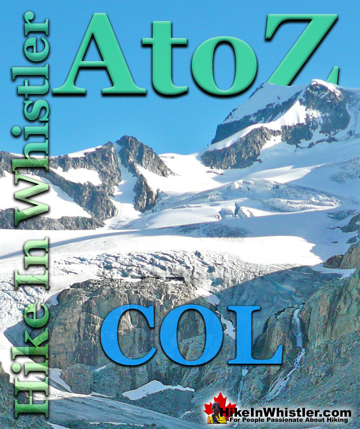
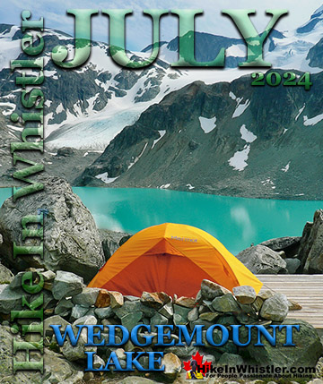
Col: a ridge between two higher peaks, a mountain pass or saddle. More specifically is the lowest point on a mountain ridge between two peaks. Sometimes called a saddle or notch. The Wedge-Weart Col is a popular destination at the top of Wedgemount Glacier. The Wedge-Weart Col connects these two highest peaks in Garibaldi Provincial Park and is easily visible from much of the area around Wedgemount Lake.
One of the defining features of Garibaldi Park, and Wedgemount Lake in particular, is the staggering number of branching hikes from the main destination of the lake itself. For many, Wedgemount Lake and the Wedge Hut is the base for hikes to Wedge Mountain, Mount Cook, Mount Weart, Mount Moe, Mount James Turner and Mount Currie in Pemberton, crossing glaciers such as Wedgemount Glacier, Weart Glacier, Armchair Glacier, Mystery Glacier and the Needles and Chaos Glacier to name a few. Wedgemount Lake itself is a magnificent destination for a day hike or spectacular overnight beneath the dazzling mountain peaks and stars. Many sleep under the stars on one of the many beautiful tent platforms that dot the landscape. Solidly built, wooden tent platforms are everywhere you look at Wedgemount Lake. Strategically positioned, these platforms manage to maintain an amazingly secluded feel despite their numbers. In all Wedgemount Lake has 20 of these tent areas. Most are wooden, but several down by the lake shore are gravel, yet every bit as nice. At a fast hiking pace you can reach Wedgemount Lake from the trailhead in just an hour and a half but at a leisurely or backpack laden pace you will likely take over two hours. The trail is well marked and well used. The steepness of the trail doesn't require any technical skill, however that last kilometre before the lake you will be scrambling on all fours quite a bit.
More Whistler & Garibaldi Park Hiking A to Z!
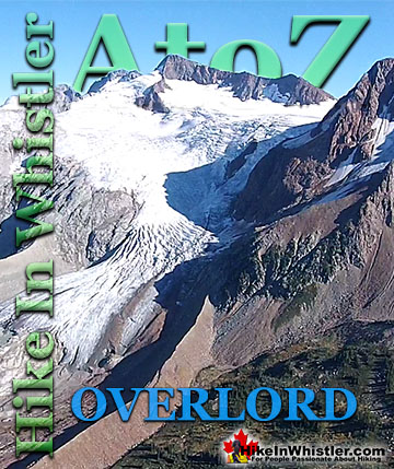
Overlord Mountain is the highest peak in the Fitzsimmons Range. Overlord is surrounded by several mountains that collectively are named the Overlord ...
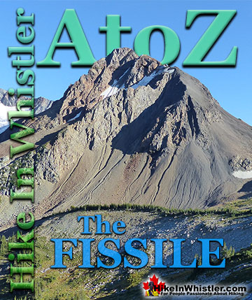
The Fissile is the stunning Matterhorn-looking mountain that is visible from Village Gate Boulevard in Whistler. Looking up from Village Gate you will see ...
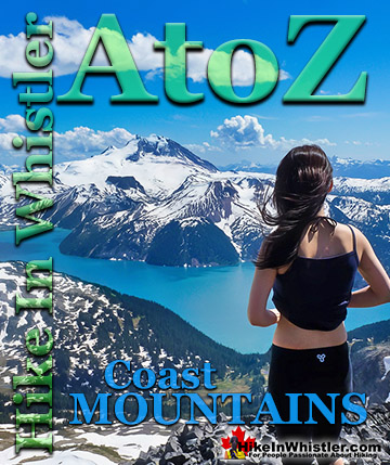
The Coast Mountains run from the Yukon down to Vancouver along the west coast of British Columbia in a band that averages 300 kilometres wide(190 miles). ...
Alec Dalgleish (1 August 1907 - 26 June 1934) was a highly respected mountaineer and climber out of Vancouver in the 1920's and 1930's. His enthusiasm and ...
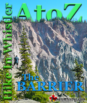
The Barrier formed as a result of huge lava flows from Clinker Peak on the west shoulder of Mount Price during the last ice age. About thirteen thousand ...
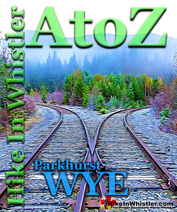
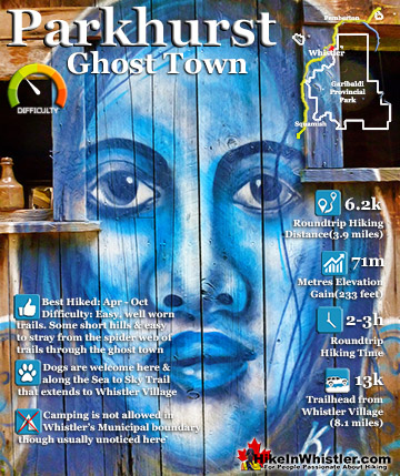
When hiking to Parkhurst Ghost Town, the first area you will encounter after you cross the disintegrating bridge over Wedge Creek is the wye. In railroad ...
Along Whistler’s Valley Trail near Rainbow Park you come across some impressively unusual trees. Unlike most other Whistler trees with straight trunks and ...
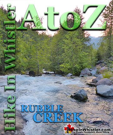
The Rubble Creek trailhead is the main access point for many of the best hikes and sights in Garibaldi Provincial Park. Rubble Creek is located midway ...
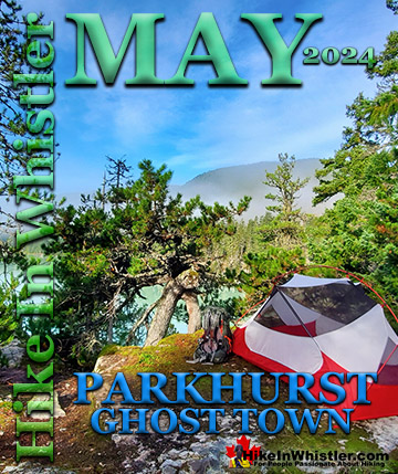
Whistler has an absurd number of wonderful and free hiking trails and Parkhurst Ghost Town certainly ranks as the most unusual and interesting. Parkhurst was a little logging town perched on the edge of Green ...
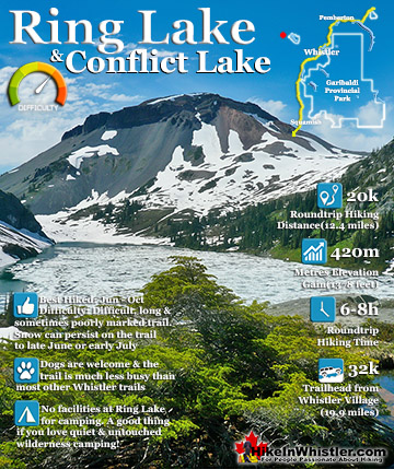
Ring Lake is a fantastically serene and wonderfully remote lake similar to Cirque Lake, but considerably farther to hike to reach it. The 10 kilometre(6.2 mile) hike takes you through a rarely hiked forest, ...
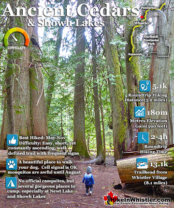
Ancient Cedars is a nice, easy/moderate 2.5 kilometre (1.6 mile) hiking trail on the far side of Cougar Mountain, just 13.1 kilometres north of Whistler Village. A small, untouched grove of huge western ...
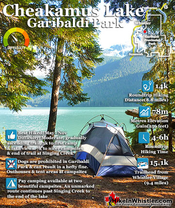
Cheakamus Lake is a wonderfully relaxing way to get in the wilderness easily and quickly from Whistler Village. The trail begins on the far side of Whistler Mountain, 8 kilometres from the Sea to Sky Highway ...
April in Whistler is a wonderful time of year. The winter deep freeze ends and T-shirt weather erupts. The village comes alive with overflowing patios and ...
May is an extraordinarily beautiful time of year in Whistler. The days are longer and warmer and a great lull in between seasons happens. Whistler is fairly ...
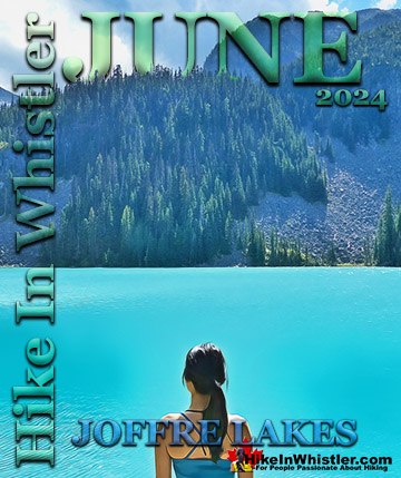
June is a pretty amazing month to hike in Whistler and Garibaldi Park. The average low and high temperatures in Whistler range from 9c to 21c(48f/70f). ...
July is a wonderful time to hike in Whistler and Garibaldi Provincial Park. The weather is beautiful and the snow on high elevation hiking trails is long ...
Hiking in Whistler is spectacular and wonderfully varied. Looking at a map of Whistler you see an extraordinary spider web of hiking trails that are unbelievably numerous. Easy trails, moderate trails and challenging hiking trails are all available. Another marvellous ...
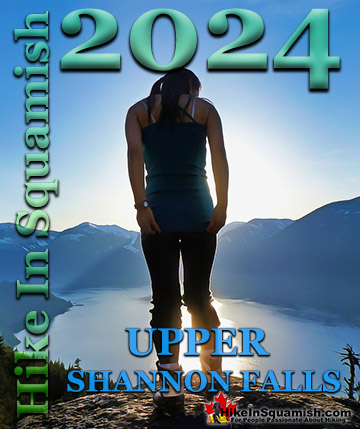
Squamish is located in the midst of a staggering array of amazing hiking trails. Garibaldi Provincial Park sprawls alongside Squamish and up and beyond Whistler. Tantalus Provincial Park lays across the valley to the west and the wonderfully remote Callaghan Valley ...
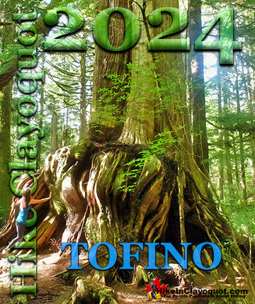
Clayoquot Sound has a staggering array of hiking trails within it. Between Tofino and Ucluelet, Pacific Rim Park has several wilderness and beach trails, each one radically different from the last. The islands in the area are often Provincial parks on their own with ...
Victoria has a seemingly endless number of amazing hiking trails. Most take you to wild and beautiful Pacific Ocean views and others take you to tranquil lakes in beautiful BC Coastal Rainforest wilderness. Regional Parks and Provincial Parks are everywhere you turn in ...
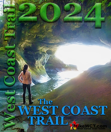
The West Coast Trail was created after decades of brutal and costly shipwrecks occurred along the West Coast of Vancouver Island. One shipwreck in particular was so horrific, tragic and unbelievable that it forced the creation of a trail along the coast, which ...