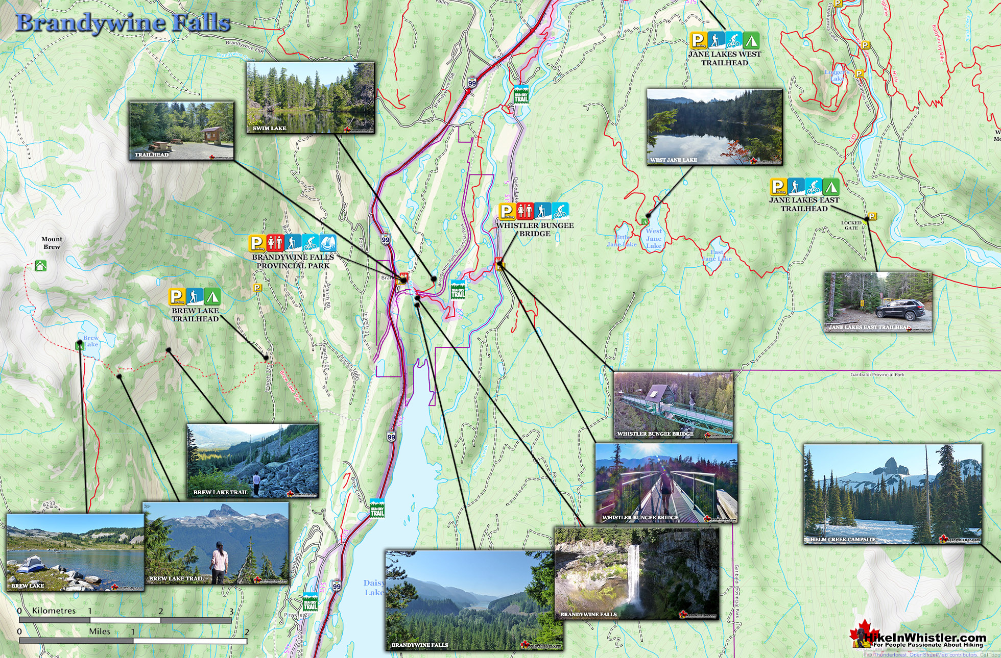
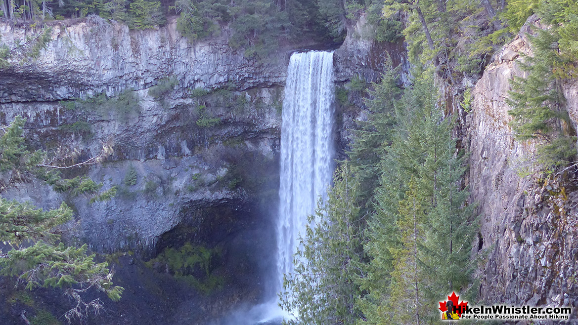
![]() Brandywine Falls is one of the must see sights on the way to or from Whistler. The falls drop from a 70 metre(230 feet), unnaturally abrupt looking cliff to the valley below. Brandywine Falls Provincial Park is such a popular, accessible and beautiful sight that it has a large and elaborate viewing platform directly opposite the falls. Located just 20 minutes south of Whistler, Brandywine Falls Provincial Park is just off of the Sea to Sky Highway.
Brandywine Falls is one of the must see sights on the way to or from Whistler. The falls drop from a 70 metre(230 feet), unnaturally abrupt looking cliff to the valley below. Brandywine Falls Provincial Park is such a popular, accessible and beautiful sight that it has a large and elaborate viewing platform directly opposite the falls. Located just 20 minutes south of Whistler, Brandywine Falls Provincial Park is just off of the Sea to Sky Highway.
 Very impressive falls from a great viewing platform
- Convenient, free parking off the Sea to Sky Highway
- Sea to Sky Trail here continues to Whistler Village
- Swim Lake is just 5 minutes away
- The Whistler Bungee Bridge is not far
- Idyllic sitting areas overlooking the falls and valley
- Dog friendly & bike friendly
- Accessible & amazing year-round
 No camping is allowed in the park
- Gets very crowded in the summer
The impressive falls are just one of a few sights to see in Brandywine Falls Provincial Park. Swim Lake, the Whistler Bungee Bridge and the Sea to Sky Trail running through the park make it a hiking, biking, jogging, snowshoeing paradise. You can set off from Whistler Village by bike on the Sea to Sky Trail and reach the falls in about an hour or two.. and rarely emerge from forest! The Sea to Sky Trail miraculously avoids roads and civilisation for most of its 33 kilometres. The Whistler section is 33 kilometres long, however the Sea to Sky Trail extends south and north of Whistler even further. If driving from Vancouver, keep your eyes out for the Brandywine Falls sign on your right about 25 minutes north of Squamish or 20 minutes south of Whistler Village. The parking lot is immediately off the highway and the short 1 kilometre trail takes you over then alongside Cheakamus River to the viewing area. The only facilities in the park are pit toilets and picnic tables and there is no charge for hiking or for parking your vehicle in the park.
 Best Dog Friendly Hiking Trails
Whistler is very dog friendly and the number of wonderful hiking trails that your dog will love is huge. The massively varied hiking trails range from easy, short, close to Whistler Village to challenging, long and deep in the endless wilderness around Whistler. You can find dog friendly trails in and around Whistler Village that take you through deep, dark and magical forests. Or you can drive beyond Whistler Village and take your dog to spectacular alpine lakes. Some requiring little or no hiking, while others are found after hiking challenging and long trails. Many of these places are comparatively quiet and often you and your dog will have the the wilderness to yourselves. In and around Whistler Village you have Lost Lake with its spider web of trails... Continued here.
 Best Free Whistler Camping
Whistler is surrounded by an immense wilderness dotted with spectacular, hidden lakes and amazing places to set up a tent. Decades of logging activity has left a network of forest service roads that has opened easy access to these places. Some of these you can drive to and some you may need a 4x4 to comfortably get to. Some places to camp for free you can drive to, some require a short hike and others are fairly long hikes to reach. Beautiful Callaghan Valley is home to several incredible and free places to camp. Callaghan Lake has a great free drive-to campsite just steps from this spectacular alpine lake. If you have a canoe, you can paddle to the end of Callaghan Lake and hike the short, but steep trail up to Cirque Lake. This gorgeous lake is deep in the alpine wilderness... Continued here.
Brandywine Falls and Surrounding Area Map

In the summer months it can be busy, but the rest of the year you often have the falls to yourself. Viewing the falls at night, under a full moon is quite a memorable experience. Brandywine Falls Provincial Park is attached to the wonderful Sea to Sky Trail which runs between and beyond Whistler and Squamish. It is a wide, gravel biking and hiking trail that will eventually extend north to Pemberton. Most visitors to the park just have a quick trip to the falls viewpoint and back and miss out on some amazing sights further along. Just a couple kilometres from the parking lot on the Sea to Sky Trail you will come to the amazing Whistler Bungee Bridge. The bridge is beautiful, huge and atrociously expensive looking. The area around the bridge is so remote feeling that when you catch sight of the Bungee Bridge, you almost gasp in surprise. There are viewing areas along the frighteningly abrupt cliffs and lots of space on the bridge to see the sights. Whistler Bungee operates here usually only when bookings have been pre-made, so often the bridge is deserted and serene. The folks at Whistler Bungee are very friendly and welcome you to watch people jumping and even try to coax you into trying.


Brandywine Falls Provincial Park Info...
Best Dog Friendly Hiking Trails
Whistler is very dog friendly and the number of wonderful hiking trails that your dog will love is huge. The massively varied hiking trails range from easy, short, close to Whistler Village to challenging, long and deep in the endless wilderness around Whistler. You can find dog friendly trails in and around Whistler Village that take you through deep, dark and magical forests. Or you can drive beyond Whistler Village and take your dog to spectacular alpine lakes. Some requiring little or no hiking, while others are found after hiking challenging and long trails. Many of these places are comparatively quiet and often you and your dog will have the the wilderness to yourselves. In and around Whistler Village you have Lost Lake with its spider web of trails... Continued here.
Best Free Whistler Camping
Whistler is surrounded by an immense wilderness dotted with spectacular, hidden lakes and amazing places to set up a tent. Decades of logging activity has left a network of forest service roads that has opened easy access to these places. Some of these you can drive to and some you may need a 4x4 to comfortably get to. Some places to camp for free you can drive to, some require a short hike and others are fairly long hikes to reach. Beautiful Callaghan Valley is home to several incredible and free places to camp. Callaghan Lake has a great free drive-to campsite just steps from this spectacular alpine lake. If you have a canoe, you can paddle to the end of Callaghan Lake and hike the short, but steep trail up to Cirque Lake. This gorgeous lake is deep in the alpine wilderness... Continued here.
 No Car? No Problem! Whistler Trails
Whistler as a resort has a wonderful car-free core. The Village Stroll runs through the heart of Whistler Village and is entirely car free. If you are visiting Whistler or living here and you don't have a car, it's no problem. On foot or on a bike you can travel the extensive network of non-motorized trails. The Valley Trail snakes through Whistler Village and extends in several directions, all of which lead to beautiful parts of Whistler. The Sea to Sky Trail and the Lost Lake trails continue this massive, car-free network of trails running almost everywhere in Whistler. When it comes to many of the best hiking trails, getting to the trailheads on foot, by bike or public transit can be tricky at best or complicated and impractical at worst. Many trailheads are far from Whistler Village and... Continued here.
 Kid Friendly Whistler Hiking Trails
There are plenty of excellent, kid and family friendly hiking trails and destinations in and around Whistler. Kid and family friendly generally means an easy and somewhat short trail that a toddler can happily manage. Some of these trails are flat enough to be stroller friendly, such as Brandywine Falls, Whistler Mountain and Blackcomb Mountain. Others such as Logger’s Lake, Cheakamus River and Madeley Lake have short enough trails to reach them that you can manage with little kids that don't want to hike too far. Some of these hikes and walks are popular and close to Whistler Village, like Whistler Mountain, Blackcomb Mountain, Lost Lake Park, Rainbow Park and Meadow Park. Others are a beautiful, but far drive into the mountains and tricky to find... Continued here.
 Best Sights Sea to Sky 99
The Sea to Sky Highway links Vancouver to Whistler and has several stops along the way that are often overlooked. Porteau Cove, for example, is surprisingly unknown even to locals that have driven past hundreds of times. Just off the highway the parking area is just steps from the huge pier stretching way out over the ocean. This gigantic pier is actually a rarely used emergency dock for BC Ferries, though more often used by visitors for its stunning views of Howe Sound. Porteau Cove is an excellent pit stop on the way to Whistler, not only for the spectacular views of Howe Sound, but one of the nicest picnic spots and most convenient restrooms! Other attractions along the Sea to Sky Highway are more obvious, such as Shannon Falls, the Sea to Sky Gondola... Continued here.
 Best Whistler Waterfalls
There are lots of beautiful waterfalls in and around Whistler. From the towering drop of Brandywine Falls to the awesome, up close and breathtaking view of Keyhole Falls. Some are absurdly convenient and easy to see and others require some tough hiking, or tricky driving to get to. All of them, however, are well worth a visit. Brandywine Falls is the most well known, impressive and easy to find along the Sea to Sky Highway. The viewing platform positioned across from the falls gives you a direct view of its 66 metre(216 feet) plunge into the chasm below. Located 17.1 kilometres(10.6 miles) from Whistler Village. The short, 1 kilometre long, dog friendly trail to the viewpoint is wide and smooth gravel. Alexander Falls, located up... Continued here.
More Whistler & Garibaldi Park Hiking Maps!
Russet Lake Maps
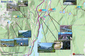
Brew Lake Maps
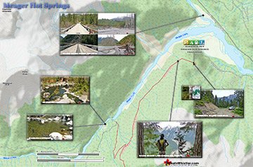
Meager Hot Springs Maps
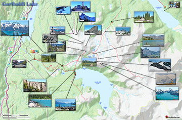
Garibaldi Lake Maps

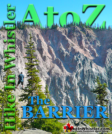
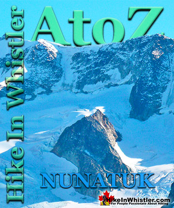
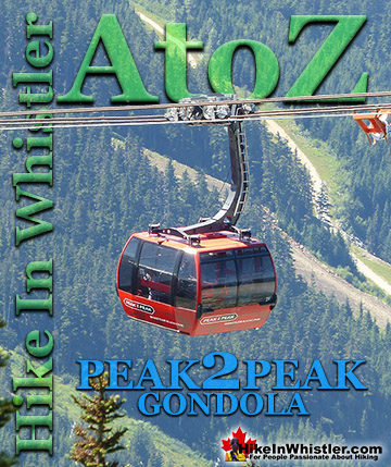
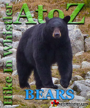
Whistler & Garibaldi Park Glossary A to Z

The Best Whistler & Garibaldi Park Hiking Trails!