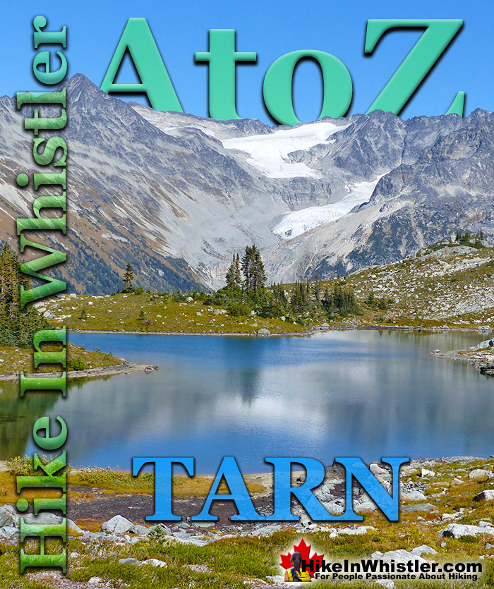
Tarn: a small alpine lake. The word tarn originates from the Norse word tjorn which translates to English as pond. In the United Kingdom, tarn is widely used to refer to any small lake or pond. In British Columbia tarn is used specifically for small mountain lakes. Around Whistler tarns number in the hundreds and many are so small and/or hidden as to remain unnamed. Russet Lake in Garibaldi Provincial Park could be called a tarn, however its relatively large size dominates the area and the term lake seems more appropriate.
Near Russet Lake there are two beautifully characteristic tarns named Adit Lakes. Both lakes are small, shallow and have irregular shapes. The two lakes lay in quite a remarkable setting overlooking the valley separating the Fitzsimmons Range and the Spearhead Range. The image below shows the view across to the Spearhead Range. Tremor Mountain and Mount Macbeth are the two prominent peaks. The upper glacier flows from Tremor Mountain from the left and Quiver Peak and The Ripsaw from the right. The lower glacier is Curtain Glacier which disappears behind Mount Macbeth. Hundreds of tarns can be found in the mountains around Whistler and most are unnamed. Mount Sproatt, across the valley from Whistler Mountain is home to several stunning tarns. Owing to the broad and seemingly endless alpine terrain on Mount Sproatt, there are dozens of tarns. Tarns are by definition quite small and comparatively warm to swim in, unlike the brutally cold Garibaldi Lake, Wedgemount Lake, Cheakamus Lake and Green Lake. Though many hiking trails in Whistler and Garibaldi Park have become crowded in recent years, finding a beautiful tarn in the wilderness around Whistler is actually pretty easy. Having a serene and secluded tarn on top of a mountain all to yourself is pretty amazing.
Finding a perfect paradise in the mountains around Whistler is not too difficult. This serene little tarn is on Mount Sproatt and just one of many found in the vast wilderness up there. The water temperature is far from cold due to the shallowness, only about 3 metres deep in the middle. Mount Sproatt is criss-crossed with several hiking and biking trails, which makes it reasonably accessible. It's vast area, however, makes it easy to find solitude and a perfect waterfront view for your tent.
More Whistler & Garibaldi Park Hiking A to Z!
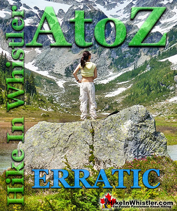
Erratic or glacier erratic is a piece of rock that has been carried by glacial ice, often hundreds of kilometres. Characteristic of their massive size and ...
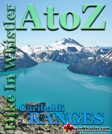
The Garibaldi Ranges are a subdivision of the Pacific Ranges of the Coast Mountains. Deriving its name from Mount Garibaldi, the Garibaldi Ranges cover the huge ...
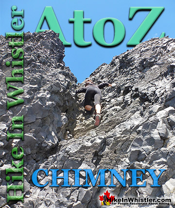
Chimney: a gap between two vertical faces of rock or ice. Often a chimney offers the only viable route to the summit of a mountain. An example of this is Black ...
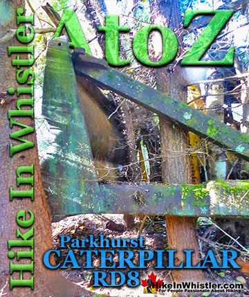
The second Caterpillar tractor in Parkhurst Ghost Town is considerably harder to find despite being just a few metres from the hulking Caterpillar at the shore ...
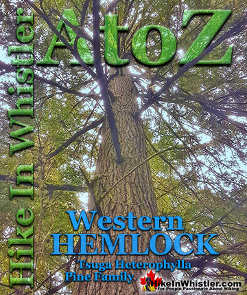
Western hemlock (tsuga heterophylla) is a large evergreen coniferous tree that is native to the west coast of North America. Unlike many other trees in ...
Inosculation is the technical name for two or more trees that have fused together into a single bizarre looking tree. They are colloquially known as ...
Tom Fyles (27 June 1887 - 27 March 1979) was an astoundingly skilled climber and mountaineer based out of Vancouver where he was an early explorer of the ...
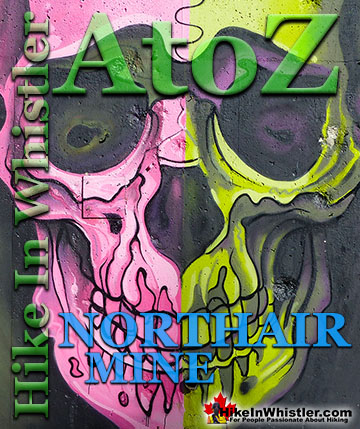
Northair Mine is wonderful, hidden world high up in Callaghan Valley. It was a gold mine run by the Northair Group from 1976 until was abandoned in 1982 ...
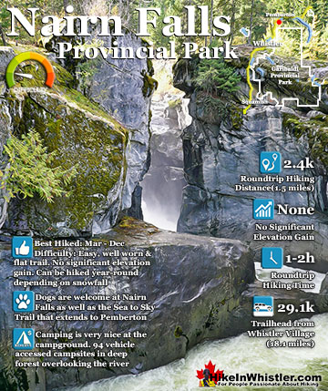
Nairn Falls is a wonderful, crashing and chaotic waterfall that surrounds you from the deluxe viewing platform that allows you to safely watch it from above. The beautiful, green water rushes through the ...
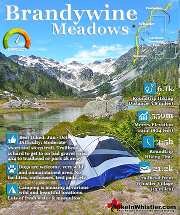
Brandywine Meadows is a nice, relatively short hike to a massive flower filled valley high up in Callaghan Valley. Located 40 minutes south of Whistler, this tough and sometimes muddy trail gains a huge 550 ...
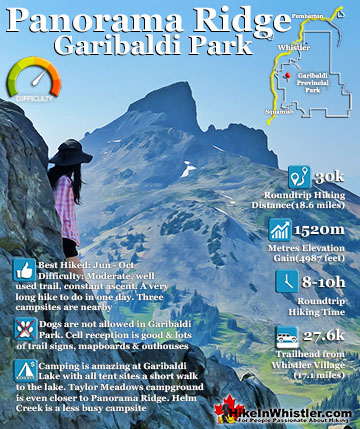
Panorama Ridge is easily one of the most amazing hikes in Garibaldi Provincial Park. The 15 kilometre(9.3 mile) hike from the trailhead at Rubble Creek to Panorama Ridge takes you through beautiful and deep ...
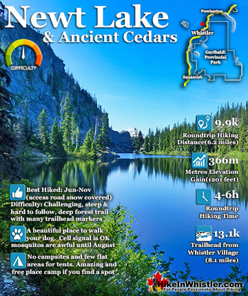
Newt Lake is cute little hidden lake high up on the far side of Cougar Mountain near Ancient Cedars. Its location is a wonderful mix of unexpected characteristics that combine to make it a gorgeous place to ...
Hiking in Whistler in October is often unexpectedly stunning. The days are much shorter and colder but the mountains are alive with colour from the fall ...
November in Whistler is when the temperatures plummet and the first heavy snow falls in the alpine and often in Whistler Village. The hiking opportunities become ...
December hiking in Whistler is mainly done on snowshoes, though not always. If it hasn't snowed much recently then trails such as Whistler Train Wreck and ...
Hiking in Whistler is spectacular and wonderfully varied. Looking at a map of Whistler you see an extraordinary spider web of hiking trails that are unbelievably numerous. Easy trails, moderate trails and challenging hiking trails are all available. Another marvellous ...
Squamish is located in the midst of a staggering array of amazing hiking trails. Garibaldi Provincial Park sprawls alongside Squamish and up and beyond Whistler. Tantalus Provincial Park lays across the valley to the west and the wonderfully remote Callaghan Valley ...
Clayoquot Sound has a staggering array of hiking trails within it. Between Tofino and Ucluelet, Pacific Rim Park has several wilderness and beach trails, each one radically different from the last. The islands in the area are often Provincial parks on their own with ...
Victoria has a seemingly endless number of amazing hiking trails. Most take you to wild and beautiful Pacific Ocean views and others take you to tranquil lakes in beautiful BC Coastal Rainforest wilderness. Regional Parks and Provincial Parks are everywhere you turn in ...
The West Coast Trail was created after decades of brutal and costly shipwrecks occurred along the West Coast of Vancouver Island. One shipwreck in particular was so horrific, tragic and unbelievable that it forced the creation of a trail along the coast, which ...