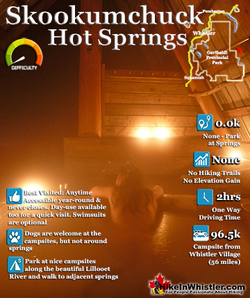
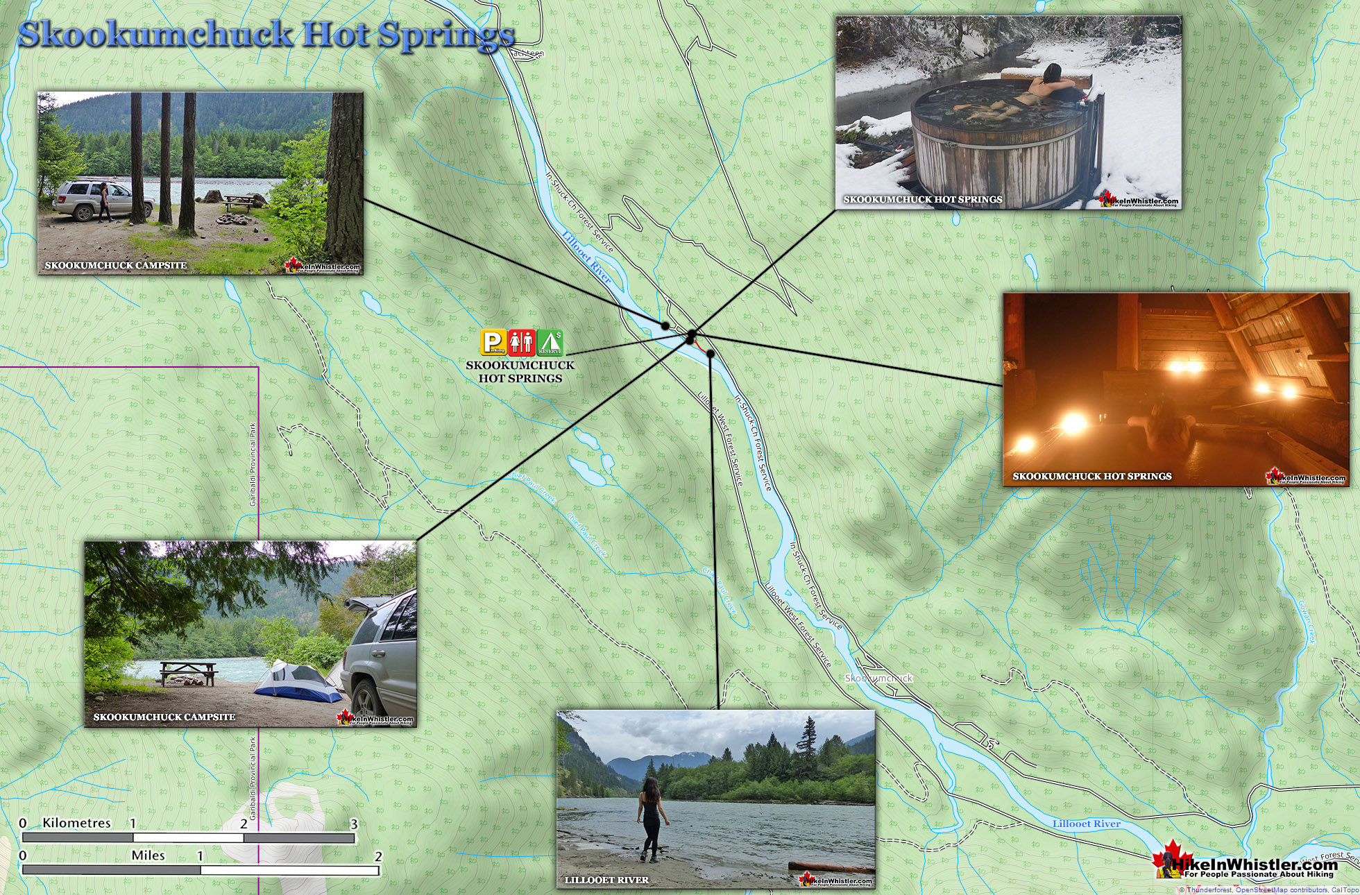
Skookumchuck Hot Springs(aka T'sek Hot Springs and St. Agnes Well), located two hours north of Whistler along the edge of the huge Lillooet River. The name Skookumchuck means "strong water" in the language of the Chinook people of the Pacific Northwest. The name is associated with the hot springs because of the nearby First Nation community of Skatin, which was once called Skookumchuck.
Very scenic drive along Lillooet Lake
Stunning campsites along the river
Sleep 1 minute away from the springs
Drive in campsites are very convenient
Helpful volunteer caretaker resides there
Drive in campsites are very convenient
Skookumchuck has an interesting history
Rules & fees increasing with new owners
Very busy on weekends in summer
On first glance the tubs looks shabby
The Skookumchuck Hot Springs were also once known as St. Agnes Well during the days of the Fraser Canyon Gold Rush, but that name has fallen into disuse. They are also known locally by the Skatin name as the T'sek Hot Springs. The Skookumchuck Hot Springs start in a pool which is far to hot to use so there are a network of tubes emanating from this pool to feed a ramshackle array of tubs. There are five tubs, which include one very large one under an A-frame which could hold 10 people and is beautifully comfortable. A smaller one under a half A-frame privacy screen which could hold 8 under the stars. And three more open tubs. Clothing, you will quickly discover, is optional. There are small change rooms and one outhouse a few metres away.
Skookumchuck Hot Springs Map
The Skookumchuck Hot Springs start in a pool which is far to hot to use so there are a network of tubes emanating from this pool to feed a ramshackle array of tubs. There are five tubs, which include one very large one under an A-frame which could hold 10 people and is beautifully comfortable. A smaller one under a half A-frame privacy screen which could hold 8 under the stars. And three more open tubs. Clothing, you will quickly discover, is optional. There are small change rooms and one outhouse a few metres away.
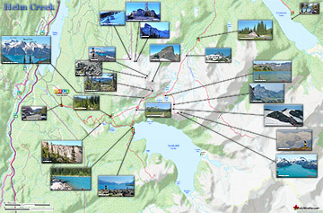
Helm Creek is a cute, meandering creek that winds its way from beyond Black Tusk, down the valley to the wonderful campground that takes its name. From the Helm Creek ...
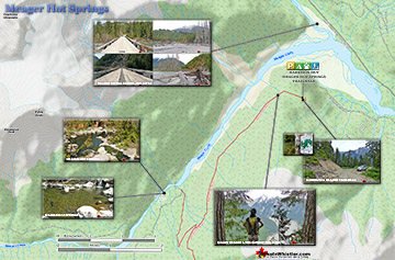
Meager Hot Springs(aka: Meager Creek Hot Springs) is located 93 kilometres northwest of Whistler, was beautifully developed into gorgeous pools, with a caretaker and usage ...
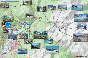
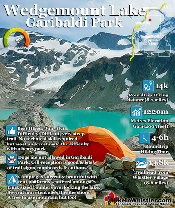
Wedgemount Lake itself is a magnificent destination for a day hike or spectacular overnight beneath the dazzling mountain peaks and stars. Many sleep under the stars on one of ...
Russet Lake is a surreal little paradise that lays at the base of The Fissile. The Fissile is the strikingly bronze mountain visible from Whistler Village. From the Village ...
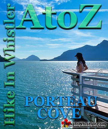
Porteau Cove is a beautiful little stop on the drive to or from Whistler. You will notice the lack of convenient washroom stops on the way to or from ...
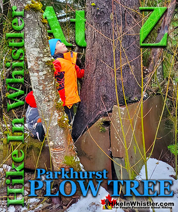
Hidden in the tangle of forest along Green Lake where the old Parkhurst Sawmill once operated, is the bizarre and beautiful Parkhurst Plow Tree. A very ...
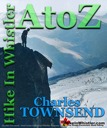
Charles Townsend (1900-1997) moved from London, England to Vancouver in the early 1920's where he met Neal Carter while studying Agriculture at UBC. Townsend was ...
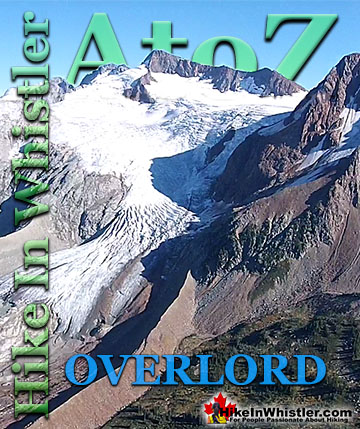
Overlord Mountain is the highest peak in the Fitzsimmons Range. Overlord is surrounded by several mountains that collectively are named the Overlord ...
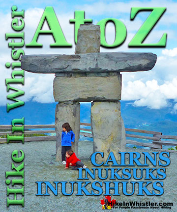
Cairns, inukshuks or inuksuks are a pile or arrangement of rocks used to indicate a route, landmark or a summit. The word cairn originates from the ...
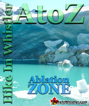
Ablation Zone: the lower altitude region of a glacier where there is a net loss of ice mass due to melting, sublimation, evaporation, ice calving or ...
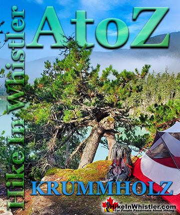
When you hike in the alpine in Whistler and Garibaldi Provincial Park, you will often encounter unbelievably hardy and sometimes mangled looking trees. ...
Skookumchuck Hot Springs(aka T'sek Hot Springs and St. Agnes Well), located two hours north of Whistler along the edge of the huge Lillooet River. The name Skookumchuck means "strong water" in the language ...
Wedgemount Lake itself is a magnificent destination for a day hike or spectacular overnight beneath the dazzling mountain peaks and stars above Garibaldi Provincial Park. Many sleep under the stars on one of ...
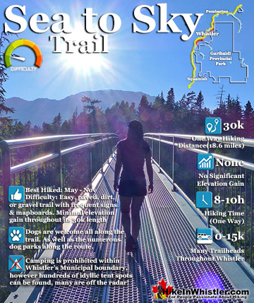
The Sea to Sky Trail is a 180 kilometre multi-use trail that runs from Squamish to D'Arcy. The trail is still under construction in many parts, however, the amazing route through Whistler is finally in ...
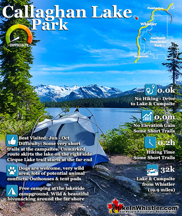
Callaghan Lake Park is a relatively untouched wilderness of rugged mountainous terrain. The valley walls were formed by relatively recent glaciation. Evidence of this can be seen in the considerable glacial ...
 Very scenic drive along Lillooet Lake
 Rules & fees increasing with new owners