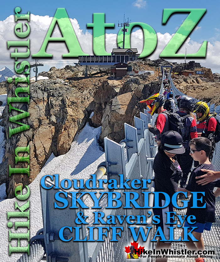
![]() The Cloudraker Skybridge and the Raven’s Eye Cliff Walk are new additions to the summit of Whistler Mountain. The Cloudraker Skybridge stretches 130 metres from just steps from the top of the Peak Express Chair across to the West Ridge. The Raven’s Eye Cliff Walk is a viewing platform that extends over 12 metres up and out from the West Ridge. Both of these exhilarating viewing areas tower way above Whistler Bowl.
The Cloudraker Skybridge and the Raven’s Eye Cliff Walk are new additions to the summit of Whistler Mountain. The Cloudraker Skybridge stretches 130 metres from just steps from the top of the Peak Express Chair across to the West Ridge. The Raven’s Eye Cliff Walk is a viewing platform that extends over 12 metres up and out from the West Ridge. Both of these exhilarating viewing areas tower way above Whistler Bowl.
Whistler & Garibaldi Hiking
![]() Alexander Falls
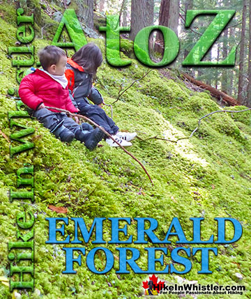
Alexander Falls ![]() Ancient Cedars
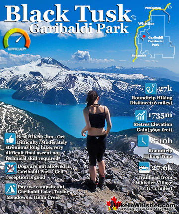
Ancient Cedars ![]() Black Tusk
Black Tusk ![]() Blackcomb Mountain
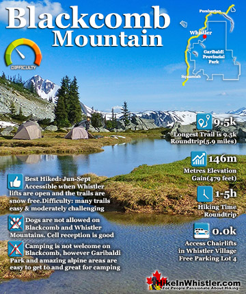
Blackcomb Mountain ![]() Brandywine Falls
Brandywine Falls ![]() Brandywine Meadows
Brandywine Meadows ![]() Brew Lake
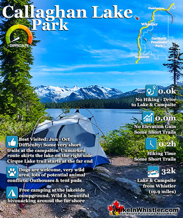
Brew Lake ![]() Callaghan Lake
Callaghan Lake ![]() Cheakamus Lake
Cheakamus Lake ![]() Cheakamus River
Cheakamus River ![]() Cirque Lake
Cirque Lake ![]() Flank Trail
Flank Trail ![]() Garibaldi Lake
Garibaldi Lake ![]() Garibaldi Park
Garibaldi Park ![]() Helm Creek
Helm Creek ![]() Jane Lakes
Jane Lakes ![]() Joffre Lakes
Joffre Lakes ![]() Keyhole Hot Springs
Keyhole Hot Springs ![]() Logger’s Lake
Logger’s Lake ![]() Madeley Lake
Madeley Lake ![]() Meager Hot Springs
Meager Hot Springs ![]() Nairn Falls
Nairn Falls ![]() Newt Lake
Newt Lake ![]() Panorama Ridge
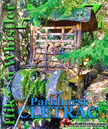
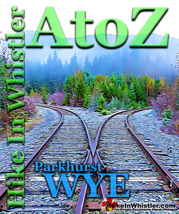
Panorama Ridge ![]() Parkhurst Ghost Town
Parkhurst Ghost Town ![]() Rainbow Falls
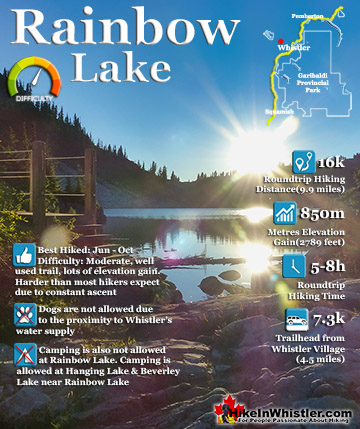
Rainbow Falls ![]() Rainbow Lake
Rainbow Lake ![]() Ring Lake
Ring Lake ![]() Russet Lake
Russet Lake ![]() Sea to Sky Trail
Sea to Sky Trail ![]() Skookumchuck Hot Springs
Skookumchuck Hot Springs ![]() Sloquet Hot Springs
Sloquet Hot Springs ![]() Sproatt East
Sproatt East ![]() Sproatt West
Sproatt West ![]() Taylor Meadows
Taylor Meadows ![]() Train Wreck
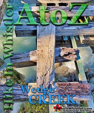
Train Wreck ![]() Wedgemount Lake
Wedgemount Lake ![]() Whistler Mountain
Whistler Mountain
![]() January
January ![]() February
February ![]() March
March ![]() April
April ![]() May
May ![]() June
June ![]() July
July ![]() August
August ![]() September
September ![]() October
October ![]() November
November ![]() December
December
The Raven's Eye Cliff Walk gives you wonderful views over the Whistler valley as well as an excellent vantage point of the Peak Express Chair with Blackcomb Mountain and the Spearhead Range in the background. The Spearhead Range encompasses Blackcomb Mountain and the Fitzsimmons Range includes Whistler Mountain and extends to Overlord Mountain. Overlord Mountain is where the two mountain ranges meet, separated by Fitzsimmons Creek that runs through Whistler Village into Green Lake. At Whistler’s peak you can hike the cliffs adjacent to the top of the Peak Express Chair on the Whistler Summit Interpretive Walk. This rugged, though very easy 1.6 kilometre set of trails can be done as a figure 8 loop trail. The large area to the right as you exit the Peak Express Chair with the Inukshuk and the Cloudraker Skybridge is one side of the figure 8 and the other side ascends up past the Peak Express Chair to some incredible lookouts and interpretive information boards before bending back to meet Mathews’ Traverse, the gravel road that brings you back to where you started. Many follow Mathews’ Traverse down to the Roundhouse Lodge on a constantly descending and gorgeous 3.2 kilometre or 2 mile route past several stunning views and through the Whistler ice walls.


The Whistler Summit Interpretive Walk is quite easy and two much more challenging hiking trails can be found starting at the trailhead located next to the inuksuk just past the Cloudraker Skybridge and Raven’s Eye Cliff Walk. The Half Note Trail and the High Note Trail both start here. The Half Note Trail is a beautiful trail that follows the ridge of Whistler Mountain overlooking Cheakamus Lake. It bends back and connects to Pika’s Traverse Road which takes you back to the Roundhouse Lodge. This route is 5.5 kilometres or 3.4 miles and should take you 2 to 3 hours from the start at the top of the Peak Express Chair to the end at the Roundhouse Lodge.

Alternatively you could take the much shorter Mathews’ Traverse Road(instead of Pika’s Traverse) back up to the summit of Whistler Mountain and ride the Peak Express Chair back down to the Roundhouse Lodge(via the short Peak Express Traverse trail). Where the Half Note trail veers back, the High Note trail continues. This much longer route takes you deeper into Garibaldi Provincial Park before meeting the junction to the Musical Bumps trail at Piccolo Summit. The High Note trail sinks into the valley in the shadow of Whistler Mountain and past Symphony Lake and Harmony Lake before reaching the Roundhouse Lodge. The High Note trail from the Cloudraker Skybridge to the Roundhouse Lodge is 11 kilometres or 6.8 miles and takes most hikers 4-5 hours.


Whistler Mountain Hiking Trails
![]() Whistler Mountain has a dozen named hiking trails that range from extremely easy and short to very challenging and long. All of them are pretty beautiful on their own, however all of them tend to be combined with others into routes, depending on what hikers are after and how much time and effort they want to put in. Another factor is the time of year and snowpack. In May and much of June, for example, you won’t have the Peak Express Chair running and almost every trail will be still buried in snow. If you are short on time and want to get to the obvious highlights, you will ride the Whistler Gondola to the Roundhouse Lodge, ride the Peak Express Chair to the summit of Whistler Mountain, see the Cloudraker Skybridge and Raven’s Eye Cliff Walk, inuksuk, Interpretive Walk, then ride back down to Whistler Village. If you are wanting more of a hike, you will not return via the Peak Express Chair, but instead hike the Half Note trail and check out the snow wall on Mathews’ Traverse. This route takes only a couple hours, but takes in a tremendous variety of sights and endless viewpoints.
Whistler Mountain has a dozen named hiking trails that range from extremely easy and short to very challenging and long. All of them are pretty beautiful on their own, however all of them tend to be combined with others into routes, depending on what hikers are after and how much time and effort they want to put in. Another factor is the time of year and snowpack. In May and much of June, for example, you won’t have the Peak Express Chair running and almost every trail will be still buried in snow. If you are short on time and want to get to the obvious highlights, you will ride the Whistler Gondola to the Roundhouse Lodge, ride the Peak Express Chair to the summit of Whistler Mountain, see the Cloudraker Skybridge and Raven’s Eye Cliff Walk, inuksuk, Interpretive Walk, then ride back down to Whistler Village. If you are wanting more of a hike, you will not return via the Peak Express Chair, but instead hike the Half Note trail and check out the snow wall on Mathews’ Traverse. This route takes only a couple hours, but takes in a tremendous variety of sights and endless viewpoints.

More Whistler & Garibaldi Park Hiking A to Z!

The Best Whistler & Garibaldi Park Hiking Trails!
Whistler & Garibaldi Park Best Hiking by Month!


Explore BC Hiking Destinations!

Whistler Hiking Trails

Squamish Hiking Trails

Vancouver Hiking Trails

Clayoquot Hiking Trails
Victoria Hiking Trails

