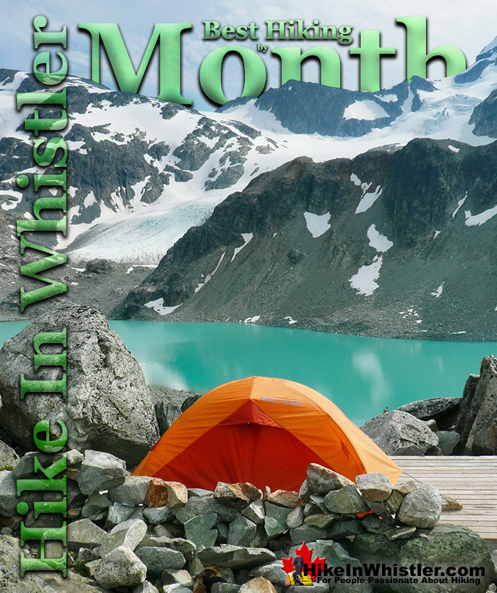
![]() Hiking in Whistler and Garibaldi Provincial Park is beautiful year-round. Some hiking trails are better than others at certain months of the year. Snow restricts some trails if you don't have snowshoes or simply makes them too exhausting or impractical for most hikers.
Hiking in Whistler and Garibaldi Provincial Park is beautiful year-round. Some hiking trails are better than others at certain months of the year. Snow restricts some trails if you don't have snowshoes or simply makes them too exhausting or impractical for most hikers.
Whistler & Garibaldi Hiking
![]() Alexander Falls
Alexander Falls ![]() Ancient Cedars
Ancient Cedars ![]() Black Tusk
Black Tusk ![]() Blackcomb Mountain
Blackcomb Mountain ![]() Brandywine Falls
Brandywine Falls ![]() Brandywine Meadows
Brandywine Meadows ![]() Brew Lake
Brew Lake ![]() Callaghan Lake
Callaghan Lake ![]() Cheakamus Lake
Cheakamus Lake ![]() Cheakamus River
Cheakamus River ![]() Cirque Lake
Cirque Lake ![]() Flank Trail
Flank Trail ![]() Garibaldi Lake
Garibaldi Lake ![]() Garibaldi Park
Garibaldi Park ![]() Helm Creek
Helm Creek ![]() Jane Lakes
Jane Lakes ![]() Joffre Lakes
Joffre Lakes ![]() Keyhole Hot Springs
Keyhole Hot Springs ![]() Logger’s Lake
Logger’s Lake ![]() Madeley Lake
Madeley Lake ![]() Meager Hot Springs
Meager Hot Springs ![]() Nairn Falls
Nairn Falls ![]() Newt Lake
Newt Lake ![]() Panorama Ridge
Panorama Ridge ![]() Parkhurst Ghost Town
Parkhurst Ghost Town ![]() Rainbow Falls
Rainbow Falls ![]() Rainbow Lake
Rainbow Lake ![]() Ring Lake
Ring Lake ![]() Russet Lake
Russet Lake ![]() Sea to Sky Trail
Sea to Sky Trail ![]() Skookumchuck Hot Springs
Skookumchuck Hot Springs ![]() Sloquet Hot Springs
Sloquet Hot Springs ![]() Sproatt East
Sproatt East ![]() Sproatt West
Sproatt West ![]() Taylor Meadows
Taylor Meadows ![]() Train Wreck
Train Wreck ![]() Wedgemount Lake
Wedgemount Lake ![]() Whistler Mountain
Whistler Mountain
![]() January
January ![]() February
February ![]() March
March ![]() April
April ![]() May
May ![]() June
June ![]() July
July ![]() August
August ![]() September
September ![]() October
October ![]() November
November ![]() December
December
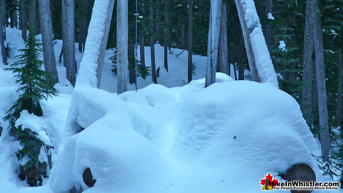
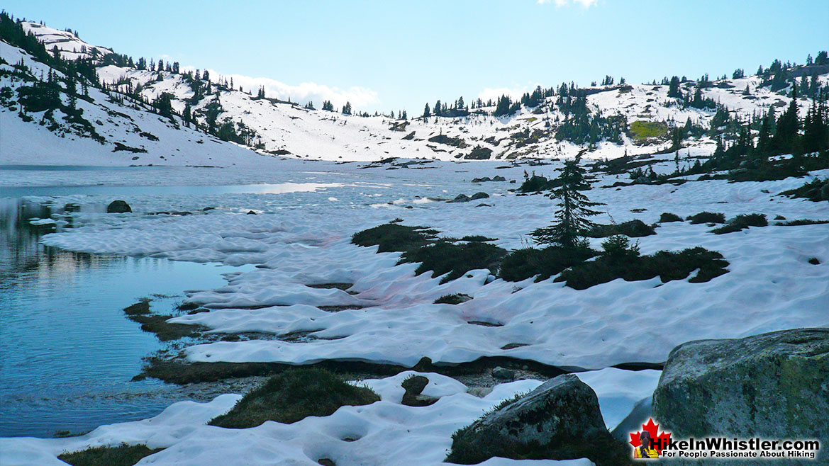
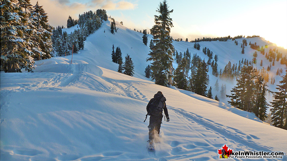
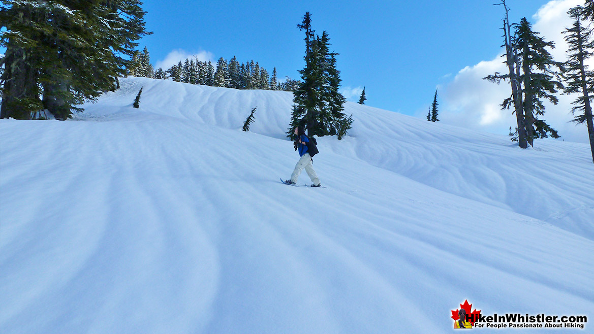
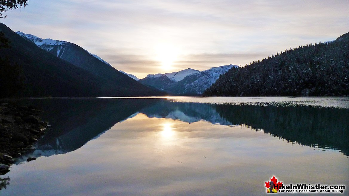
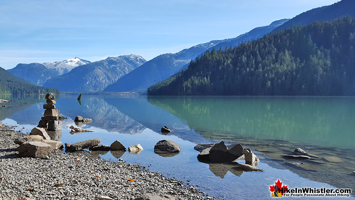
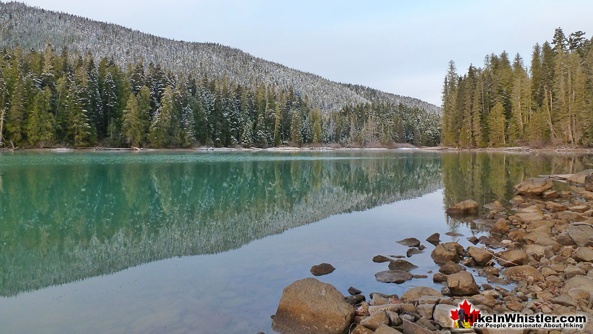
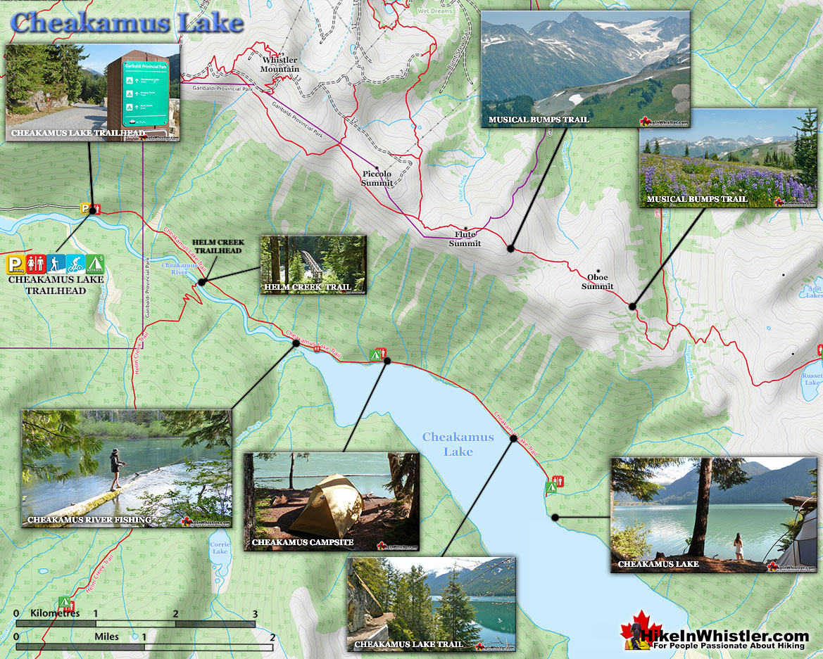
We have gone through each month of the year and outlined in detail what trails are best hiked for every month. The best hiking months in Whistler and Garibaldi Park tend to be from late June to mid September. May and early June can be very good for hiking if you don't mind a bit of snow, or hiking trails at lower elevations. The Flank Trail, for example is great to hike from April to November. On a sunny day, it is amazing and outside of the summer months you will encounter few other hikers. Cheakamus Lake is similarly worth hiking in the fall and spring. Busy in the summer months, on an average October or November morning, you will likely find the whole lake to yourself. The best time of year to hike the best and most well known Whistler and Garibaldi Park hiking trails is arguably the first two weeks in September. The official summer season ends and tourism grinds to a halt in this part of the world and still the weather is reliably beautiful. Sitting at Wedgemount Lake in early September in t-shirt weather, with the entire valley to yourself is something special. Panorama Ridge and Black Tusk can often be found deserted at this perfect time of year. Added to that, the annoying mosquitoes and flies have vanished in the previous weeks. Though September is hard to beat, every month you can find enticing reasons to head out hiking or snowshoeing in Whistler and Garibaldi Park. January has the best, most reliably winter wonderland conditions. You can snowshoe along Cheakamus River or Rainbow Falls, for example, in metre(3 feet) deep snow! February also has consistently deep powder snow for snowshoeing and many of Whistler's snowshoe trails are devoid of people. March is when the temperatures rise, yet the deep snow remains. On a sunny day, you might get away with taking off your jacket while snowshoeing through waist deep snow. April is when springtime hits the valley and you will definitely get some sunny days of t-shirt weather and beautifully deep snow. May is a gorgeous month for hiking lower elevation trails such as Parkhurst Ghost Town, Whistler Train Wreck, Cheakamus River, Logger’s Lake and the Sea to Sky Trail. Few people are out hiking these trails, yet the weather can be amazing. Twenty plus degree days(70+farenheit) are frequent and the few people you encounter on Whistler's trails, parks and beaches are locals. June is even warmer and the temperature often sits in the mid twenties(80 farenheit).
Guides to the Best of Whistler
 Best Dog Friendly Hiking Trails
Whistler is very dog friendly and the number of wonderful hiking trails that your dog will love is huge. The massively varied hiking trails range from easy, short, close to Whistler Village to challenging, long and deep in the endless wilderness around Whistler. You can find dog friendly trails in and around Whistler Village that take you through deep, dark and magical forests. Or you can drive beyond Whistler Village and take your dog to spectacular alpine lakes. Some requiring little or no hiking, while others are found after hiking challenging and long trails. Many of these places are comparatively quiet and often you and your dog will have the the wilderness to yourselves. In and around Whistler Village you have Lost Lake with its spider web of trails... Continued here.
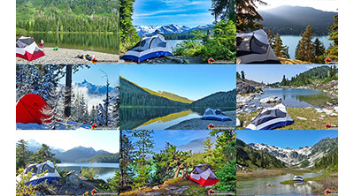 Best Free Whistler Camping
Whistler is surrounded by an immense wilderness dotted with spectacular, hidden lakes and amazing places to set up a tent. Decades of logging activity has left a network of forest service roads that has opened easy access to these places. Some of these you can drive to and some you may need a 4x4 to comfortably get to. Some places to camp for free you can drive to, some require a short hike and others are fairly long hikes to reach. Beautiful Callaghan Valley is home to several incredible and free places to camp. Callaghan Lake has a great free drive-to campsite just steps from this spectacular alpine lake. If you have a canoe, you can paddle to the end of Callaghan Lake and hike the short, but steep trail up to Cirque Lake. This gorgeous lake is deep in the alpine wilderness... Continued here.
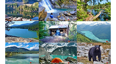 No Car? No Problem! Whistler Trails
Whistler as a resort has a wonderful car-free core. The Village Stroll runs through the heart of Whistler Village and is entirely car free. If you are visiting Whistler or living here and you don't have a car, it's no problem. On foot or on a bike you can travel the extensive network of non-motorized trails. The Valley Trail snakes through Whistler Village and extends in several directions, all of which lead to beautiful parts of Whistler. The Sea to Sky Trail and the Lost Lake trails continue this massive, car-free network of trails running almost everywhere in Whistler. When it comes to many of the best hiking trails, getting to the trailheads on foot, by bike or public transit can be tricky at best or complicated and impractical at worst. Many trailheads are far from Whistler Village and... Continued here.
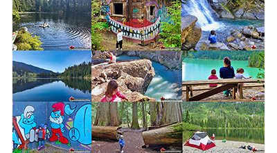 Kid Friendly Whistler Hiking Trails
There are plenty of excellent, kid and family friendly hiking trails and destinations in and around Whistler. Kid and family friendly generally means an easy and somewhat short trail that a toddler can happily manage. Some of these trails are flat enough to be stroller friendly, such as Brandywine Falls, Whistler Mountain and Blackcomb Mountain. Others such as Logger’s Lake, Cheakamus River and Madeley Lake have short enough trails to reach them that you can manage with little kids that don't want to hike too far. Some of these hikes and walks are popular and close to Whistler Village, like Whistler Mountain, Blackcomb Mountain, Lost Lake Park, Rainbow Park and Meadow Park. Others are a beautiful, but far drive into the mountains and tricky to find... Continued here.
Whistler's Best Hiking and Snowshoeing by Month
Hiking to places like Wedgemount Lake, Garibaldi Lake, Panorama Ridge, Black Tusk and Helm Creek require hiking on a fair bit of snow. The extra work is worth it though as standing in a snowy valley on a hot summer day is pretty amazing and most people wait until the snow melts to venture into the mountains of Whistler and Garibaldi Park. July and August are the best months for sunny, hot weather in Whistler. With the winter snow disappearing in late June most years, July sees the first month of snow free hiking trails to the popular Garibaldi Provincial Park destinations. Though, places like Garibaldi Lake, Black Tusk, Panorama Ridge and Wedgemount Lake can get chaotically busy in July and August, you can easily escape the crowds by heading out early, staying out late, or venturing into the vast alpine around these popular places. Black Tusk, for example, is surrounded by an enormous alpine terrain that is extraordinarily beautiful and interesting. The crowds tend to stick to the one, well-worn route to Black Tusk. You can hike quite safely down the valley on the Helm Creek side. This massive valley goes on and on and on, and gives you tremendous views of Black Tusk, surrounding mountains as well as the Lord of the Rings looking valley below. September is wonderfully serene as the crowds have gone, the weather is still amazing, and there are no bugs to bother you. October brings the fall colours and shorter days. But it also means the hiking trails are astoundingly deserted. Few hikers venture out in October, yet the snow has yet to fall on the trails. Hikes with huts in Garibaldi Park are particularly wonderful in October. Cold, rainy nights are pretty amazing if you have a cute little mountain hut to yourself. November is when you get some snowfall in Whistler and the ski season starts. Cheakamus Lake is often accessible for much of November as the snow doesn't cover the access road until mid November most years. Cheakamus Lake is a relatively easy hike to an amazing mountain lake. In November it is gorgeous and absolutely silent. December in Whistler is quite a special month. Every tree in Whistler Village seems to have a thousand Christmas lights. The Village glows, the snow usually falls heavy, and everyone is happy and on holidays. The winter wonderland hits the valley in December and you get your first opportunity to stomp through the forest in waist deep powder! Fantastic.
Rainbow Falls - Best Whistler Snowshoeing January
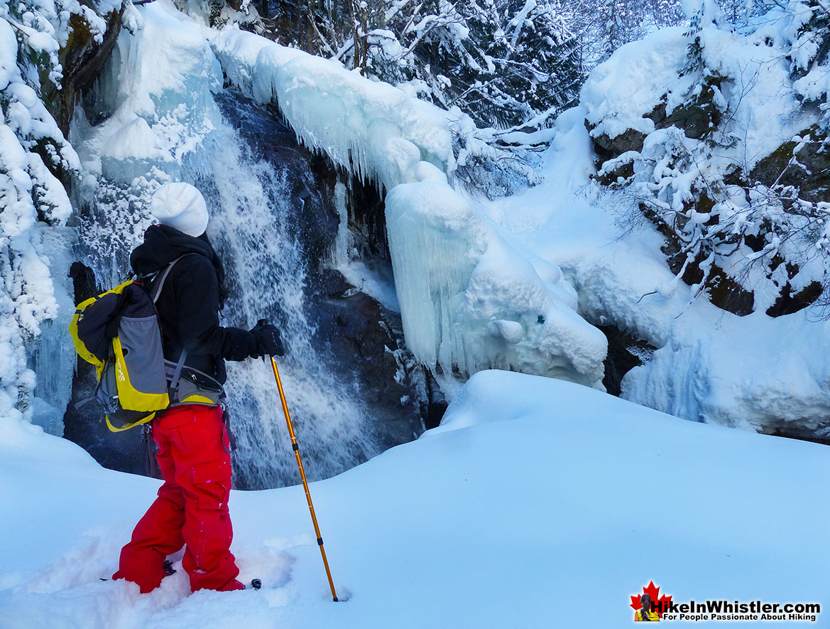
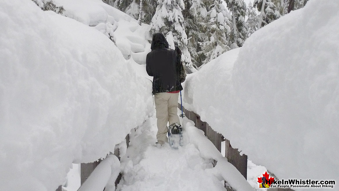
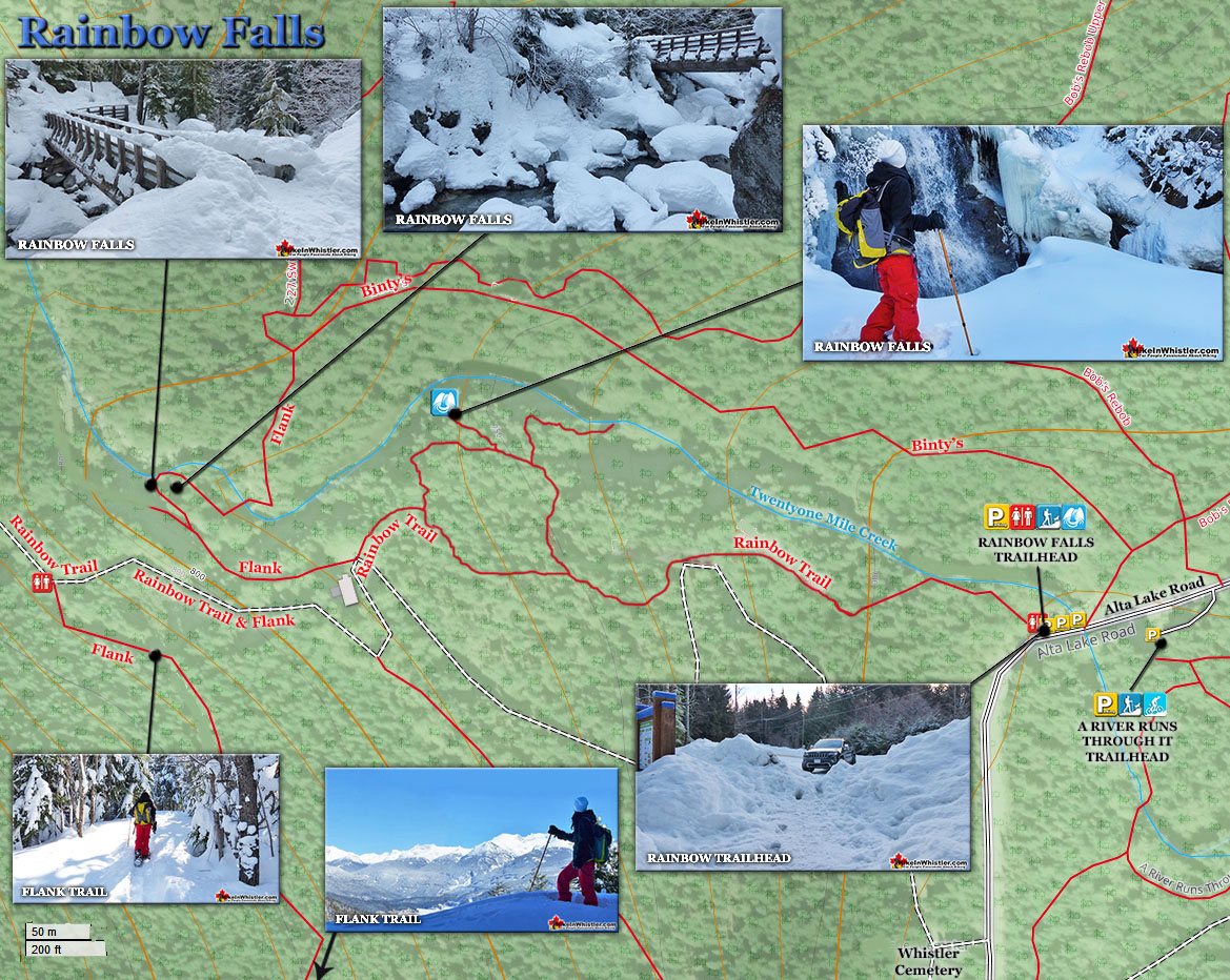
![]() Rainbow Falls, just north of Whistler Village is a nice, easy and fairly convenient snowshoe trail to try in January. This always up and down and zig-zagging trail is possibly the easiest way to see deep, wilderness snow in Whistler in January. Snow accumulates deep and fast here, it seems. And the short trail to Rainbow Falls, buried deep in this winter wonderland is located in a cute little wintry oasis. Along with Rainbow Falls, the zig-zagging trail takes you to a bridge over Twentyone Mile Creek, with more great views. Kids love this trail as it is easy, yet very scenic and adults love it for the same reasons. Rainbow Falls can be done in less than and hour and is just a short 10 minute drive north of Whistler Village. Located very near to Rainbow Park, another beautiful place to visit in January or any time of the year.
Rainbow Falls, just north of Whistler Village is a nice, easy and fairly convenient snowshoe trail to try in January. This always up and down and zig-zagging trail is possibly the easiest way to see deep, wilderness snow in Whistler in January. Snow accumulates deep and fast here, it seems. And the short trail to Rainbow Falls, buried deep in this winter wonderland is located in a cute little wintry oasis. Along with Rainbow Falls, the zig-zagging trail takes you to a bridge over Twentyone Mile Creek, with more great views. Kids love this trail as it is easy, yet very scenic and adults love it for the same reasons. Rainbow Falls can be done in less than and hour and is just a short 10 minute drive north of Whistler Village. Located very near to Rainbow Park, another beautiful place to visit in January or any time of the year.
More Best Whistler Snowshoeing - Rainbow Falls
The Flank Trail - Best Whistler Snowshoeing January
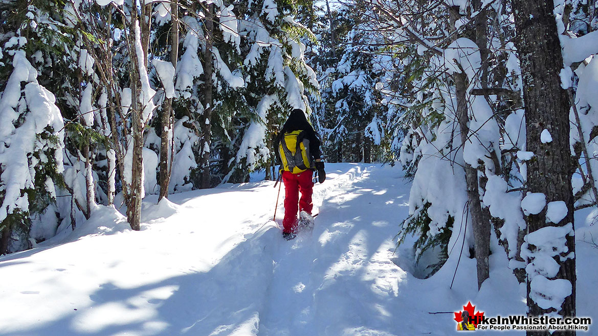
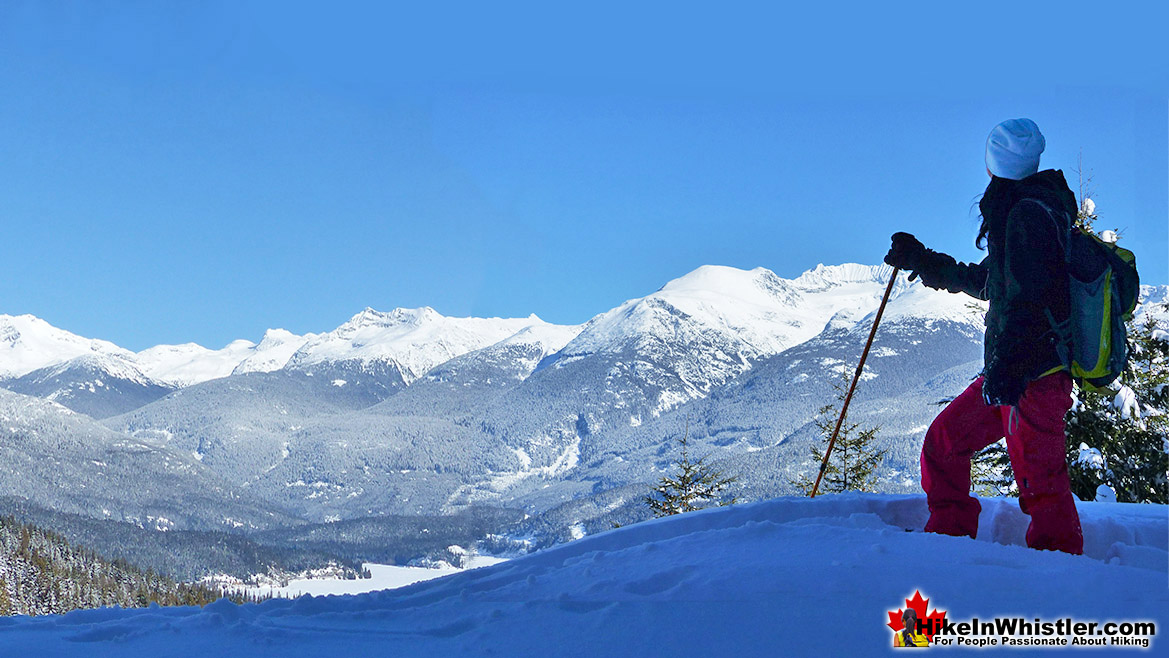
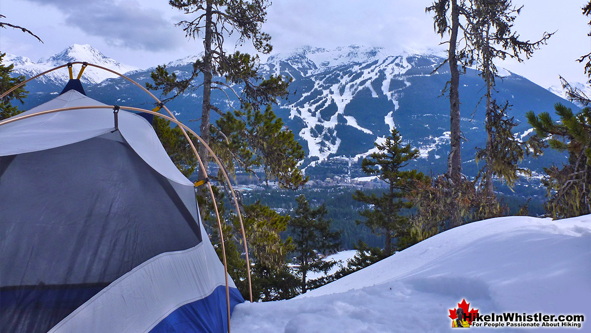
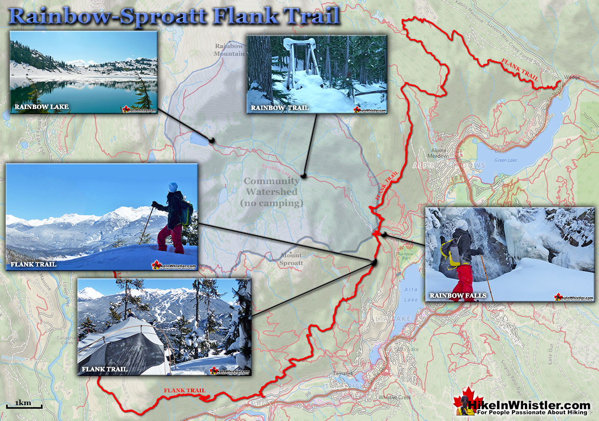
![]() If you continue beyond Rainbow Falls along the Rainbow Trail as if going to Rainbow Lake, you will come to the Flank Trail. The Rainbow Sproatt Flank Trail cuts along the edge of Mount Sproatt. Once you get on the Flank Trail from the Rainbow Trail, you have hiked most of the elevation. The Flank Trail then runs along with amazing views across to Whistler Mountain, Blackcomb Mountain and Wedge Mountain. Below you, you look down on Alta Lake and tiny people, like ants, skating on the lake. Endless viewpoints along the Flank Trail slow your progress and you will likely only hike or snowshoe for a couple kilometres before taking in enough sights to turn back home. This trail is well marked and very wide, making it easy to follow and navigate. Signs at every junction make it easy to find your way and though you may get lost on your way back. Getting lost usually only means, finding your way to a different place on Alta Lake Road, just a short walk back to your car. All in all, expect to take a couple hours to hike or snowshoe this small section of the Flank Trail.
If you continue beyond Rainbow Falls along the Rainbow Trail as if going to Rainbow Lake, you will come to the Flank Trail. The Rainbow Sproatt Flank Trail cuts along the edge of Mount Sproatt. Once you get on the Flank Trail from the Rainbow Trail, you have hiked most of the elevation. The Flank Trail then runs along with amazing views across to Whistler Mountain, Blackcomb Mountain and Wedge Mountain. Below you, you look down on Alta Lake and tiny people, like ants, skating on the lake. Endless viewpoints along the Flank Trail slow your progress and you will likely only hike or snowshoe for a couple kilometres before taking in enough sights to turn back home. This trail is well marked and very wide, making it easy to follow and navigate. Signs at every junction make it easy to find your way and though you may get lost on your way back. Getting lost usually only means, finding your way to a different place on Alta Lake Road, just a short walk back to your car. All in all, expect to take a couple hours to hike or snowshoe this small section of the Flank Trail.
More Best Whistler Snowshoeing - Flank Trail
Rainbow Park - Best Whistler Snowshoeing January
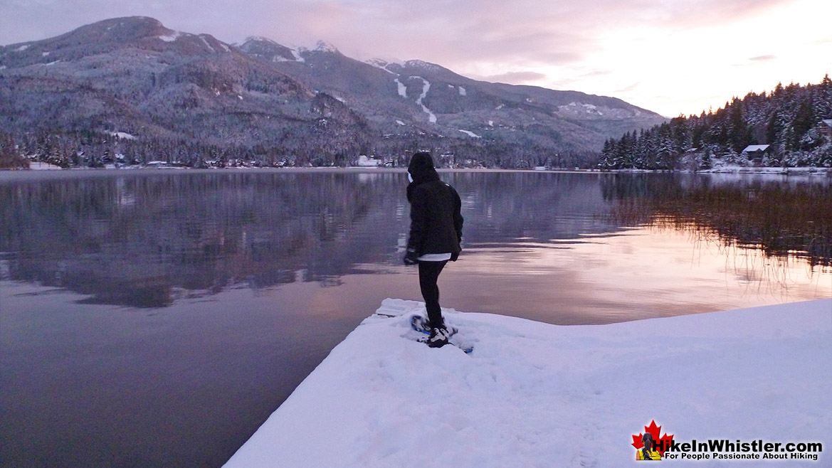
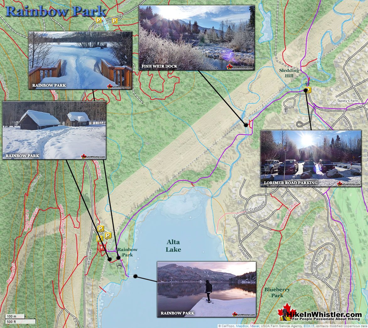
![]() Rainbow Park is located just across from the trailhead to Rainbow Falls, Rainbow Lake and the Flank Trail. The year-round parking for Rainbow Park is just a couple hundred metres past the "Rainbow Trail" parking area at the edge of Alta Lake Road. Rainbow Park is a must see place in Whistler, especially in January. In January Alta Lake is frozen solid, usually a hockey game is being played somewhere on the lake and the views are beautiful. Whistler Mountain and Blackcomb Mountain are best seen from here. Just far enough to take them both in at once, yet still close enough to easily make out the ski runs in the daytime and the bright lights from the snow groomers at night. Just a 10 minute drive from Whistler Village and a 1 minute walk from your car to the lake and beautiful sights. The Valley Trail leading to and from Rainbow Park is buried in snow and unplowed all winter. When the heavy snow of December comes, the valley trail becomes a snowshoeing and cross country ski trail. It can still be hiked, but once you reach Rainbow Park you will be knee deep in snow. The piers so well used in summer are frozen in place and, like everything else are buried in snow. This snowshoe trail is excellent for the novelty of snowshoeing and great for kids. Snowshoes are not really necessary due to short length of the trail and the relatively small size of the park. If you have small kids, however, they will be in paradise. By Christmas the park is often waist deep in snow and if you are new to snowshoeing, you will have a great time. And if you do bring kids, you will have trouble getting them to leave. Rainbow Park is a very easy, 1 kilometre trail from the parking area at the dead end of Lorimer Road to the park. It is a relaxing trail that doesn't change in elevation. It runs for a while along the River of Golden Dreams then crosses the river on a cute little bridge giving you your first view of Alta Lake. Just past the bridge on your left you can walk to a viewing platform over the lake. Back on the trail it is just another five minutes to the lake.
Rainbow Park is located just across from the trailhead to Rainbow Falls, Rainbow Lake and the Flank Trail. The year-round parking for Rainbow Park is just a couple hundred metres past the "Rainbow Trail" parking area at the edge of Alta Lake Road. Rainbow Park is a must see place in Whistler, especially in January. In January Alta Lake is frozen solid, usually a hockey game is being played somewhere on the lake and the views are beautiful. Whistler Mountain and Blackcomb Mountain are best seen from here. Just far enough to take them both in at once, yet still close enough to easily make out the ski runs in the daytime and the bright lights from the snow groomers at night. Just a 10 minute drive from Whistler Village and a 1 minute walk from your car to the lake and beautiful sights. The Valley Trail leading to and from Rainbow Park is buried in snow and unplowed all winter. When the heavy snow of December comes, the valley trail becomes a snowshoeing and cross country ski trail. It can still be hiked, but once you reach Rainbow Park you will be knee deep in snow. The piers so well used in summer are frozen in place and, like everything else are buried in snow. This snowshoe trail is excellent for the novelty of snowshoeing and great for kids. Snowshoes are not really necessary due to short length of the trail and the relatively small size of the park. If you have small kids, however, they will be in paradise. By Christmas the park is often waist deep in snow and if you are new to snowshoeing, you will have a great time. And if you do bring kids, you will have trouble getting them to leave. Rainbow Park is a very easy, 1 kilometre trail from the parking area at the dead end of Lorimer Road to the park. It is a relaxing trail that doesn't change in elevation. It runs for a while along the River of Golden Dreams then crosses the river on a cute little bridge giving you your first view of Alta Lake. Just past the bridge on your left you can walk to a viewing platform over the lake. Back on the trail it is just another five minutes to the lake.
More Best Whistler Snowshoeing - Rainbow Park
Blueberry Park - Best Whistler Snowshoeing January
![]() Across from Rainbow Park is another great Whistler park. Blueberry Park and the Blueberry Trail lay hidden in the forest of Blueberry Hill. The park has three nice wharves on Alta Lake that you may be able to make out from Rainbow Park. Also, the Blueberry Trail cuts up and across Blueberry Hill, linking the neighbourhoods of Alta Vista and Whistler Cay. There are a couple very nice viewpoints along the trail, high above Alta Lake. At times the trail is challenging and steep, it is quite short and can be done in under a hour by even the most leisurely hikers. In January the trail is a bit treacherous with snow, ice and huge tree roots across the trail, so be careful. Take a look here for a great walking route from Whistler Village to Blueberry Park and back. Check out our January Hike In Whistler & Garibaldi Park Guide here.
Across from Rainbow Park is another great Whistler park. Blueberry Park and the Blueberry Trail lay hidden in the forest of Blueberry Hill. The park has three nice wharves on Alta Lake that you may be able to make out from Rainbow Park. Also, the Blueberry Trail cuts up and across Blueberry Hill, linking the neighbourhoods of Alta Vista and Whistler Cay. There are a couple very nice viewpoints along the trail, high above Alta Lake. At times the trail is challenging and steep, it is quite short and can be done in under a hour by even the most leisurely hikers. In January the trail is a bit treacherous with snow, ice and huge tree roots across the trail, so be careful. Take a look here for a great walking route from Whistler Village to Blueberry Park and back. Check out our January Hike In Whistler & Garibaldi Park Guide here.
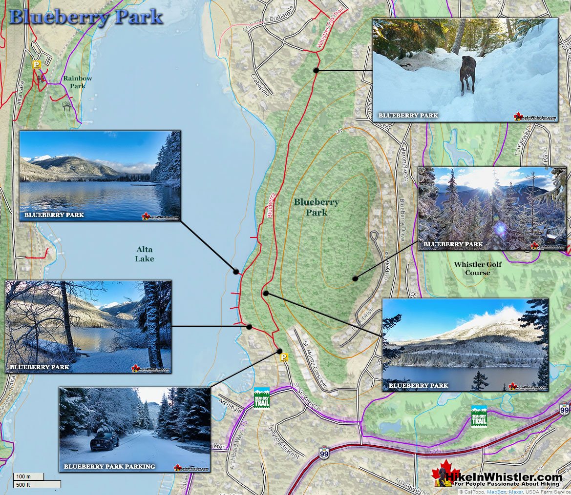
More Best Whistler Snowshoeing - Blueberry Park
Parkhurst - Best Whistler Snowshoeing February
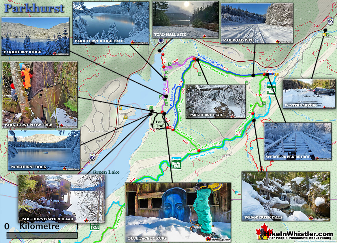
![]() In February we like snowshoeing to Parkhurst Ghost Town at the far side of Green Lake. In snow it is quite an adventure. It is located just a short, 10 minute drive north of Whistler Village and is, for the most part an easy snowshoe trail. If you can find your way to the marked trail from the unmarked route where you can park, then you will find the trail well marked with flagging tape. Parkhurst was a logging town several decades ago that has been long abandoned. Now it exists as an interesting array of old machinery and a couple ancient looking houses. What makes this trail amazing is not just the ghost town itself, but the town's setting. High up on a ridge overlooking Green Lake, the views are sensational. Depending on how deep the snow is and how close you park to the Parkhurst trailhead, expect to take two or three hours, roundrip on an average January day. Take a look at our complete guide to Hiking in Whistler & Garibaldi Park in February here.
In February we like snowshoeing to Parkhurst Ghost Town at the far side of Green Lake. In snow it is quite an adventure. It is located just a short, 10 minute drive north of Whistler Village and is, for the most part an easy snowshoe trail. If you can find your way to the marked trail from the unmarked route where you can park, then you will find the trail well marked with flagging tape. Parkhurst was a logging town several decades ago that has been long abandoned. Now it exists as an interesting array of old machinery and a couple ancient looking houses. What makes this trail amazing is not just the ghost town itself, but the town's setting. High up on a ridge overlooking Green Lake, the views are sensational. Depending on how deep the snow is and how close you park to the Parkhurst trailhead, expect to take two or three hours, roundrip on an average January day. Take a look at our complete guide to Hiking in Whistler & Garibaldi Park in February here.
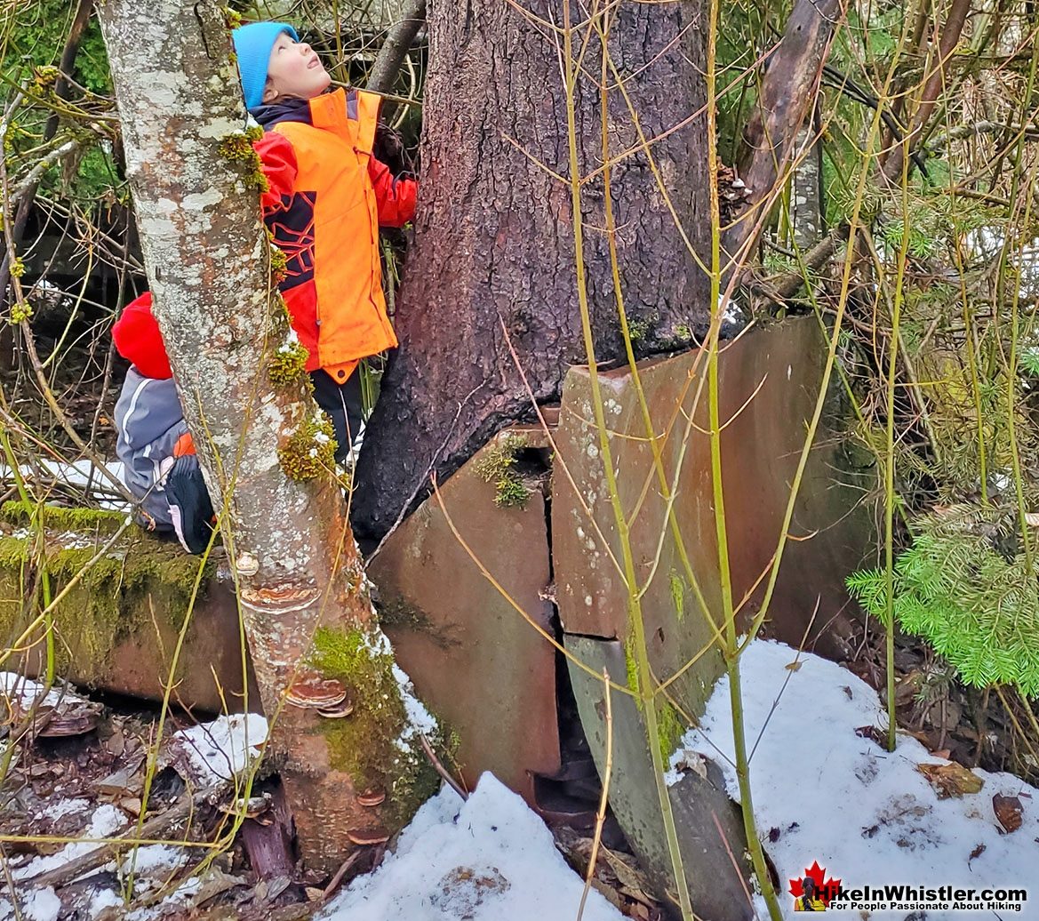
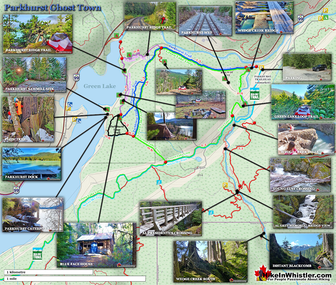
The places to put up a tent in and around Parkhurst are too numerous to list here. From the obvious camping among the crumbling houses at various places around the town to the less obvious areas down by the lake. If you go down to the shore of Green Lake to where the giant tractor is you will notice that if you head along the shore of Green Lake north for about 200 metres you will come to the old cement foundations of the mill and some clearings hidden in the spooky forest there. This area has some positives and negatives. The bad of course is the train goes by at 2am and again at 6am, just 40 metres from your tent. If you don't mind that then this area is great. Spooky, though cute little forest, steps from the lake and nice, clean, grassy areas to wander around. If you are a fan of history, you might revel in the fact that this is the once home of the iconic Toad Hall naked picture from the early 70's. This picture can be seen at the Whistler Museum as several originals were donated. Back up the trail to Parkhurst, you have the beautiful ridge, high above the train tracks with mossy and grassy fields overlooking the lake. You still get the train going by, but its fun to watch it from above. This cliff has an amazing view of the setting sun over Rainbow Mountain every evening as well. Another great place is at Green River by the bridge next to the highway. Both sides of the bridge have several excellent places next to the river ideal for camping and with the added benefit of being steps from your vehicle. The land the Parkhurst sits on was recently purchased by the Resort Municipality of Whistler, so camping there is prohibited as it falls within the Whistler Municipal Boundary. Parkhurst is so remote that you likely won't be bothered by surreptitiously spending the night. An obnoxiously ostentatious campsite at Parkhurst, however, will likely attract attention of bylaw officers. The concern from campers in Whistler is not so much the mess and wear and tear on the terrain, but the forest fire risk that comes with long term campers. Every year it seems, a long-term camper in the woods around Whistler causes a fire of some sort that could have been catastrophic if not immediately contained. So keep that in mind if you do bivouac in Parkhurst. An innocent campfire could light up a forest.
More Best Whistler Snowshoeing - Parkhurst Ghost Town
Joffre Lakes - Best Whistler Snowshoeing February
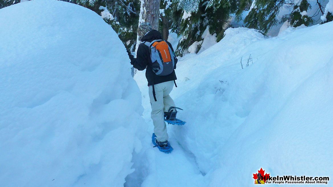
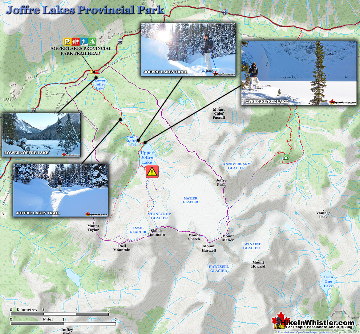
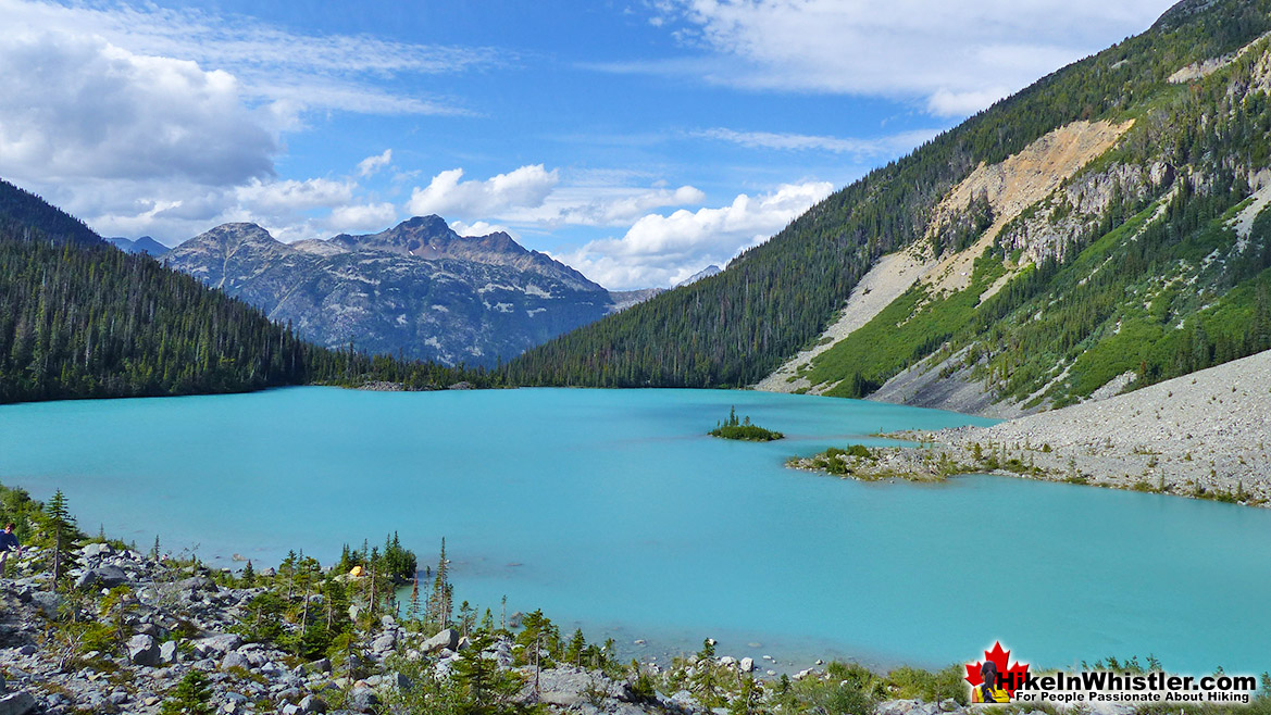
![]() Joffre Lakes Provincial Park is a hiking paradise in the summer and a skiing and snowshoeing paradise in the winter. About 1 hour and 20 minutes north of Whistler gets you to the Joffre Lakes trailhead. Located up on the Duffy Lake Road north of Pemberton, Joffre Lakes is well known for its incredibly surreal, turquoise water. In the winter of course, all three of the Joffre Lakes are frozen over but the trail is popular with skiers and snowshoers between the months of November and April. The Joffre Lakes trail is fairly well marked and almost always tracked out in the winter it is still possible to lose the trail after dark or or during heavy snowfall. Joffre Lakes Provincial Park is centred around the three Joffre Lakes. All of them are beautiful on their own and each more beautiful than the last. Frozen over in the winter, you won't be able to marvel at the amazing turquoise colours the lakes, caused by light reflecting off of the particles of glacial silt suspended in the water. In the winter, with the lakes frozen and the trees weighed down with snow, Joffre Lakes takes on a serene beauty, with the low sun cutting through the trees and the forest brightly reflecting. The third of the Joffre Lakes ends in a U-shaped valley where you will find the far side of the lake towering with glaciers relentlessly crushing down on the lake. The sun fills the valley and the silence is wonderful. The trailhead and parking lot will be buried in metres of snow in the winter months, however a small parking area is plowed throughout the winter. There are plenty of signs, so even in snowy weather, you should easily spot them. From the winter parking area you will likely have to climb over a plowed, wall of snow and then continue through the snow buried parking lot. At the far end, the parking lot bends right and you will spot the trailhead sign.
Joffre Lakes Provincial Park is a hiking paradise in the summer and a skiing and snowshoeing paradise in the winter. About 1 hour and 20 minutes north of Whistler gets you to the Joffre Lakes trailhead. Located up on the Duffy Lake Road north of Pemberton, Joffre Lakes is well known for its incredibly surreal, turquoise water. In the winter of course, all three of the Joffre Lakes are frozen over but the trail is popular with skiers and snowshoers between the months of November and April. The Joffre Lakes trail is fairly well marked and almost always tracked out in the winter it is still possible to lose the trail after dark or or during heavy snowfall. Joffre Lakes Provincial Park is centred around the three Joffre Lakes. All of them are beautiful on their own and each more beautiful than the last. Frozen over in the winter, you won't be able to marvel at the amazing turquoise colours the lakes, caused by light reflecting off of the particles of glacial silt suspended in the water. In the winter, with the lakes frozen and the trees weighed down with snow, Joffre Lakes takes on a serene beauty, with the low sun cutting through the trees and the forest brightly reflecting. The third of the Joffre Lakes ends in a U-shaped valley where you will find the far side of the lake towering with glaciers relentlessly crushing down on the lake. The sun fills the valley and the silence is wonderful. The trailhead and parking lot will be buried in metres of snow in the winter months, however a small parking area is plowed throughout the winter. There are plenty of signs, so even in snowy weather, you should easily spot them. From the winter parking area you will likely have to climb over a plowed, wall of snow and then continue through the snow buried parking lot. At the far end, the parking lot bends right and you will spot the trailhead sign.
More Best Whistler Snowshoeing - Joffre Lakes
Cheakamus River - Best Whistler Snowshoeing March
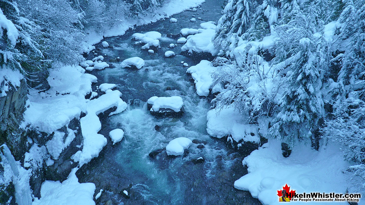
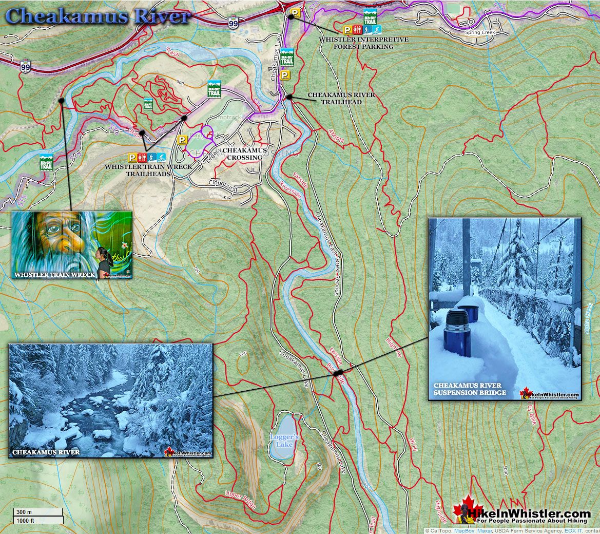
![]() Cheakamus River is a beautiful, crashing, turquoise coloured river that flows from Cheakamus Lake, through Whistler Interpretive Forest at Cheakamus Crossing, then down past Brandywine Falls to Daisy Lake. Also a popular kayaking route, the main attraction to Cheakamus River is the wonderful and quite extensive network of hiking and biking trails that run along either side of it. The Riverside trail and the Farside trail run on either side of Cheakamus River and connect at both ends by bridges. Connecting to the Riverside trail is the short trail to Logger's Lake, which in turn is surrounded by more hiking and biking trails. The Lake Loop trail, Crater Rim trail, the Ridge trail, Upper Ridge trail, and the Lower Ridge trail. On the Farside trail along Cheakamus River you can connect to Cheakamus Road(gravel road) and hike 6 kilometres up to the Cheakamus Lake trailhead. On the other side of the neighbourhood of Cheakamus Crossing, which Cheakamus River bends around keeping the Sea to Sky Highway and train tracks on its opposite side, you find still more hiking and biking trails. Trash trail hugs the river all the way to the beautiful bridge to Whistler Train Wreck. Or, continue past the bridge to connect with the Sea to Sky trail. For the most part, however, if you are talking about the Cheakamus River trails you are likely talking about the Farside and Riverside trails in Whistler Interpretive Forest. Eight kilometres south of Whistler Village and surrounding the recently constructed neighbourhood of Cheakamus Crossing is Whistler Interpretive Forest. This beautiful forest surrounds the Cheakamus River and has been cut and replanted in several areas in the past decades. Hiking and biking trails have sprung up over the years making the area a wonderful place to explore. Unfortunately, the Interpretive Forest is day-use only, no camping is permitted. The main highlights of the Interpretive Forest are the Cheakamus River trails, and the extraordinary Logger's Lake. Logger's Lake, just a short hike from the Cheakamus River suspension bridge, sits within a 10000 year old, extinct volcano and is a hiking destination on its own.
Cheakamus River is a beautiful, crashing, turquoise coloured river that flows from Cheakamus Lake, through Whistler Interpretive Forest at Cheakamus Crossing, then down past Brandywine Falls to Daisy Lake. Also a popular kayaking route, the main attraction to Cheakamus River is the wonderful and quite extensive network of hiking and biking trails that run along either side of it. The Riverside trail and the Farside trail run on either side of Cheakamus River and connect at both ends by bridges. Connecting to the Riverside trail is the short trail to Logger's Lake, which in turn is surrounded by more hiking and biking trails. The Lake Loop trail, Crater Rim trail, the Ridge trail, Upper Ridge trail, and the Lower Ridge trail. On the Farside trail along Cheakamus River you can connect to Cheakamus Road(gravel road) and hike 6 kilometres up to the Cheakamus Lake trailhead. On the other side of the neighbourhood of Cheakamus Crossing, which Cheakamus River bends around keeping the Sea to Sky Highway and train tracks on its opposite side, you find still more hiking and biking trails. Trash trail hugs the river all the way to the beautiful bridge to Whistler Train Wreck. Or, continue past the bridge to connect with the Sea to Sky trail. For the most part, however, if you are talking about the Cheakamus River trails you are likely talking about the Farside and Riverside trails in Whistler Interpretive Forest. Eight kilometres south of Whistler Village and surrounding the recently constructed neighbourhood of Cheakamus Crossing is Whistler Interpretive Forest. This beautiful forest surrounds the Cheakamus River and has been cut and replanted in several areas in the past decades. Hiking and biking trails have sprung up over the years making the area a wonderful place to explore. Unfortunately, the Interpretive Forest is day-use only, no camping is permitted. The main highlights of the Interpretive Forest are the Cheakamus River trails, and the extraordinary Logger's Lake. Logger's Lake, just a short hike from the Cheakamus River suspension bridge, sits within a 10000 year old, extinct volcano and is a hiking destination on its own.
More Best Whistler Snowshoeing - Cheakamus River
Nairn Falls - Best Whistler Snowshoeing March
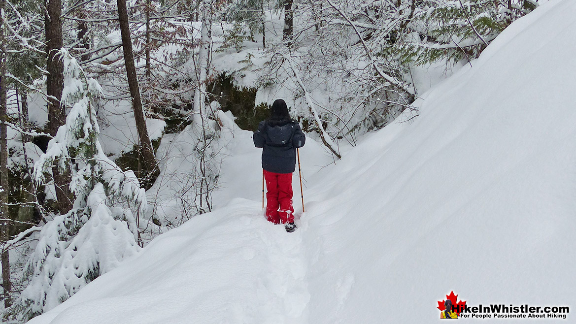
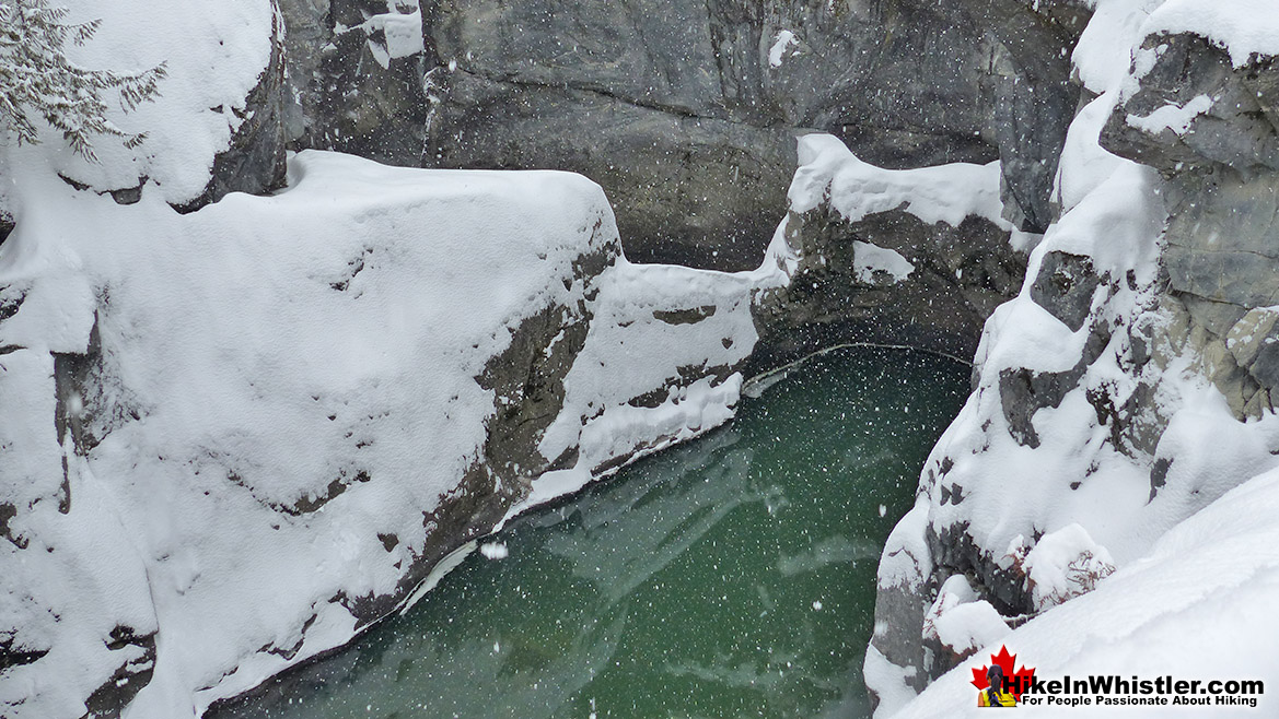
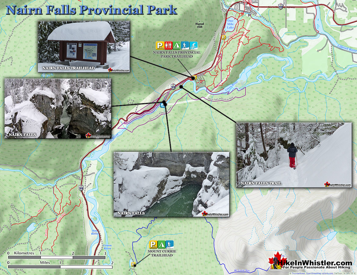
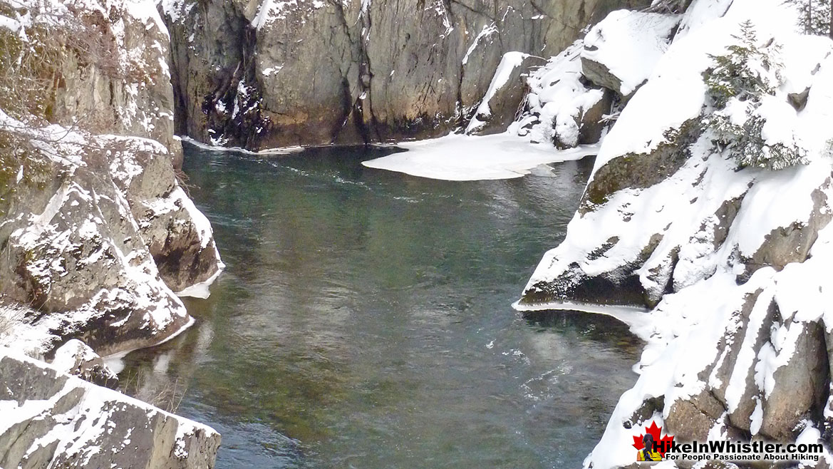
![]() Nairn Falls Provincial Park is located just a twenty minute drive north of Whistler Village. There is a nice, relaxing 1.2 kilometre hiking/snowshoeing trail that runs along Green River to a gorgeous viewing area in the midst of Nairn Falls. The popular trail is actually hike-able year-round, so you most likely will not need your snowshoes unless there has been lots of new snow in the last couple days. The trail is well marked and doesn't gain any significant elevation, making it a very easy, kid friendly trail. The viewing area is located within a bend in the falls/river and the churning waters rushes around where you stand, far below. The water crashes through deep cuts in the rock and rushes into deep, green pools. There is a wonderful sign depicting how the area was formed over thousands of years. A short side trail from the main viewing area takes you over to an abrupt edge, where you can look down on the Green River below. Railings have been constructed as a precaution to prevent people falling off the cliffs. Nairn Falls is one of several amazing waterfalls in the Whistler area that can be seen year-round. Other waterfalls in the area include, Rainbow Falls near Whistler Village, Alexander Falls and Brandywine Falls, both about 30-40 minutes south of Whistler.
Nairn Falls Provincial Park is located just a twenty minute drive north of Whistler Village. There is a nice, relaxing 1.2 kilometre hiking/snowshoeing trail that runs along Green River to a gorgeous viewing area in the midst of Nairn Falls. The popular trail is actually hike-able year-round, so you most likely will not need your snowshoes unless there has been lots of new snow in the last couple days. The trail is well marked and doesn't gain any significant elevation, making it a very easy, kid friendly trail. The viewing area is located within a bend in the falls/river and the churning waters rushes around where you stand, far below. The water crashes through deep cuts in the rock and rushes into deep, green pools. There is a wonderful sign depicting how the area was formed over thousands of years. A short side trail from the main viewing area takes you over to an abrupt edge, where you can look down on the Green River below. Railings have been constructed as a precaution to prevent people falling off the cliffs. Nairn Falls is one of several amazing waterfalls in the Whistler area that can be seen year-round. Other waterfalls in the area include, Rainbow Falls near Whistler Village, Alexander Falls and Brandywine Falls, both about 30-40 minutes south of Whistler.
More Best Whistler Snowshoeing - Nairn Falls
Rainbow Lake - Best Whistler Snowshoeing March
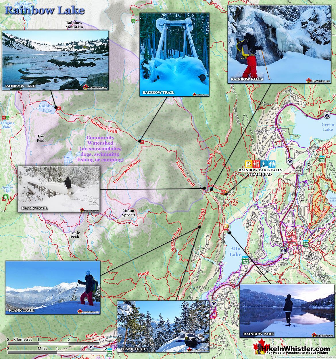
![]() The Rainbow Trail is a convenient and popular trail near Whistler Village that takes you to Rainbow Lake as well as the Rainbow-Sproatt Flank Trail, Rainbow Falls, Hanging Lake, Madeley Lake, Beverley Lake, Rainbow Mountain... and even Whistler Olympic Park if you are determined. It is a consistently uphill and very beautiful trail with several water (bridge) crossings and waterfalls on the way to the picture-perfect lake. Rainbow Lake is a tough and beautiful 8 kilometre snowshoeing trail high up in the mountains across the valley from Whistler Mountain and Blackcomb Mountain. The trail is generally well marked and easy to follow, however some sections are tricky to follow as the heavy snow bends the bushes down obscuring the trail. The trail is a constant, fairly steep ascent and you may notice ski tracks along the route. A somewhat popular skiing attraction in Whistler is to get heli-dropped on Rainbow Mountain and skiing back to Whistler. Rainbow Falls is a nice detour near the beginning of the Rainbow Lake trail. When you come to the small water purification building you will see a distinct fork in the trail and a sign directing you to Rainbow Lake turn left. If you go right however, in just a few hundred metres you will come to the beautiful Rainbow Falls as well as a nice picturesque bridge over the river. You of course have to backtrack to get back to the Rainbow Lake trail. Though Rainbow Lake is only 8k(5 miles) from the trailhead, on snowshoes it will likely take nearly four hours to get there. You can snowshoe around up there for quite a while so you have to be careful with the time as in the winter months the sun goes down way before 5pm.
The Rainbow Trail is a convenient and popular trail near Whistler Village that takes you to Rainbow Lake as well as the Rainbow-Sproatt Flank Trail, Rainbow Falls, Hanging Lake, Madeley Lake, Beverley Lake, Rainbow Mountain... and even Whistler Olympic Park if you are determined. It is a consistently uphill and very beautiful trail with several water (bridge) crossings and waterfalls on the way to the picture-perfect lake. Rainbow Lake is a tough and beautiful 8 kilometre snowshoeing trail high up in the mountains across the valley from Whistler Mountain and Blackcomb Mountain. The trail is generally well marked and easy to follow, however some sections are tricky to follow as the heavy snow bends the bushes down obscuring the trail. The trail is a constant, fairly steep ascent and you may notice ski tracks along the route. A somewhat popular skiing attraction in Whistler is to get heli-dropped on Rainbow Mountain and skiing back to Whistler. Rainbow Falls is a nice detour near the beginning of the Rainbow Lake trail. When you come to the small water purification building you will see a distinct fork in the trail and a sign directing you to Rainbow Lake turn left. If you go right however, in just a few hundred metres you will come to the beautiful Rainbow Falls as well as a nice picturesque bridge over the river. You of course have to backtrack to get back to the Rainbow Lake trail. Though Rainbow Lake is only 8k(5 miles) from the trailhead, on snowshoes it will likely take nearly four hours to get there. You can snowshoe around up there for quite a while so you have to be careful with the time as in the winter months the sun goes down way before 5pm.
More Best Whistler Snowshoeing - Rainbow Lake
Elfin Lakes - Best Whistler Snowshoeing April
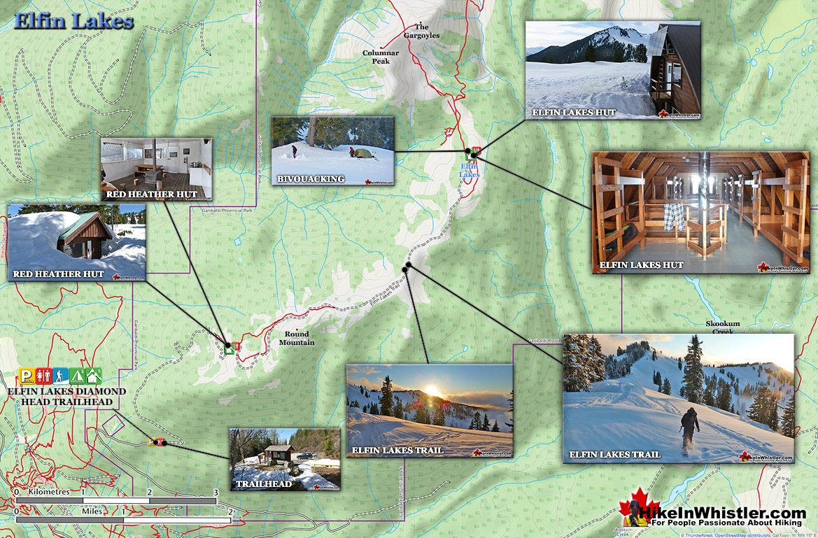
![]() April is when Elfin Lakes in Garibaldi Provincial Park is particularly incredible. Lots of snow and spring temperatures mean you can find yourself in a snowy paradise in t-shirt weather. More Hike in Whistler in April here. Elfin Lakes in Garibaldi Provincial Park is an absolutely phenomenal, though long, hiking, biking, snowshoeing and skiing trail that begins at the Diamond Head area in Squamish. From Whistler Village, the trailhead is just over an hours drive away, located near the south end of Garibaldi Park. Garibaldi Provincial Park is the massive wilderness park of nearly two thousand square kilometres that stretches from Squamish to Pemberton. If you are driving the Sea to Sky Highway to Whistler, Garibaldi Park will be the vast wilderness of snow-capped mountains on your right. The Elfin Lakes trail is very well marked and maintained and leads to the wonderful, Elfin Lakes hut. This amazing hut sleeps 33 and is solar powered and propane heated. There is a charge of $15/person(payable online) to stay the night there which is a small price to pay for the beautiful comfort after the long, 11 kilometre snowshoe or hike to get there. This area is very popular with skiers as well as snowshoers in the winter and deep snow covers the trail usually from November to June. The trail to Elfin Lakes starts out ascending through deep forest, reaching the Red Heather hut after 5 kilometres. This is a small warming hut equipped with a wood stove complete with a stack of wood free to use, though sleeping here is for emergencies only. The final 6k from this hut to Elfin Lakes takes you along a beautiful ridge with amazing views of snowy mountains all around. The sheer distance of this snowshoeing trail ranks it as difficult, though overall you will just be doing a moderately steady ascending trail. Expect to take four hours to reach the Elfin Lakes hut as you are almost constantly ascending a gradual, though consistently uphill trail.
April is when Elfin Lakes in Garibaldi Provincial Park is particularly incredible. Lots of snow and spring temperatures mean you can find yourself in a snowy paradise in t-shirt weather. More Hike in Whistler in April here. Elfin Lakes in Garibaldi Provincial Park is an absolutely phenomenal, though long, hiking, biking, snowshoeing and skiing trail that begins at the Diamond Head area in Squamish. From Whistler Village, the trailhead is just over an hours drive away, located near the south end of Garibaldi Park. Garibaldi Provincial Park is the massive wilderness park of nearly two thousand square kilometres that stretches from Squamish to Pemberton. If you are driving the Sea to Sky Highway to Whistler, Garibaldi Park will be the vast wilderness of snow-capped mountains on your right. The Elfin Lakes trail is very well marked and maintained and leads to the wonderful, Elfin Lakes hut. This amazing hut sleeps 33 and is solar powered and propane heated. There is a charge of $15/person(payable online) to stay the night there which is a small price to pay for the beautiful comfort after the long, 11 kilometre snowshoe or hike to get there. This area is very popular with skiers as well as snowshoers in the winter and deep snow covers the trail usually from November to June. The trail to Elfin Lakes starts out ascending through deep forest, reaching the Red Heather hut after 5 kilometres. This is a small warming hut equipped with a wood stove complete with a stack of wood free to use, though sleeping here is for emergencies only. The final 6k from this hut to Elfin Lakes takes you along a beautiful ridge with amazing views of snowy mountains all around. The sheer distance of this snowshoeing trail ranks it as difficult, though overall you will just be doing a moderately steady ascending trail. Expect to take four hours to reach the Elfin Lakes hut as you are almost constantly ascending a gradual, though consistently uphill trail.
More Best Whistler Snowshoeing - Elfin Lakes
Taylor Meadows - Best Whistler Snowshoeing April
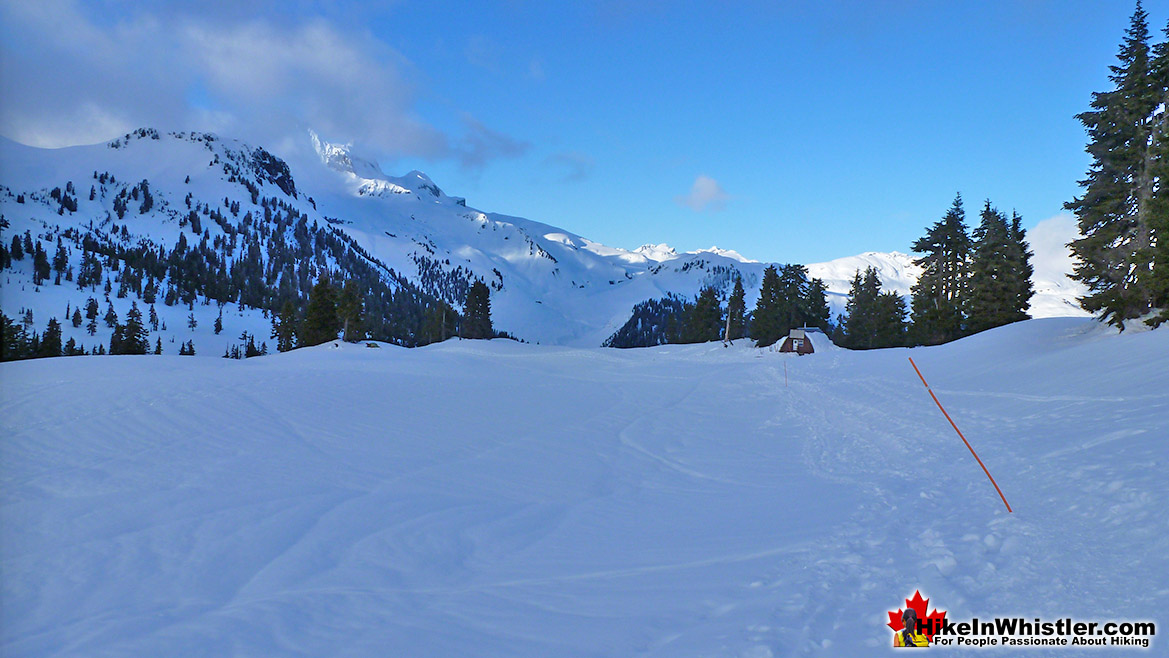
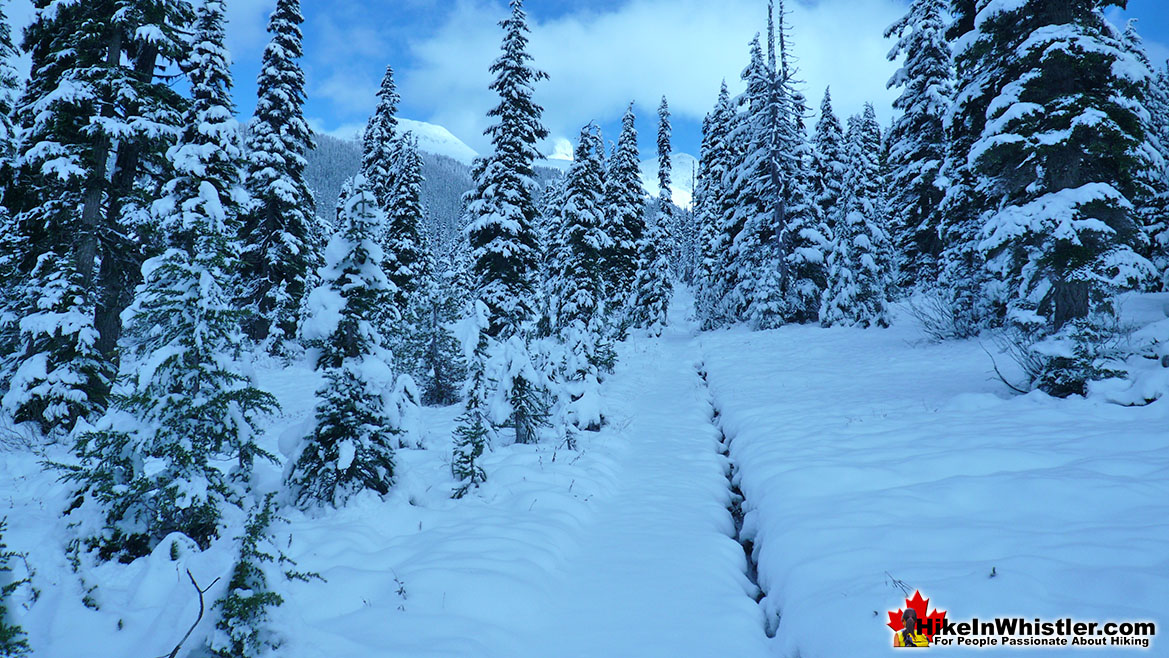
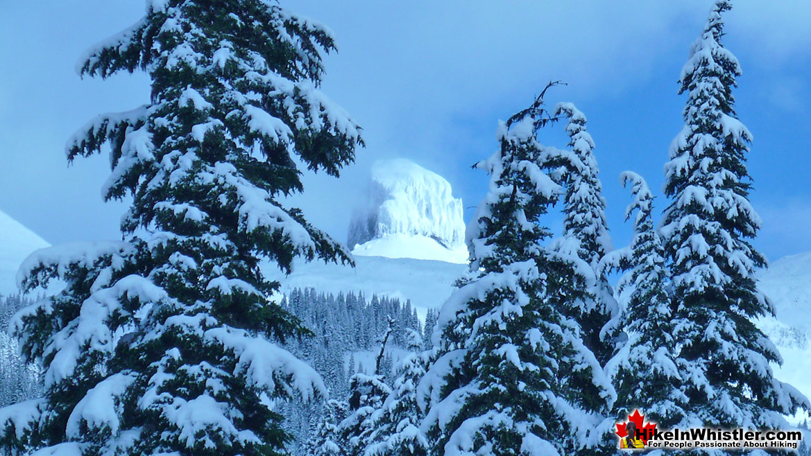
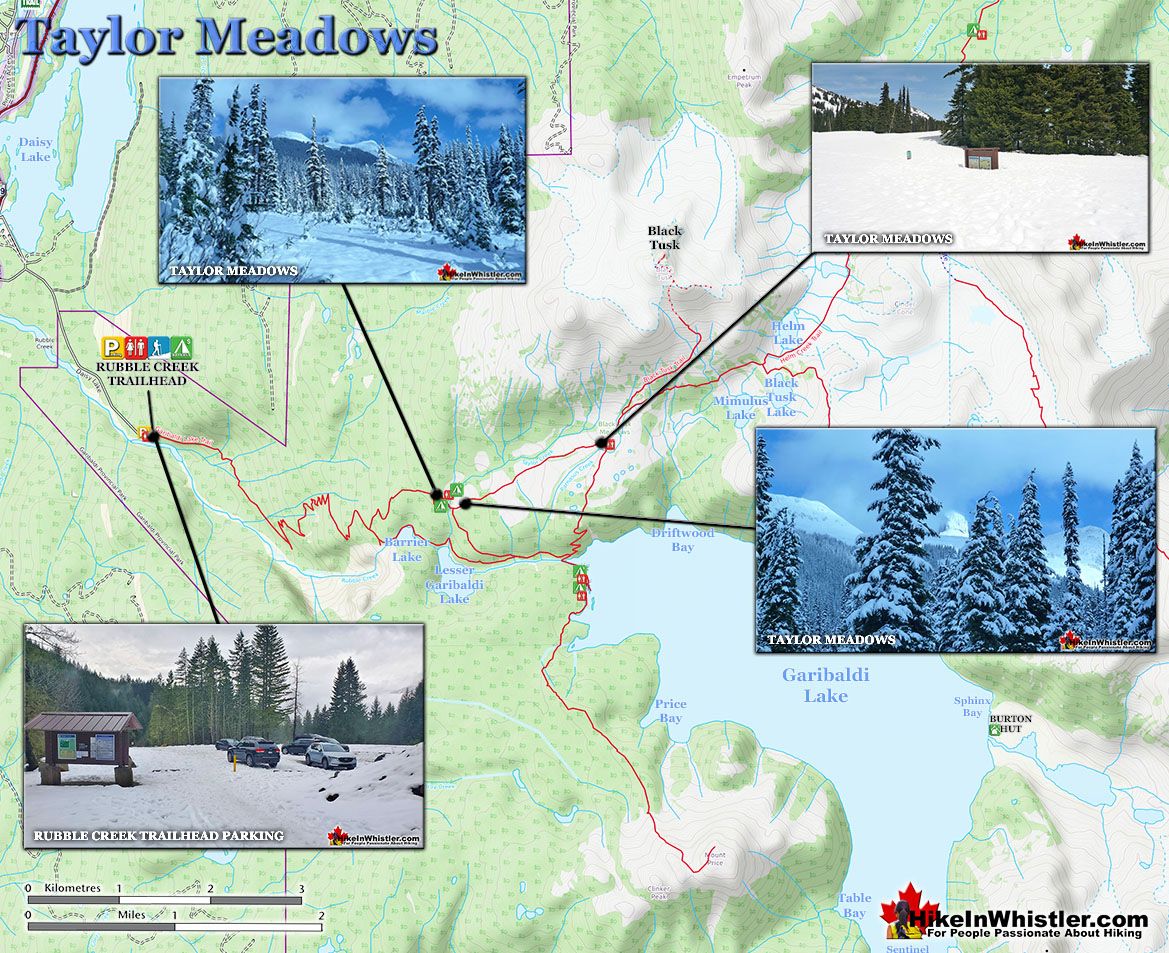
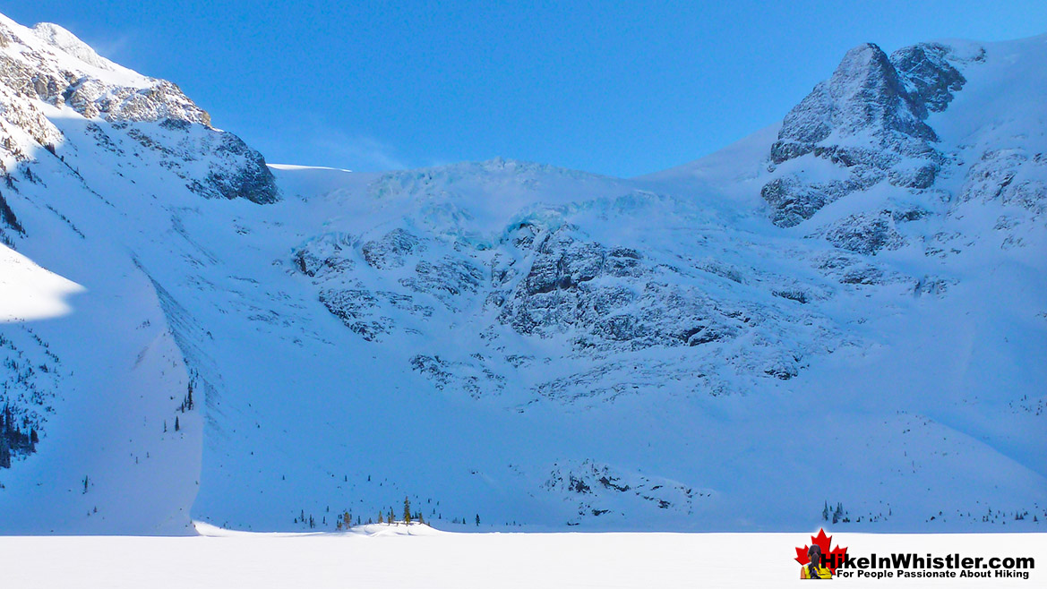
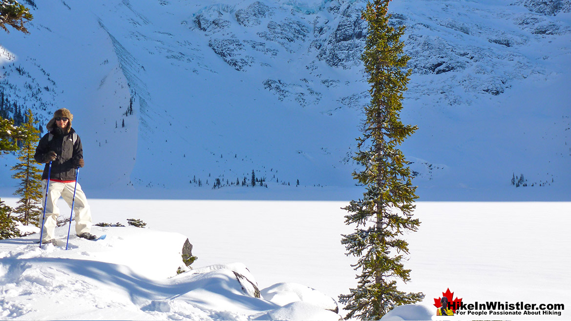
![]() Taylor Meadows, in Garibaldi Provincial Park is an amazing place to snowshoe in the winter near Whistler. Beautiful snowy meadows surrounded by mountains everywhere you look. Black Tusk towering in the distance so close and blanketed in wonderful, beautiful snow. Garibaldi Lake is accessible as well on this snowshoeing hike. The Taylor Meadows trail forks partway up, left goes to Taylor Meadows, right to Garibaldi Lake. The trail joins again at the far side of both campsites. Garibaldi Lake, so massive and dramatically beautiful in the winter, a huge frozen valley. The downside to this hike is the length of hiking to get to the beautiful parts. In the summer it's not so bad as the trailhead is a moderately difficult 9k from Garibaldi Lake. In the winter however, the trailhead parking lot is unplowed almost down to the highway. So just to get to the trailhead requires about a 2k uphill snowshoe slog. If you snowshoe the beautiful route to Taylor Meadows and return via Garibaldi Lake the route is 25 kilometres long and very strenuous as a one day snowshoe trip. Camping at either Taylor Meadows or Garibaldi Lake are great options if you can stand the cold and are well prepared. If you plan to do this trip in one day be sure to leave very early and be well prepared for winter hiking. In the winter the days are very short so always have lights with you. Although the trail will likely be tracked out by previous hikers and skiers, having a gps is an excellent backup in case you lose the trail. If you are not troubled by a lot of exertion then it's a wonderful snowshoe destination. Like Joffre Lakes it is frequented by skiers just enough to ensure an almost constant track throughout the winter so you can concentrate more on the scenery then keeping from getting lost. Another nice attribute of this hike is the fact that you can snowshoe through the beautiful Taylor Meadows on the way up then across to Garibaldi Lake on the way back, therefore doing a little snowshoe circle route before heading back to your car at Rubble Creek. From Village Gate Boulevard, drive south, toward Vancouver. The well marked turnoff to Black Tusk(Garibaldi) trailhead is 25 kilometres south of Whistler on your left. The 2 kilometre road to the trailhead parking is not plowed in the winter so you will have to park at the end of this road. Be sure not to block the road in any way however, as it is not unusual for huge 4x4's to drive up to the trailhead through the deep snow.
Taylor Meadows, in Garibaldi Provincial Park is an amazing place to snowshoe in the winter near Whistler. Beautiful snowy meadows surrounded by mountains everywhere you look. Black Tusk towering in the distance so close and blanketed in wonderful, beautiful snow. Garibaldi Lake is accessible as well on this snowshoeing hike. The Taylor Meadows trail forks partway up, left goes to Taylor Meadows, right to Garibaldi Lake. The trail joins again at the far side of both campsites. Garibaldi Lake, so massive and dramatically beautiful in the winter, a huge frozen valley. The downside to this hike is the length of hiking to get to the beautiful parts. In the summer it's not so bad as the trailhead is a moderately difficult 9k from Garibaldi Lake. In the winter however, the trailhead parking lot is unplowed almost down to the highway. So just to get to the trailhead requires about a 2k uphill snowshoe slog. If you snowshoe the beautiful route to Taylor Meadows and return via Garibaldi Lake the route is 25 kilometres long and very strenuous as a one day snowshoe trip. Camping at either Taylor Meadows or Garibaldi Lake are great options if you can stand the cold and are well prepared. If you plan to do this trip in one day be sure to leave very early and be well prepared for winter hiking. In the winter the days are very short so always have lights with you. Although the trail will likely be tracked out by previous hikers and skiers, having a gps is an excellent backup in case you lose the trail. If you are not troubled by a lot of exertion then it's a wonderful snowshoe destination. Like Joffre Lakes it is frequented by skiers just enough to ensure an almost constant track throughout the winter so you can concentrate more on the scenery then keeping from getting lost. Another nice attribute of this hike is the fact that you can snowshoe through the beautiful Taylor Meadows on the way up then across to Garibaldi Lake on the way back, therefore doing a little snowshoe circle route before heading back to your car at Rubble Creek. From Village Gate Boulevard, drive south, toward Vancouver. The well marked turnoff to Black Tusk(Garibaldi) trailhead is 25 kilometres south of Whistler on your left. The 2 kilometre road to the trailhead parking is not plowed in the winter so you will have to park at the end of this road. Be sure not to block the road in any way however, as it is not unusual for huge 4x4's to drive up to the trailhead through the deep snow.
More Best Whistler Snowshoeing - Taylor Meadows
Train Wreck - Best Whistler Hiking April
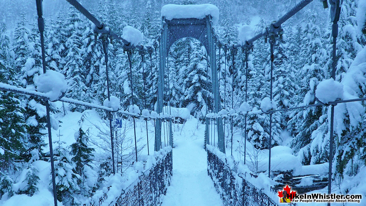
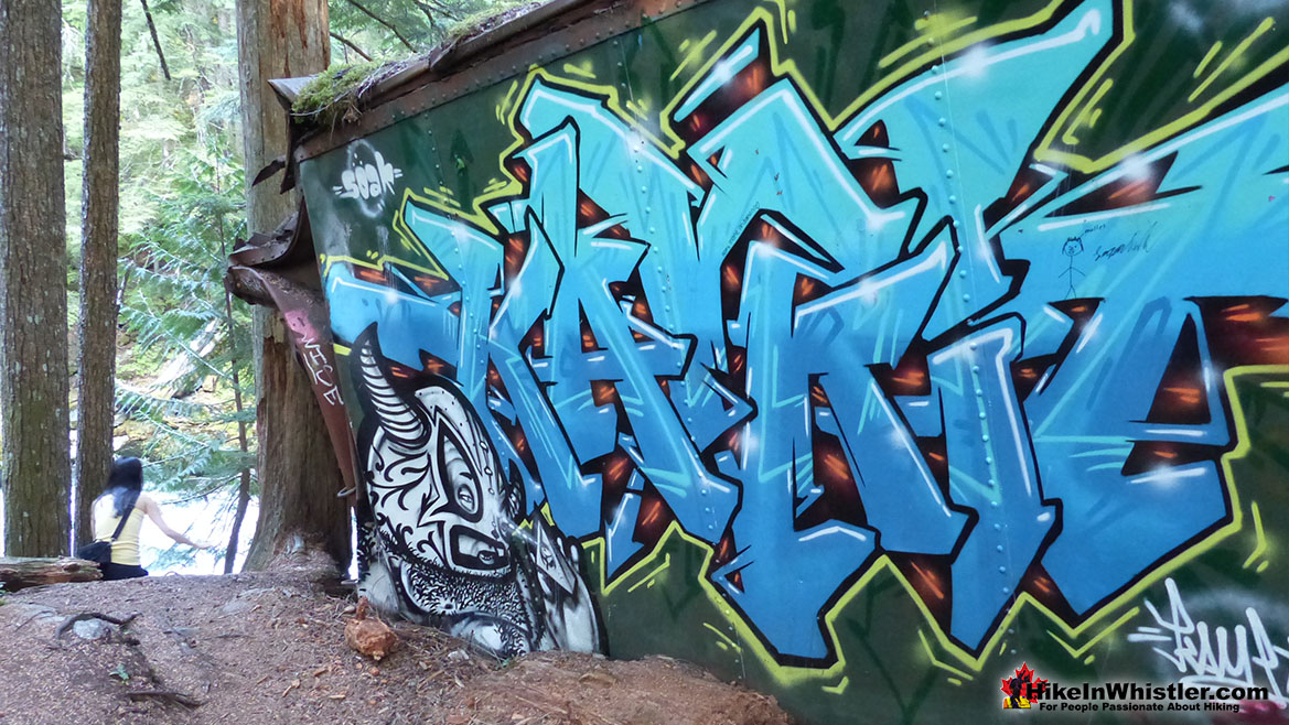
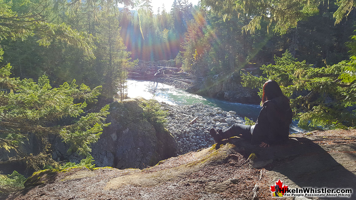
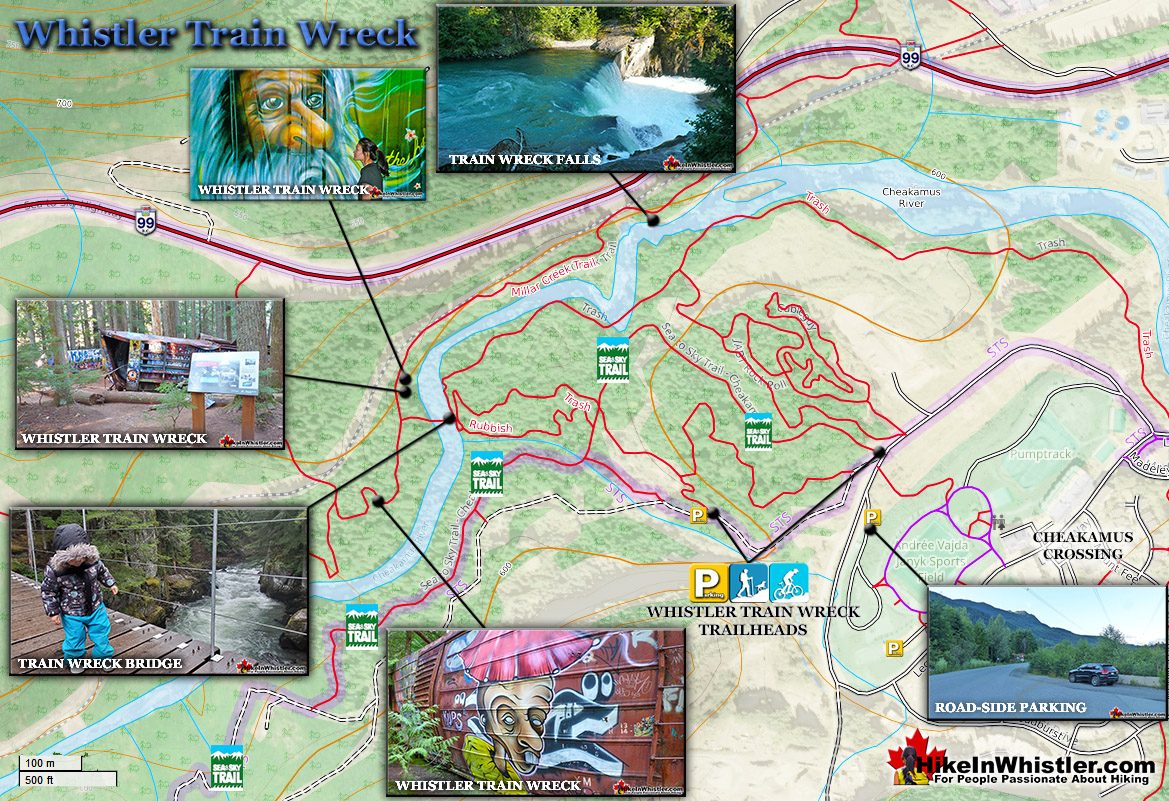
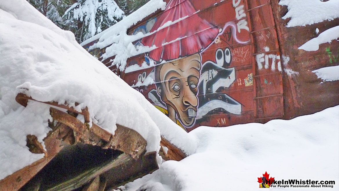
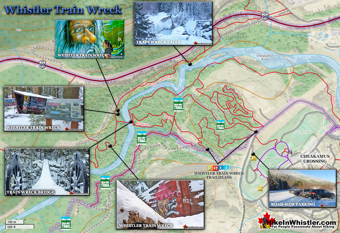
![]() The trail to Whistler Train Wreck is an easy, yet varied route through deep forest, across a great suspension bridge over Cheakamus River, to a stunning array of wrecked train cars. The trail from your car to the wrecks only takes about 15 minutes, however once you reach one wreck, you see another, then another. There are seven wrecks in total that are spread over an area about 400 metres long. Along with the surreal train wrecks painted with stunning murals, you find yourself in a thick forest that runs along Cheakamus River. Cheakamus River is a beautiful, wild and crashing river that snakes past the train wrecks. Numerous side trails take you to some marvellous viewpoints, several metres above the rushing water below. If you follow a trail past the wrecks(heading north or in the direction of Whistler Village) you will emerge at the train tracks. If you are adventurous you will then walk along, beside the tracks for a couple hundred metres and some truly breath taking views of Cheakamus River. Keep in mind that skirting the train tracks is illegal, so you must never do this if a train is in the vicinity. If you plan to bivouac under the stars, this area is a great choice. Multiple beautiful rock outcrops along and above the river and you may not get disturbed as most hikers don't risk violating the law. Camping is prohibited within Whistler's municipal boundary, which Train Wreck is within, yet a sleeping bag under the stars will almost certainly go unnoticed. If bivouacking or stealth camping is what you are after, you will find quite a lot to choose from as you hike in along the Train Wreck trail.
The trail to Whistler Train Wreck is an easy, yet varied route through deep forest, across a great suspension bridge over Cheakamus River, to a stunning array of wrecked train cars. The trail from your car to the wrecks only takes about 15 minutes, however once you reach one wreck, you see another, then another. There are seven wrecks in total that are spread over an area about 400 metres long. Along with the surreal train wrecks painted with stunning murals, you find yourself in a thick forest that runs along Cheakamus River. Cheakamus River is a beautiful, wild and crashing river that snakes past the train wrecks. Numerous side trails take you to some marvellous viewpoints, several metres above the rushing water below. If you follow a trail past the wrecks(heading north or in the direction of Whistler Village) you will emerge at the train tracks. If you are adventurous you will then walk along, beside the tracks for a couple hundred metres and some truly breath taking views of Cheakamus River. Keep in mind that skirting the train tracks is illegal, so you must never do this if a train is in the vicinity. If you plan to bivouac under the stars, this area is a great choice. Multiple beautiful rock outcrops along and above the river and you may not get disturbed as most hikers don't risk violating the law. Camping is prohibited within Whistler's municipal boundary, which Train Wreck is within, yet a sleeping bag under the stars will almost certainly go unnoticed. If bivouacking or stealth camping is what you are after, you will find quite a lot to choose from as you hike in along the Train Wreck trail.
More Best Whistler Hiking - Whistler Train Wreck
Parkhurst Ghost Town - Best Whistler Hiking May
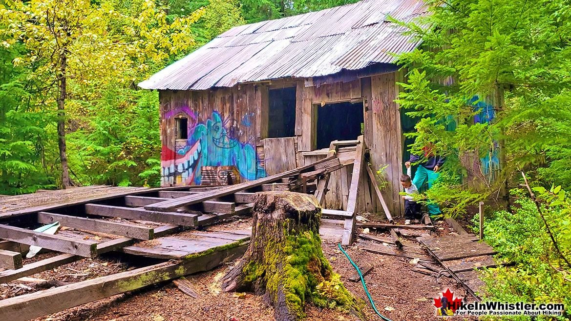
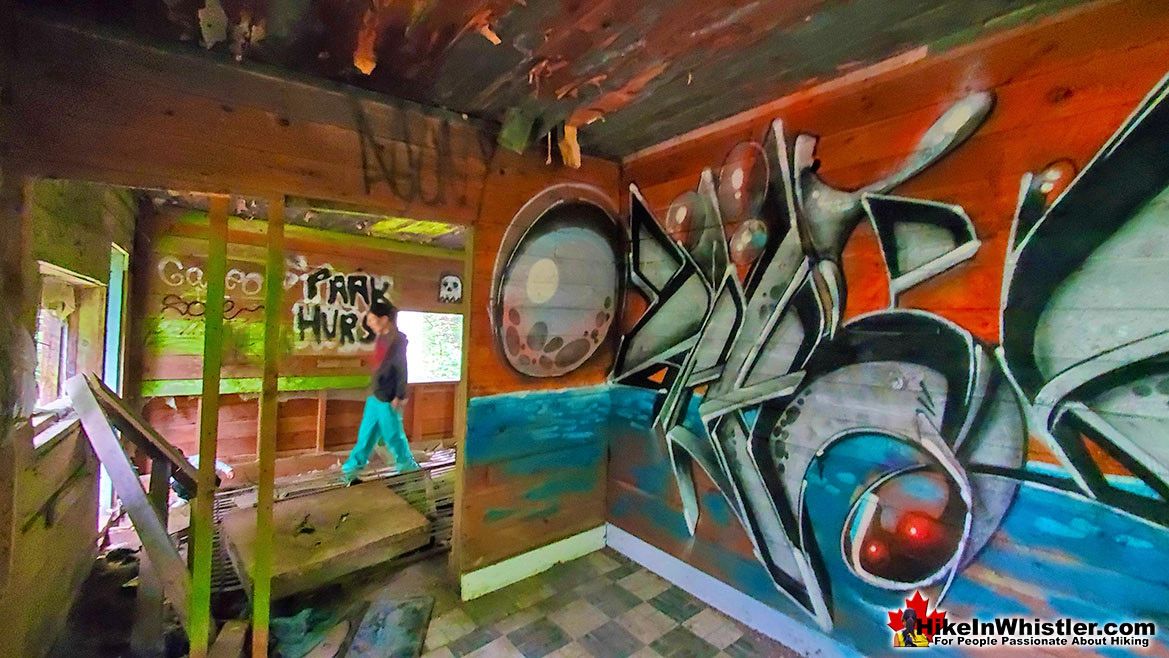
![]() May is a great month to visit Parkhurst Ghost Town. Emerged from the long winter, Parkhurst reveals a bunch of old curiosities as well as the unexpectedly beautiful far shore of Green Lake. Remote and wild, on a hot May day, Parkhurst is a wonderful place to wander the beautiful wilderness. Our Hike in Whistler & Garibaldi Park Guide here. Whistler has an absurd number of wonderful and free hiking trails and Parkhurst Ghost Town certainly ranks as one of the most unusual, exotic and interesting. Parkhurst was a little logging town perched on the edge of Green Lake way before Whistler was Whistler. Up on the ridge where Parkhurst sits, the views are sensational. Green Lake far below, a solid unnatural looking mass of green. Blackcomb Mountain and Whistler Mountain out in the distance to the left and Rainbow Mountain across and beyond the lake. If you have a good look around Parkhurst today, you can find remnants of its past almost everywhere you look. From the old disintegrating truck from the 50's to the absurdly and improbably located car being consumed by the forest. What makes Parkhurst Ghost Town such a great hiking trail and destination is where it is located and the trail to get to it. One route, one of several ways to get to it, runs along the scenic Green River and next to the still active train tracks that run through Whistler. There always seems to be something to see. From the beautiful meadow along the train tracks, to the suddenly deep forest where you have to play a game of finding the next, pink tree marker or risk wandering off the trail. The trail markers are numerous, and though getting lost is inevitable, you can only stray a few metres before, the river or steep terrain push you back onto the marked trail. Once up on the ridge above Green Lake where Parkhurst is located, the forest takes on a spooky feel. Trees are all far apart and with branches only high up give the forest a unnaturally lifeless look.
May is a great month to visit Parkhurst Ghost Town. Emerged from the long winter, Parkhurst reveals a bunch of old curiosities as well as the unexpectedly beautiful far shore of Green Lake. Remote and wild, on a hot May day, Parkhurst is a wonderful place to wander the beautiful wilderness. Our Hike in Whistler & Garibaldi Park Guide here. Whistler has an absurd number of wonderful and free hiking trails and Parkhurst Ghost Town certainly ranks as one of the most unusual, exotic and interesting. Parkhurst was a little logging town perched on the edge of Green Lake way before Whistler was Whistler. Up on the ridge where Parkhurst sits, the views are sensational. Green Lake far below, a solid unnatural looking mass of green. Blackcomb Mountain and Whistler Mountain out in the distance to the left and Rainbow Mountain across and beyond the lake. If you have a good look around Parkhurst today, you can find remnants of its past almost everywhere you look. From the old disintegrating truck from the 50's to the absurdly and improbably located car being consumed by the forest. What makes Parkhurst Ghost Town such a great hiking trail and destination is where it is located and the trail to get to it. One route, one of several ways to get to it, runs along the scenic Green River and next to the still active train tracks that run through Whistler. There always seems to be something to see. From the beautiful meadow along the train tracks, to the suddenly deep forest where you have to play a game of finding the next, pink tree marker or risk wandering off the trail. The trail markers are numerous, and though getting lost is inevitable, you can only stray a few metres before, the river or steep terrain push you back onto the marked trail. Once up on the ridge above Green Lake where Parkhurst is located, the forest takes on a spooky feel. Trees are all far apart and with branches only high up give the forest a unnaturally lifeless look.
More Best Whistler Hiking - Parkhurst Ghost Town
Joffre Lakes - Best Whistler Hiking June
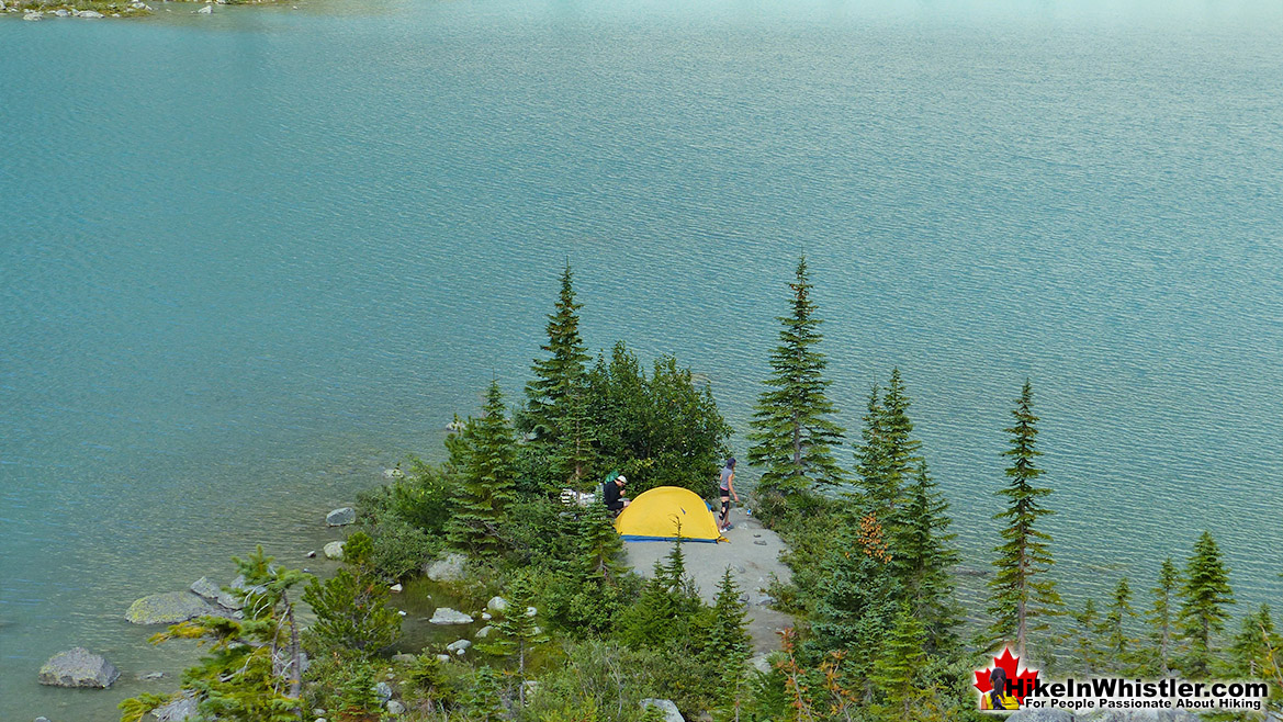
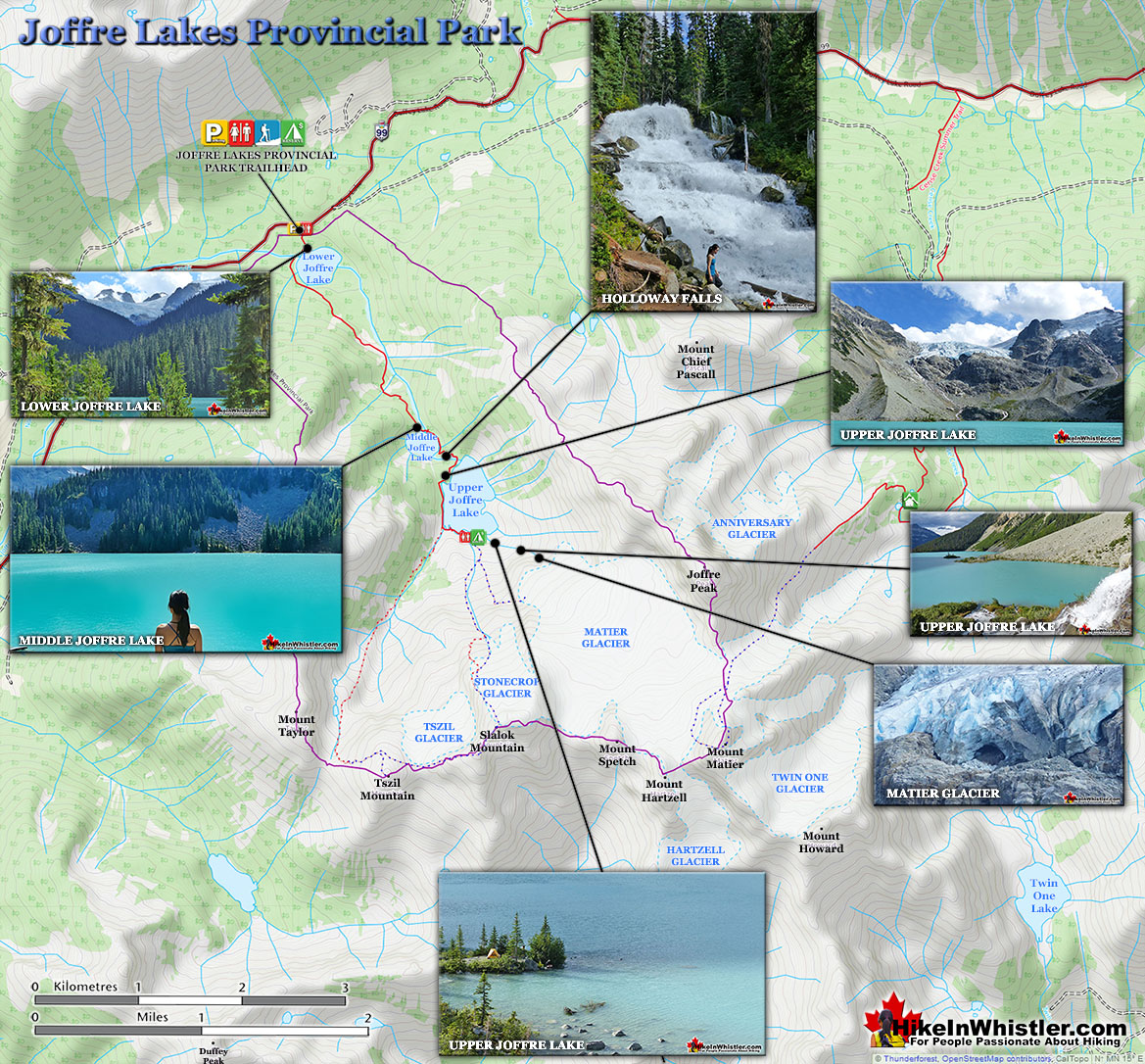
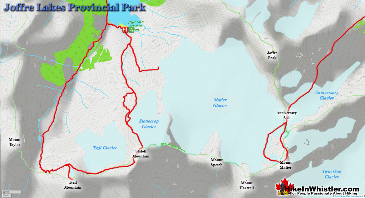
![]() June is a great month to explore Joffre Lakes Provincial Park. Recently emerged from the snow, Joffre Lakes is a magical place on a hot June day. There are a huge variety of hiking trails to try in June, check out our Hike in Whistler Guide to June here. As hiking trails go, Joffre Lakes has a lot going for it. It is not terribly long at just 5.5 kilometres(3.4 miles). Shorter than the trail to Garibaldi Lake which is 9 kilometres long and much shorter than the hike to Panorama Ridge which is 15 kilometres, one way! The elevation gain is not overly taxing either at just 400 metres, compared to Garibaldi Lake at 900 metres. Despite the relatively short trail and moderate elevation gain, the Joffre Lakes trail is quite a workout, especially if you have a heavy pack on. There is, however, quite a lot to see on the trail. All three lakes are stunning and quite different. The first lake has a great, picture-perfect, distant glacier view. The second lake has a wonderful boulder section flanking the lake which makes for a great place to sit in the sun and feed the cute little birds that eagerly will land on your hand if you have food for them. The second lake has that fallen tree that extends from the shore that almost seems staged for a perfect picture opportunity. As you continue past Middle Joffre Lake you come to a lovely, crashing waterfall, Holloway Falls. A little further you reach Upper Joffre Lake and a series of amazing viewpoints over the impossibly coloured lake surrounded by brutally jagged mountains and Matier Glacier.
June is a great month to explore Joffre Lakes Provincial Park. Recently emerged from the snow, Joffre Lakes is a magical place on a hot June day. There are a huge variety of hiking trails to try in June, check out our Hike in Whistler Guide to June here. As hiking trails go, Joffre Lakes has a lot going for it. It is not terribly long at just 5.5 kilometres(3.4 miles). Shorter than the trail to Garibaldi Lake which is 9 kilometres long and much shorter than the hike to Panorama Ridge which is 15 kilometres, one way! The elevation gain is not overly taxing either at just 400 metres, compared to Garibaldi Lake at 900 metres. Despite the relatively short trail and moderate elevation gain, the Joffre Lakes trail is quite a workout, especially if you have a heavy pack on. There is, however, quite a lot to see on the trail. All three lakes are stunning and quite different. The first lake has a great, picture-perfect, distant glacier view. The second lake has a wonderful boulder section flanking the lake which makes for a great place to sit in the sun and feed the cute little birds that eagerly will land on your hand if you have food for them. The second lake has that fallen tree that extends from the shore that almost seems staged for a perfect picture opportunity. As you continue past Middle Joffre Lake you come to a lovely, crashing waterfall, Holloway Falls. A little further you reach Upper Joffre Lake and a series of amazing viewpoints over the impossibly coloured lake surrounded by brutally jagged mountains and Matier Glacier.
More Best Whistler Hiking - Joffre Lakes
Wedgemount Lake - Best Whistler Hiking July
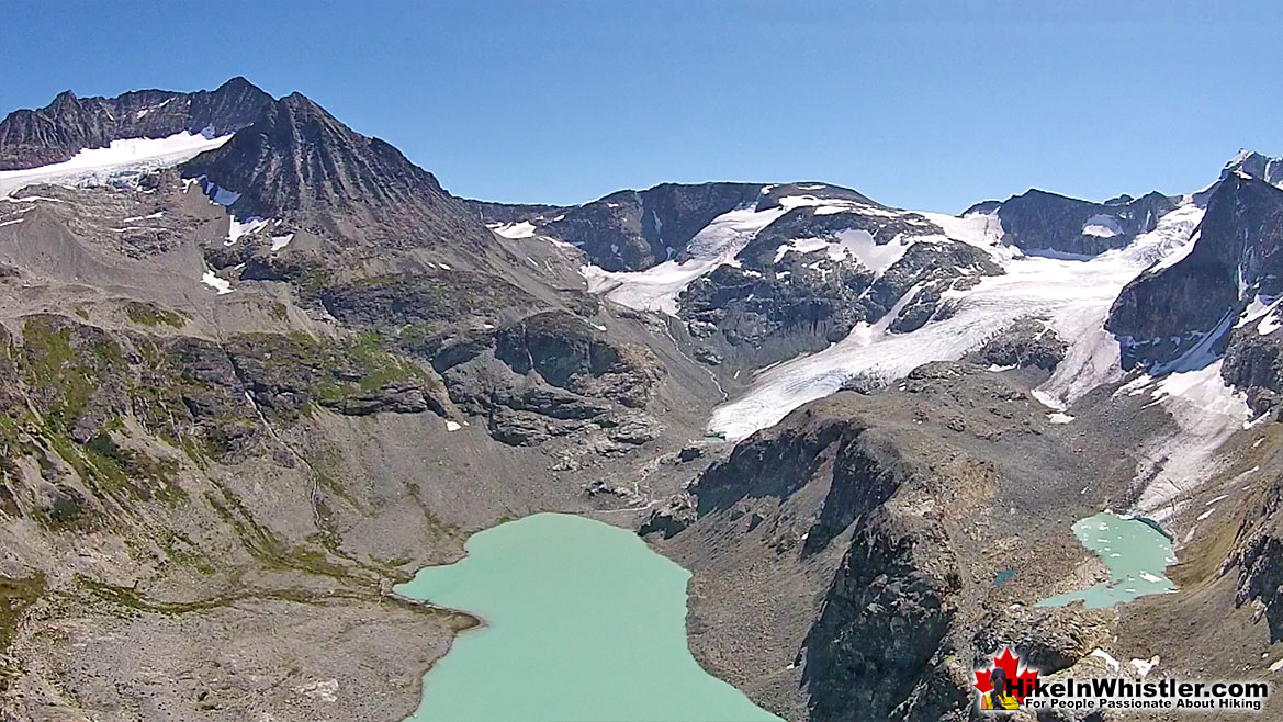
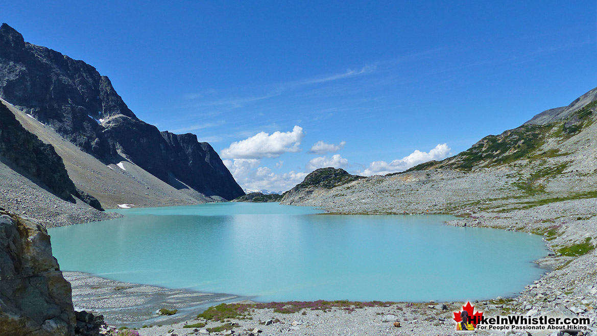
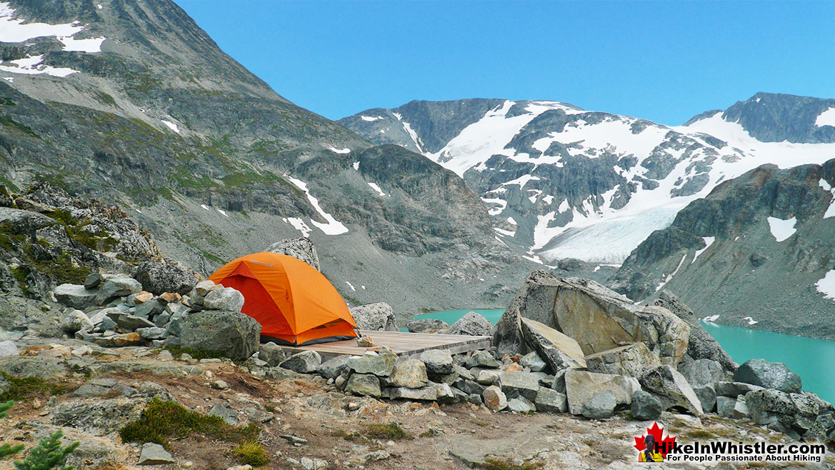
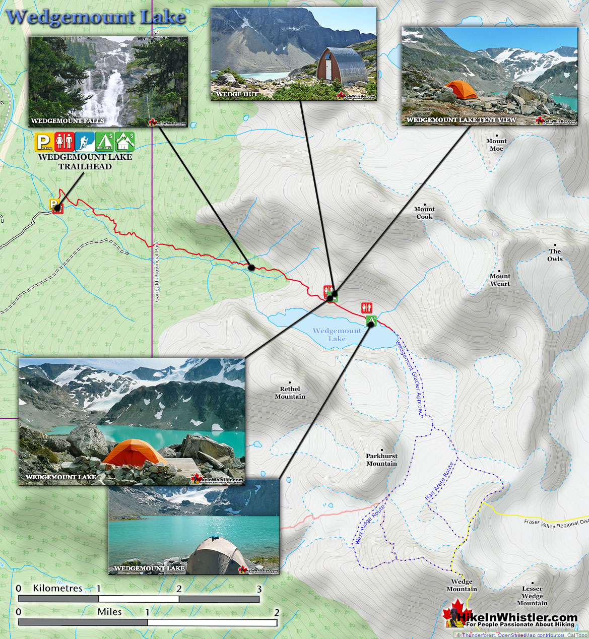
![]() July is when every hiking trail in Whistler and Garibaldi Park become perfect for hiking. All are free of snow and the hot July days entice the brave to dive into glacier fed lakes. Wedgemount Lake is one of these stunning lakes that has a bright, turquoise colour, flanked by menacing cliffs with a stunning glacier filling the valley at one end. Check out this amazing hike and plenty more in our Hike in Whistler & Garibaldi Park July Guide here. Wedgemount Lake itself is a magnificent destination for a day hike or spectacular overnight beneath the dazzling mountain peaks and stars above Garibaldi Provincial Park. Many sleep under the stars on one of the many beautiful tent platforms that dot the landscape. Solidly built, wooden tent platforms are everywhere you look at Wedgemount Lake. Strategically positioned, these platforms manage to maintain a secluded feel despite their numbers. In all Wedgemount Lake has 20 of these tent areas. Most are wooden, but several down by the lake shore are gravel, yet every bit as nice. Wedgemount Lake is one of the most spectacular hikes in Garibaldi Park. Though it is a relentlessly exhausting, steep trail, it is mercifully short at only 7 kilometres one way. The elevation gain in that short distance is over 1200 metres which makes it a much steeper hike than all the other Whistler area hiking trails. Compared with other Whistler and Garibaldi Provincial Park hikes, Wedgemount Lake is half the roundtrip distance of either Black Tusk or Panorama Ridge, for example, at 13.5 kilometres and 15 kilometres respectively one way. At a fast hiking pace you can reach Wedgemount Lake from the trailhead in just an hour and a half but at a leisurely or backpack laden pace you will likely take over two hours. The trail is well marked and well used. The steepness of the trail doesn't require any technical skill, however that last kilometre before the lake you will be scrambling on all fours quite a bit. The elevation gain makes a tremendous difference when carrying a heavy backpack and unprepared for the exertion. There is hardly a section of the trail that is not steeply uphill. The first 15 minutes takes you into the deep forest as you run along Wedgemount Creek.
July is when every hiking trail in Whistler and Garibaldi Park become perfect for hiking. All are free of snow and the hot July days entice the brave to dive into glacier fed lakes. Wedgemount Lake is one of these stunning lakes that has a bright, turquoise colour, flanked by menacing cliffs with a stunning glacier filling the valley at one end. Check out this amazing hike and plenty more in our Hike in Whistler & Garibaldi Park July Guide here. Wedgemount Lake itself is a magnificent destination for a day hike or spectacular overnight beneath the dazzling mountain peaks and stars above Garibaldi Provincial Park. Many sleep under the stars on one of the many beautiful tent platforms that dot the landscape. Solidly built, wooden tent platforms are everywhere you look at Wedgemount Lake. Strategically positioned, these platforms manage to maintain a secluded feel despite their numbers. In all Wedgemount Lake has 20 of these tent areas. Most are wooden, but several down by the lake shore are gravel, yet every bit as nice. Wedgemount Lake is one of the most spectacular hikes in Garibaldi Park. Though it is a relentlessly exhausting, steep trail, it is mercifully short at only 7 kilometres one way. The elevation gain in that short distance is over 1200 metres which makes it a much steeper hike than all the other Whistler area hiking trails. Compared with other Whistler and Garibaldi Provincial Park hikes, Wedgemount Lake is half the roundtrip distance of either Black Tusk or Panorama Ridge, for example, at 13.5 kilometres and 15 kilometres respectively one way. At a fast hiking pace you can reach Wedgemount Lake from the trailhead in just an hour and a half but at a leisurely or backpack laden pace you will likely take over two hours. The trail is well marked and well used. The steepness of the trail doesn't require any technical skill, however that last kilometre before the lake you will be scrambling on all fours quite a bit. The elevation gain makes a tremendous difference when carrying a heavy backpack and unprepared for the exertion. There is hardly a section of the trail that is not steeply uphill. The first 15 minutes takes you into the deep forest as you run along Wedgemount Creek.
More Best Whistler Hiking - Wedgemount Lake
Panorama Ridge - Best Whistler Hiking August
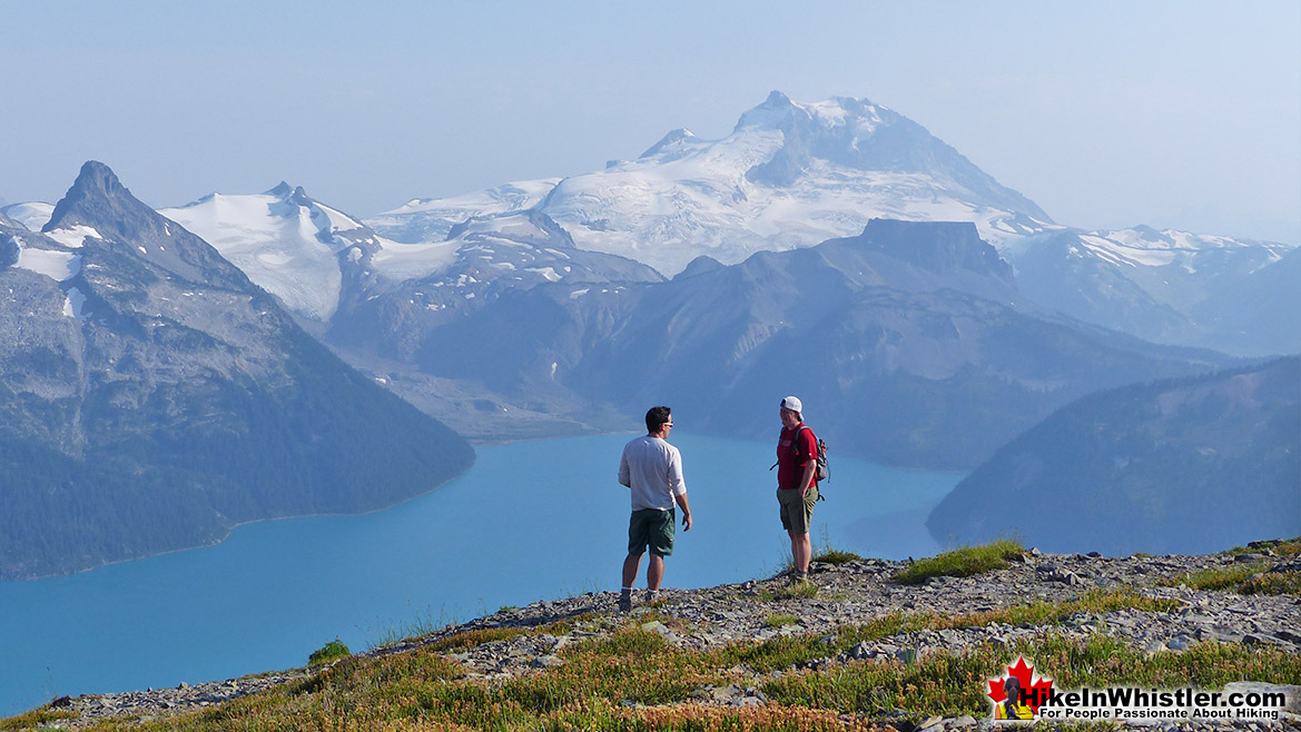
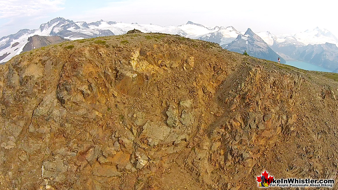
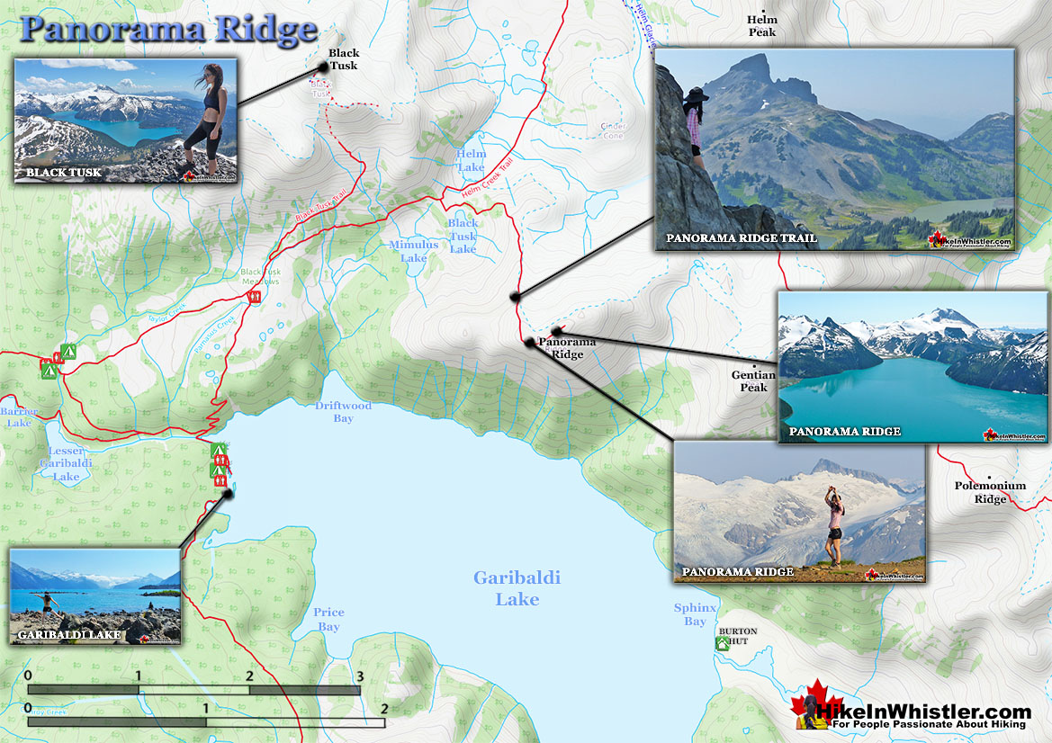
![]() In August we like Panorama Ridge. This ridge in Garibaldi Park overlooks the impossibly coloured Garibaldi Lake with Mount Garibaldi in the distance, numerous glaciers, meadows, alpine lakes and directly across from Black Tusk. August is spectacular in Whistler. Check out our Hike in Whistler & Garibaldi Park Guide for August. Panorama Ridge is easily one of the most amazing hikes in Garibaldi Provincial Park. The 15 kilometre hike from the trailhead at Rubble Creek to Panorama Ridge takes you through beautiful and deep forests, across countless idyllic streams, through meadows filled with flowers, and past dozens of jaw dropping viewpoints. The amazing views start once you reach Taylor Meadows and get even more spectacular as the trail progresses. Once you arrive at Panorama Ridge and its phenomenal vantage point, high above Garibaldi Park, you will stare in wonder. Mesmerized first by Garibaldi Lake, far below you and looking unnaturally blue, the lake looks amazing surrounded by green, untouched wilderness and snow capped mountains. The Table, the massive and unusual looking mountain with its bizarre flat top lays across the lake with the enormous Mount Garibaldi just beyond. In the distance, where Garibaldi Lake ends, a massive glacier rises out of the blue and jagged crevasses can be seen even from such a great distance. Behind you, Black Tusk lays across the valley. Close to the same elevation as Panorama Ridge, you get this wonderful view of it. Certainly the best and closest viewpoint to this iconic mountain. Panorama Ridge sits, along with Black Tusk in the midst of some of the most popular and beautiful hiking trails in Garibaldi Provincial Park. There are two main trailheads for Panorama Ridge, Cheakamus Lake and Rubble Creek.
In August we like Panorama Ridge. This ridge in Garibaldi Park overlooks the impossibly coloured Garibaldi Lake with Mount Garibaldi in the distance, numerous glaciers, meadows, alpine lakes and directly across from Black Tusk. August is spectacular in Whistler. Check out our Hike in Whistler & Garibaldi Park Guide for August. Panorama Ridge is easily one of the most amazing hikes in Garibaldi Provincial Park. The 15 kilometre hike from the trailhead at Rubble Creek to Panorama Ridge takes you through beautiful and deep forests, across countless idyllic streams, through meadows filled with flowers, and past dozens of jaw dropping viewpoints. The amazing views start once you reach Taylor Meadows and get even more spectacular as the trail progresses. Once you arrive at Panorama Ridge and its phenomenal vantage point, high above Garibaldi Park, you will stare in wonder. Mesmerized first by Garibaldi Lake, far below you and looking unnaturally blue, the lake looks amazing surrounded by green, untouched wilderness and snow capped mountains. The Table, the massive and unusual looking mountain with its bizarre flat top lays across the lake with the enormous Mount Garibaldi just beyond. In the distance, where Garibaldi Lake ends, a massive glacier rises out of the blue and jagged crevasses can be seen even from such a great distance. Behind you, Black Tusk lays across the valley. Close to the same elevation as Panorama Ridge, you get this wonderful view of it. Certainly the best and closest viewpoint to this iconic mountain. Panorama Ridge sits, along with Black Tusk in the midst of some of the most popular and beautiful hiking trails in Garibaldi Provincial Park. There are two main trailheads for Panorama Ridge, Cheakamus Lake and Rubble Creek.
More Best Whistler Hiking - Panorama Ridge
Cirque Lake - Best Whistler Hiking September
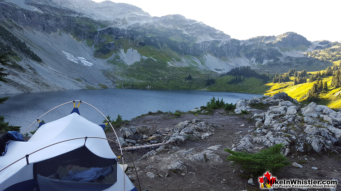
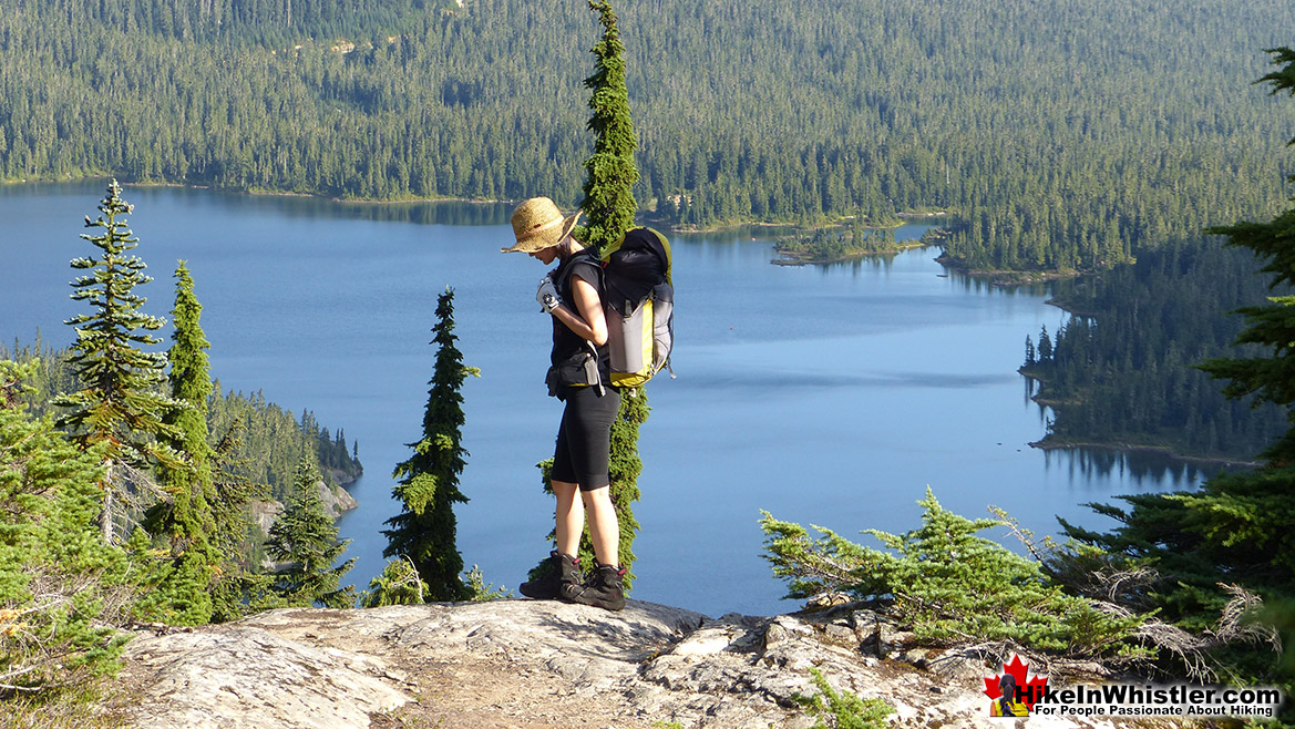
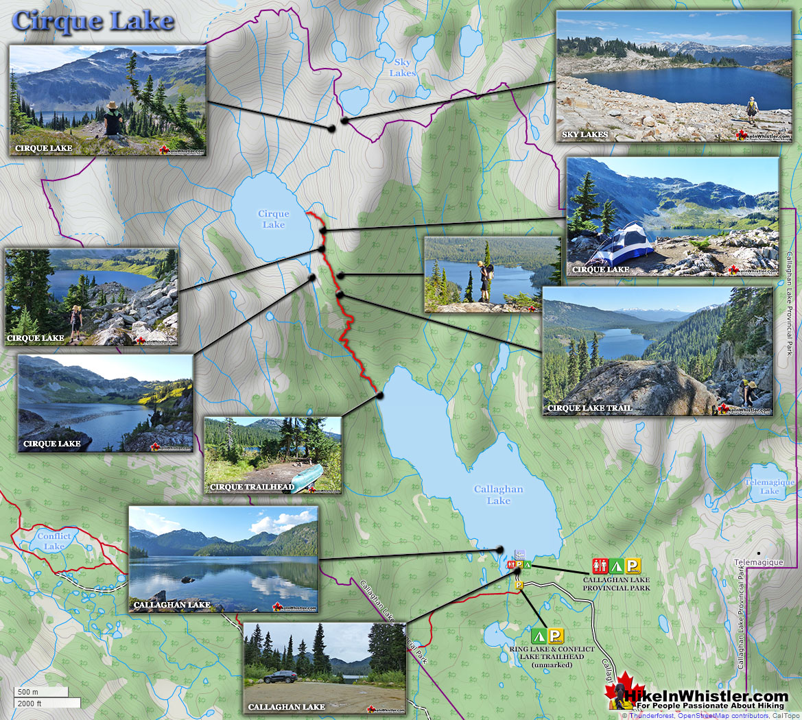
![]() For September's best hike in Whistler we like Cirque Lake in Callaghan Lake Provincial Park. This beautiful wonder of nature is a nearly perfect, wild, alpine paradise. Hidden high above Callaghan Lake, you need a canoe to cross the length of the lake then hike up the steep, but short trail to reach the huge, bowl shaped Cirque Lake. Far from civilization, you likely will have this bit of paradise for yourself on a nice day in September. September is arguably the best month of the year for hiking in Whistler, check out our Hike in Whistler Guide for September here. Callaghan Lake is accessible via an 8 kilometre weather battered and very potholed forest service road. The entire road is cratered with deep potholes, cut by frequent cross-ditches, and more recently a small section collapsing into the valley below. This logging road begins high up in the Callaghan Valley, which itself is largely overlooked by travellers to Whistler. The Callaghan Valley is home to quite a few natural and man-made attractions. Brandywine Meadows, Alexander Falls, Northair Mine and Mount Sproatt are all found in the valley. Recently, the 2010 Olympic Games produced the largest man-made attraction in Callaghan Valley, Whistler Olympic Park. Though Cirque Lake is tremendously far into the wilderness, the amount of hiking required to reach it is effectively less than two kilometres. Another two kilometres of canoeing is required to reach the trailhead at the far end of Callaghan Lake. But for such an enchantingly beautiful, mountain lake, the exertion to reach it is remarkably little.
For September's best hike in Whistler we like Cirque Lake in Callaghan Lake Provincial Park. This beautiful wonder of nature is a nearly perfect, wild, alpine paradise. Hidden high above Callaghan Lake, you need a canoe to cross the length of the lake then hike up the steep, but short trail to reach the huge, bowl shaped Cirque Lake. Far from civilization, you likely will have this bit of paradise for yourself on a nice day in September. September is arguably the best month of the year for hiking in Whistler, check out our Hike in Whistler Guide for September here. Callaghan Lake is accessible via an 8 kilometre weather battered and very potholed forest service road. The entire road is cratered with deep potholes, cut by frequent cross-ditches, and more recently a small section collapsing into the valley below. This logging road begins high up in the Callaghan Valley, which itself is largely overlooked by travellers to Whistler. The Callaghan Valley is home to quite a few natural and man-made attractions. Brandywine Meadows, Alexander Falls, Northair Mine and Mount Sproatt are all found in the valley. Recently, the 2010 Olympic Games produced the largest man-made attraction in Callaghan Valley, Whistler Olympic Park. Though Cirque Lake is tremendously far into the wilderness, the amount of hiking required to reach it is effectively less than two kilometres. Another two kilometres of canoeing is required to reach the trailhead at the far end of Callaghan Lake. But for such an enchantingly beautiful, mountain lake, the exertion to reach it is remarkably little.
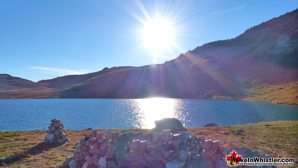
The other attribute of Cirque Lake that makes it special, is its cirque structure. From the moment you catch sight of Cirque Lake, the abruptly steep sides all around give you the humbling feeling that you are inside a volcano. A volcano filled with emerald water and ringed by grassy meadows and crumbling, near vertical cliffs. Where you stand, at the entrance to the cirque, is not far from the only water channel out of the cirque. An ever narrowing gap in the cliffs spills water down one cliff after another until reaching Callaghan Lake just 1.4 kilometres away. Owing to the fact that you have to reach the trailhead to Cirque Lake by boat ensures that it almost always remains deserted. Even in the middle of summer, your tent will almost certainly be the only one that resides in this magical cirque. You sometimes get hikers venturing up from their campsites at Callaghan Lake for a couple hours, otherwise nobody. One feature of the Cirque Lake trail that no doubt scares hikers away is its steepness and ruggedness. It is mostly very steep, and due to the obliterating effects of winter snow, the trail markers are sporadic at best. One consolation is of course the length of the trail. Under two kilometres, makes the steepness much easier to tackle. With a heavy pack you can easily hike the trail in a little over an hour. Or an hour and a half or two if you linger at the frequent viewpoints looking back on Callaghan Lake. The eruption of blueberry bushes in August is cause for some delays as well as it is surprisingly hard to pass up feasting on every bush you see.. and you will see a lot. The trail, for the most part is quite scenic and enjoyable. The first 15 minutes of the trail winds through a cute forest along and over some small streams. The next 15 minutes takes you up some steeper and more challenging terrain that require pulling yourself up with tree roots and at one section a knotted rope.
More Best Whistler Hiking - Cirque Lake
Russet Lake - Best Whistler Hiking October
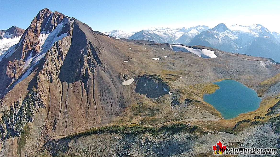
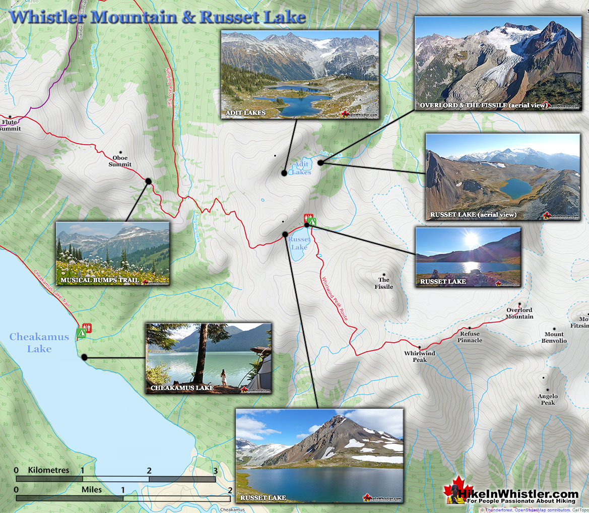
![]() October is a great time to venture deep into Garibaldi Provincial Park, between Blackcomb Mountain and Whistler Mountain to Russet Lake. The Whistler gondolas are closed until the ski season begins in November, so you will almost certainly have this remarkable place to yourself. From the campsite you have views of Overlord Glacier, Overlord Mountain, The Fissile and just steps from Russet Lake. If you manage a night up there during a full moon, you might find yourself blown away by the magnificent surroundings, moonlit and spectacular.. and in a month known as sober October! Check out all the amazing and recommended hiking trails in Whistler in October here. Russet Lake is a surreal little paradise that lays at the base of The Fissile, in Garibaldi Provincial Park. The Fissile is the strikingly bronze mountain visible from Whistler Village. From the Village look into the distance at the Peak2Peak Gondola hanging between Whistler Mountain and Blackcomb Mountain and you will see The Fissile. Its pyramid shape in the distance perfectly separates the two mountains. Though Russet Lake is not terribly impressive in terms of size or colour, the valley around it is remarkably beautiful. The colours change from moment to moment in and extraordinary way. The distinctive colour of The Fissile and the stark grey of the mountains around contrast amazingly with the blue of the lake and green grass in the valley. So many different factors fill the place with colour. There are several ways to get to hike Russet Lake. The Singing Pass trail from the base of Whistler Mountain near the Whistler Gondola. The Musical Bumps trail that begins near the top of the Whistler Gondola. Both routes take you deep into the magnificent Fitzsimmons Range. The Fitzsimmons Range runs east from the summit of Whistler Mountain to Russett Lake. Fitzsimmons Creek cuts between Whistler Mountain and Blackcomb Mountain, parallel to the Singing Pass trail. Where the Fitzsimmons Range ends at Fitzsimmons Creek, the Spearhead Range begins and continues along a set of peaks resembling spearheads to Blackcomb Mountain. These peaks include The Spearhead, Mount Trorey, Tremor, Shatter, Shudder, Quiver, and more.
October is a great time to venture deep into Garibaldi Provincial Park, between Blackcomb Mountain and Whistler Mountain to Russet Lake. The Whistler gondolas are closed until the ski season begins in November, so you will almost certainly have this remarkable place to yourself. From the campsite you have views of Overlord Glacier, Overlord Mountain, The Fissile and just steps from Russet Lake. If you manage a night up there during a full moon, you might find yourself blown away by the magnificent surroundings, moonlit and spectacular.. and in a month known as sober October! Check out all the amazing and recommended hiking trails in Whistler in October here. Russet Lake is a surreal little paradise that lays at the base of The Fissile, in Garibaldi Provincial Park. The Fissile is the strikingly bronze mountain visible from Whistler Village. From the Village look into the distance at the Peak2Peak Gondola hanging between Whistler Mountain and Blackcomb Mountain and you will see The Fissile. Its pyramid shape in the distance perfectly separates the two mountains. Though Russet Lake is not terribly impressive in terms of size or colour, the valley around it is remarkably beautiful. The colours change from moment to moment in and extraordinary way. The distinctive colour of The Fissile and the stark grey of the mountains around contrast amazingly with the blue of the lake and green grass in the valley. So many different factors fill the place with colour. There are several ways to get to hike Russet Lake. The Singing Pass trail from the base of Whistler Mountain near the Whistler Gondola. The Musical Bumps trail that begins near the top of the Whistler Gondola. Both routes take you deep into the magnificent Fitzsimmons Range. The Fitzsimmons Range runs east from the summit of Whistler Mountain to Russett Lake. Fitzsimmons Creek cuts between Whistler Mountain and Blackcomb Mountain, parallel to the Singing Pass trail. Where the Fitzsimmons Range ends at Fitzsimmons Creek, the Spearhead Range begins and continues along a set of peaks resembling spearheads to Blackcomb Mountain. These peaks include The Spearhead, Mount Trorey, Tremor, Shatter, Shudder, Quiver, and more.
More Best Whistler Hiking - Russet Lake
Sea to Sky Trail - Best Whistler Hiking November
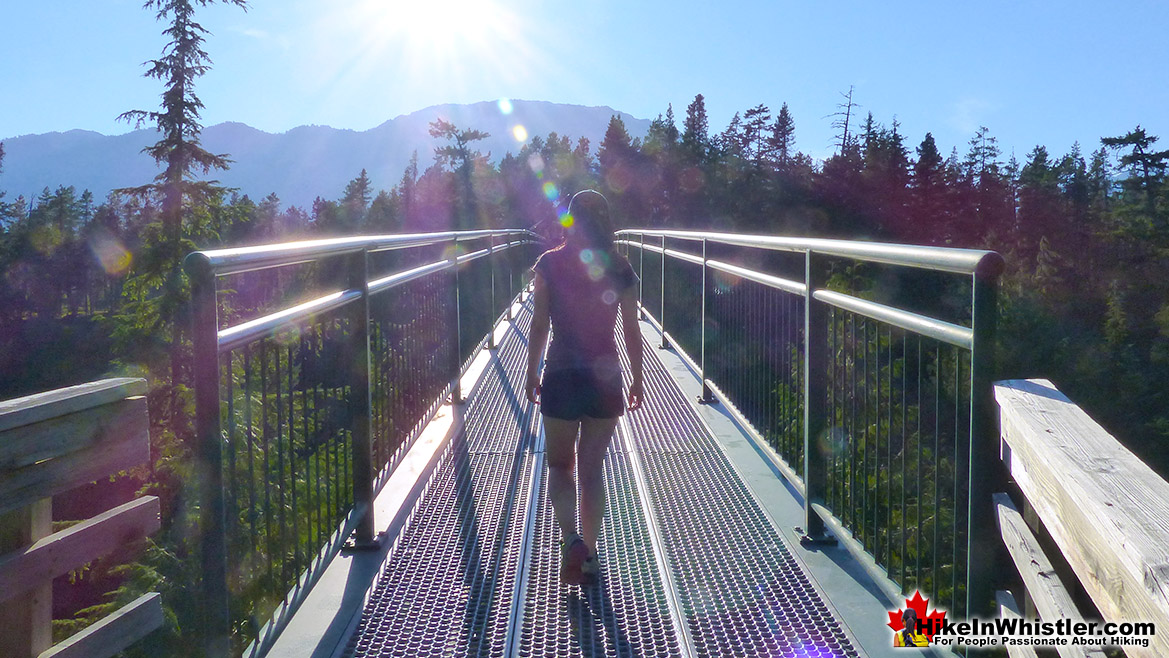
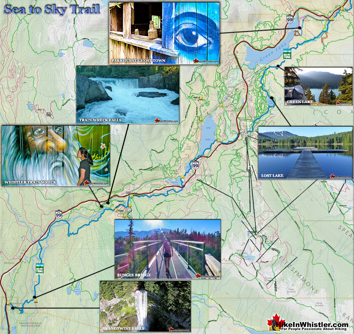
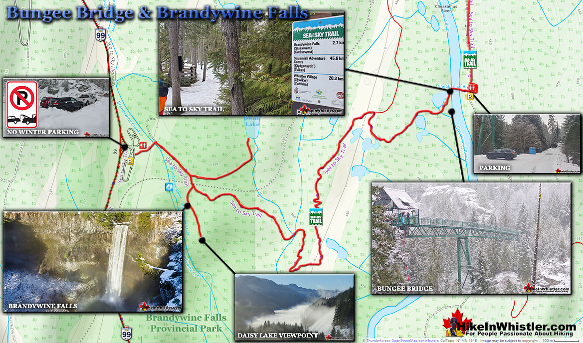
![]() November we like to explore the Sea to Sky Trail that runs through Whistler and seems to pass every beautiful Whistler park and viewpoint. From the always impressive Brandywine Falls, the gorgeous bungee bridge, the Whistler Train Wreck, along Alpha Lake Park, Nita Lake Park, Wayside Park, Lakeside Park, through Whistler Village to Lost Lake Park, high up and around Green Lake, past Parkhurst Ghost Town, the Sea to Sky Trail is amazing. The Sea to Sky Trail is a 180 kilometre multi-use trail that runs from Squamish to D'Arcy. The trail is still under construction in many parts, however, the amazing route through Whistler is finally in place. The Whistler section of the Sea to Sky Trail is 33 kilometres long between Brandywine Falls Provincial Park and WedgeWoods Estates just north of Green Lake(north of Whistler Village).
November we like to explore the Sea to Sky Trail that runs through Whistler and seems to pass every beautiful Whistler park and viewpoint. From the always impressive Brandywine Falls, the gorgeous bungee bridge, the Whistler Train Wreck, along Alpha Lake Park, Nita Lake Park, Wayside Park, Lakeside Park, through Whistler Village to Lost Lake Park, high up and around Green Lake, past Parkhurst Ghost Town, the Sea to Sky Trail is amazing. The Sea to Sky Trail is a 180 kilometre multi-use trail that runs from Squamish to D'Arcy. The trail is still under construction in many parts, however, the amazing route through Whistler is finally in place. The Whistler section of the Sea to Sky Trail is 33 kilometres long between Brandywine Falls Provincial Park and WedgeWoods Estates just north of Green Lake(north of Whistler Village).
More Best Whistler Hiking - Sea to Sky Trail
Cheakamus Lake - Best Whistler Hiking November
![]() Depending on the snowfall in November, Cheakamus Lake may be accessible. If it is, you will be in for a magical experience. Beautiful sunsets and sunrises. Magnificent scenery and a thin layer of snow making the forest unbelievably peaceful. Cheakamus Lake is a wonderfully relaxing way to get in the wilderness easily and quickly from Whistler Village. The trail begins on the far side of Whistler Mountain, 8 kilometres from the Sea to Sky Highway at Cheakamus Crossing across from Function Junction. This 8 kilometre stretch of logging road is fairly bumpy and potholed, but does have the benefit of allowing you to drive the elevation gain instead of hiking it. You can easily manage this road in a car, however carefully and very slowly in parts. Once you reach the trailhead/parking the entire 7 kilometre hiking trail to the end of the maintained Cheakamus Lake trail has barely any elevation gain. Just plenty of gradual inclines and declines along the winding route. In fact, this makes it one of the few trails in Whistler and Garibaldi Park that can boast that. The nearby Garibaldi Lake trail and the Wedgemount Lake trail make you work for the views, however, the Cheakamus Lake trail hardly makes you work at all. The trail to Cheakamus Lake takes you through an amazing forest of giant cedars that fill the forest with their amazing aroma. This forest is so packed with ancient giants that year to year the trail is adjusted by a monster of a tree fallen across the trail during some winter storm. Sometimes the trail bends around these behemoths, but more often they are laboriously chainsawed by BC Parks staff. The more enormous of these remain as fixtures of the trail. Either edging the trail or as a mighty obstacle to climb over.
Depending on the snowfall in November, Cheakamus Lake may be accessible. If it is, you will be in for a magical experience. Beautiful sunsets and sunrises. Magnificent scenery and a thin layer of snow making the forest unbelievably peaceful. Cheakamus Lake is a wonderfully relaxing way to get in the wilderness easily and quickly from Whistler Village. The trail begins on the far side of Whistler Mountain, 8 kilometres from the Sea to Sky Highway at Cheakamus Crossing across from Function Junction. This 8 kilometre stretch of logging road is fairly bumpy and potholed, but does have the benefit of allowing you to drive the elevation gain instead of hiking it. You can easily manage this road in a car, however carefully and very slowly in parts. Once you reach the trailhead/parking the entire 7 kilometre hiking trail to the end of the maintained Cheakamus Lake trail has barely any elevation gain. Just plenty of gradual inclines and declines along the winding route. In fact, this makes it one of the few trails in Whistler and Garibaldi Park that can boast that. The nearby Garibaldi Lake trail and the Wedgemount Lake trail make you work for the views, however, the Cheakamus Lake trail hardly makes you work at all. The trail to Cheakamus Lake takes you through an amazing forest of giant cedars that fill the forest with their amazing aroma. This forest is so packed with ancient giants that year to year the trail is adjusted by a monster of a tree fallen across the trail during some winter storm. Sometimes the trail bends around these behemoths, but more often they are laboriously chainsawed by BC Parks staff. The more enormous of these remain as fixtures of the trail. Either edging the trail or as a mighty obstacle to climb over.
More Best Whistler Hiking - Cheakamus Lake
Joffre Lakes - Best Whistler Snowshoeing December
![]() December is when the snow piles high in the mountains and Joffre Lakes becomes a winter, snowshoeing paradise. On a sunny day in December, Joffre Lakes is wild and beautiful. About 1 hour and 20 minutes north of Whistler gets you to the Joffre Lakes trailhead. Located up on the Duffy Lake Road north of Pemberton, Joffre Lakes is well known for its incredibly surreal, turquoise water. In the winter of course, all three of the Joffre Lakes are frozen over but the trail is popular with skiers and snowshoers between the months of November and April. The Joffre Lakes trail is fairly well marked and almost always tracked out in the winter it is still possible to lose the trail after dark or or during heavy snowfall. Joffre Lakes Provincial Park is centred around the three Joffre Lakes. All of them are beautiful on their own and each more beautiful than the last. Frozen over in the winter, you won't be able to marvel at the amazing turquoise colours the lakes, caused by light reflecting off of the particles of glacial silt suspended in the water. In the winter, with the lakes frozen and the trees weighed down with snow, Joffre Lakes takes on a serene beauty, with the low sun cutting through the trees and the forest brightly reflecting. The third of the Joffre Lakes ends in a U-shaped valley where you will find the far side of the lake towering with glaciers relentlessly crushing down on the lake. The sun fills the valley and the silence is wonderful. The trailhead and parking lot will be buried in metres of snow in the winter months, however a small parking area is plowed throughout the winter. There are plenty of signs, so even in snowy weather, you should easily spot them. From the winter parking area you will likely have to climb over a plowed, wall of snow and then continue through the snow buried parking lot. At the far end, the parking lot bends right and you will spot the trailhead sign.
December is when the snow piles high in the mountains and Joffre Lakes becomes a winter, snowshoeing paradise. On a sunny day in December, Joffre Lakes is wild and beautiful. About 1 hour and 20 minutes north of Whistler gets you to the Joffre Lakes trailhead. Located up on the Duffy Lake Road north of Pemberton, Joffre Lakes is well known for its incredibly surreal, turquoise water. In the winter of course, all three of the Joffre Lakes are frozen over but the trail is popular with skiers and snowshoers between the months of November and April. The Joffre Lakes trail is fairly well marked and almost always tracked out in the winter it is still possible to lose the trail after dark or or during heavy snowfall. Joffre Lakes Provincial Park is centred around the three Joffre Lakes. All of them are beautiful on their own and each more beautiful than the last. Frozen over in the winter, you won't be able to marvel at the amazing turquoise colours the lakes, caused by light reflecting off of the particles of glacial silt suspended in the water. In the winter, with the lakes frozen and the trees weighed down with snow, Joffre Lakes takes on a serene beauty, with the low sun cutting through the trees and the forest brightly reflecting. The third of the Joffre Lakes ends in a U-shaped valley where you will find the far side of the lake towering with glaciers relentlessly crushing down on the lake. The sun fills the valley and the silence is wonderful. The trailhead and parking lot will be buried in metres of snow in the winter months, however a small parking area is plowed throughout the winter. There are plenty of signs, so even in snowy weather, you should easily spot them. From the winter parking area you will likely have to climb over a plowed, wall of snow and then continue through the snow buried parking lot. At the far end, the parking lot bends right and you will spot the trailhead sign.
More Best Whistler Snowshoeing - Joffre Lakes
Train Wreck - Best Whistler Snowshoeing December
![]() The trail to Whistler Train Wreck is an easy, yet varied route through deep forest, across a great suspension bridge over Cheakamus River, to a stunning array of wrecked train cars. The trail from your car to the wrecks only takes about 15 minutes, however once you reach one wreck, you see another, then another. There are seven wrecks in total that are spread over an area about 400 metres long. Along with the surreal train wrecks painted with stunning murals, you find yourself in a thick forest that runs along Cheakamus River. Cheakamus River is a beautiful, wild and crashing river that snakes past the train wrecks. Numerous side trails take you to some marvellous viewpoints, several metres above the rushing water below. If you follow a trail past the wrecks(heading north or in the direction of Whistler Village) you will emerge at the train tracks. If you are adventurous you will then walk along, beside the tracks for a couple hundred metres and some truly breathtaking views of Cheakamus River. Keep in mind that skirting the train tracks is illegal, so you must never do this if a train is in the vicinity. If you plan to bivouac under the stars, this area is a great choice. Multiple beautiful rock outcrops along and above the river and you may not get disturbed as most hikers don't risk violating the law. Camping is prohibited within Whistler's municipal boundary, which Train Wreck is within, yet a sleeping bag under the stars will almost certainly go unnoticed. If bivouacking or stealth camping is what you are after, you will find quite a lot to choose from as you hike in along the Train Wreck trail.
The trail to Whistler Train Wreck is an easy, yet varied route through deep forest, across a great suspension bridge over Cheakamus River, to a stunning array of wrecked train cars. The trail from your car to the wrecks only takes about 15 minutes, however once you reach one wreck, you see another, then another. There are seven wrecks in total that are spread over an area about 400 metres long. Along with the surreal train wrecks painted with stunning murals, you find yourself in a thick forest that runs along Cheakamus River. Cheakamus River is a beautiful, wild and crashing river that snakes past the train wrecks. Numerous side trails take you to some marvellous viewpoints, several metres above the rushing water below. If you follow a trail past the wrecks(heading north or in the direction of Whistler Village) you will emerge at the train tracks. If you are adventurous you will then walk along, beside the tracks for a couple hundred metres and some truly breathtaking views of Cheakamus River. Keep in mind that skirting the train tracks is illegal, so you must never do this if a train is in the vicinity. If you plan to bivouac under the stars, this area is a great choice. Multiple beautiful rock outcrops along and above the river and you may not get disturbed as most hikers don't risk violating the law. Camping is prohibited within Whistler's municipal boundary, which Train Wreck is within, yet a sleeping bag under the stars will almost certainly go unnoticed. If bivouacking or stealth camping is what you are after, you will find quite a lot to choose from as you hike in along the Train Wreck trail.
More Best Whistler Snowshoeing - Whistler Train Wreck
Brandywine Falls - Best Whistler Snowshoeing December
![]() Brandywine Falls Provincial Park is a beautiful park centred around the wonderful falls that plunge 70 metres down a vertical wall of glacier fractured rock. The peculiar, angular cubes of rock that the cliffs surrounding the falls is the result of lava rapidly cooling against a glacier. The rapid cooling causes solid rock to fracture in bizarrely angular ways known as columnar jointing. From the viewing platform across from the falls you can make out four distinct layers of columnar jointing separated by glacial till. These layers, formed by separate lava flows impacting the glacier that once filled this valley. Another viewing area faces the south, looking down the valley and over Daisy Lake. Brandywine Falls Provincial Park is located along the Sea to Sky Highway, 15 minutes south of Whistler and BC Parks has locked the parking lot during winter for years. In 2021, despite the ever-increasing popularity of the park, has now put up tow away zone signs along the large turnaround area outside the gate. With no decent parking alternatives nearby this has prevented thousands of people from enjoying this beautiful park and one of the best, and free attractions along the Sea to Sky Highway. Some wintertime visitors to Brandywine Falls know to park at the Bungee Bridge down the very potholed Cal-Cheak forest service road. As inconvenient as this sounds, it is actually a pretty nice alternative as the Bungee Bridge is a worthwhile sight on its own and the 3 kilometre trail to Brandywine Falls is nice and easy. There are quite a few highlights along the Bungee Bridge to Brandywine Falls trail. The Bungee Bridge is quite an impressive sight to see spanning Cheakamus River high above the tree tops. Whistler Bungee is open year-round which is why the road is plowed in the winter and drivable. When they have bookings you will see people bungee jumping off the bridge and there is a great viewing area across from the bridge at the edge of the cliffs. Cheakamus River is a beautiful, crashing river cutting through a deep canyon far below and seeing it from such a height is fantastic. The Sea to Sky Trail is another highlight of this hike as it is easy to follow, wide and well defined with signs at every junction.
Brandywine Falls Provincial Park is a beautiful park centred around the wonderful falls that plunge 70 metres down a vertical wall of glacier fractured rock. The peculiar, angular cubes of rock that the cliffs surrounding the falls is the result of lava rapidly cooling against a glacier. The rapid cooling causes solid rock to fracture in bizarrely angular ways known as columnar jointing. From the viewing platform across from the falls you can make out four distinct layers of columnar jointing separated by glacial till. These layers, formed by separate lava flows impacting the glacier that once filled this valley. Another viewing area faces the south, looking down the valley and over Daisy Lake. Brandywine Falls Provincial Park is located along the Sea to Sky Highway, 15 minutes south of Whistler and BC Parks has locked the parking lot during winter for years. In 2021, despite the ever-increasing popularity of the park, has now put up tow away zone signs along the large turnaround area outside the gate. With no decent parking alternatives nearby this has prevented thousands of people from enjoying this beautiful park and one of the best, and free attractions along the Sea to Sky Highway. Some wintertime visitors to Brandywine Falls know to park at the Bungee Bridge down the very potholed Cal-Cheak forest service road. As inconvenient as this sounds, it is actually a pretty nice alternative as the Bungee Bridge is a worthwhile sight on its own and the 3 kilometre trail to Brandywine Falls is nice and easy. There are quite a few highlights along the Bungee Bridge to Brandywine Falls trail. The Bungee Bridge is quite an impressive sight to see spanning Cheakamus River high above the tree tops. Whistler Bungee is open year-round which is why the road is plowed in the winter and drivable. When they have bookings you will see people bungee jumping off the bridge and there is a great viewing area across from the bridge at the edge of the cliffs. Cheakamus River is a beautiful, crashing river cutting through a deep canyon far below and seeing it from such a height is fantastic. The Sea to Sky Trail is another highlight of this hike as it is easy to follow, wide and well defined with signs at every junction.
More Best Whistler Snowshoeing - Bungee Bridge to Brandywine Falls
Guides to the Best of Whistler & Garibaldi Park!

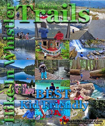
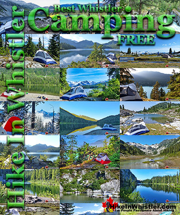
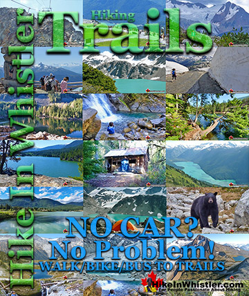
Best Whistler & Garibaldi Park Hiking by Month!
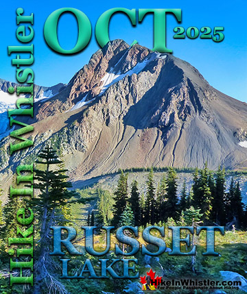
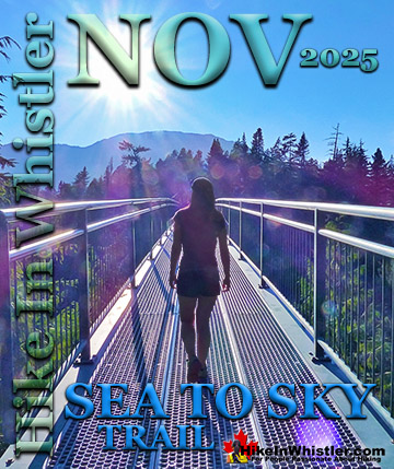

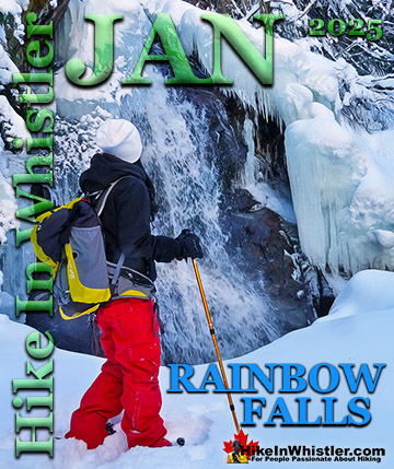
Explore BC Hiking Destinations!
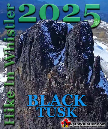
Whistler Hiking Trails
Squamish Hiking Trails
Vancouver Hiking Trails

Clayoquot Hiking Trails

Victoria Hiking Trails
