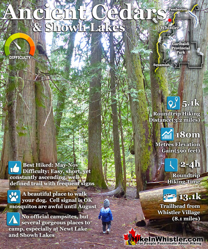
![]() Ancient Cedars is a nice, easy/moderate 2.5 kilometre (1.6 mile) hiking trail on the far side of Cougar Mountain, just 13.1 kilometres north of Whistler Village. A small, untouched grove of huge western red-cedars hidden high up in the mountains. Often overlooked by hikers, certainly there are other groves of massive cedars found in other Whistler area hikes.
Ancient Cedars is a nice, easy/moderate 2.5 kilometre (1.6 mile) hiking trail on the far side of Cougar Mountain, just 13.1 kilometres north of Whistler Village. A small, untouched grove of huge western red-cedars hidden high up in the mountains. Often overlooked by hikers, certainly there are other groves of massive cedars found in other Whistler area hikes.
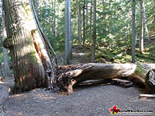
 Easy trail to huge & ancient trees
 A quick, far feeling escape from civilisation
 A relatively quiet hiking trail that is dog friendly!
 Serene backcountry, drive-in camping for free
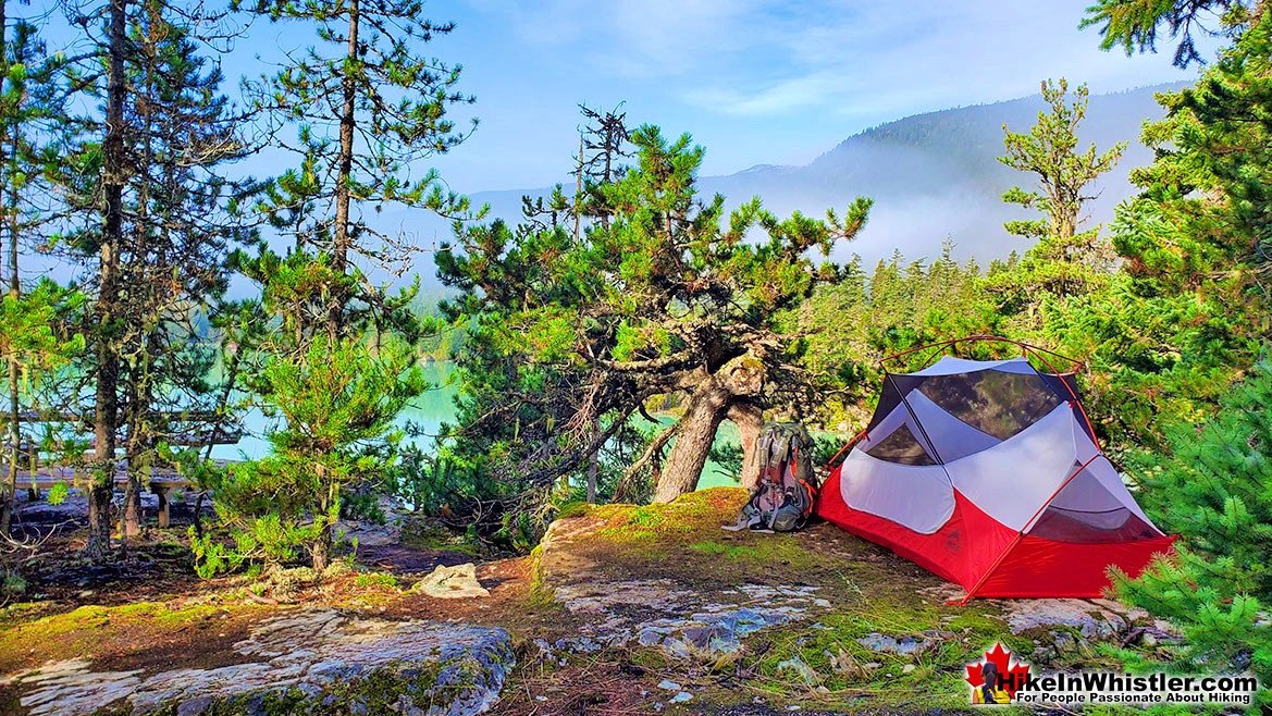
 Lots of hidden & amazing tent sites
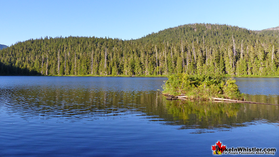
 Newt Lake is wild, hidden & serene
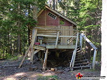
 Abandoned cabin at Showh Lakes
 Lots of mosquitoes in June to August
 ATV's tours in the area are noisy
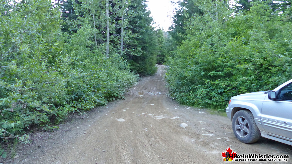
 The access logging road is brutally potholed
Whistler & Garibaldi Hiking
![]() Alexander Falls
Alexander Falls ![]() Ancient Cedars
Ancient Cedars ![]() Black Tusk
Black Tusk ![]() Blackcomb Mountain
Blackcomb Mountain ![]() Brandywine Falls
Brandywine Falls ![]() Brandywine Meadows
Brandywine Meadows ![]() Brew Lake
Brew Lake ![]() Callaghan Lake
Callaghan Lake ![]() Cheakamus Lake
Cheakamus Lake ![]() Cheakamus River
Cheakamus River ![]() Cirque Lake
Cirque Lake ![]() Flank Trail
Flank Trail ![]() Garibaldi Lake
Garibaldi Lake ![]() Garibaldi Park
Garibaldi Park ![]() Helm Creek
Helm Creek ![]() Jane Lakes
Jane Lakes ![]() Joffre Lakes
Joffre Lakes ![]() Keyhole Hot Springs
Keyhole Hot Springs ![]() Logger’s Lake
Logger’s Lake ![]() Madeley Lake
Madeley Lake ![]() Meager Hot Springs
Meager Hot Springs ![]() Nairn Falls
Nairn Falls ![]() Newt Lake
Newt Lake ![]() Panorama Ridge
Panorama Ridge ![]() Parkhurst Ghost Town
Parkhurst Ghost Town ![]() Rainbow Falls
Rainbow Falls ![]() Rainbow Lake
Rainbow Lake ![]() Ring Lake
Ring Lake ![]() Russet Lake
Russet Lake ![]() Sea to Sky Trail
Sea to Sky Trail ![]() Skookumchuck Hot Springs
Skookumchuck Hot Springs ![]() Sloquet Hot Springs
Sloquet Hot Springs ![]() Sproatt East
Sproatt East ![]() Sproatt West
Sproatt West ![]() Taylor Meadows
Taylor Meadows ![]() Train Wreck
Train Wreck ![]() Wedgemount Lake
Wedgemount Lake ![]() Whistler Mountain
Whistler Mountain
![]() January
January ![]() February
February ![]() March
March ![]() April
April ![]() May
May ![]() June
June ![]() July
July ![]() August
August ![]() September
September ![]() October
October ![]() November
November ![]() December
December
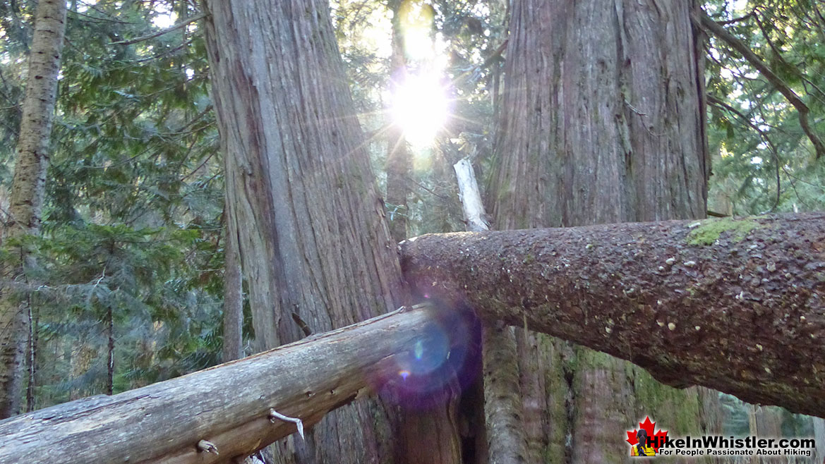
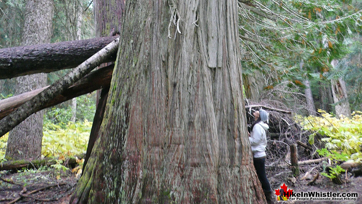
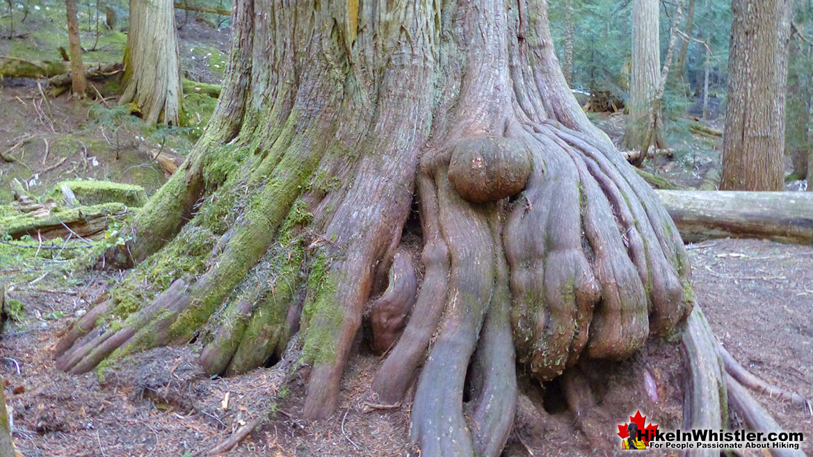
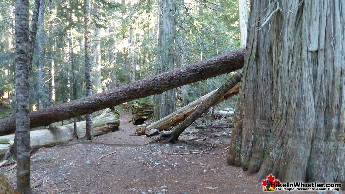
If you hike the short, three kilometre trail to Cheakamus Lake and you will marvel at the size, frequency and wonderful aroma of these massive and numerous giant cedars. The Wedgemount Lake trail also has some majestic cedars along the hike. You can even walk through an impressive grove of huge cedars on the Valley Trail at the north end of the Whistler Golf Club. None of them compare, however, to the giants at Ancient Cedars. They are extraordinarily huge and some are estimated to be a thousand years old. Most of these giants stretch toward the sky, but some lay along the forest floor giving you an even closer grasp of their size. If you bring kids along, they will disappear into the endless, natural playground. Ancient Cedars is great to visit in the spring and fall months as you rarely see people and never feel mosquitoes. The problem is the trailhead is up a long way into the mountains and snow at this elevation persists until April and sometimes May. Snow, along with the steep access road make driving to the trailhead impossible for most cars until it disappears. Summer is great for seeing Ancient Cedars and Showh Lakes in particular.
Guides to the Best of Whistler
 Best Dog Friendly Hiking Trails
Whistler is very dog friendly and the number of wonderful hiking trails that your dog will love is huge. The massively varied hiking trails range from easy, short, close to Whistler Village to challenging, long and deep in the endless wilderness around Whistler. You can find dog friendly trails in and around Whistler Village that take you through deep, dark and magical forests. Or you can drive beyond Whistler Village and take your dog to spectacular alpine lakes. Some requiring little or no hiking, while others are found after hiking challenging and long trails. Many of these places are comparatively quiet and often you and your dog will have the the wilderness to yourselves. In and around Whistler Village you have Lost Lake with its spider web of trails... Continued here.
 Best Free Whistler Camping
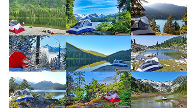
Whistler is surrounded by an immense wilderness dotted with spectacular, hidden lakes and amazing places to set up a tent. Decades of logging activity has left a network of forest service roads that has opened easy access to these places. Some of these you can drive to and some you may need a 4x4 to comfortably get to. Some places to camp for free you can drive to, some require a short hike and others are fairly long hikes to reach. Beautiful Callaghan Valley is home to several incredible and free places to camp. Callaghan Lake has a great free drive-to campsite just steps from this spectacular alpine lake. If you have a canoe, you can paddle to the end of Callaghan Lake and hike the short, but steep trail up to Cirque Lake. This gorgeous lake is deep in the alpine wilderness... Continued here.
 No Car? No Problem! Whistler Trails
Whistler as a resort has a wonderful car-free core. The Village Stroll runs through the heart of Whistler Village and is entirely car free. If you are visiting Whistler or living here and you don't have a car, it's no problem. On foot or on a bike you can travel the extensive network of non-motorized trails. The Valley Trail snakes through Whistler Village and extends in several directions, all of which lead to beautiful parts of Whistler. The Sea to Sky Trail and the Lost Lake trails continue this massive, car-free network of trails running almost everywhere in Whistler. When it comes to many of the best hiking trails, getting to the trailheads on foot, by bike or public transit can be tricky at best or complicated and impractical at worst. Many trailheads are far from Whistler Village and... Continued here.
 Kid Friendly Whistler Hiking Trails
There are plenty of excellent, kid and family friendly hiking trails and destinations in and around Whistler. Kid and family friendly generally means an easy and somewhat short trail that a toddler can happily manage. Some of these trails are flat enough to be stroller friendly, such as Brandywine Falls, Whistler Mountain and Blackcomb Mountain. Others such as Logger’s Lake, Cheakamus River and Madeley Lake have short enough trails to reach them that you can manage with little kids that don't want to hike too far. Some of these hikes and walks are popular and close to Whistler Village, like Whistler Mountain, Blackcomb Mountain, Lost Lake Park, Rainbow Park and Meadow Park. Others are a beautiful, but far drive into the mountains and tricky to find... Continued here.
Ancient Cedars, Showh Lakes & Newt Lake
The Beautiful Ancient Cedars Trail
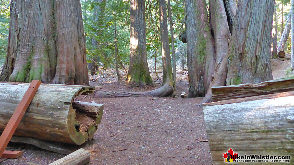
Ancient Cedars is Fun for Kids
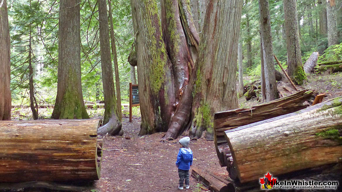
Ancient Cedars Deadfall
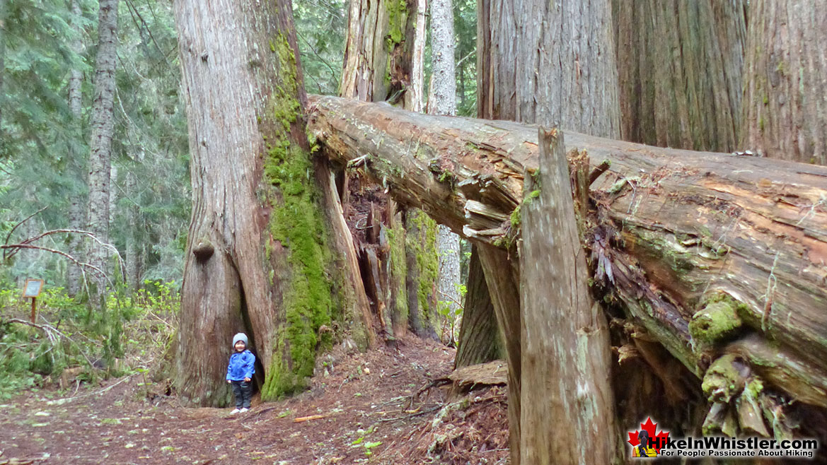
Walking Among Giants at Ancient Cedars
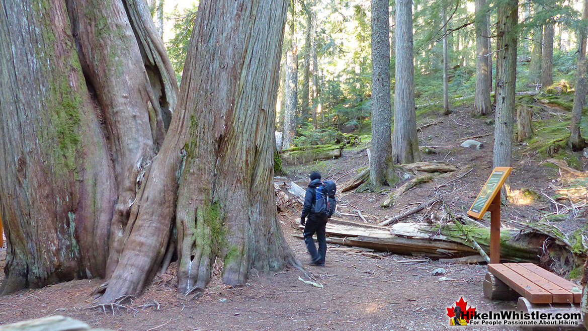
The Ancient Cedars Trail
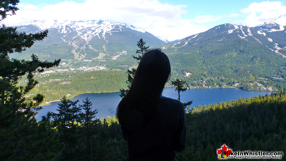
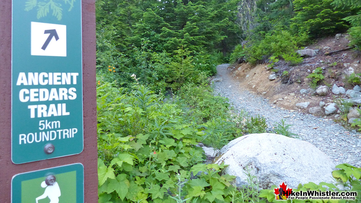
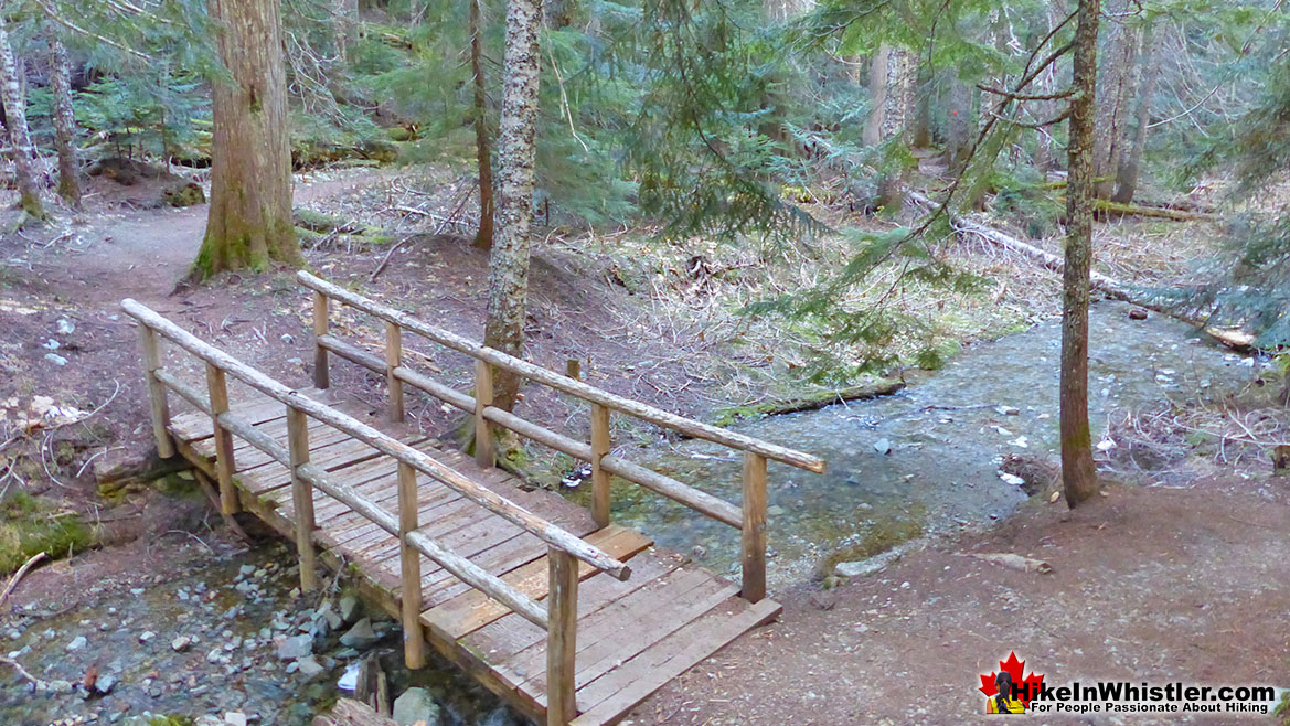
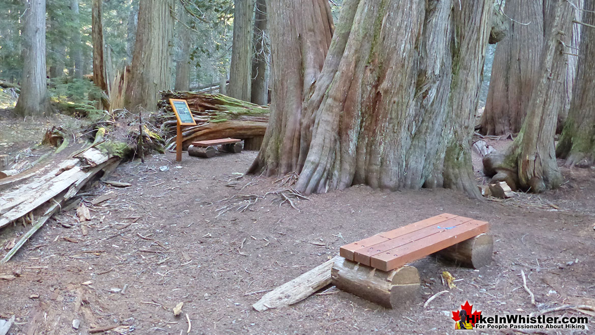
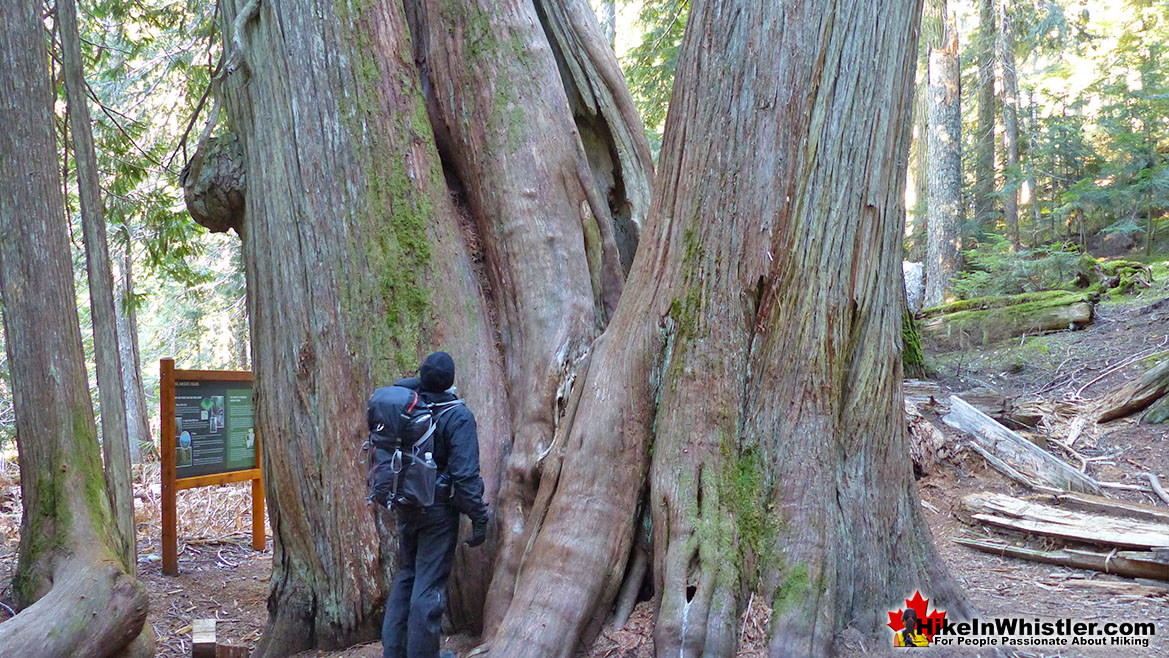
![]() The Ancient Cedars trail is well marked and well worn and only gradually uphill for the 2.5 kilometre hike, trailhead to ancient forest. At the Ancient Cedars forest there is a short circle trail that takes you throughout the giants then leads you back to the main trail for the return journey. The whole trail takes you through the tranquil and remote forest that hides up on the side of Cougar Mountain. Cougar Mountain is home to TAG and Superfly Ziplines. The rows of atv's you will pass while driving up the Cougar Mountain Forest Service Road will belong to TAG. Superfly Ziplines is worth a look here too as they boast the "Longest, highest, fastest ziplines in Canada." The whole 5.1 kilometre(3.2 mile) Ancient Cedars roundtrip should take you less than three or four hours. Unlike most other Whistler hiking trails, Ancient Cedars is dog friendly. Unfortunately snow makes the road undrivable much of the year, so you can only reliably get up there around mid June to early to mid November. The main attraction to the Ancient Cedars trail is of course the monster cedars at the end of the trail. The trail itself is scenic and at least a couple times the forest opens up to some great views of the Soo Valley and snow capped mountains beyond. With the trail improvements in late 2013, you will now find more trail signs and kilometre markers. Some interpretive information about the beautiful forest around and above you, as well as some strategically placed benches to sit and appreciate the grandeur of the trees.
The Ancient Cedars trail is well marked and well worn and only gradually uphill for the 2.5 kilometre hike, trailhead to ancient forest. At the Ancient Cedars forest there is a short circle trail that takes you throughout the giants then leads you back to the main trail for the return journey. The whole trail takes you through the tranquil and remote forest that hides up on the side of Cougar Mountain. Cougar Mountain is home to TAG and Superfly Ziplines. The rows of atv's you will pass while driving up the Cougar Mountain Forest Service Road will belong to TAG. Superfly Ziplines is worth a look here too as they boast the "Longest, highest, fastest ziplines in Canada." The whole 5.1 kilometre(3.2 mile) Ancient Cedars roundtrip should take you less than three or four hours. Unlike most other Whistler hiking trails, Ancient Cedars is dog friendly. Unfortunately snow makes the road undrivable much of the year, so you can only reliably get up there around mid June to early to mid November. The main attraction to the Ancient Cedars trail is of course the monster cedars at the end of the trail. The trail itself is scenic and at least a couple times the forest opens up to some great views of the Soo Valley and snow capped mountains beyond. With the trail improvements in late 2013, you will now find more trail signs and kilometre markers. Some interpretive information about the beautiful forest around and above you, as well as some strategically placed benches to sit and appreciate the grandeur of the trees.

Showh Lakes(aka Cougar Lakes)
![]()
![]() T
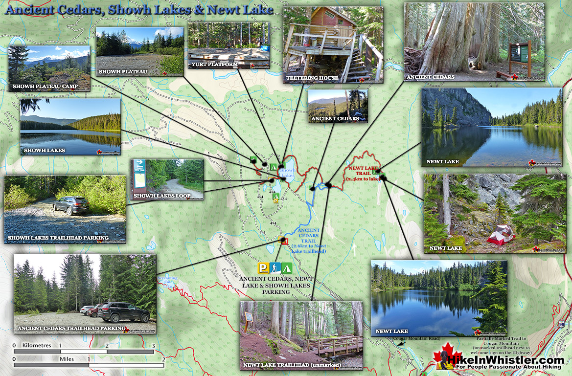
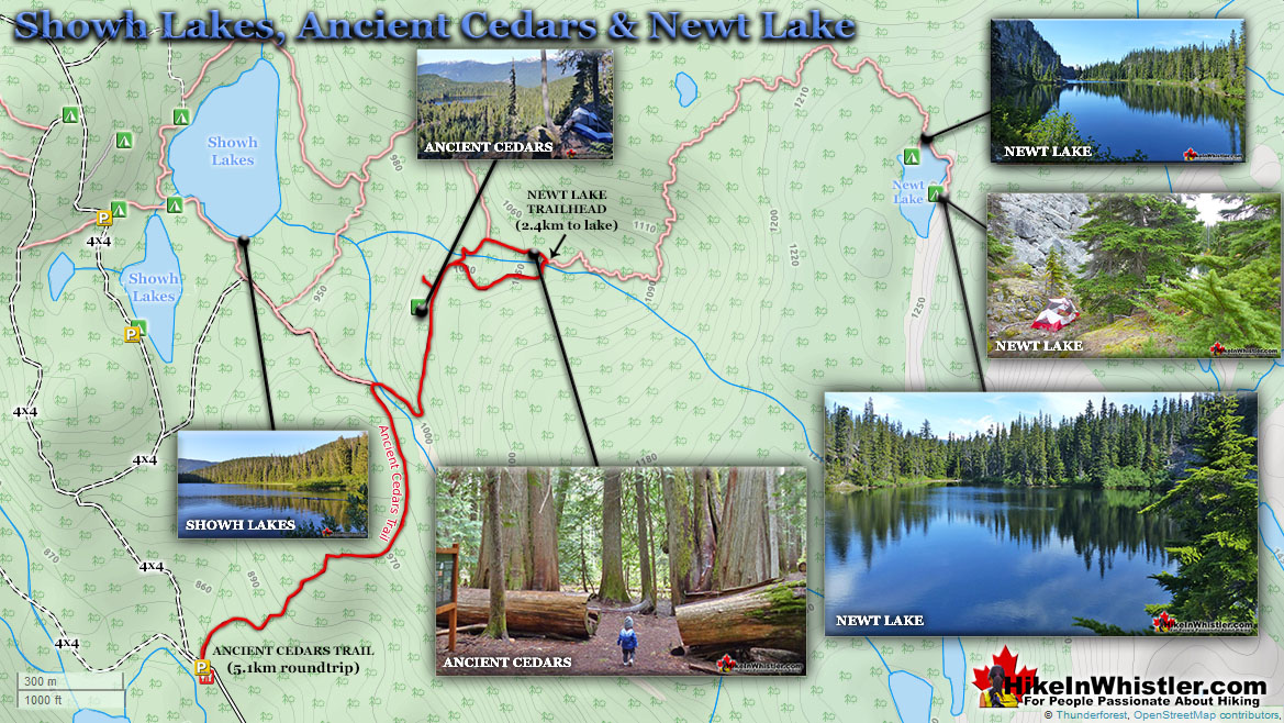
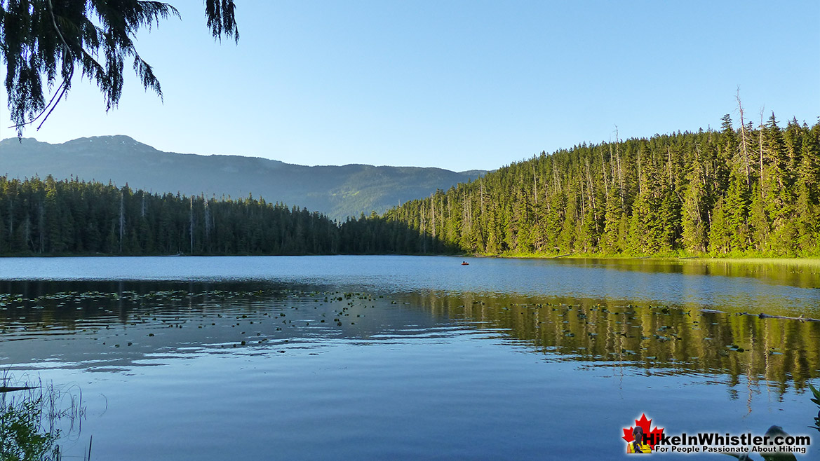
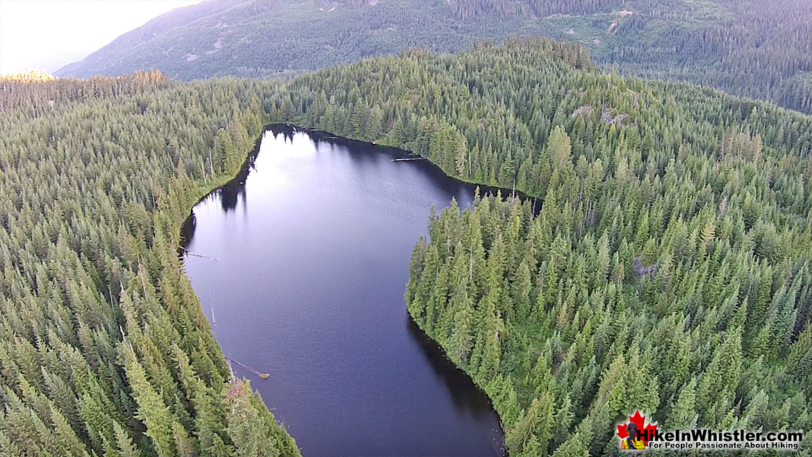
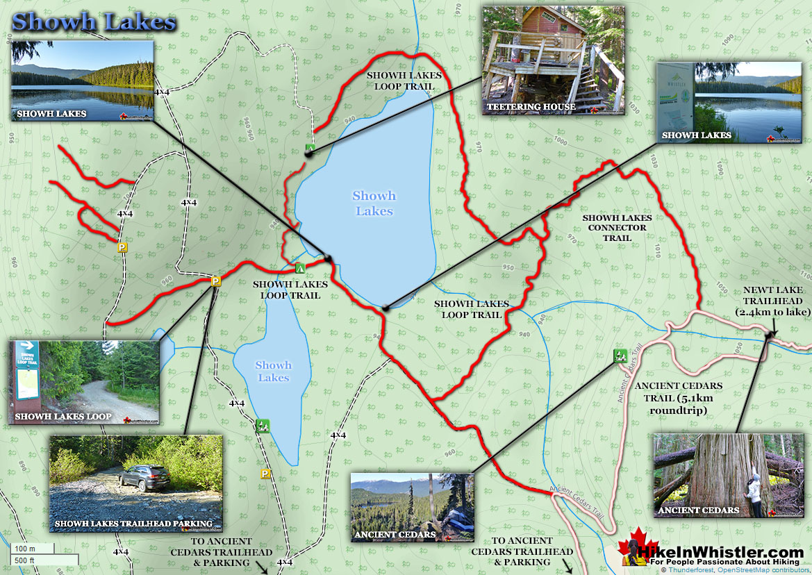
T![]() he obvious draw of Ancient Cedars trail tends to make hikers overlook the connecting trail to Showh Lakes. After hiking to Ancient Cedars, halfway along the trail take the connecting trail to Showh Lakes(sometimes known as Showh Lake and Cougar Lake). The trail runs along the left side of the larger lake on your right and then veers left, crosses a creek and circles around the smaller lake on your left where it connects with the logging road and Showh Lakes parking area. You can either follow the road back to your car at the Ancient Cedars trailhead or continue rounding this smaller Showh Lake and rejoin the main trail you came in on and hike back to your car. Showh Lakes are very remote and wild feeling lakes which certainly ads to their draw as fishing lakes. They are stocked with trout every year and your average summer day will find a couple fly fishermen out on the water floating inside those funny little one-man rubber float tubes having a great time catching lots of fish. Swimming is not the best at Showh Lakes, however, the wonderful remote setting more than makes up for the lack of inviting beach.
he obvious draw of Ancient Cedars trail tends to make hikers overlook the connecting trail to Showh Lakes. After hiking to Ancient Cedars, halfway along the trail take the connecting trail to Showh Lakes(sometimes known as Showh Lake and Cougar Lake). The trail runs along the left side of the larger lake on your right and then veers left, crosses a creek and circles around the smaller lake on your left where it connects with the logging road and Showh Lakes parking area. You can either follow the road back to your car at the Ancient Cedars trailhead or continue rounding this smaller Showh Lake and rejoin the main trail you came in on and hike back to your car. Showh Lakes are very remote and wild feeling lakes which certainly ads to their draw as fishing lakes. They are stocked with trout every year and your average summer day will find a couple fly fishermen out on the water floating inside those funny little one-man rubber float tubes having a great time catching lots of fish. Swimming is not the best at Showh Lakes, however, the wonderful remote setting more than makes up for the lack of inviting beach.
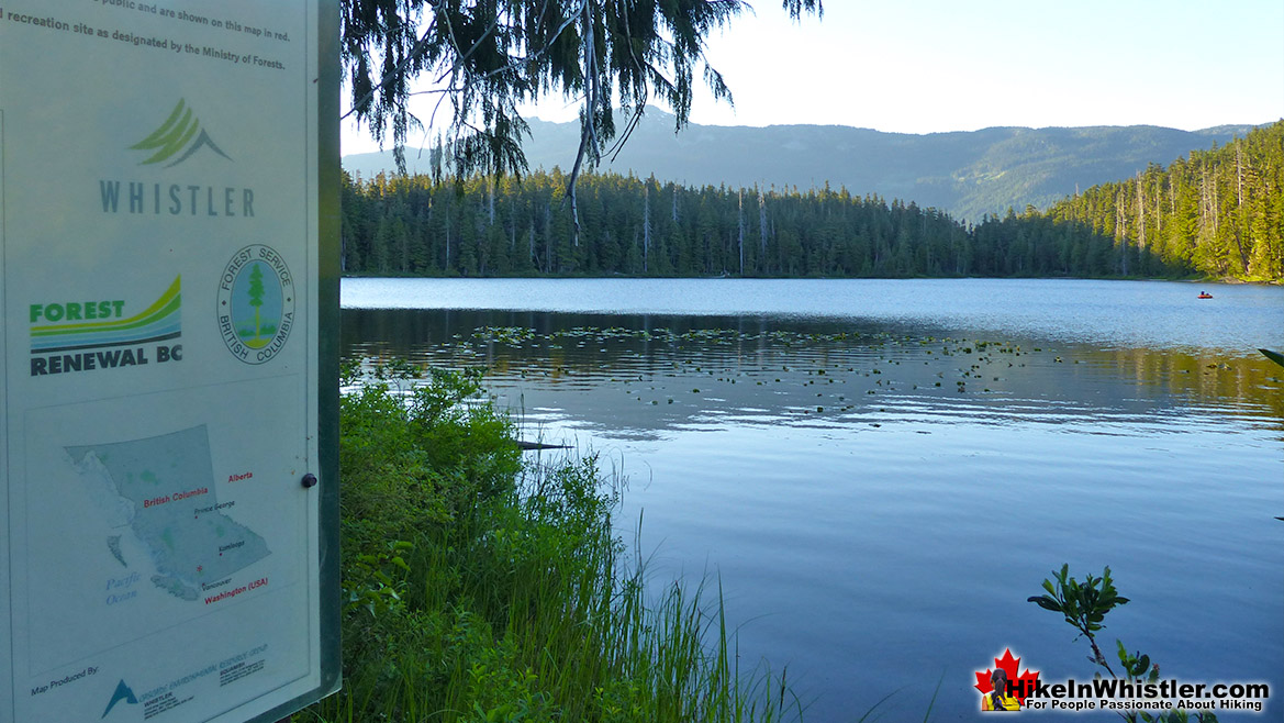
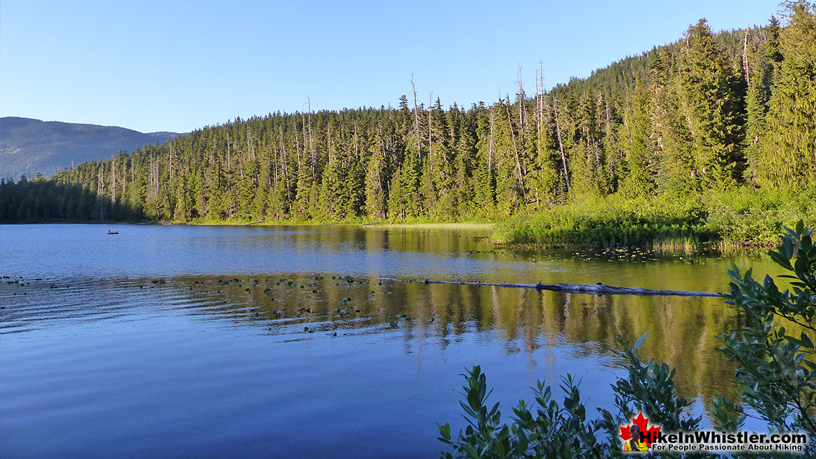
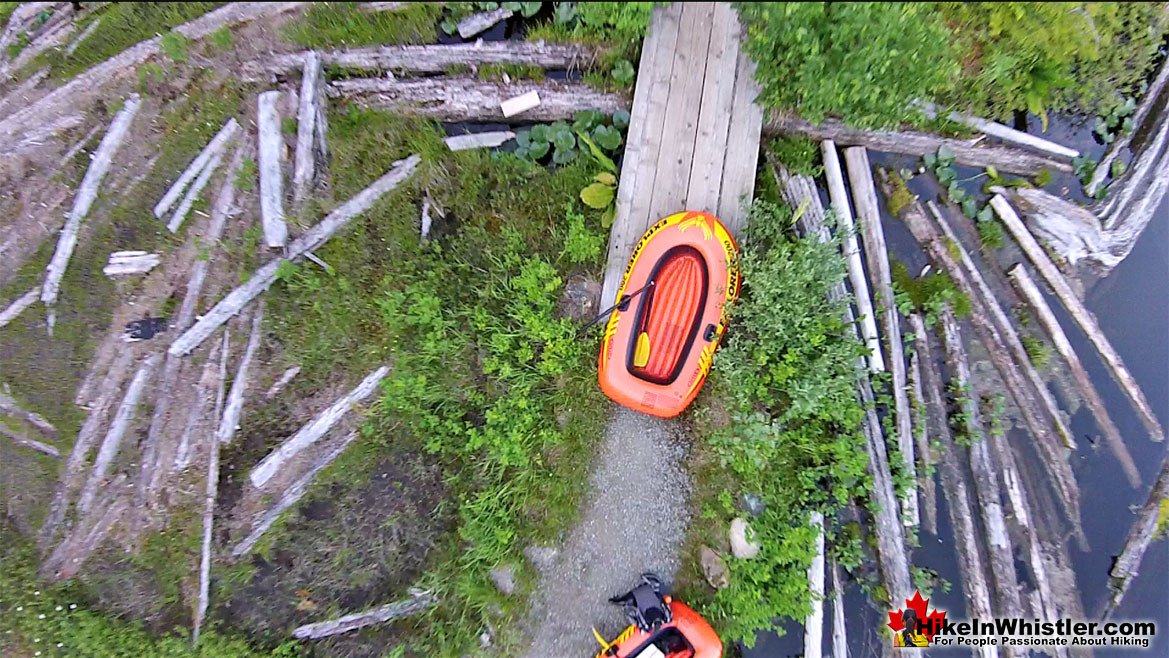
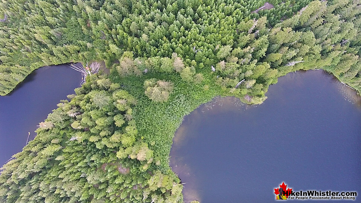
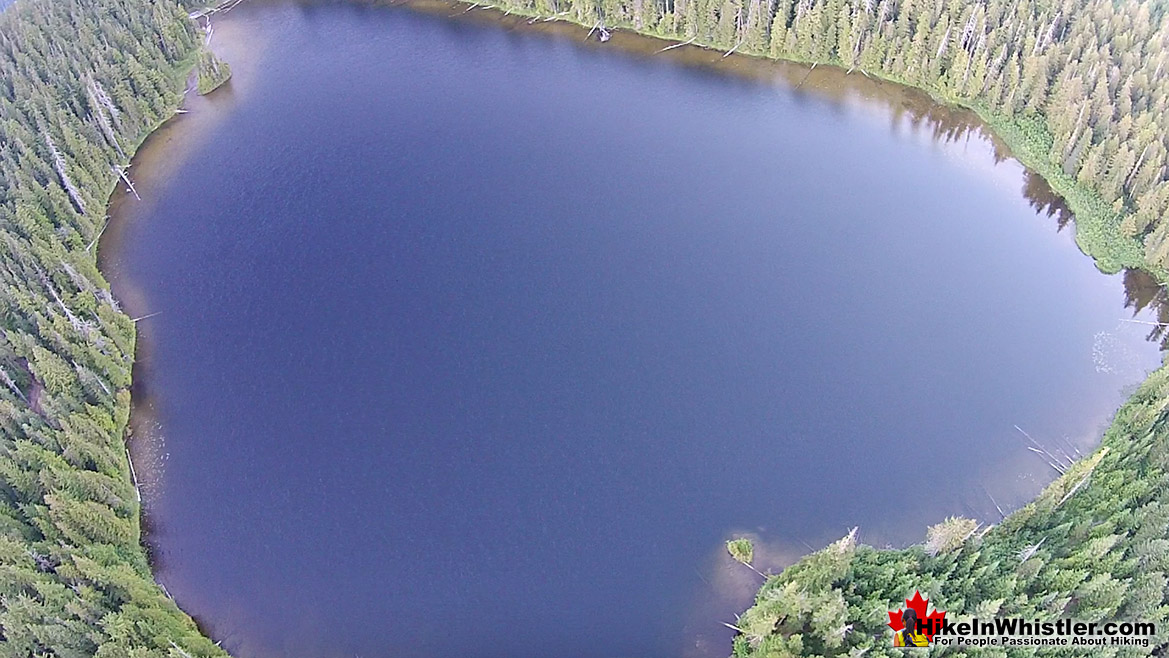
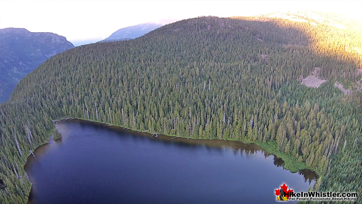
If you have a 4x4, you can drive right to the shores of Showh Lakes and crack a beer with little chance of humanity disturbing you. If you don't have a 4x4, you can make it to a short walk to the lakes and if you have some sort of inflatable boat or canoe, you will find yourself in paradise. Floating in a mirror under a blue sky, surrounded by deep and wild forest.
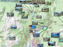
Showh Lakes & Ancient Cedars Trail Map
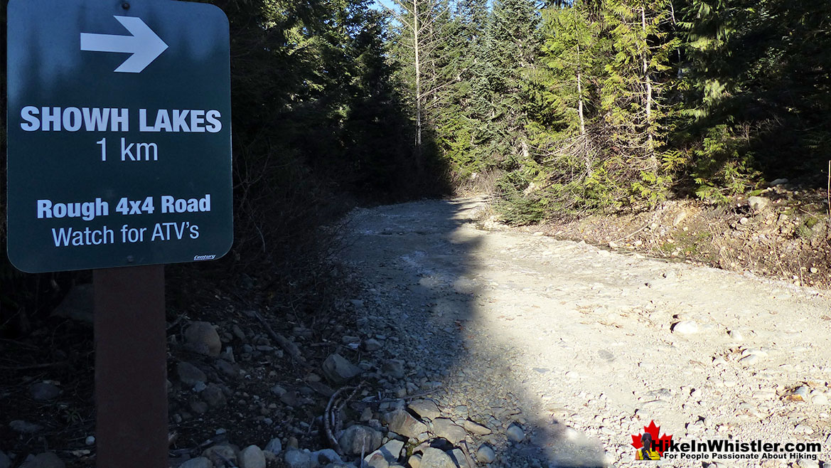
![]() Ancient Cedars is somewhat well known, however Showh Lakes is not. Very wild and back of beyond feeling, Showh Lakes is definitely worth a look if you want more hiking beyond the Ancient Cedars trail. Another great draw for Showh Lakes is the great places(though small and unmarked) to put up a tent. There is a good mapboard at the Ancient Cedars trailhead, as well as good signs directing you along the trail. Having a map in your pocket is probably not necessary unless you are venturing up Showh Lakes, where you could end up on a gravel ATV/horse trail and get a bit lost. Most cars will have no trouble with the drive to the trailhead, though the road is spectacularly potholed. The forest service road to Showh Lakes is very bad and even high clearance 4x4's will have difficulty getting through the narrow, winding and boulder strewn road. This road is more appealing to ATV's or horses. Both of which you occasionally see passing through from the tour operators nearby.
Ancient Cedars is somewhat well known, however Showh Lakes is not. Very wild and back of beyond feeling, Showh Lakes is definitely worth a look if you want more hiking beyond the Ancient Cedars trail. Another great draw for Showh Lakes is the great places(though small and unmarked) to put up a tent. There is a good mapboard at the Ancient Cedars trailhead, as well as good signs directing you along the trail. Having a map in your pocket is probably not necessary unless you are venturing up Showh Lakes, where you could end up on a gravel ATV/horse trail and get a bit lost. Most cars will have no trouble with the drive to the trailhead, though the road is spectacularly potholed. The forest service road to Showh Lakes is very bad and even high clearance 4x4's will have difficulty getting through the narrow, winding and boulder strewn road. This road is more appealing to ATV's or horses. Both of which you occasionally see passing through from the tour operators nearby.
History of Ancient Cedars
![]() Back in the late 1980's workers building a bike trail on the lower part of Cougar Mountain discovered a small grove of stunningly enormous western redcedars. Several noted at the time were over 10 feet in diameter. Core samples were taken and indicated that the trees were likely close to 1000 years old. The Douglas Firs in the grove were similarly ancient and estimated to be no less than 650 years old. Suddenly it became evident that word of these monsters would reach the logging companies and the magnificent ancient grove would be turned into lumber. On March 25th, 1988 a meeting was held in Squamish between the Forest Service(logging interests) and the Pocket Wilderness Coalition(a group dedicated to preserving this ancient forest). The PWC came with two requests: to protect the Cougar Mountain and Rainbow Mountain areas and prevent logging activity, road building and other development on these two mountains. Predictably the local Forest Service Operations Manager, Don Kinnear refused. Kinnear went on to inform the PWC that logging permits have already been issued for Cougar Mountain and logging would commence as soon as weather permits. Worried that Mr Kinnear would speed up logging in the area in order to destroy the ancient forest and therefore avoid further opposition, the PWC asked to be notified when new logging plans were submitted to the Forest Service. Kinnear refused, and some argued that this went against his professed goal of keeping the public involved. We can be grateful to the PWC's relentless effort. Against all odds it seems, they prevailed. Cougar Mountain, with Ancient Cedars nestled high up in the beautiful wilderness, remains today. The victory was partly owing to public perceptions of usefulness and profitability from tourism from natural wonders, such as this forest. Locals in Whistler recount the steady growth of tourism operators around Whistler's third mountain. So much so, that today the area is home to Ziplines, tree-top adventures, ATVing, snowmobiling, as well as criss-crossed by dozens of hiking and biking trails. All this development and Ancient Cedars has survived. The bewilderingly huge ancient cedars are protected and we can watch these monsters continue to grow for generations to come.
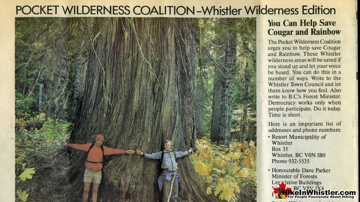
Back in the late 1980's workers building a bike trail on the lower part of Cougar Mountain discovered a small grove of stunningly enormous western redcedars. Several noted at the time were over 10 feet in diameter. Core samples were taken and indicated that the trees were likely close to 1000 years old. The Douglas Firs in the grove were similarly ancient and estimated to be no less than 650 years old. Suddenly it became evident that word of these monsters would reach the logging companies and the magnificent ancient grove would be turned into lumber. On March 25th, 1988 a meeting was held in Squamish between the Forest Service(logging interests) and the Pocket Wilderness Coalition(a group dedicated to preserving this ancient forest). The PWC came with two requests: to protect the Cougar Mountain and Rainbow Mountain areas and prevent logging activity, road building and other development on these two mountains. Predictably the local Forest Service Operations Manager, Don Kinnear refused. Kinnear went on to inform the PWC that logging permits have already been issued for Cougar Mountain and logging would commence as soon as weather permits. Worried that Mr Kinnear would speed up logging in the area in order to destroy the ancient forest and therefore avoid further opposition, the PWC asked to be notified when new logging plans were submitted to the Forest Service. Kinnear refused, and some argued that this went against his professed goal of keeping the public involved. We can be grateful to the PWC's relentless effort. Against all odds it seems, they prevailed. Cougar Mountain, with Ancient Cedars nestled high up in the beautiful wilderness, remains today. The victory was partly owing to public perceptions of usefulness and profitability from tourism from natural wonders, such as this forest. Locals in Whistler recount the steady growth of tourism operators around Whistler's third mountain. So much so, that today the area is home to Ziplines, tree-top adventures, ATVing, snowmobiling, as well as criss-crossed by dozens of hiking and biking trails. All this development and Ancient Cedars has survived. The bewilderingly huge ancient cedars are protected and we can watch these monsters continue to grow for generations to come.
Geology of Ancient Cedars
![]() What would eventually be known as Cougar Mountain was consumed by ice as two kilometre thick glaciers filled Whistler valley during the last great Ice Age, roughly 10000 years ago. Just the upper reaches of the mountain would have been above the glacier for hundreds of years as the glacier pulverized the valley and carved the terrain all the way to Porteau Cove, down past Squamish! You can stand anywhere in Whistler with a view over the valley and imagine the depth of the glacier that once filled the valley. The alpine mountain peaks, visible by their treeless terrain, are a good marker of where the glacier once rose to. Another indication is the shape of the mountains. Rounded mountain peaks were likely glacier covered, whereas jagged peaks, such as Wedge Mountain, Blackcomb Mountain, and Whistler Mountain were not. Looking around at Whistler's mountains give you a vivid look into the look of the valley thousands of years ago.
What would eventually be known as Cougar Mountain was consumed by ice as two kilometre thick glaciers filled Whistler valley during the last great Ice Age, roughly 10000 years ago. Just the upper reaches of the mountain would have been above the glacier for hundreds of years as the glacier pulverized the valley and carved the terrain all the way to Porteau Cove, down past Squamish! You can stand anywhere in Whistler with a view over the valley and imagine the depth of the glacier that once filled the valley. The alpine mountain peaks, visible by their treeless terrain, are a good marker of where the glacier once rose to. Another indication is the shape of the mountains. Rounded mountain peaks were likely glacier covered, whereas jagged peaks, such as Wedge Mountain, Blackcomb Mountain, and Whistler Mountain were not. Looking around at Whistler's mountains give you a vivid look into the look of the valley thousands of years ago.
Camping & Bivouacking at Ancient Cedars
![]() There are no dedicated camping options in and around Ancient Cedars, however you can find some very rugged areas to put up a tent well away from the Ancient Cedars trail. The tent shown here is just a few dozen metres off of the main trail and has an amazing view over Showh Lakes. Down at Showh Lakes you will find several good spaces for a tent.. but it takes a little looking, and none are exceptional. The terrain is too irregular and just not ideal for camping, however there is a good clearing in the forest just before you arrive at the far lake. What the lakes lack in flat, tent-friendly ground, they more than make up for with amazing wilderness serenity. With the exception of seasonal engine sounds from atv's or snowmobiles, you will rarely see or hear any hint of mankind. If you are a fan of taking your 4x4 to your campsite, Showh Lakes will suit you as well. Depending on your 4x4, you may be able to drive right to where you plan to camp. If not, you will just have to park a 3 minute walk from where you camp. Either way, it is a very convenient and unexpectedly remote feeling, wilderness setting to camp for free, so close to Whistler.
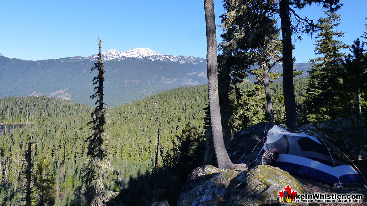
There are no dedicated camping options in and around Ancient Cedars, however you can find some very rugged areas to put up a tent well away from the Ancient Cedars trail. The tent shown here is just a few dozen metres off of the main trail and has an amazing view over Showh Lakes. Down at Showh Lakes you will find several good spaces for a tent.. but it takes a little looking, and none are exceptional. The terrain is too irregular and just not ideal for camping, however there is a good clearing in the forest just before you arrive at the far lake. What the lakes lack in flat, tent-friendly ground, they more than make up for with amazing wilderness serenity. With the exception of seasonal engine sounds from atv's or snowmobiles, you will rarely see or hear any hint of mankind. If you are a fan of taking your 4x4 to your campsite, Showh Lakes will suit you as well. Depending on your 4x4, you may be able to drive right to where you plan to camp. If not, you will just have to park a 3 minute walk from where you camp. Either way, it is a very convenient and unexpectedly remote feeling, wilderness setting to camp for free, so close to Whistler.
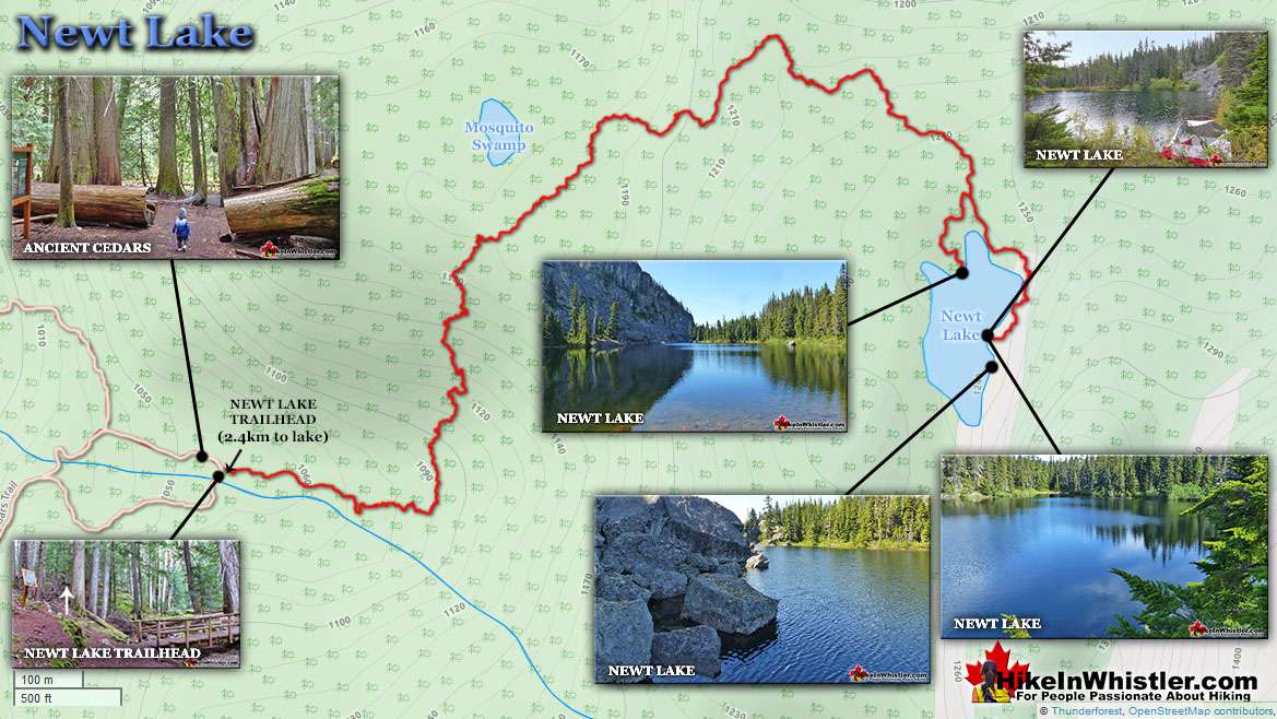
Newt Lake is an excellent option to camp for free near Ancient Cedars. The unmarked trailhead is found at the end of the Ancient Cedars trail next to the far bridge. The trail is tough, steep, wild, but short at just 2.4 kilometres. Newt Lake is wild and beautiful, though finding a flat spot for a tent takes a bit of searching. More info, details and directions to Newt Lake here...
![]() Another decent place to camp would be back down to the Sea to Sky Highway, turn left(north) and in a couple kilometres watch for the Wedgemount Lake turnoff on your right. Turn here and cross the train tracks and park next to the Green River. There are several places on both sides of the river that are very nice and perfect for a tent. If you are more adventurous, cross the river and turn right. Drive along this bumpy logging road for about 1 kilometre, pass Whistler Paintball on your left and at the yellow gate, park on the clearing on the right. You will see the Sea to Sky Trail head up along the gated gravel road. If instead you follow the old gravel road on the right. After a few hundred metres running parallel to the train tracks, you will come to the trail to Parkhurst Ghost Town, leading to Parkhurst Ghost Town and a very interesting and beautiful place to camp overlooking Green Lake.
Another decent place to camp would be back down to the Sea to Sky Highway, turn left(north) and in a couple kilometres watch for the Wedgemount Lake turnoff on your right. Turn here and cross the train tracks and park next to the Green River. There are several places on both sides of the river that are very nice and perfect for a tent. If you are more adventurous, cross the river and turn right. Drive along this bumpy logging road for about 1 kilometre, pass Whistler Paintball on your left and at the yellow gate, park on the clearing on the right. You will see the Sea to Sky Trail head up along the gated gravel road. If instead you follow the old gravel road on the right. After a few hundred metres running parallel to the train tracks, you will come to the trail to Parkhurst Ghost Town, leading to Parkhurst Ghost Town and a very interesting and beautiful place to camp overlooking Green Lake.
![]() Further north on the Sea to Sky Highway you will come to Nairn Falls Provincial Park. This is a huge, pay-to-use campground with plenty of facilities and located on Green River, just a short hike to Nairn Falls. In Whistler, just north of the Village near the south end of Green Lake, is Riverside Resort. This deluxe campground has tent spots on the Fitzsimmons Creek as well as RV camping, yurts and log cabins to rent. A bit pricey and often crowded in the summer with wall to wall RV's. But if you are OK with that, Riverside Resort is pretty amazing because of its great location close to Whistler Village and nice forest setting along Fitzsimmons Creek.
Further north on the Sea to Sky Highway you will come to Nairn Falls Provincial Park. This is a huge, pay-to-use campground with plenty of facilities and located on Green River, just a short hike to Nairn Falls. In Whistler, just north of the Village near the south end of Green Lake, is Riverside Resort. This deluxe campground has tent spots on the Fitzsimmons Creek as well as RV camping, yurts and log cabins to rent. A bit pricey and often crowded in the summer with wall to wall RV's. But if you are OK with that, Riverside Resort is pretty amazing because of its great location close to Whistler Village and nice forest setting along Fitzsimmons Creek.
Facilities at Ancient Cedars
![]() There is an outhouse across from the trailhead to Ancient Cedars. The tour operators further down towards the highway turnoff may let you borrow their deluxe facilities if you ask nicely. A couple kilometres south on the Sea to Sky Highway, at the entrance Alpine, you will find the closest real washrooms. Alpine Cafe and Alpine Market are just off the highway(south from Ancient Cedars), turn right into Alpine and then immediately right again. The Alpine Cafe has been a locals favourite since it opened in 2004. A small, but very cute and warm feeling cafe with great coffee and lots of cafe style food for great prices. You will want to order everything on the menu. Open everyday 630am to 9pm. There is a small waterfall and several clean mountain streams at Ancient Cedars with fresh, clean water.
There is an outhouse across from the trailhead to Ancient Cedars. The tour operators further down towards the highway turnoff may let you borrow their deluxe facilities if you ask nicely. A couple kilometres south on the Sea to Sky Highway, at the entrance Alpine, you will find the closest real washrooms. Alpine Cafe and Alpine Market are just off the highway(south from Ancient Cedars), turn right into Alpine and then immediately right again. The Alpine Cafe has been a locals favourite since it opened in 2004. A small, but very cute and warm feeling cafe with great coffee and lots of cafe style food for great prices. You will want to order everything on the menu. Open everyday 630am to 9pm. There is a small waterfall and several clean mountain streams at Ancient Cedars with fresh, clean water.
Restrictions and Concerns at Ancient Cedars
![]() Ancient Cedars and Showh Lakes are located in a somewhat quiet and forgotten corner of Whistler that is remarkably easy to access. The forest service roads cut through the wilderness, allowing you to drive to the middle of nowhere. But the middle of nowhere is a wonderful thing. At Showh Lakes you will find a tranquil paradise free of signs to not do this and not do that. Ancient Cedars and Show Lakes are very dog friendly. The hiking trails are less busy than the Garibaldi Provincial Park trails across the valley which don't allow dogs. The amazing Sea to Sky Trail is another dog friendly option close by. This 180 kilometre trail cuts right through Whistler and there are several access points. The closest access from Ancient Cedars is just north on the Sea to Sky Highway. Turn right at the sign for Wedgemount Lake, cross the train tracks and bridge over Green River and look for the Sea to Sky Trail signs. For a list of the best dog friendly hiking trails in Whistler try here.
Ancient Cedars and Showh Lakes are located in a somewhat quiet and forgotten corner of Whistler that is remarkably easy to access. The forest service roads cut through the wilderness, allowing you to drive to the middle of nowhere. But the middle of nowhere is a wonderful thing. At Showh Lakes you will find a tranquil paradise free of signs to not do this and not do that. Ancient Cedars and Show Lakes are very dog friendly. The hiking trails are less busy than the Garibaldi Provincial Park trails across the valley which don't allow dogs. The amazing Sea to Sky Trail is another dog friendly option close by. This 180 kilometre trail cuts right through Whistler and there are several access points. The closest access from Ancient Cedars is just north on the Sea to Sky Highway. Turn right at the sign for Wedgemount Lake, cross the train tracks and bridge over Green River and look for the Sea to Sky Trail signs. For a list of the best dog friendly hiking trails in Whistler try here.
Wildlife at Ancient Cedars
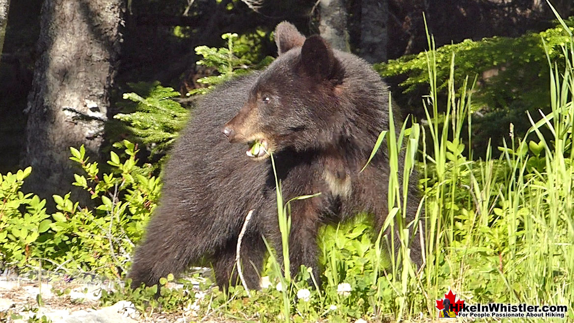
![]() Cougar Mountain and the surrounding wilderness that encompasses Ancient Cedars and Showh Lakes is a wonderfully remote and wild corner of Whistler. Bears are frequently seen in the summer, spring and fall months. Whistler black bears are timid and almost certainly will retreat away from humans. Doing the same yourself is your best bet to avoid being the first unprovoked bear attack statistic in Whistler. It's true. With black bears numbering in the hundreds and people numbering in the thousands in this cozy valley, there has never been an unprovoked bear attack. Cougars are known to roam the mountains around Whistler as well, though very rarely seen as they are very reclusive. Many locals will laugh at the danger of black bears, while getting very serious about potential cougar attacks. Just like with bears, there has never been any cougar attacks in Whistler, however having a 150 pound, hungry cat roaming in the forest is always unnerving.
Cougar Mountain and the surrounding wilderness that encompasses Ancient Cedars and Showh Lakes is a wonderfully remote and wild corner of Whistler. Bears are frequently seen in the summer, spring and fall months. Whistler black bears are timid and almost certainly will retreat away from humans. Doing the same yourself is your best bet to avoid being the first unprovoked bear attack statistic in Whistler. It's true. With black bears numbering in the hundreds and people numbering in the thousands in this cozy valley, there has never been an unprovoked bear attack. Cougars are known to roam the mountains around Whistler as well, though very rarely seen as they are very reclusive. Many locals will laugh at the danger of black bears, while getting very serious about potential cougar attacks. Just like with bears, there has never been any cougar attacks in Whistler, however having a 150 pound, hungry cat roaming in the forest is always unnerving.
Ancient Cedars Parking & Trailhead Directions
![]()
![]()
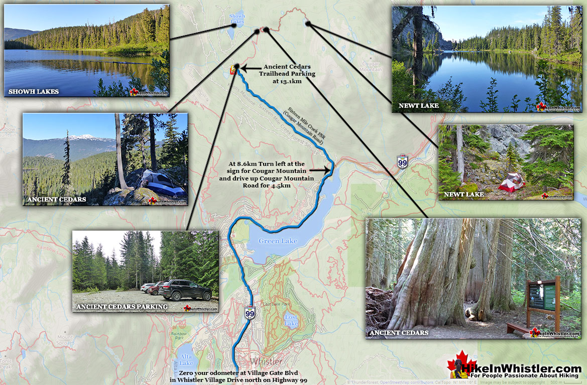
![]() To find the Ancient Cedars trailhead parking, zero your odometer at Village Gate Boulevard in Whistler village then drive north on Highway 99, towards Pemberton. At 8.6km you will see on your left Cougar Mountain Road(Sixteen Mile Creek Forest Service Road). If you keep your eyes out for the big Cougar Mountain sign on your left, you should spot this turn easily. There is no turn lane, however the highway is wide and safe enough to slow and stop if needed while turning left. Turn here and continue straight for 4.5 kilometres(passing through some busy tour operator areas) until you see the sign for Ancient Cedars. This road is very bad with potholes after you pass the tour operators. Though the potholes are brutal, most cars should be fine reaching the parking area as long as you drive carefully and slow. The parking lot to Ancient Cedars is well marked and, unless you have a serious 4x4, this parking lot is as far as you will be able to drive. If you have a serious 4x4, you can continue to the shores of Showh Lakes and potential car-camping or wilderness camping options.
To find the Ancient Cedars trailhead parking, zero your odometer at Village Gate Boulevard in Whistler village then drive north on Highway 99, towards Pemberton. At 8.6km you will see on your left Cougar Mountain Road(Sixteen Mile Creek Forest Service Road). If you keep your eyes out for the big Cougar Mountain sign on your left, you should spot this turn easily. There is no turn lane, however the highway is wide and safe enough to slow and stop if needed while turning left. Turn here and continue straight for 4.5 kilometres(passing through some busy tour operator areas) until you see the sign for Ancient Cedars. This road is very bad with potholes after you pass the tour operators. Though the potholes are brutal, most cars should be fine reaching the parking area as long as you drive carefully and slow. The parking lot to Ancient Cedars is well marked and, unless you have a serious 4x4, this parking lot is as far as you will be able to drive. If you have a serious 4x4, you can continue to the shores of Showh Lakes and potential car-camping or wilderness camping options.
More Hiking Near Ancient Cedars
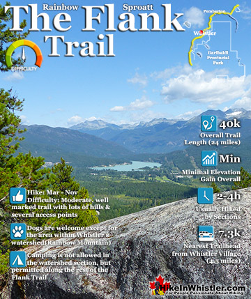
![]() Ancient Cedars is north of Whistler Village and sits effectively at one end of the mighty Rainbow-Sproatt Flank Trail(aka the Flank Trail). This wonderful trail flanks Whistler Valley for several kilometres. On the Flank Trail you can hike or bike from Ancient Cedars all the way to the Callaghan Valley. Along this route, you will see few signs of humanity, except far below and across the valley. Known for its amazing vantage point to see Whistler Mountain and Blackcomb Mountain, this wild and winding trail was once an access road for logging. Often the Flank Trail is a narrow and winding trail, and other parts are wide and flat as a road. The Flank Trail passes over the Rainbow Trail, which is another great trail that extends to the Callaghan Valley, emerging at the idyllic Madeley Lake. The Callaghan Valley is also home to one side of the Sproatt Alpine Trail, Northair Mine, Alexander Falls, Ring Lake, Callaghan Lake, Cirque Lake. Further down the valley you will come to Brandywine Meadows and Brew Lake. The Callaghan Valley is the wild and untamed side of Whistler valley, compared with the busy and rule-driven Whistler, Blackcomb and Garibaldi Lake trails.
Ancient Cedars is north of Whistler Village and sits effectively at one end of the mighty Rainbow-Sproatt Flank Trail(aka the Flank Trail). This wonderful trail flanks Whistler Valley for several kilometres. On the Flank Trail you can hike or bike from Ancient Cedars all the way to the Callaghan Valley. Along this route, you will see few signs of humanity, except far below and across the valley. Known for its amazing vantage point to see Whistler Mountain and Blackcomb Mountain, this wild and winding trail was once an access road for logging. Often the Flank Trail is a narrow and winding trail, and other parts are wide and flat as a road. The Flank Trail passes over the Rainbow Trail, which is another great trail that extends to the Callaghan Valley, emerging at the idyllic Madeley Lake. The Callaghan Valley is also home to one side of the Sproatt Alpine Trail, Northair Mine, Alexander Falls, Ring Lake, Callaghan Lake, Cirque Lake. Further down the valley you will come to Brandywine Meadows and Brew Lake. The Callaghan Valley is the wild and untamed side of Whistler valley, compared with the busy and rule-driven Whistler, Blackcomb and Garibaldi Lake trails.
Beautiful Whistler Sights & History
 Whistler Train Wreck Murals
The colourful graffiti and murals that make Whistler Train Wreck the magical place it is today began appearing in 2011, when this hidden place was known by just a few Whistler locals. In the summer of 2011 several Whistler artists came here for "The Train Wreck Paint Jam" and transformed the mangled wreckage into a surreal art exhibit. The artists ranged from aspiring graffiti artists to professional artists like Kups. Remnants of one of his murals from 2011 is found inside the first boxcar you come to after crossing the bridge into Whistler Train Wreck. Several of the original murals were gorgeous. Brilliantly coloured and surreal in such an unusual, tranquil and hidden forest with seven mangled train boxcars scattered. Like some sort of haunting art gallery... Continued here.
 Northair Mine Murals
Way up in the Callaghan Valley on the back side of Mount Sproatt is an abandoned gold mine. Old cement foundations and two unexpectedly beautiful lakes mark the location of Northair Mine, abandoned in 1982. It was a fairly productive gold mine that extracted five tons of gold. Largely forgotten for years, in the last decade it has come to life in stunning colour by graffiti artists and professional muralists. In the summer of 2013, the first mural appeared on the blank foundation walls of Northair Mine. A creation of a professional Whistler artist PETKO. Painted on one of the inside, pillar walls, the mural is about 8 feet tall and five feet wide of what looks like a robot snake in front of a cube background. It stood out in striking contrast to the grey walls in the background... Continued here.
 Neal Carter Mountaineer
Neal Carter (14 Dec 1902 – 15 Mar 1978) was a mountaineer and early explorer of the Coast Mountains primarily in the 1920’s and 1930’s. Highly skilled as a mountaineer and climber, Carter also excelled at cartography and surveying which he used to map the vast unnamed and unexplored mountains of BC. He named a staggering number of mountains and alpine features, as well as making at least 25 first ascents, many around what we now call the Whistler Valley. Carter began climbing the mountains around Vancouver as a teenager and at the age of seventeen he met someone who would change his life forever. In 1920, while hiking with high school friends Carter had a chance encounter with Tom Fyles, arguably the greatest mountaineer of the era. Continued here.
 Tom Fyles Mountaineer
Tom Fyles (27 June 1887 - 27 March 1979) was an astoundingly skilled climber that figured prominently in the mountaineering community in Vancouver for more than two decades. From his introduction to mountaineering in 1912, to his prolific array of elite level climbing ascents that began in earnest just four years later. In 1916 he solo climbed The Table in Garibaldi Park, a mountain widely considered to be too difficult and dangerous to even attempt. Those that knew him well admired his friendliness, enthusiasm, boundless endurance and incredible ability to read a mountain and navigate the best route to the summit. He made many first ascents and inspired countless new climbers, some becoming giants of the era. Continued here.
Whistler's Best Hiking Trails!
Whistler & Garibaldi Park Best Hiking by Month!

Explore BC Hiking Destinations!
Whistler Hiking Trails

Squamish Hiking Trails
Vancouver Hiking Trails
Clayoquot Hiking Trails
Victoria Hiking Trails
