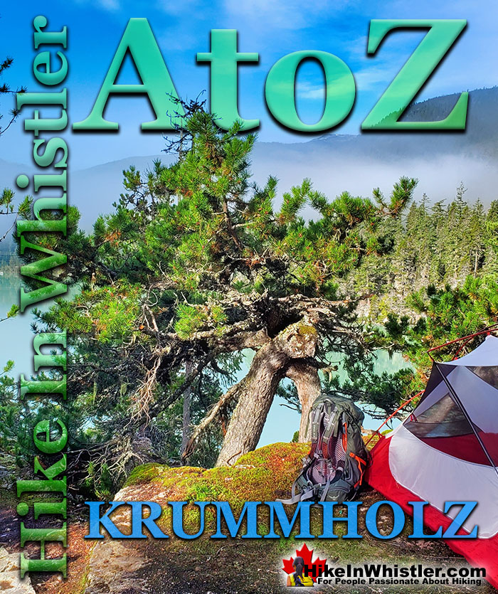
When you hike in the alpine in Whistler and Garibaldi Provincial Park, you will often encounter unbelievably hardy and sometimes mangled looking trees. Weathering high winds, freezing temperatures, deep snow and usually growing where most other things can't. These weather battered trees are called krummholz. Krummholz is a German derived word that comes from two words, krumm and holz. Krumm means bent, crooked, twisted and holz means wood.
The lodgepole pine is commonly found in the alpine regions around Whistler. There are many other types of trees that are known to form into bizarre krummholz trees, including spruce, mountain pine, balsam fir, subalpine fir and limber pine. The krummholz tree pictured here is on a cliff above Cirque Lake in the Callaghan Valley. A tremendously hostile place to live in the winter months, however, during the summer Cirque Lake is a tranquil paradise. Most krummholz trees you will see will be found growing out of a rocky landscape with just a thin layer of dirt. Often they have a short, yet very solid shape, pushing the bedrock apart as they grow. Other common krummholz trees form into a flag shape, where high winds have blasted the branches so they form on one side only. Regardless of the shape of krummholz trees, they always appear to have lived through brutal winters in improbable locations. This krummholz tree pictured below is growing out of a rocky island, one of the Battleship Islands in Garibaldi Lake, Garibaldi Provincial Park.
Below are examples of krummholz trees at Brew Lake, Garibaldi Lake and Brandywine Meadows. The Brew Lake krummholz on the bottom left is a great example of a twisted, mangled looking krummholz. The centre picture from Garibaldi Lake shows two, much older, weather battered krummholz trees at the shore of the lake. And the right side picture shows krummholz trees with the characteristic flag shape at Brandywine Meadows with Mount Garibaldi in the distance.
More Whistler & Garibaldi Park Hiking A to Z!
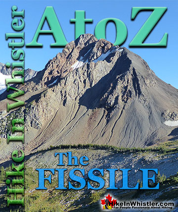
The Fissile is the stunning Matterhorn-looking mountain that is visible from Village Gate Boulevard in Whistler. Looking up from Village Gate you will see ...
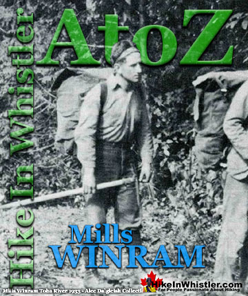
Mills Winram was a very active mountaineer from Vancouver with some very notable ascents in the 1920's and 1930's. He, along with Fred Parkes and Stan ...
Whistler spruce is a hybrid of the Sitka spruce and the interior Engelmann spruce. Sitka spruce trees thrive in the rainforests of the Pacific Northwest ...
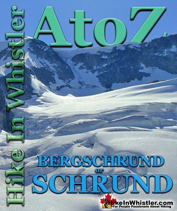
Bergschrund or abbreviated schrund: a crevasse that forms from the separation of moving glacier ice from the stagnant ice above. Characterized by a deep ...
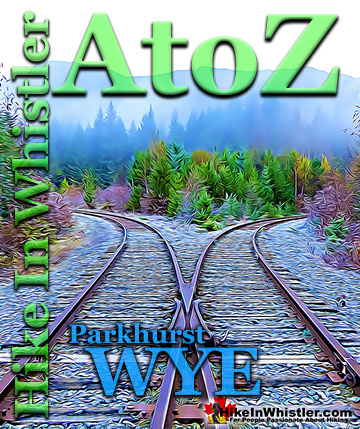
When hiking to Parkhurst Ghost Town, the first area you will encounter after you cross the disintegrating bridge over Wedge Creek is the wye. In railroad ...
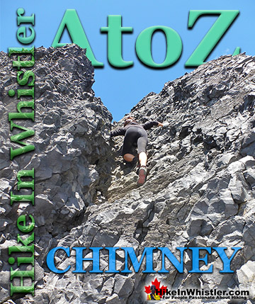
Chimney: a gap between two vertical faces of rock or ice. Often a chimney offers the only viable route to the summit of a mountain. An example of this is Black ...
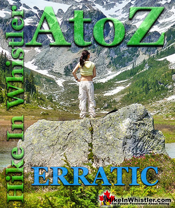
Erratic or glacier erratic is a piece of rock that has been carried by glacial ice, often hundreds of kilometres. Characteristic of their massive size and ...
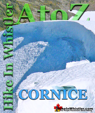
Cornice: a wind deposited wave of snow on a ridge, often overhanging a steep slope or cliff. They are the result of snow building up on the crest of a ...
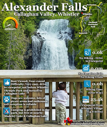
Alexander Falls is a very impressive 43 metre/141 foot waterfall just 30 to 40 minutes south of Whistler in the Callaghan Valley. Open year-round and located just before Whistler Olympic Park where several ...
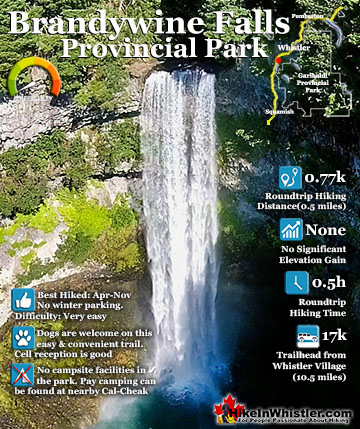
Brandywine Falls is one of the must see sights on the drive to or from Whistler, and arguably the nicest of Whistler’s numerous beautiful waterfalls. Located about halfway between Squamish and Whistler, the ...
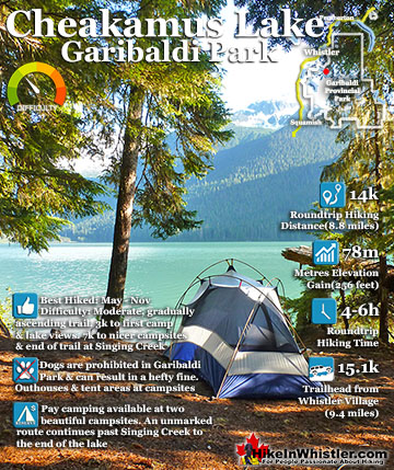
Cheakamus Lake is a wonderfully relaxing way to get in the wilderness easily and quickly from Whistler Village. The trail begins on the far side of Whistler Mountain, 8 kilometres from the Sea to Sky Highway ...
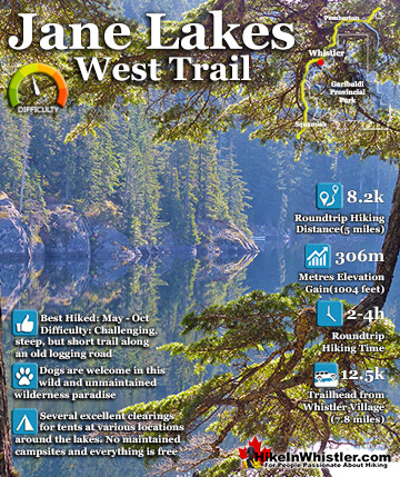
Jane Lakes are a very remote feeling set of lakes in the beautiful wilderness near Cheakamus Crossing. Consisting of three lakes, West Jane Lake, East Jane Lake and Little Jane Lake, they have a great ...
Hiking in Whistler in October is often unexpectedly stunning. The days are much shorter and colder but the mountains are alive with colour from the fall ...
November in Whistler is when the temperatures plummet and the first heavy snow falls in the alpine and often in Whistler Village. The hiking opportunities become ...
December hiking in Whistler is mainly done on snowshoes, though not always. If it hasn't snowed much recently then trails such as Whistler Train Wreck and ...
Hiking in Whistler is spectacular and wonderfully varied. Looking at a map of Whistler you see an extraordinary spider web of hiking trails that are unbelievably numerous. Easy trails, moderate trails and challenging hiking trails are all available. Another marvellous ...
Squamish is located in the midst of a staggering array of amazing hiking trails. Garibaldi Provincial Park sprawls alongside Squamish and up and beyond Whistler. Tantalus Provincial Park lays across the valley to the west and the wonderfully remote Callaghan Valley ...
Clayoquot Sound has a staggering array of hiking trails within it. Between Tofino and Ucluelet, Pacific Rim Park has several wilderness and beach trails, each one radically different from the last. The islands in the area are often Provincial parks on their own with ...
Victoria has a seemingly endless number of amazing hiking trails. Most take you to wild and beautiful Pacific Ocean views and others take you to tranquil lakes in beautiful BC Coastal Rainforest wilderness. Regional Parks and Provincial Parks are everywhere you turn in ...
The West Coast Trail was created after decades of brutal and costly shipwrecks occurred along the West Coast of Vancouver Island. One shipwreck in particular was so horrific, tragic and unbelievable that it forced the creation of a trail along the coast, which ...