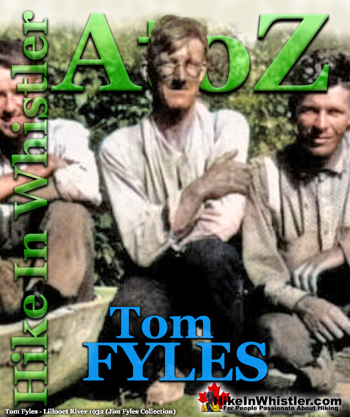
![]() Tom Fyles (27 June 1887 - 27 March 1979) was an astoundingly skilled climber and mountaineer based out of Vancouver where he was an early explorer of the Coast Mountains. He was extremely active and all but dominated the mountaineering scene in Vancouver for two decades. He began exploring the mountains around Vancouver in 1912 and discovered and joined the BCMC that same year.
Tom Fyles (27 June 1887 - 27 March 1979) was an astoundingly skilled climber and mountaineer based out of Vancouver where he was an early explorer of the Coast Mountains. He was extremely active and all but dominated the mountaineering scene in Vancouver for two decades. He began exploring the mountains around Vancouver in 1912 and discovered and joined the BCMC that same year.
Tom Fyles Mountaineer
- Tom Fyles Mountaineering Highlights
- First Ascents by Tom Fyles
- 1916: First Ascent of The Table
- 1920: Black Tusk North Pinnacle
- 1922: Second Ascent of The Table
- 1928: Mount Cayley First Ascent
- 1930: The Peaks of Bute Inlet
- 1931: Tricouni First Ascent
- 1932: Mount Meager Expedition
- 1933: To the Cradle of Toba River!
In just two years he was leading BCMC groups and mountaineering at an elite level well into the 1930’s. As a member of the BCMC he led hikes so frequently that one member later recalled, “In the old days Tom was the club. He led every trip.” Tom Fyles possessed several remarkable characteristics that made him apparently loved by all and regarded with awe for his climbing ability. He made several first ascents and was fearless and relentless when he set his eyes on ever more challenging peaks. He had boundless energy, skill and courage in the mountains which he exemplified in 1916 when he made the first ascent of The Table in what is now Garibaldi Park. He would go on to achieve numerous first ascents over the next two decades with his last one, Tzoonie Mountain was achieved in 1939. Not only was Fyles one of the greatest mountaineers of the era, but he also was responsible for encouraging and training several new mountaineers that would go on to be giants of the era.
The list of first ascents by Tom Fyles is considerable, and it is believed owing to his modest personality, that many first ascents credited to large BCMC parties were led by him. For example, the first recorded ascent of Mount Elsay was on May 6, 1923 by a BCMC group of 29 hikers led by Tom Fyles. Some of his first ascents include, the true summit (North Peak) of Black Tusk and The Table. In the Tantalus Range across the valley from Garibaldi Park, beyond Squamish he made first ascents of Mount Pelops, Mount Dione and Mount Omega. Closer to Whistler, Fyles led two groups, one in 1928 and the second in 1931, to the first ascent of Mount Cayley and Tricouni Peak. Attempts were made on the very dangerous Mount Fee, but were unsuccessful. During the two forays into the mountains they named all three mountains, Fee and Cayley after fellow mountaineers who recently died. Tricouni Peak was named, according to Fyles, "Tricouni Mountain was the name suggested for the peak, as from a distance it had the appearance of three cones". More first ascents by Fyles were down in the mountains around Vancouver he was the first to climb American Border Peak, Widgeon Peak and Mount Judge Howay.
Perhaps as significant an achievement to Tom Fyles' mountaineering talent was his incomparable passion and devotion to encouraging new climbers. His enthusiasm and leadership seemed to propel newcomers to mountaineering into well rounded experts in short periods of time. Alec Dalgleish, Stan Henderson, Eric Brooks, Mills Winram, Bill Wheatley and Neal Carter to name just a few out of countless people he inspired to become giants in BC mountaineering. Neal Carter, who at just 17 years old, was introduced to the BCMC by Tom Fyles, would make first ascents of Wedge Mountain and Mount James Turner and go on to explore and name countless peaks around Whistler. Neal Carter was the driving force behind massively extending Garibaldi Park to include the mountains north of present-day Whistler.
Tom Fyles & Neal Carter on The Camels Head in 1920

Expeditions in 1930, 1932 & 1933
Tom Fyles and Alec Dalgleish partnered in three remarkable expeditions into the unknown wilderness of the Coast Mountains of BC in the early 1930’s. In 1930 they, along with Stan Henderson explored deep into the mountains at the head of Bute Inlet. In 1932, Tom Fyles, Alec Dalgleish, Neal Carter and Mills Winram went on an amazing expedition into the mountains at the head of Lillooet River. The following year, in 1933, the same four explored the mountains at the head of Toba Inlet. All of these expeditions would result in first ascents and the naming of many previously unnamed mountains. Decades later, Mills Winram would describe Tom Fyles personality and style with undisguised respect and admiration. "Tom was a natural leader. If he said we can do this or we can't do that, you realized he had assessed all the possibilities. He had the complete and utter confidence of the people he went with."
Tom Fyles Discovers Mountaineering
Tom Fyles grew up in Bolton, a town in Manchester, England, where he was born in 1887. In his early twenties he worked as a joiners apprentice, and at 23, in 1910 he and his brother emigrated to Vancouver. In an interview in 1973 Tom Fyles recalled his first impressions of Vancouver and the surrounding mountains.
It was all so new. I can remember going down Granville Street looking at the stores. They were all so different than what they were in Bolton. I particularly noticed the mountains the first time we were on Powell Street. It was a beautiful, bright day, breezy and the mountains across the way. We though t i was wonderful, and we were quite sure we were going to go up there. I didn't know anything about how to get up [to the mountains] but we went across on the ferry and got on the street car at the terminus and then we walked. First time we didn't even get to Mosquito Creek. But we soon got over that. There was a man in the Post Office - I worked in the Post Office not long after I came here, in 1912- and he was a member of the Mountaineering Club. He suggested I went up with him to the cabin on Grouse, which I did on a snowy Saturday evening. and that was the start. I joined the Club. In 1914 I went to Garibaldi with the Mountaineering Club. We came out just [at] the beginning of August, just when war had been declared. The party went in on the weekend and I couldn't go till the following Tuesday. The PGE was just being built and only went as far as Cheakamus, 'bout 12 miles up from Squamish. But you could get a coach to there, and then I walked along the Pemberton Trail and found my way in to Garibaldi. I had a little confusion getting in but I got there. I was all alone. I hadn't been beyond Squamish before that. But I knew that looks of the mountains when I saw them from up above. I could tell what they all were because I'd read about them. And of course, I joined the party. We did a number of things and then decided that we might have a look at The Table. We went round the Panorama Ridge and down to the Barrier and down to The Barrier and over to The Table. We spent some time looking at The Table.
Fyles was an early member of BC Mountaineering Club and planned and led nearly all the hikes for several years. As one member recalled, “In the old days, Tom was the club. He led every trip.” Susan Leslie recalled in an article in the Canadian Alpine Journal in 1980, shortly after his death:
..by most reports, he was an unimpressive man – quiet, plain-spoken, without ambition. But in the mountains, Tom Fyles seems to expand. He became a man whom other people instinctively recognized as a leader. It wasn’t just that Tom could climb anything, or outwalk anyone, or find his way out of anywhere. It was that Tom seemed never to be afraid or discouraged. He had an ample, natural confidence that pervaded the people around him. With Tom people felt safe.
1917 BCMC Summer Camp
Just three years after joining the BCMC, Tom Fyles was already an established star of mountaineering and loved by all. H.B. Hinman of the Mountaineers described Tom Fyles after their 1917 summer camp:
Too much praise cannot be given Mr. Tom Fyles, on whom the chief responsibility of the climbs rested. Never have I seen a more indefatigable and efficient worker, a more genial personality, a more skillful and daring climber, yet careful and considerate of his party.
Tom Fyles Leads Ascent of Mount Garibaldi in 1917

These are colorized versions of the original black and white photos (possibly taken by David Martin) from Library and Archives Canada that show Tom Fyles in 1917 leading an ascent of Mount Garibaldi.
Dramatic Departure from the BCMC in 1926
In December 1926 a conflict developed between the old and new members of the BCMC, leading to Fyles and eight other prominent members walking out of a general club meeting and quitting. Tom Fyles was the director, Bill Wheatley and J. H Speer were vice presidents, R. E Knight was the club’s secretary, Neal Carter was the editor, Mrs. Carter was the reporter, Beverley Cayley and W. E Martin were members of the executive committee. Most, including Fyles would join the Alpine Club in Canada, where he would eventually be honoured as a lifetime member. In 1977, with Tom Fyles approached his 90th birthday, Neal Carter pushed to have Mount Taillefer, near Bella Coola, renamed Mount Fyles. Tom Fyles, his brother and two other companions first climbed the area in 1919 and the mountain had appeared on early maps as Mount Fyles. As the Canadian Permanent Committee on Geographical Names has a general principle to not allow names of living people, the name Mount Taillefer became the official name. The following year, in 1978, Tom Fyles received official notification that Mount Fyles and Fyles Glacier were officially approved on August 25th, 1977.
Tom Fyles Mountaineering Highlights
 1916: The Table First Ascent
The first organized hiking into the Black Tusk/Garibaldi Lake region of Garibaldi Park was done by the BC Mountaineering Club in 1912. Club president W.J. Gray described The Table with a mixture of awe and terror. “The dark forbidding walls of the “Table” have defied our most expert rock climbers. The slightest disturbance is sufficient to bring down a shower of sharp stones upon the head of the unwary climber.” He goes on to compare Black Tusk and The Table and concludes that Black Tusk is comparatively easy while “The Table on the other hand, offers but a succession of somber cliffs on all sides, the lower slopes of which are covered with a heavy talus, and are swept by stone avalanches at intervals.” Continued here...
 1920: Black Tusk North Pinnacle
In 1920 Tom Fyles led a BCMC party to the top of Black Tusk and impulsively decided to attempt the true summit. Slightly higher and just a few metres from main summit, known officially as the true summit. This terrifying feat involved climbing down the crumbling edge of Black Tusk into a gully and up the north pinnacle. Surrounding the pinnacle is a vertical drop of hundreds of metres and most of the surface rock is fractured and finding a solid handhold to climb is difficult. Likely a spur of the moment idea by Tom Fyles, who had the extraordinary ability to climb anything and was absolutely fearless. Continued here...
 1922: The Table Second Ascent
In 1922, Tom Fyles, Neal Carter and Bill Wheatley successfully climbed The Table, a mountain so difficult and dangerous that even today, few have climbed it. Theirs was only the second recorded ascent of The Table, with Tom Fyles making the first ascent in 1916. The Table is a crumbling, flat topped mountain that formed as a volcano pushing its way to the surface of a glacier. Located across Garibaldi Lake from Black Tusk, The Table is similarly crumbling and its steep sides make it incredibly hard to climb. In 1922, Fyles reached the top once again and Carter and Wheatley followed with help from Fyles’ rope from the summit. Continued here...
 1928: Mount Cayley First Ascent
Mount Cayley and Mount Fee are distinctive mountains, well known and strikingly visible from the Sea to Sky Highway and countless vantage points in Whistler. Before 1928, they remained unnamed and unclimbed as Tom Fyles would later write in The Canadian Alpine Journal: "A tongue of mountain country running north and south for 30 miles, with a width of 10 or 12 miles, bounded on the one side by the Squamish valley and on the other by the Cheakamus River and its tributary Callaghan creek... From vantage points in Garibaldi Park, mountaineers had often looked across the Cheakamus River to a crest of jagged rocks 20 or 25 miles away, set on this mountain tongue." Continued here...
 1930: Peaks of the Bute Inlet
In the summer of 1930, Tom Fyles, Alec Dalgleish and Stan Henderson went on a two-week expedition into the relatively unknown mountains at the end of Bute Inlet. At over 80 kilometres long and averaging 4 kilometres wide, Bute Inlet is a spectacularly wild and beautiful fjord that leads to 9000 foot mountains and glacier filled valleys. Despite its beauty, even today, it is infrequently visited and relatively untouched. In an article written by Fyles in the 1930 edition of The Canadian Alpine Journal, he describes the topography beautifully. "In this group three or four peaks exceed perhaps 10,000 feet in height, and elevations of 8,000 or 9,000 feet are the general rule..." Continued here...
 1931: Tricouni First Ascent
Three years after Fyles, Wheatley, Brooks, Clegg & Knight made their first ascent of Mount Cayley, Fyles returned with J. Cherry, H. Wynne-Edwards & A.R. Fraser to climb Mount Fee. Once again, they were unable to conquer Mount Fee, however they climbed Mount Cayley via a different route and climbed and named another mountain, Tricouni Mountain. They chose the name Tricouni, as it appears as three cones from a distance. Overall, the trip was a great success as the weather was perfectly sunny the entire time and they did considerable climbing and exploring. They did however conclude that Mount Fee is too dangerous and an, "unjustifiable climb." Continued here...
 1932: Meager Expedition
August 8th-20th, 1932 Tom Fyles, Neal Carter, Mills Winram and Alec Dalgleish went on a spectacular mountaineering expedition up the headwaters of Lillooet River to Mount Meager. On day 5 Carter recalled, "the toe of a likely looking ridge at an elevation of 1750 feet opposite some hot springs on the bank of the creek was reached." The hot springs they saw are now well known as Meager Hot Springs. In the following days they climbed all six of the volcanic peaks of the Mount Meager massif and named the five unnamed ones. Mount Job, Capricorn Mountain, Devastator Peak, Plinth Peak and Pylon Peak were named. Beyond Meager, unknown peaks stretched to the ocean and another expedition was planned. Continued here...
 1933: Toba Expedition
The unknown mountains they saw from Mount Meager in 1932 were located at the headwaters of Toba River, which drained into Toba Inlet far up the coast of BC. In 1933, Tom Fyles, Neal Carter, Mills Winram and Alec Dalgleish teamed up again to explore this vast unknown. The remote Toba Inlet was reached by boat and the expedition involved boating upriver for several miles, then hiking great distances through near impenetrable forest. Despite weathering brutal terrain, considerable bushwhacking, and dangerous river crossings, they managed to make the first ascent of a towering and forbidding mountain they named Mount Julian. Continued here...
Some First Ascents by Tom Fyles
- 1916: The Table solo first ascent by Tom Fyles.
- 1916: Omega Mountain first ascent with his brother, John Fyles.
- 1916: Mount Pelops first ascent with his brother, John Fyles.
- 1916: Mount Dione first ascent with his brother, John Fyles.
- 1920: Black Tusk north peak, true summit first ascent with Neal Carter and Bill Wheatley.
- 1921: Mount Judge Howay (Snow Peaks) first ascent with E. Fuller and H. O'Conner.
- 1921: Grizzly Mountain north ridge first ascent with Neal Carter and Don Munday.
- 1923: Mount Elsay first ascent by group of 29 hikers led by Tom Fyles.
- 1928: Mount Cayley first ascent and named by Tom Fyles, Eric Brooks, Bill Wheatley, B. Clegg & R. Knight.
- 1930: Gargoyle Peak first ascent and named by Tom Fyles and Alec Dalgleish.
- 1930: American Border Peak first ascent with Alec Dalgleish and Stan Henderson.
- 1931: Tricouni Peak first ascent and named by Tom Fyles, J. Cherry, H. Wynne-Edwards & A.R. Fraser.
- 1932: Capricorn Mountain first ascent and named with Neal Carter, Alec Dalgleish and Mills Winram.
- 1932: Mount Meager first ascent with Neal Carter, Alec Dalgleish and Mills Winram.
- 1932: Plinth Peak first ascent and named with Neal Carter, Alec Dalgleish and Mills Winram.
- 1932: Pylon Peak first ascent and named with Neal Carter, Alec Dalgleish and Mills Winram.
- 1932: Devastator Peak first ascent and named with Neal Carter, Alec Dalgleish and Mills Winram.
- 1932: Mount Job first ascent and named with Neal Carter, Alec Dalgleish and Mills Winram.
- 1933: Widgeon Peak first ascent with Bill Wheatley.
- 1933: Mount Dalgleish first ascent with Neal Carter, Alec Dalgleish and Mills Winram.
- 1939: Tzoonie Mountain first ascent by Tom Fyles.
1916: First Ascent of The Table
Tom Fyles Solo Ascent
The Table, in Garibaldi Provincial Park is an extremely difficult mountain to climb owing to its steep sides and disintegrating rock. The very few written accounts are terrifying and without exception conclude that it is too dangerous to climb. The first ascent in 1916 was led by one of Canada’s greatest rock climbers and possibly the most underappreciated ascent in the history of climbing. Unfortunately, Tom Fyles was as modest as he was an expert climber and a detailed account from him of the legendary climb is surprisingly hard to find. The few details known, added with the astoundingly harrowing ascents that followed in the next few decades, make his initial ascent of The Table border on miraculous. Joseph T. Hazard, in his excellent book, Snow Sentinels of the Pacific Northwest, recalls that Fyles made that solo ascent after his two BC Mountaineering Club companions gave up and watched for hours as he surmounted the final 240 terrifying feet!

“Climbing The Table is one near impossible obstacle after another.”
Words seem unable to grasp how difficult The Table is to climb; however Hazard illustrates it well when he described the 1923 ascent he witnessed made by Wallace Burr and “Happy” Fisher. “Wally and Happy climbed a fifty-foot face of scaling rock, of disintegrating, columnar structure, to a sharp edge. Here Happy lay on his back for thirty minutes, bracing himself in position by hooking his legs to both sides of the knife-edge of rock. He held Wally's legs in his arms while for a half-hour Wally cast the middle of a hundred-foot rope at a point of rock, thirty-five feet above.” Hazard continues to describe how, “Climbing The Table is one near impossible obstacle after another.” And, “Each requiring a tremendous feat of courage and expertise to overcome.” Hazard’s admiration of Tom Fyles’ skill and bravery is subtly expressed when he concludes, “How he did it alone, he can only tell. He is modest and will not give the whole story.”
Joseph T. Hazard (left) View of The Table in 1922

“If he had fifty lives, he would not climb any further.”
The first organized hiking into the Black Tusk/Garibaldi Lake region of Garibaldi Park was done by the BC Mountaineering Club in 1912. Led by the club president Mr. W.J. Gray who, in 1914, described The Table with a mixture of awe and terror. “The dark forbidding walls of the “Table” have defied our most expert rock climbers. The slightest disturbance is sufficient to bring down a shower of sharp stones upon the head of the unwary climber.” He goes on to compare Black Tusk and The Table and concludes that Black Tusk is comparatively easy while “The Table on the other hand, offers but a succession of somber cliffs on all sides, the lower slopes of which are covered with a heavy talus, and are swept by stone avalanches at intervals.” Gray later recalled how the most determined rock climber in their party was, “slowly progressing up the western face when he was summarily arrested by the next man in line, who intimated that “if he had fifty lives, he would not climb any further.” So, The Table remains as the only peak within reach of the camp which has not been climbed.”
The Dark Forbidding Walls of The Table

The Table in Garibaldi Park

The First Ascent of The Table
The first ascent of The Table would be achieved just four years later by a newcomer, and by all accounts, a novice climber. Tom Fyles, in 1916 made the solo ascent alone while his two BCMC climbing companions watching from below. One good contemporary account of the first ascent of The Table on August 7, 1916 was published just a couple weeks later in the Vancouver Daily World newspaper with the byline, “Written by a Member of the Party.” The article strangely doesn’t mention the other two climbers in Tom Fyles’ party.
A party of three left the camp on the morning of August 7th and made their way around the shores of Garibaldi Lake to the base of The Table. Early in the afternoon the leader had marked a course up the eastern end, and began to climb upwards by means of a narrow chimney. The rocks were very loose and progress correspondingly slow. It soon became apparent that there was great danger from falling fragments, and it was decided to allow the leader to attempt the climb alone, while the rest of the party sought shelter. Above the chimney the climber ascended over the eastern arête, then traversed diagonally up the perpendicular north face till a point was reached almost level with the summit. Ten minutes more and The Table was conquered. The descent was even more dangerous, and some idea of the difficulties may be gathered from the fact that three hours were spent climbing up 300 feet and down again, allowing sufficient time to build a small cairn and leave a record.
The Vancouver World August 19, 1916

Tom Fyles First Look at The Table in 1914
In an interview with Dan Bowers in 1973, Tom Fyles recalled the first ascent of The Table. He described how two year previous, he attended the 1914 summer camp with the BCMC. He was unable to travel with the club and had to get there four days later by navigating the route himself. A pretty challenging feat when you consider that he had never been north of Squamish before and the walking route began along the Pemberton Trail about halfway between Squamish and Stoney Creek. Today we call Stoney Creek, Rubble Creek, but in 1914 the route to Black Tusk Meadows began at Cheakamus River. The route ascended over boulders in roughly the same direction as the 2 kilometre access road used today to reach the Rubble Creek trailhead parking. The route then followed the recently cut trail through the wilderness 12 kilometres up to the alpine meadows near the base of Black Tusk. Fyles recalled that he was able to find his way, at least partly, from recollections from what he read about the descriptions of the mountains. Fyles described his described his first look at The Table.
The Table is a flat-topped mountain made of basalt and it has a rather peculiar opening at one end that's an archway. The whole area looks like an inverted cup with a handle. It's not very high. It's quite abrupt, and quite steep and made of loose rock. Whilst we went most of the way around and looked at the different chimneys, we didn't do anything more on that trip. We were camped at Black Tusk Meadows and so it made an all-day journey going round the lake. We went round the lake and we came back over Red Mountain.
What we call Mount Price today, was called Red Mountain back then. Tom Fyles recollection of the first ascent of The Table is wonderfully modest and conceals the terrifying difficulty.
I had a long rope. The Mountaineering Club only had two ropes in those days. One was a hundred feet; the other was sixty feet. I think I had the hundred-foot rope. So, I pulled this with me, and I intended to be able to help another man up with the end of the rope. I went up all the way alone, and then traversed across the face a little toward the west and managed to get into another gully which led to the top. The top, of course, was the big more or less level area, just one or two bits of scrubby trees and a few flowers. I walked all over it and I was able to talk to my friends who were there on the ridge below. They were making tea for the time when I got back. I was quite happy to have got to the top because it had been a challenge for some time to different members of the Club. I got down without any great difficulty. There were loose rocks, but by having two handholds and two footholds at the same time, it was possible for the odd piece of rock to give way. But we got down and had our tea and enjoyed it and walked back around the opposite side of the lake from what we'd come over.
1920: Black Tusk North Pinnacle
Tom Fyles, Neal Carter & Bill Wheatley
The August 17th, 1920 edition of the Vancouver Sun newspaper ran a story titled, "Garibaldi Park Is Formally Opened by Local Mountaineers”. The article details several peaks climbed over the two weeks and described their climb of Black Tusk with interesting detail. “Several good climbs were made from the camp last week, one of the most ambitious being the ascent of Black Tusk, a huge basalt rock that projects out of the top of the mountain over 7,000 feet in the air like the horn of a giant rhinoceros.” The article goes on the describe how Black Tusk formed from the plug of an ancient volcano and the only way to climb to the top is done, “by climbing over the projecting rim of a funnel which a lightening bolt has cut in the rock.” This interesting observation is strange and the article doesn’t mention where that theory came from, or how lightening could carve out a huge gouge in a mountain. The article also mentions another strange and improbable incident involving lightening. “One of the treasured trophies in the cairn is an ancient tobacco tin which held the record in the previous cairn. A lightening bolt a few years ago shattered the cairn, blew three feet off the face of Tusk, bored diagonally clean through the tobacco tin, burning the record and dashing the tin a hundred feet away. The present receptacle for the scroll is a common glass “sealer” inside the cairn.” Both of these lightening stories seem hard to believe, and probably made up, but the article does describe another event on Black Tusk that day that is certainly true. The first known ascent of Black Tusk’s north pinnacle, the true summit by Tom Fyles, Neal Carter and Bill Wheatley.
Black Tusk's North Pinnacle Far Away and Up Close

Black Tusk's True Summit
The top of Black Tusk is quite broad, large, flat and slopes down toward the chimney route up. At the opposite end is the high point of Black Tusk and the final destination for everyone that climbs it. Technically this point is not the true summit of Black Tusk. Another, slightly higher pinnacle rises just a few metres from the top edge. This narrow, crumbling pinnacle of rock has a very small area at its peak and getting to it requires climbing down the frightening, vertical edge of Black Tusk and descending into the deep gully between the two peaks and climbing up the near vertical, crumbling side of the narrow pinnacle. Terrifying, dangerous, very difficult, and almost certainly unclimbed, Tom Fyles had to climb it. Fearless and an astoundingly skilled climber, in 1916 Fyles had climbed The Table, a similarly crumbling, yet vastly larger and more challenging mountain. By comparison, this tiny ascent must have looked to Fyles as a short and simple climb, which to an astoundingly skilled climber like him, it was. From the top of the crumbling pinnacle and true summit of Black Tusk, Fyles was soon joined by Neal Carter and Bill Wheatley, with the encouraging help of Fyles’ rope. Years later Carter would recall, “I had shown signs of mountain madness even during my first trip into Garibaldi (1920) when I helped build that little cairn on that rotten bit of the Black Tusk that sticks up (a foot or so higher than the main peak) to the west.” These two photos are from one of Neal Carter's climbing albums on exhibit at MONOVA Museum in Vancouver.
Fyles (standing) on Black Tusk's True Summit - 11 Aug 1920

1922: Second Ascent of The Table
Tom Fyles, Neal Carter & Bill Wheatley
In 1922 Tom Fyles, Neal Carter and Bill Wheatley made the second recorded ascent of The Table. It is hard to appreciate the extraordinary difficulty of this accomplishment. Climbing The Table involves several terrifying vertical ascents up walls of crumbling rock which dislodge frequently and rain down on climbers below. Thirty-seven years later, in 1959 Neal Carter wrote a letter to Karl Ricker, in which he briefly mentioned the remarkable day.
I was on the second ascent (again in 1922 - I must have been crazy that year). That's one mountain that I never want to climb again! The only consolation was that it was in the fog, so we couldn't see how far the drop below us was as we three clung to the loose chunks of rock that kept threatening to pull out of the sheer wall.
The Table and Mount Garibaldi

"You are too heavy, Hazard, to make The Table."
The amazing picture below captures the terrifying start of the ascent of The Table, with Tom Fyles on the left, Bill Wheatley top middle and Neal Carter bottom right with the famous rope around his neck that remained fixed for a decade. The fourth person in the picture on the lower left is Joseph T. Hazard, an expert mountaineer and writer from Seattle. In his 1948 book Pacific Crest Trails, Hazard recalls a hilarious comment made by Tom Fyles poking fun at him, likely at the time this photo was taken.
"You are too heavy, Hazard, to make The Table. You can climb anything that will hold you--but The Table will not. It will scale off under you and drop you into oblivion! Don't try it."
Fyles, Hazard, Wheatley & Carter The Table - 19 Aug 1922

"Top of Table Mountain is Reached"
In an article written for The Province newspaper shortly after the 1922 ascent, Neal Carter wrote about the treacherous climb in detail. Recalling how after the first ascent in 1916.
Mr. Fyles, pronounced it so rotten and loose as to warrant the name of an unjustifiable hazard; in 1920 he made two attempts to re-ascend it, but failed. This time we started off with 180 feet of alpine rope and the slogan “Table or bust.” We nearly “bust.”
Neal Carter then continues the story in beautifully vivid detail:
The weather was most unpropitious and soon after commencing the ascent, rain began to fall. Tom Fyles went up first, with a rope about his waist, and all went well up to the first little pinnacle. Here it was deemed advisable to continue up the arête at the low end; said arête being about as solid as a child’s house of blocks. Sixty feet of rope brought the party to the next stopping place, a little dip in the sharp arête that made a niche just big enough for two of us while Tom continued the ascent with 120 feet of rope dragging behind him. Shower after shower of rock whizzed past our heads as we sat almost motionless for fifty-five minutes during which only 110 feet were gained. Finally, a dim shout was heard: “All right,” and our stiffened bodies were given a chance to exercise themselves on a slanting traverse of a precipitous rock-face composed of the shakiest material imaginable. Fully half a ton of rocks were unavoidably dislodged during the ascent and descent; and did not add much to the confidence of the climbers as they went singing past in the fog to fall uninterrupted on the scree slopes below.
As the rope was followed upward in the fog, it finally landed us beside Mr. Fyles in another niche on a level with the summit, but connected to it by about twenty-five feet of wobbly, knife-edged ridge. One of these rocks was partially demolished to enable us to grip a reasonably firm rock as we straddled along it. Once the summit was reached, it was like stepping on to a macadamized field. We built a good-sized cairn on the edge in plain view from below, and placed our own as well as Mr. Fyles’ previous record in a subsidiary cairn beside it, around which were transplanted a few erigeron, or mountain daisies. Several meanings may be taken from this as to our feelings towards the descent; however, camp was reached again at 7 o’clock and The Table was conquered for the second time after a five and a half hour climb of 240 feet and back, though 120 feet of rope remain attached to the top as a mute token of a guaranteed safe descent for all three of us. It may be some time before another name is added to the three already in the cairn.
Tom Fyles & Neal Carter The Table - 19 Aug 1922

1928: Mount Cayley First Ascent
Tom Fyles, Bill Wheatley, Eric Brooks, B. Clegg & R. Knight
Mount Cayley and Mount Fee are distinctive mountains, well known and strikingly visible from the Sea to Sky Highway and countless vantage points in Whistler. Before 1928, they remained unnamed and unclimbed as Fyles would later write in The Canadian Alpine Journal:
A tongue of mountain country running north and south for 30 miles, with a width of 10 or 12 miles, bounded on the one side by the Squamish valley and on the other by the Cheakamus River and its tributary Callaghan creek... From vantage points in Garibaldi Park, mountaineers had often looked across the Cheakamus River to a crest of jagged rocks 20 or 25 miles away, set on this mountain tongue.
In July of 1928, Tom Fyles, Bill Wheatley, Eric Brooks, B. Clegg and R. Knight set out to climb these unknown mountains. They bushwhacked their way from the train station at McGuire to the head of Brandywine Creek. McGuire is located 16 kilometres south of Whistler Village, off the Sea to Sky Highway, roughly between Brandywine Falls and Cal-Cheak. In 1928 it was a large community centred around several sawmills and was one of the main train stations that ran through the valley. The head of Brandywine Creek that Fyles' party bushwhacked to in 1928 is now known as Brandywine Meadows. Fyles described the day in which they made the first ascent and also named one of the mountains.
In July 1928 five members of the Vancouver Section took the P. G. E. train to McGuire, 30 miles north of Squamish and forced a way, “for the most part through tailless bush,” to the timberline at the head of Brandywine creek, a distance of about ten miles from the railway. A little scouting soon revealed the rock peaks seen from Garibaldi Park, and the highest of these was found to be a volcanic mountain which, though a little under 8000 feet in altitude, proved an interesting mountain and a good climb, Messrs. W. G. Wheatley, E. A. Brooks and T. Fyles making the first ascent. The mountain was named after the late Mr. B. C. Cayley, a friend of those in the party and a member of the club, who had died only a month before.
After Mount Cayley they set their eyes on another interesting and far more challenging mountain.
Another interesting problem was a flake of rock which rose 500 feet above a snow ridge, in form suggesting the crest of a wave just ready to break. This peak, which we named Mt. Fee, proved to be most uncompromising; the upper part was decidedly loose, and after two attempts the party admitted defeat and retired.
Charles Fee was another fellow BCMC member and friend that had passed away the previous year. Below is a picture of Charles Fee and Tom Fyles in 1920 and a recent photo of Mount Fee.
Charles Fee and Tom Fyles in 1920 and Mount Fee

1930: The Peaks of Bute Inlet
Tom Fyles, Alec Dalgleish & Stan Henderson
Running up the coast from Vancouver between Vancouver Island and the mainland are several large inlets, also known as fjords. Fjords are characterized as long, narrow arms of the sea that stretch far inland and are usually extremely deep. In Vancouver when you drive across the Lions Gate Bridge, you will be crossing Burrard Inlet, a relatively shallow-sided fjord formed during the last Ice Age. Up the coast from Burrard Inlet is Howe Sound, a huge fjord that extends to Squamish. The Sea to Sky Highway famously runs along Howe Sound to Squamish before climbing into the mountains to Whistler. Called a ‘sound’ instead of an inlet or fjord because of its wide entrance. Particularly large and wide fjords/inlets are generally referred to as ‘sounds’ in the English language. Beyond Howe Sound are countless fjords stretching up to Alaska, though two in particular captured the attention of mountaineers from Vancouver in the 1930’s, Toba Inlet and Bute Inlet. Because these inlets cut so deep into the mainland of British Columbia, they provided comparatively easy access to scores of unnamed mountains that mountaineers in the previous decade had spotted from a distance. Geographically speaking, these inlets lead to regions that roughly extend to Mount Meager. Mount Meager lays near the headwaters of Lillooet River, which flows down the valley to the town of Pemberton.
Northwest of Vancouver the major inlets are Howe Sound, Jervis Inlet, Toba Inlet, Bute Inlet and Knight Inlet. In the summer of 1930, Tom Fyles, Alec Dalgleish and Stan Henderson went on a two-week expedition into the relatively unknown mountains at the end of Bute Inlet. At over 80 kilometres long and averaging 4 kilometres wide, Bute Inlet is a spectacularly wild and beautiful fjord that leads to 9000 foot mountains and glacier filled valleys. Despite its beauty, even today, it is infrequently visited and relatively untouched. In an article written by Fyles in the 1930 edition of The Canadian Alpine Journal, he describes the topography beautifully. "In this group three or four peaks exceed perhaps 10,000 feet in height, and elevations of 8,000 or 9,000 feet are the general rule. A large section is covered by a plateau of snow from which glaciers descend like the overflow of a generously iced cake. Reference to a map might reveal in that section about half a dozen names and a few; short lines meant for rivers, but for the most part it is shown blank... This section is part of the Coast Range which stretches in an almost impenetrable line from the head of Howe Sound, 30 miles north of Vancouver to the Bella Coola valley, a distance of over 200 miles."

The journey to the head of Bute Inlet was by a weekly boat service that sailed every week from Vancouver on Saturday. Sailing overnight, the Union Steamship “Chelosun” dropped them off on the small jetty at Homathko at the head of Bute Inlet. From the ship they had hoped to get an idea of peaks to aim for and routes to navigate, but despite the clear weather, the steep sided inlet kept their planning to a minimum. They decided that a relatively easy mountain should be climbed in order to gain a viewpoint over the region to plan their more ambitious climbs. They decided on a modest sized 7000 foot mountain named Mount Evans, immediately north of their arrival point. Fyles recalled,
The first problem was to row across the mouth of the Homathko River and find a landing sufficiently high on which to deposit our belongings and, as the tide was low, some time was lost. It was almost noon when the base of the hillside was reached and the heat was excessive as we scrambled upwards through a tangle of brambles. By continued effort a point overlooking the glacier was gained at 5pm and an hour and a half later from the crest of the snow-field above, at a height of 6,800 feet, we were rewarded by a splendid view of the surrounding country. Lengthening shadows emphasized the beauty of the array of mountains which had grown into our horizon as we ascended. Beyond the depression where the Homathko River moved seaward, 30 miles away, was Mt. Waddington and its high neighbors, and on all sides were mountain peaks 2,000 or 3,000 feet higher than the ridge on which we stood.
View Northeast from Bute Mountain

The next two days were spent hiking towards and climbing to the summit of Mount Bute. They recorded the altitude at the summit to be 9,200 feet, considerably higher than Mount Evans and they were able to see a lot more of the surrounding mountains. "A jumble of peaks and glaciers spread in all directions as far as the eye could see. In a deep basin more than 9000 feet below, the head of Bute Inlet lay like a lake amidst a surrounding wall of mountains. Across the mouth of the Southgate River Mts. Rodney, Superb and the Needles Peaks rose from the east side of the Inlet, whilst behind them a fine unnamed group about 9000 feet high looked as if it would offer good climbing."
They returned to their camp and the following day made the long descent back down the valley to their starting point by the river at the head of Bute Inlet. They packed up more food and set off up the valley of the Teaquahan River. For two days, under heavy packs they bushwhacked their way into the unfamiliar wilderness along the wide and crashing river. By the end of the second day they had managed to just cover 10 or 12 miles before finally making camp and, “a cheery blaze and hot meal were very welcome after our strenuous endeavors.”
The next morning, they followed a stream to its source which was an enormous glacier, which they were glad to hike on after miles of erratic, bushwhacking terrain. The easygoing glacier hiking was short lived however, as they came to an icefall a thousand feet high. They eventually skirted the obstacle by climbing a moraine and continuing further up the glacier to 5500 feet and another icefall. This obstacle was not to hard to cross and they once again continued up the glacier, which they named Eva after the name the locals use for Teaquahan River. Continuing along a ridge they soon reached an altitude of 8000 feet and finally got a good look at the difficulty that lay ahead. With the head of Eva Glacier blocked by an impossible to climb ridge, they decided to return back to camp. On their return journey along the moraine along the lower icefall, Henderson was bowled over by a large rock that he inadvertently disturbed. He received bad bruising to one leg and fortunately did not fall down the steep moraine. He was able to walk back to the camp, however was too battered to hike the following day. As Fyles later recalled,
The following morning, leaving Henderson to nurse his bruises, Dalgleish and I retraced our steps of the previous day and followed the upper part of Eva Glacier to where it merged into the great snow plateau at a height of 7,000 feet. Rising from the snowfield about a mile away, appeared a rocky blade 1,500 feet high, and as it was evident this would make an excellent viewpoint, the intervening distance was crossed and the southern arete climbed. It provided an interesting scramble. The highest point, a projecting rock about 50 feet high (which suggested the name Gargoyle for the peak) almost defeated our efforts to scale it but with the aid of a rope thrown over a convenient corner, the obstacle was overcome and a cairn built on the summit. The day was again perfect and for two and a half hours we stayed to enjoy the wonderful panorama, a sea of peaks wave on wave reaching to the horizon. The expanse of snow out of which our peak protruded spread in an undulating plateau 15 or 20 miles long and several miles wide, and formed the most interesting object of our view. Two or three peaks about 10,000 feet in height rose to the northeast; Mt. Goodhope near the south end of Chilko Lake farther east, while the big peak we had seen from Bute Mountain and which we had hoped to climb, looked temptingly near. Mt. Waddington again showed clearly to the northwest. Descending the rocks and picking up our trail on the snow below, we went down the slopes, reveling in the changing details of the snowy landscape with the deepening of evening shadows. On reaching camp we were rejoiced to find our friend much improved by his easy day. The following morning the journey out to the inlet was commenced and by taking easy stages to help our lame companion the trip was made in two days. Here we enjoyed the hospitality of Mr. and Mrs. Adkins, who were in charge of logging operations. The memory of a great feast from a table carrying a variety of food not included in our own bill of fare, will long remain.
1931: Tricouni First Ascent
Tom Fyles, J. Cherry, H. Wynne-Edwards & A.R. Fraser
Three years after Fyles, Wheatley, Brooks, Clegg & Knight made their first ascent of Mount Cayley, Fyles returned with J. Cherry, H. Wynne-Edwards & A.R. Fraser to climb Mount Fee. Once again, they were unable to conquer Mount Fee, however they climbed Mount Cayley via a different route and climbed and named another mountain, Tricouni Mountain. They chose the name Tricouni, as it appears as three cones from a distance. Overall, the trip was a great success as the weather was perfectly sunny the entire time and they did considerable climbing and exploring. They did however conclude that Mount Fee is too dangerous and an, "unjustifiable climb."
Mount Fee and Tricouni Mountain in 1931
Photos by Tom Fyles of Mount Fee and Tricouni Mountain that appeared in his Canadian Alpine Journal 1931 article.

Top of Mount Cayley and Low Peak
These are two of the photos by Tom Fyles of Mount Cayley that appeared in his Canadian Alpine Journal article in 1931. The picture on the left shows J. Cherry and H. Wynne-Edwards on the top of Mount Cayley.

1932: Mount Meager Expedition
Tom Fyles, Neal Carter, Alec Dalgleish and Mills Winram
The Mount Meager massif is a collection of volcanic peaks visible to the west of Pemberton Valley, 150 kilometres north of Vancouver. Mount Meager produced the largest volcanic eruption in Canada in the last 10000 years when it had a huge eruption 2400 years ago. In recent years it has produced another type of hazard, debris flows. The last one happened in 2010 when more than 48 million square metres of debris cascaded down from Capricorn Glacier. It was the largest debris flow ever to occur in Canada. In 1932 Neal Carter, Tom Fyles, Alec Dalgleish and Mills Winram went on a two week expedition into the mountains at the source of Lillooet River. Two years previously Tom Fyles caught a distant glimpse of the unexplored peaks from Gargoyle Peak. Fyles described the area of ice and snowfields far exceeding that of the Columbia Icefield. The 1932 expedition was photographed and Neal Carter wrote a detailed article, ‘Exploration in the Lillooet River Watershed’ in the 1932 edition of the Canadian Alpine Journal. This is the article Carter wrote which details their amazing journey into the unknown. Date headings in blue have been added for clarity. The black and white photos from the article have also been added and some have been colorized a little or a lot.
EXPLORATION IN THE LILLOOET RIVER WATERSHED
By NEAL M. CARTER
That section of the British Columbia Coast range of mountains which covers the 1500 square miles between latitudes 50°30’-51°00” and longitudes 123°30°-124°30° is practically unknown from a mountaineering standpoint. Large scale maps of the Coast utilize this area for title and legend, which, in an alpine region is a direct invitation for exploration.
Parties which have penetrated comparable watershed areas such as the Mt. Waddington district and the mountains north of Bute inlet have shown that such exploration is well rewarded by the finding of peaks of unexpected height and panoramas of snow and ice reminiscent of the last throes of an ice age. The possibility of similar surprises in the region just described seemed quite likely in view of the fact that it is known to feed four large glacial rivers; the Southgate flowing into Bute inlet, the Toba emptying into Toba inlet, the Lillooet which joins the lower Fraser River, and the Elaho, a main tributary of the Squamish flowing into Howe Sound.
Distant views of this region had been obtained by Mr. T. Fyles’ party which ascended Gargoyle Peak in 1930 and by Major F. V. Longstaff’s party when at the headwaters of the Bridge River. The latter reported that the area of ice and snowfields seen far exceeded that of the Columbia Icefield. Four members of the Club, Messrs. Tom Fyles, Alec Dalgleish, Mills Winram and the writer, discovered a fortnight of coincident holidays in August of this year and decided the occasion was opportune for investigating what lay behind this tantalizing skyline which all had seen from some angle or other.
August 8th, 1932 Day 1: Vancouver to Pemberton
Leaving Vancouver on the morning of August 8th, the ever pleasurable journey by boat to Squamish and past Garibaldi Park on the P.G.E. train brought us late that afternoon to Pemberton, where the railway crosses the Lillooet river. It was up this river that we had decided to journey in our effort to reconnoiter the high peaks on the watersheds at its source. Twelve miles upriver by auto left us at a farm near the edge of civilization, where we literally “hit the hay” for the night.
August 9th, 1932 Day 2: Bert Perkins
Next morning, we placed ourselves in the care of one Bert Perkins, trapper of marten and packer extraordinary. What Bert didn’t know about the river systems of this part of the country wasn’t worth knowing, but he confessed that neither he nor anyone else could state what lay above and between the Lillooet and Toba rivers. If we would point out where we wished to go, however, he promised to do his best to get his three horses and our packs as far up as possible, and he did!
For twenty more miles up the south side of the Lillooet River we travelled over trail, swamp, gravel bar and quicksand, stopping overnight at a small cabin near South creek. The Lillooet changes its course so frequently that settlement of its wide and fertile upper valley has been found impracticable, much to the sorrow of some who made the experiment. Near the confluence of several of its tributaries the main stream had shifted since Bert’s last visit and we were left to negotiate delightful beaver swamps and devil’s club thickets while he waded channels with the horses. Occasionally an ice-cold, raging torrent with its load of water-borne boulders would prove too much for us on foot and the pack-horses would be requisitioned as ferries. Because of the steep sides of the main valley, very little of the surrounding mountains could be seen; our attention being chiefly centered on two peaks which lay far up the valley in the approximate position given for Meager Mt., the only named mountain shown on Government maps of this vicinity.
Mills Winram, Alec Dalgleish, Tom Fyles and Neal Carter

August 10th, 1932 Day 3: Meager Creek
By three o’clock in the afternoon of August 10th we reached Bert’s winter trapping headquarters, a well-equipped cabin some two miles below the junction of Meager creek, or south fork of the Lillooet. Here, at an elevation of approximately 1200 feet we paused to take in our surroundings. A wonderful stand of huge red cedars made the area almost park-like, a pleasing variation of the succession of nondescript forest types we had encountered. Besides cedar, the Lillooet valley supports a certain amount of cottonwood, white pine, Douglas fir and hemlock; the undergrowth consisting chiefly of snow bush, elderberry, devil’s club, high bush cranberry and young willow and alder. At higher elevations the cotton-wood and cedar give way almost entirely to the amabilis and Douglas fir and hemlock, which in turn is replaced by the usual alpine fir (Abies lasiocarpa) intermingled with wild rhododendron.
It was now necessary to decide from what direction we should approach our objective, tentatively chosen as the group of peaks lying between Meager creek and the Lillooet. Only by climbing to some vantage point could this question be settled. So up we went, taking only our sleeping bags and overnight provisions, after promising to return by ten o’clock the following morning to allow Bert to get us across Meager Creek before the afternoon high water. A steep ridge immediately behind the cabin provided good going and by 8 p.m. we crossed timberline at 6000 feet and made camp after a fashion.
August 11th, 1932 Day 4: Beyond Meager Creek
Early next morning Fyles and Dalgleish crossed a glacier and ascended an 8000-foot rocky peak, while Winram and myself remained on the lower ridge where we established the first camera station of the photographic survey which had been planned by the writer. Unfortunately, rising mists from the valleys obscured much of the view. The general direction of the higher mountains was ascertained, however, and after a headlong descent of the steep ridge we reached the cabin on time and were able to inform Bert that our route appeared to lie up Meager Creek. That afternoon the southeast bank of the creek was followed until a cut-bank forced a crossing. The horses experienced considerable difficulty in finding a footing among the rolling boulders of the stream bed and we had some misgivings as to the condition of the river on our return, should the weather clear up and become hot. Bert’s little dog “Scotty” which we had met at the cabin got left behind here, since he refused to swim the torrent and the horses were not equal to an extra return trip for him. Some three miles up the creek, camp was pitched for the night.
Crossing Meager Creek - 11 August 1932

August 12th, 1932 Day 5: Hot Springs
On the morning of August 12th, the toe of a likely looking ridge at an elevation of 1750 feet opposite some hot springs on the bank of the creek was reached. Here we expected Bert would leave us with his blessing, to return six days later. But not Bert. He disappeared for a while and returned with the news that he thought he could get the horses up that ridge. It was a mighty task; but windfalls, hornets, rhododendron bush and rock slides were slowly left behind (except in the case of the hornets) and a camp finally established on a flower strewn bench just at timberline (5665 feet).
August 13th, 1932 Day 6: Mt Capricorn
The weather for our first climbing day was disappointing and only four days’ climbing was available. With no definite knowledge of how our ridge was connected with the high peaks we had seen two days previously, we decided to tackle the foggy heights immediately behind camp. The ridge grew more arête-like and on a sharp pinnacle of rock we halted for a bite to eat at 7850 feet, hoping the fog might lift. When it eventually did, pinnacle after pinnacle appeared dimly before us, each higher than the last, until we wondered when the procession would cease. It was soon evident that we had chosen the wrong approach to the high, rocky pyramid in which our ridge culminated, so retracing our steps we descended to a glacier below and skirted the base of the ridge. This glacier proved most tractable in providing a fine crevasse-free bench which was to become a necessary matutinal and evening promenade each day as the easiest route to the mountains beyond.
Projecting from a snowy dome at the head of the glacier was a most startling series of grotesque pinnacles of rock. Here we spent an hour waiting for the fog to lift, climbing the more solid towers and inspecting three remarkable rock “windows” which pierced the base of one mass. We named this group “The Marionettes” from their diversity of form. The generally volcanic nature of the region justifies the belief that they are the remains of a volcanic rim, a most interesting vertical section through breccia, basalt and fused ash containing nodules of banded quartz being visible.
The fog had now lifted but the dullness of the day did not encourage an attempt on the rocky peak which rose above us, accessible apparently only by means of a steep snow couloir. We accordingly descended 700 feet to a snow pass and made the first ascent of an easy, snowcapped summit which gave us our first glimpses of the lay of the land. Swirling clouds discouraged a prolonged stay and we left the summit confident that we now knew how to best utilize our three remaining climbing days. The name chosen later for this 8440-foot mountain was Mt. Capricorn, a variation of the all-too-common appellation “Goat” applied by Bert to the stream which drains the Capricorn glacier at its base. A lusty shout before commencing an exhilarating 500-foot glissade down a snow bank just behind camp informed Bert that it was time to put on the kettle, and we retired to the accompaniment of pattering raindrops.
Neal Carter on Capricorn Summit Surveying - 13 August 1932

August 14th, 1932 Day 7: Plinth, Perkins Pillar and Meager
August 14th dawned most promisingly and we decided to bag the highest peaks seen close at hand yesterday. Following our return footsteps of the previous evening as far as the base of Mt. Capricorn, we swung to the right and ascended the Capricorn glacier to a peculiar, three-way pass below what we believed to be the aforementioned Meager Mt. This pass, named Triskelion after the device on the Manx coat-of-arms, provided a close up view of a sheer, 400-foot rock pillar which had been observed by different trappers from the Lillooet valley. At Bert’s request its height was triangulated in order to settle a (financial?) argument which appears to have originated between him and some of his pals. “Perkins’ Pillar” seemed a good name.
Meager Mountain & Perkins Pillar - 14 August 1932

Turning now to the supposed Meager Mt., we found its ascent relatively simple except for the last hundred feet. The loose, igneous rock, brightly colored in hues of red and sulphur-yellow, proved most treacherous and we rested on an ashy saddle just below the summit, where a Lapland longspur graced us with its company. An interesting feature of the view from here was an outlier surmounted by two pointed pillars of rock strongly reminiscent of the well-known horns of the dilemma. One of these pillars was pierced by a “window” estimated to be twenty feet high, and which could be readily discerned from the valley below.
Tom Fyles on the Summit Ridge of Mount Meager - 14 August 1932

Fyles and Dalgleish went on to the final, tottering pile of rock which called itself a peak, but seemed hesitant about announcing their victory. They commenced throwing rocks at the blade-like crest of the ridge and triumphant shouts finally re-echoed their success in knocking over the unattainable summit, leaving them on the (now) 8830-foot peak of Meager Mt., one of the few recorded instances of the mountain coming to Mohammed. My effort to establish a camera station on the actual summit was unsuccessful since the necessary cairn would not stay poised. A small gap just below was finally utilized, and by pushing over several projecting masses with an ice-axe, most of the horizon could be photographed. Splendid views of the Lillooet valley and the mountains of the Bridge River district were obtained, but we were still at that edge of our little group farthest removed from the snowy giants to the west and northwest.
Just across one arm of Triskelion pass lay another peak which we had seen from the valley, and which now proved to be higher than our present viewpoint. Two hours later, after a final scramble up a shattered ridge thereby giving two goats a bad fright, we emerged on a flat, pumice-strewn summit which was the absolute antithesis of the one we had recently quitted. From four until six in the afternoon we tarried, sorting out the view and trying to recognize something on the horizon. An entirely unknown, heavily glaciated range over 9000 feet high lay some dozen miles to the west, behind which the tips of several peaks exceeding 10,000 feet in elevation could be distinguished. These lay in the direction of the headwaters of the Toba River and it was evident that they would have to be approached from that direction. Toward the southwest wave after wave of lower, entirely glacier-covered ridges culminated in some very high and sharp peaks which must lie some distance north of the head of Jervis inlet. Others at the head of Chilko Lake could be seen, but those few which possess names could not be identified with certainty. An angle read to one towering, cloud-capped giant far to the northwest disproved our supposition that it might be Mt. Waddington. Even the high summits near the head of Bute inlet known to Fyles and Dalgleish were apparently hidden.
The visibility was perfect and each of the party was quite familiar with the Coast range mountains, yet it was an eerie sensation not to be able to definitely recognize a single one of the sea of peaks extending over 180° of the horizon. Only to the east and south were old friends visible, where Mts. Cayley’ and Tantalus, together with various high summits in Garibaldi Park were visible. These mountains, 30-50 miles away, were the only reference points available for tying-in the survey. Later, during the plotting from the photographs, Mt. Albert (8260 feet) above Princess Louisa inlet was identified at a distance of 33 miles. An interesting feature of the immediate vicinity was the visible portion of the large glacier which forms the source of the Lillooet River. From its snout at an approximate elevation of 2500 feet, eight miles of this typical valley glacier was visible before it disappeared around a ridge in a westerly direction, where its shape suggested that it continues upward for several miles more. The only existing survey of the Lillooet River extended no further than Cypress creek which joins the river nine miles below the glacier, showing that the hypothetical western extension of the Lillooet River as shown on present maps is quite erroneous. It was with great reluctance that we were forced to leave our 8885-foot viewpoint, since named Plinth Mt. from its flat-topped, massive shape.

August 15th, 1932 Day 8: Pylon Peak
The third day of climbing saw us to the top of the rocky peak inadvertently attempted the first day. The steep couloir previously mentioned was negotiated with only one relief from the tedium of kicking steps. That was occasioned by a large boulder seeking a lower altitude via the same couloir. Once on the arête, a short rock climb led to the extremely satisfying summit composed of huge, angular blocks. Despite its lower altitude (8175 feet), this peak provided the best view yet obtained of the glaciated ranges lying across Meager Creek to the southeast, where several high mountains lay between us and Mt. Cayley. The entire drainage system of Meager creek was unraveled, as well as the watersheds and upper tributaries of the Elaho River. Pylon Peak seemed a fitting name for this rocky pyramid which has the most striking appearance of any mountain in the district.
Pylon Peak - 15 August 1932

Neal Carter and Tom Fyles Pylon Peak - 15 August 1932

The same afternoon a 7780-foot outlier of Pylon Pk. was ascended in order to ascertain the origin of a devastating flood which swept down Meager creek in October, 1931. Traces of its ravages had been evident as we travelled up the creek, and Bert recounted how he had witnessed from his cabin a succession of sudden floods passing down the Lillooet. The river rose many feet in a few minutes, was highly discolored, and bore many newly-uprooted trees. We discovered that a large portion of the volcanic ash and debris forming the flank of the summit on which we now stood had slid onto a glacier below which forms the source of one of the tributaries of Meager creek. The slide had apparently impounded the considerable surface drainage of the glacier, then giving way, had swept downstream. At each sharp bend in the valley great sections of the bank had been washed away and the amount of material deposited throughout the length of Meager Valley was enormous. Even the location and nature of the hot springs had been altered. Remains of the slide still buried the snout of the glacier which we named “Devastation glacier,” the peak above being dubbed “The Devastator.” The peculiar contrast between the extremely shattered, western portion of The Devastator and the firm, eastern summit composed of ancient rock bearing glacial furrows with a north-south trend gave indication of some intense, former stress. That night we sat around our camp fire under a full moon admiring a wonderful display of lightning taking place at the coast, 100 miles to the south. Each flash gave distinct silhouettes of mountains far down the Squamish valley which could not even be seen by daylight.
August 16th, 1932 Day 9: Job Mountain and Polychrome Ridge
On our final day, three of us set off shortly after dawn to see how close we could approach one of the real high peaks seen toward the west. Traversing the now familiar route to the pass (7200 feet) below Mt. Capricorn, we struck off to the left and ascended the Devastation glacier, passing enroute an unclimbed volcanic pile which we termed Job Mt. because of the boil-like appearance of the innumerable protuberances of breccia on its sides. Around the rim of a large wind-cirque, over a flat outcrop of broken rock and down 1100 feet into a snow pass we travelled for miles with ever dwindling hopes. A half-hour after noon we topped an 8130-foot ridge composed of disintegrated fragments of multi-coloured, volcanic rock only to find that we were cut off from our objective by a valley far too deep to consider crossing.
Manatee Glacier Meager Glacier - 16 August 1932

We contented ourselves, therefore, with the close up view of the Promised Land and discussed ways and means of penetrating it from another direction some other year. To the south lay a large Icefield tumbling from a group of 9000-foot rocky peaks and terminating in a large glacier which spread out over a gentle divide. The tongue flowing east from the divide passes through an almost level, open valley and forms one source of Meager Creek, which immediately jumps over a high waterfall. In the valley are several small lakes, some of which are formed by the glacier (Meager Glacier) overriding the surrounding meadow. The tongue flowing west, after uniting with the Manatee glacier, so called because of a flipper-like process, dipped into the deep valley before us to form Manatee creek, the first southern tributary of the Lillooet River. Had we descended into the glacier pass, we might have had time to climb one of the lower peaks in the opposite range; the patience of Fyles and Dalgleish while I occupied myself for three hours with my instruments was commendable. I am sure they visualized themselves already part way up some mountain across the valley, but contented themselves with having explored practically all of our isolated little group. So we left “Polychrome Ridge” and wandered down its brightly colored rocks to the snow pass at the head of what was to become known as the Mosaic glacier. Then commenced the 1100-foot climb of the gentle snow slope of the opposite side, where we frequently paused to admire the gorgeous late afternoon coloring on the almost completely white southern horizon.

We varied our return route somewhat so as to traverse the névés of several small glaciers which flow toward the north to form tributaries of the Lillooet. “Job” and “Affliction” were names which suggested themselves for two of these, and later, when ascending the last, long slope leading up to the Marionettes, we encountered such numbers of ice worms that the name “Henlea” was chosen for this small glacier. Camp was reached just before dark and after supper, while quietly drinking in the smoke of our last high elevation camp fire, we listened to Winram’s and Bert’s tales of horse-fly swatting and goat hunting. Quite unsuspected by us, a hang-over of the previous evening’s thunderstorm cowardly crept up the Lillooet valley behind us and “let go” right above the tent (so it seemed). Actually, a tree was kindled on a ridge just across Meager Valley.
August 17th, 1932 Day 10: Meager Creek
We said adieu to the lupin and companionable little cottontops on the morning of the 17th and induced the horses to essay the downward plunge. Meager Creek was reached without mishap, but could not be crossed because of high water. Bert got almost half-way across at one point but nearly lost a horse in turning back. An hour after lunching on a gravel bar, the bar disappeared, and our equipment had to be moved twice before we felt safe for the night.
Mills Winram, Alec Dalgleish & Neal Carter Lillooet River - 1932

August 18th, 1932 Day 11: Hike to Bert's Cabin
Next morning, we crossed without much difficulty at a place where the stream had divided, and arrived at Bert’s cabin in time to have a much appreciated dip and shave followed by flapjacks and coffee ad lib. Shortly after leaving the cabin “Scotty” turned up on the trail after having apparently spent the intervening six days since his desertion in wandering up and down the trail trying to summon courage to swim either of the two streams which separated him from us and from home. We had one last unforgettable camp on the bank of the Lillooet where we could watch the shadows fall over Meager and Plinth, then the weather broke and...
August 19th, 1932 Day 12: Long Hike Out to Pemberton
...the next day was spent fighting wet devil’s club and soggy willow bottoms when we were not wading around trying to find a way from one gravel bar to the next. A disconsolate march through a mile of abandoned farm land (now flooded) left us in such a state that when we finally regained the first vestiges of a road with pole bridges, we had to restrain Winram from wallowing through the sloughs from force of habit.
August 20th, 1932 Day 13: Back to Vancouver
Another night in the hay loft and we were on our way home, thankful that we had been favored with the only good weather for weeks while “up above.” Subsequent working up of the photographs and information has resulted in a sketch map covering some 300 square miles of previously unmapped mountain territory. Several drainage systems have been elucidated and new approaches to the area indicated. The elevations given in this narrative are the averages of aneroid readings, to be considered as provisional pending the completion of a contoured map constructed from the photographs.
1933: To the Cradle of Toba River!
Tom Fyles, Neal Carter, Alec Dalgleish and Mills Winram
From their towering vantage point on Mount Meager in 1932, Neal Carter, Tom Fyles, Mills Winram and Alec Dalgleish could see for the first time, the vast range of unknown snowy peaks stretching west to the ocean. Carter recalled that moment in his article ‘Exploration in the Lillooet River Watershed’ he wrote in the Canadian Alpine Journal in 1932, "An entirely unknown, heavily glaciated range over 9000 feet high lay some dozen miles to the west, behind which the tips of several peaks exceeding 10,000 feet in elevation could be distinguished. These lay in the direction of the headwaters of the Toba River and it was evident that they would have to be approached from that direction." Alec Dalgleish recalled, "how we sat on the summit of Meager Mountain, a hitherto unclimbed peak of the B.C. Coast Range and vainly endeavored to identify the snowy ranges which rose to the north and west. The desire to view these peaks more intimately grew within us during the following winter and we finally decided to explore the source of the Toba River which we thought might lead us into them.” In 1933 Carter, Fyles, Winram and Dalgleish would embark on another mountaineering expedition into the unknown mountains and glaciers at the source of Toba River.
To the Cradle of the Toba River! by Alec Dalgleish

Dalgleish wrote two wonderfully detailed articles about their ambitious, second expedition in the summer of 1933. One appeared in the 1933 edition of the Canadian Alpine Journal and the other in the Vancouver Province on August 19th, 1933. Both articles wonderfully detailed their journey almost day by day, and you quickly get a sense of the brutal terrain they faced through they faced bushwhacking for miles through harsh and unknown terrain. The Province article “To the Cradle of the Toba River!” was illustrated with a drawing, photo and map. The Canadian Alpine Journal article titled, “The Source of the Toba River” includes eight photos taken by Dalgleish, as well as detailed map drawn of the area they covered. Mills Winram was interviewed in 1979 about his past hiking adventures and talked about the Toba hike. The interview was printed in the excellent book, In the Western Mountains: Early Mountaineering in British Columbia, published in 1980. The following is a day by day account of their expedition as recalled by Dalgleish and Winram.
Day 1: Vancouver to Toba Inlet
On Saturday, July 8th, 1933 Neal Carter, Tom Fyles, Mills Winram and Alec Dalgleish boarded the steamship Chelohsin in Vancouver to begin their 250 kilometre boat journey to Toba Inlet.
Carter, Winram & Fyles on the Chelohsin - 8 July 1933

Day 2: Head of Toba Inlet
The Chelohsin arrived at Redonda Island in Toba Inlet at 4am on Sunday morning, July 9th, 1933. Dalgleish recalls:
Here we were met by Bill and Joe Barnes, sons of Walter Barnes, trapper and farmer of Toba Inlet, and his Indian wife. We stowed our supplies in their dilapidated though dependable gas-boat and were soon chugging our way through the winding channels whose waters changed slowly from deepest blue to glacial green as we neared the head of the inlet. At half past one we reached the head. Progress up the river would have to be delayed until high tide at 6:30 the following morning. The weather was glorious and a snowy peak rising some six thousand feet above Bill Barnes’ little shack invited us to climb it and see what was up the river.
We made elevation rapidly on an open timbered ridge, thickly populated by large and hungry mosquitoes. At 6 o'clock we reached the summit but the sky had clouded over and all we could see beyond the head of the river was a great, white, glacier-clad slope, the peaks above hidden in the clouds—thirty miles away it must be as the crow flies—but we hoped for the best and put our trust in the gas boat.
We left the peak by 7 and descended the last two thousand feet in darkness and a driving rain. In a log chute a few hundred feet above the salt chuck I slipped and fell some ten feet between two huge logs. My heartless companions roused me from blissful unconsciousness and the descent was completed without further mishap. We descended in darkness and rain to spend the last few hours of the night on the rough floor of Joe Barnes’ shack among his numerous children.
Day 3: Boat Journey Up Toba River
On Monday, July 10th, 1933 they were finally able to start their long boat journey up Toba River battling the strong current and with the weather turning to rain. Dalgleish continues the story:
With the high tide on Monday morning, we started up the river and at 2:30 in the afternoon reached the first forks, sixteen miles from the inlet. Here we transferred from the gas boat to a dugout canoe with outboard motor and continued on our way. With the weight of six men and our far from inconsiderable packs the canoe made slow headway against the rushing waters. Concealed snags were a constant menace to the fragile bottom of our craft but we escaped damage, thanks to the keen eyes of Bill and Joe. The going in the torrential river became slower, sometimes we barely seemed to crawl. Again, a patch of slow water allowed us to shoot ahead at a more encouraging speed. Soon we had to reinforce the kicker with the oars and about 7 p.m. reached a deserted hand-logger's cabin and decided to spend the night.
Day 4: Canoeing Up Toba River
On Tuesday, July 11th they continued up Toba River by canoe, fighting against its ever increasing current, making painfully slow progress. Dalgleish continues:
After spending the night in a deserted logger’s cabin, we continued in the canoe on Tuesday. The river grew swifter and swifter and finally we took to the shore while Bill and Joe cajoled the canoe along with pole and kicker. It was slow going, but so long as progress was being made the packs were more comfortable in the canoe than on our backs. At noon we came to a rapid and decided that the time to backpack had come at last. We had travelled twenty-five miles of the river by boat. Unfortunately, so snake-like are the windings of the Toba that our airline distance from the head of the inlet was only about fifteen miles.
Fyles, Winram & Carter Toba River - 11 July 1933

After bidding farewell to Bill and Joe who were to meet us at this spot eleven days later, we divided our supplies into four packs, finding to our surprise that these weighed but fifty-five pounds each. Surplus equipment was left in a trapper’s cabin nearby, the last habitation on the Toba River. We followed a sketchy trapper’s trail along the river bank. Sometimes the trail was good but it had a disconcerting trick of petering out in the midst of almost impenetrable tangles of devil’s club, vine maple and other exasperating Coast Range vegetation. For the rest of the day we plodded along the riverbank, sometimes on a sketchy but recognizable trail and again wrapped in clinging devil's club and salmonberry bush, fighting for minutes at a time to gain fifteen or twenty feet. At 9 p.m. we camped on a ten-foot strip of sand bar by the side of the river.
Day 5: Bushwhacking
Wednesday, July 12th, 1933, day 5 of their expedition was a day of little progress as the bushwhacking continued. Dalgleish has little to say about this day:
On Wednesday we struggled along all day and in the afternoon the river swung sharply to the north, shamelessly contradicting the north-easterly course shown on the map. We followed its new course for half a mile on a beautifully open gravel bar before camping.
Day 6: First Glimpse of Source of Toba River
On Thursday, July 13th, the sixth day of their expedition they finally were able to see the peaks and glaciers at the source of Toba River. They could finally plan their exciting days of alpine hikes. They also became aware of how they had just three days of climbing before having to start the long descent back down the river. Dalgleish wrote in his Vancouver Province article:
Next day two hours travelling brought us to two equal branches of the river, one continuing to the north, the other coming in from the east. Without reluctance we left our packs upon the bar and made a hurried ascent to a height of 4500 feet on the ridge to the west. At last we could see the actual sources of the river. The northern branch flowed from a sinuous green glacier some two or three miles above the forks, cascaded over a band of cliffs, tore its way through an amazingly narrow cleft in a ridge of rock and then tamed down a little for the final mile before joining the east branch. The north branch glacier appeared to descend to a very low level, between one and two thousand feet above sea level; the east branch came also from a large glacier about the same distance from the confluence but somewhat higher, perhaps twenty-five hundred feet above the sea.
What drew our attention most however, was a massive peak which reared its impressive bulk at the head of the east branch glacier. Great ice-falls half masked in snow draped its shoulders from which rose a double peak, one chisel-shaped, the other a sharp rock tusk. A difficult thing to explain to the non-mountaineer but it was just one of those peaks! It must be climbed, even if we climbed nothing else. In solemn conclave that evening we apportioned the rest of our time. We would pack five days grub up the east branch. A day in and a day out would allow three days to climb. Then a day to explore the source of the north branch and two days to get back down river to meet the canoe.
Day 7: The Nose of the Glacier
On Friday, July 14th, 1933 they packed five days worth of supplies and hiked up the east fork. In his Vancouver Province article Dalgleish wrote:
Friday was clear and hot as we slowly mounted along the side-hill, packs now reduced to about forty pounds. The underbrush was reasonably penetrable but it was 5pm when we threw down our packs on a flat space of gravel not fifty feet from the great mud covered nose of the glacier. Our elevation was only twenty-seven hundred feet above the sea, yet all about us stretched a waste of rock and ice. For wood we must resurrect bits of smashed and gritty tree trunks brought down from the higher benches by snowslides. Two or more miles farther on, our chosen peak thrust its sharp rock summit from the clinging ice-falls of the glacier. We climbed into our bags early that night, dedicating the next day to its ascent.
Day 8: Summit of Julian Peak
On Saturday, July 15th they reached the summit of an unknown peak which they named Julian Peak. Julian Peak turned out to be the only mountain they climbed. Mainly this was due to the short window of time that had to climb, but also due to the difficult and time consuming glacier travel required to reach the nearby summits. Weather would also cause delays by reducing visibility so much as to make navigating the maze of glacier crevasses near impossible. Yet another difficulty they faced was caused by the brutal ordeal they faced hiking. Mills Winram described the days leading up to the 15th their battered condition they were in when they climbed Julian Peak:
It turned out we only climbed one mountain. which was later named Mount Dalgleish, after one of the members of our party who was killed on Mount Waddington the following year. But as to the bushwhacking part, that valley had an awful lot of devil's club. And we hadn't taken our gloves with us, so in spreading the branches apart, we inevitably got lots of thorns in our fingers, and they became painfully infected. And some days, we couldn't go further than three or four miles and then we'd struggle out to the shore of the river and camp on the gravel bars. And then next morning, we'd waken about 4 or 4:30, have a quick breakfast, put on our pack and struggle on through the bush again. The weather had been cool and rainy, so when we got up near the headwaters, the river was down, and we were able to cross it quite easily. It would be maybe fifty feet wide at that point, and it didn't go much over our boot tops. And then we went up to where the river came out of the snout of what is now the Dalgleish Glacier, and we camped on the gravel there. The next day we made our climb right up to the peak, which is about 9,700 feet, and came back to our camp.
In his newspaper article ‘To the Cradle of the Toba River’ Dalgleish wrote about July 15th, 1933 in great detail:
Before daylight we were up and as the first glints of sunlight appeared on the highest peaks we crossed the tongue of the glacier and started up a steep, rocky slope. Above it we knew lay the upper snowfields which mounted in great icy curves to the summit. The rocks were soon passed but we were still far below timberline and more than two hours were consumed in fighting through the inevitable tangle of slide alder which clings to any avalanche-swept slope below the five thousand foot mark.
At last the upper glacier was reached and we roped up before threading our way through the maze of crevasses which criss-crossed its snowy surface. Some were good honest gaping holes but others were treacherously masked beneath a thin layer of snow. The snow grew softer under the growing heat of the sun and we plodded more and more slowly up the glaring slopes, eyes sheltered by dark glasses, and a protective coating of grease paint on our faces, At two in the afternoon we stepped on the summit, our aneroids giving the altitude at 9150 feet. It was a perfect day, and all the peaks from Mt. Garibaldi in the south to Mt. Waddington in the north were spread out around us. These are the moments which fully reward the mountain climber for all his hours of labor.
Julian Peak - 15 July 1933

We sat long on the peak, taking photographs and angles and scanning the horizon with binoculars to recognize old friends and make vague speculations on future ascents of various previously unseen peaks which bulked above the lesser ranges. Two huge peaks rose to the north somewhere near the Bishop River. Our shoulders ached at the thought of the back-packing necessary to reach them.
View West From Julian Peak - 15 July 1933

We felt it our privilege, as the first climbers, to apply a name to the peak we were on, and it was decided to call it Julian Peak in honor of the old Toba Indian chief. He is eighty-six years of age and still lives at the head of Toba Inlet where he was born. As a boy he had crossed from the head of the Toba River into the Lillooet. Toba Mountain would seem appropriate for the higher peak (approximately 9600 feet) to the northwest, as it is the highest point on the Toba River drainage system. We left at last and descended the mushy snowfields, avoiding the morning's tangled bush by a detour on steep rock, and reached camp by fading evening light.
Alec Dalgleish Below Julian Peak - 15 July 1933

Day 9: Rest and Recover
Sunday, July 16th, 1933 was devoted to resting and recovering. Dalgleish wrote briefly of the day:
Sunday was a day of rest, more, I am afraid, for the good of our bodies than our souls. Mills had a very sunburnt face due to his child-like faith in the anti-actinic properties of castor oil, and I was quite lame with an infected sliver in the calf of my right leg. Tom’s hands were very sore from the effects of devil’s club needles. The familiar spirits of the Toba River apparently resented our intrusion.
Day 10: Toba Mountain
On Monday July 17th, 1933 while Dalgleish rested at the camp, Fyles, Carter and Winram set out to climb Toba Mountain. Dalgleish described the day:
On Monday, Tom, Neal and Mills made an attempt upon Toba Mountain. Attempting to follow a route which appeared feasible as seen from Mt. Julian, they found themselves in dense fog amidst a maze of crevasses. Crossing toward the southeast face to avoid these, they managed to ascend the east ridge to a height of 8400 feet where a combination of fog and general bewilderment as to the nature of intervening glacier-covered ridges forced them to turn back after spending over two hours huddled in a scooped-out hole waiting for the clouds to lift. On descending to the great snowfield which lay between Toba and Julian they got below the fog and decided to explore its northern extremity. Almost an hour and a half was required to reach this point but they were rewarded with a view of the upper reaches of the great Lillooet River Glacier. These appeared to originate chiefly in the snowfield on which the party stood, though other tributaries came in from the north. The ice also sloped to the west and almost certainly curved around the west side of Toba Mountain to feed the north branch of the Toba River.
About 8pm, in heavy rain, they squished into camp and made short work of a huge pot of macaroni and dried vegetables over which I had brooded with dripping jaws all afternoon. A council of war was held that night over my right leg. It was swollen to regal proportions and colored in delicate shades of violet and magenta. Four days remained until we met Bill and Joe down the river and it had taken us three to reach this point. Handicapped by a cripple we must allow ourselves plenty of time to get out. Sadly we decided that we would start the retreat on the morrow.
Day 11: Begin Hiking Out
On Tuesday, July 18th, 1933 they began their return journey. Dalgleish wrote:
Despite two days rest my leg was still worse on Tuesday morning and as we were to meet Bill and Joe on Friday we decided that we must start out at once. I forced a climbing boot upon my protesting limb and by evening we were back at the junction of the north and east branches.
Day 12: The River Crossing
Mills Winram recalled the difficult river crossing they faced on their return journey on Wednesday, July 19th:
By this time, Alec Dalgleish had a bad infection in his heel, and he could hardly walk without the aid of a cane. So we hobbled down the glacier to the place where we had crossed the river. Only it had been hot weather in the interval, and now the river was about six feet deep, and roaring down full of mud and boulders. We knew we couldn't cross it in that state. So we cut down a tree, hoping to bridge it that way, and the first tree we cut down was swept away almost at once. And then we tackled a big cedar, a partially dead tree about three and a half feet at the butt. And after an awful lot of work with one little axe, it did come down and it bridged the river. And water rushed across the middle of it about three or four inches deep, and it shook with the force of the current. But we had to get across. I grabbed my pack and I rushed right across, and I wouldn’t have gone back over that thing for anything. Neal Carter came across after me, and then Tom Fyles came across carrying his own pack, and helping Alec Dalgleish who couldn't balance himself alone. And somebody had to go back and get Alec 's pack, so Tom made a second trip across that awful log, which I'm sure went out in the next hour.
River Crossing - 19 July 1933

Day 13: Trapper's Cabin
Thursday afternoon on July 20th they arrived at the trapper’s cabin where they arranged to meet the boat the following day.
Day 14: Canoeing Down Toba River
Dalgleish wrote briefly about Friday, July 21st, 1933: "Friday, while Tom and Neal engaged in a titanic struggle with the bluffs and bushes of a nearby hillside, Mills and I loafed on a gravel-bar and joyfully hailed the canoe as it crept around the bend that afternoon."
Day 15: Toba River to Toba Inlet
On Saturday, July 22nd, fifteen days from when they started, they emerged from the wilderness and back to the farmhouse on Redonda Island in Toba Inlet. Dalgleish wrote: “The swift return trip down the river made without incident, though we will long remember the dinner set before us by Mrs. Mattson, mother of one of the Toba River farmers.”
Day 16: Depart Toba Inlet by Boat
On Sunday afternoon on July 23rd they were on the boat back to Vancouver and Dalgleish recalled: “Monday morning, July the twenty-fourth we slid through the First Narrows, back once more, with mixed feelings of joy and regret, to the land of street cars, sidewalks and clean shaves.”
Mills Winram recalled their journey back to Vancouver and reflected on what the Toba expedition meant to him when interviewed in 1979:
At mealtime, the waiter wouldn't let me sit in the little dining room on the boat because I had this great running sore - a spectacular hit from a devil's club thorn. Poor Alec Dalgleish was worse than me because he was limping from his bad heel. And the others looked puffy, and their skin was all burnt out from glacier burn, and infected with thorns. It took me at least a month and a half after that just to get back my full energy. I was sleeping quite a lot to get over it. I suppose it's something like a military campaign. After you've really struggled very, very hard physically, you have to relax for a while.
But we saw a place that no one else had been. We knew we could do what no one else had done; there were a few other people who could do it, but we had managed to do it. And this is a reward you can claim without paying taxes on it. It's just curiosity. If no one else has been there, it’s a sort of fatal attraction. It may not sound like much, but when this fellow Mallory was asked in 1924 why he bothered to try to climb Mt. Everest, he couldn't think of any other reason, except to say no one else had been there, and therefore he'd like to see what it was like. And that's the way we felt.
Dalgleish's Canadian Alpine Journal Article Map

More Whistler & Garibaldi Park Hiking A to Z!
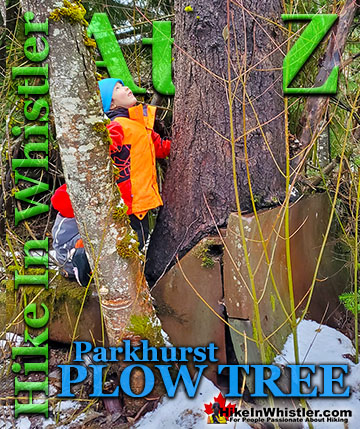
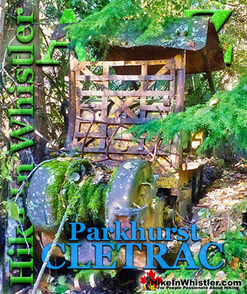

The Best Whistler & Garibaldi Park Hiking Trails!
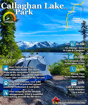
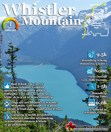
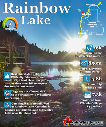
Whistler & Garibaldi Park Best Hiking by Month!


Explore BC Hiking Destinations!

Whistler Hiking Trails

Squamish Hiking Trails

Vancouver Hiking Trails

Clayoquot Hiking Trails
Victoria Hiking Trails

