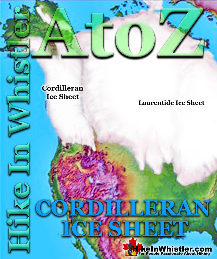
![]() The Cordilleran Ice Sheet covered most of north-west North America for much of the last 2.6 million years. At the Last Glacial Maximum during the Last Glacial Period(26,500 years ago), the Cordilleran Ice Sheet likely covered as much as 2.5 million square kilometres. Stretching from Alaska to Oregon, British Columbia was entirely covered in ice that in many places over two kilometres thick. At the Continental Divide of North America the Cordilleran Ice Sheet merged with the Laurentide Ice Sheet.
The Cordilleran Ice Sheet covered most of north-west North America for much of the last 2.6 million years. At the Last Glacial Maximum during the Last Glacial Period(26,500 years ago), the Cordilleran Ice Sheet likely covered as much as 2.5 million square kilometres. Stretching from Alaska to Oregon, British Columbia was entirely covered in ice that in many places over two kilometres thick. At the Continental Divide of North America the Cordilleran Ice Sheet merged with the Laurentide Ice Sheet.
Whistler & Garibaldi Hiking
![]() Alexander Falls
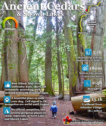
Alexander Falls ![]() Ancient Cedars
Ancient Cedars ![]() Black Tusk
Black Tusk ![]() Blackcomb Mountain
Blackcomb Mountain ![]() Brandywine Falls
Brandywine Falls ![]() Brandywine Meadows
Brandywine Meadows ![]() Brew Lake
Brew Lake ![]() Callaghan Lake
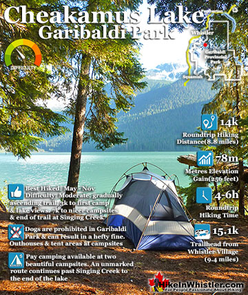
Callaghan Lake ![]() Cheakamus Lake
Cheakamus Lake ![]() Cheakamus River
Cheakamus River ![]() Cirque Lake
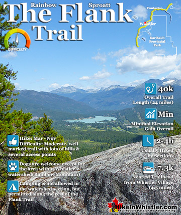
Cirque Lake ![]() Flank Trail
Flank Trail ![]() Garibaldi Lake
Garibaldi Lake ![]() Garibaldi Park
Garibaldi Park ![]() Helm Creek
Helm Creek ![]() Jane Lakes
Jane Lakes ![]() Joffre Lakes
Joffre Lakes ![]() Keyhole Hot Springs
Keyhole Hot Springs ![]() Logger’s Lake
Logger’s Lake ![]() Madeley Lake
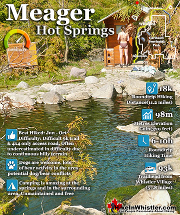
Madeley Lake ![]() Meager Hot Springs
Meager Hot Springs ![]() Nairn Falls
Nairn Falls ![]() Newt Lake
Newt Lake ![]() Panorama Ridge
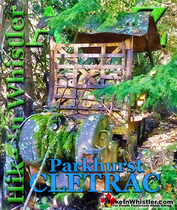
Panorama Ridge ![]() Parkhurst Ghost Town
Parkhurst Ghost Town ![]() Rainbow Falls
Rainbow Falls ![]() Rainbow Lake
Rainbow Lake ![]() Ring Lake
Ring Lake ![]() Russet Lake
Russet Lake ![]() Sea to Sky Trail
Sea to Sky Trail ![]() Skookumchuck Hot Springs
Skookumchuck Hot Springs ![]() Sloquet Hot Springs
Sloquet Hot Springs ![]() Sproatt East
Sproatt East ![]() Sproatt West
Sproatt West ![]() Taylor Meadows
Taylor Meadows ![]() Train Wreck
Train Wreck ![]() Wedgemount Lake
Wedgemount Lake ![]() Whistler Mountain
Whistler Mountain
![]() January
January ![]() February
February ![]() March
March ![]() April
April ![]() May
May ![]() June
June ![]() July
July ![]() August
August ![]() September
September ![]() October
October ![]() November
November ![]() December
December
The Cordilleran and Laurentide ice sheets combined covered most of North America and held one and a half times more water than the Antarctic Ice Sheet does today. Interestingly, the Cordilleran Ice Sheet did not cover most of Alaska(north of the Alaska Ridge) due to the climate being too dry to produce lasting glaciers. Another remarkable feature of the Cordilleran Ice Sheet is how quickly it disappeared relative to the Laurentide Ice Sheet. It is thought, and it really only is a thought, that the Laurentide took eleven thousand years to disappear, whereas the Cordilleran only about four thousand years. Ice ages are bewilderingly complex and it is hard to get a grasp on how so many barely understood variables combine to move us into and out of ice ages. The best we can do is hone in on more graspable aspects of glaciation and try to piece together an enormous puzzle. Approximately 9000 years ago the Cordilleran Ice Sheet was in rapid retreat and Mount Price was an active volcano. Lava flowing from Mount Price met the ice wall that filled Cheakamus Valley and formed The Barrier. The Barrier allowed Garibaldi Lake to form, where previously it was a valley extending into Cheakamus Valley. The Barrier is just one of many striking geologically formed features of Garibaldi Park close to Whistler. The Table and Black Tusk are two other bizarre and beautiful mountains produced through volcanoes pushing through the enormous Cordilleran Ice Sheet.

The Table is thought to have formed just a few thousand years ago when the Cordilleran Ice Sheet covered much of northwest North America. In 1951 Canadian Geologist Bill Mathews pieced together how this interesting mountain formed. He theorized that magma must have melted a vertical tube through to the surface of the Cordilleran Ice Sheet. The pooling lava cooled and hardened into a flat topped mountain. The lack of glacier erosion around The Table indicates that it formed at the end of the last ice age when the Cordilleran Ice Sheet was in quick retreat. So, looking across from Black Tusk to The Table you can try to visualize the land all around buried in an ice sheet about level with where you are standing. About 12000 years ago, there was a pure white sea of ice all around, and an unseen column of lava melting to the surface like a molten rock lake. What a sight it must have been with a cauldron of lava in the midst of a glacier hundreds of metres thick. While studying The Table as well as others in norther British Columbia, Bill Mathews referred to these flat topped mountains as tuyas. He called them tuyas after the Tuya River and Tuya Range in northern British Columbia.


More Whistler & Garibaldi Park Hiking A to Z!

The Best Whistler & Garibaldi Park Hiking Trails!
Whistler & Garibaldi Park Best Hiking by Month!


Explore BC Hiking Destinations!

Whistler Hiking Trails

Squamish Hiking Trails

Vancouver Hiking Trails

Clayoquot Hiking Trails
Victoria Hiking Trails

