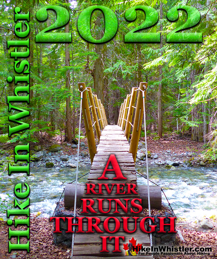
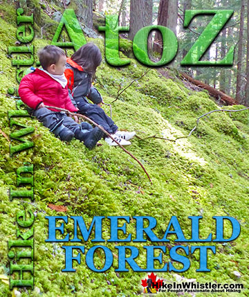
![]() Sept 11th, 2022: The notoriously difficult biking trail in the wilderness between Emerald Forest and Rainbow Park is a pretty fun place to wander around. It zig-zags through the deep stretch of forest with Alta Lake Road along one side and the train tracks and the River of Golden Dreams on the other. A River Runs Through It, or ARRTI as it is more affectionately called by the locals who love it, is buried in such a thick forest that you often only see slivers of sky above and wandering off the trail leads you to bizarre and beautiful places.
Sept 11th, 2022: The notoriously difficult biking trail in the wilderness between Emerald Forest and Rainbow Park is a pretty fun place to wander around. It zig-zags through the deep stretch of forest with Alta Lake Road along one side and the train tracks and the River of Golden Dreams on the other. A River Runs Through It, or ARRTI as it is more affectionately called by the locals who love it, is buried in such a thick forest that you often only see slivers of sky above and wandering off the trail leads you to bizarre and beautiful places.
Whistler & Garibaldi Hiking
![]() Alexander Falls
Alexander Falls ![]() Ancient Cedars
Ancient Cedars ![]() Black Tusk
Black Tusk ![]() Blackcomb Mountain
Blackcomb Mountain ![]() Brandywine Falls
Brandywine Falls ![]() Brandywine Meadows
Brandywine Meadows ![]() Brew Lake
Brew Lake ![]() Callaghan Lake
Callaghan Lake ![]() Cheakamus Lake
Cheakamus Lake ![]() Cheakamus River
Cheakamus River ![]() Cirque Lake
Cirque Lake ![]() Flank Trail
Flank Trail ![]() Garibaldi Lake
Garibaldi Lake ![]() Garibaldi Park
Garibaldi Park ![]() Helm Creek
Helm Creek ![]() Jane Lakes
Jane Lakes ![]() Joffre Lakes
Joffre Lakes ![]() Keyhole Hot Springs
Keyhole Hot Springs ![]() Logger’s Lake
Logger’s Lake ![]() Madeley Lake
Madeley Lake ![]() Meager Hot Springs
Meager Hot Springs ![]() Nairn Falls
Nairn Falls ![]() Newt Lake
Newt Lake ![]() Panorama Ridge
Panorama Ridge ![]() Parkhurst Ghost Town
Parkhurst Ghost Town ![]() Rainbow Falls
Rainbow Falls ![]() Rainbow Lake
Rainbow Lake ![]() Ring Lake
Ring Lake ![]() Russet Lake
Russet Lake ![]() Sea to Sky Trail
Sea to Sky Trail ![]() Skookumchuck Hot Springs
Skookumchuck Hot Springs ![]() Sloquet Hot Springs
Sloquet Hot Springs ![]() Sproatt East
Sproatt East ![]() Sproatt West
Sproatt West ![]() Taylor Meadows
Taylor Meadows ![]() Train Wreck
Train Wreck ![]() Wedgemount Lake
Wedgemount Lake ![]() Whistler Mountain
Whistler Mountain
![]() January
January ![]() February
February ![]() March
March ![]() April
April ![]() May
May ![]() June
June ![]() July
July ![]() August
August ![]() September
September ![]() October
October ![]() November
November ![]() December
December
A skeleton relic of a 1976 Chevrolet Vega is so consumed by the forest that it is nearly invisible. A dirt road once existed here that now ends in a tangle of forest with this decades old abandoned car near its end. A trail appears to have been cut in the previous week here and upon encountering this obstacle, the trail had to be cut in an abrupt arc around the car. The recently chainsawed trail continues through the forest for a couple hundred metres to a big clearing a stones throw from the train tracks. Back on ARRTI, just up from the bridge over Twentyone Mile Creek is a tranquil little emerald world. An enormous water pipe under Alta Lake Road allows the huge torrents of water pass under and continue to meet the River of Golden Dreams. This time of year, Twentyone Mile Creek is not so much a huge crashing creek, as it is a tame little creek. With such a small amount of water flowing through, the huge creek bed of large polished boulders is dry and unexpectedly beautiful. A big and tranquil emerald coloured pool is nestled next to Alta Lake Road. The water pipe, which is big enough to drive a car through, is channelling barely a trickle. With the road so far above it is easy to forget it is there. Serene and beautiful in September, but in a few weeks the rainy days of October will transform this quiet creek into a chaotic, crashing creek once again.
Twentyone Mile Creek
Twentyone Mile Creek begins its long and steep journey from Rainbow Lake, high up and between Mount Sproatt and Rainbow Mountain. Cutting between the two mountains, Twentyone Mile Creek flattens out somewhat, passes under Alta Lake Road, then winds its way through a deep and dark forest before flowing into the River of Golden Dreams near the end of Lorimer Road. This hidden forest extends from Rainbow Park to Emerald Forest and between Alta Lake Road and the River of Golden Dreams.


A River Runs Through It Trailheads
If you look closely at one of the parking lots in Rainbow Park, you will see a small trail sign for the wonderful trail that takes you through this secluded forest, all the way to Emerald Forest. A River Runs Through It is an insanely winding trail that follows a dizzying route through this captivating forest with Twentyone Mile Creek running through it. A popular, though brutally challenging bike trail, A River Runs Through It has numerous, elaborate ramps, small bridges, and one large bridge that spans Twentyone Mile Creek. A River Runs Through It has a couple shortcut trails that cut a couple kilometres off of it to make it a more manageable and enjoyable hiking trail. If you add in another two connecting trails, you can turn A River Runs Through It into a beautiful 6 kilometre circle route. You can start this circle route from a couple spots on Alta Lake Road, or at Rainbow Park, or at the end of Lorimer Road. The end of Lorimer Road starting point has the advantage of being very close to Whistler Village. You can drive to this starting point from Whistler Village in 3 minutes, or bike there in 8 minutes, or walk there in 22 minutes. From the end of Lorimer Road you get on the Valley Trail, cross the bridge over the River of Golden Dreams, then cross the train tracks and enter Emerald Forest on your left. Climbing up the trail that skirts the gravel pit leads you to the top of the gravel pit and you then enter the deep, dark, emerald coloured forest.
Emerald Forest Leads to A River Runs Through It


Emerald Forest to A River Runs Through It
This trail takes you 1.4 kilometres through Emerald Forest before bearing left and descending down to the old access road. Directly across this road is the start of A River Runs Through It North. If you don't see it, you may have come out of Emerald Forest too early and just need to follow the old road to the right and you will spot the sign for A River Runs Through It on your left. If you come out to Alta Lake Road, you have gone too far. The trail quickly descends into the wonderfully dark and wild forest. One kilometre in you come to your first shortcut by connecting onto Bart's Dark Trail. This 0.8 kilometre section cuts out a much longer and windier section of A River Runs Through It. Bart's Dark Trail leads to the narrow bridge across Twentyone Mile Creek.

More hiking info, directions and maps for A River Runs Through It
More Whistler Updates!

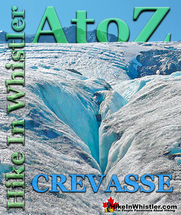
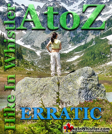
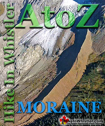
Whistler & Garibaldi Park Hiking Glossary A to Z

Whistler & Garibaldi Park Best Hiking by Month!


Explore BC Hiking Destinations!

Whistler Hiking Trails

Squamish Hiking Trails

Vancouver Hiking Trails

Clayoquot Hiking Trails
Victoria Hiking Trails

