![]() July 20th, 2022: A little knowledge before you head out into the wilderness is a good idea. Especially if you are new to hiking or in unknown terrain. Planning a suitable hike is a great first step is having a great hike. Bringing along extra clothing and food is a great idea and having a first aid kit will help you with any troubles you may encounter. Courtesy and hiking etiquette is an important factor as well. Leaving no trace and packing out what you pack in are paramount to keeping the wilderness wild.
July 20th, 2022: A little knowledge before you head out into the wilderness is a good idea. Especially if you are new to hiking or in unknown terrain. Planning a suitable hike is a great first step is having a great hike. Bringing along extra clothing and food is a great idea and having a first aid kit will help you with any troubles you may encounter. Courtesy and hiking etiquette is an important factor as well. Leaving no trace and packing out what you pack in are paramount to keeping the wilderness wild.
Whistler & Garibaldi Hiking
![]() Alexander Falls
Alexander Falls ![]() Ancient Cedars
Ancient Cedars ![]() Black Tusk
Black Tusk ![]() Blackcomb Mountain
Blackcomb Mountain ![]() Brandywine Falls
Brandywine Falls ![]() Brandywine Meadows
Brandywine Meadows ![]() Brew Lake
Brew Lake ![]() Callaghan Lake
Callaghan Lake ![]() Cheakamus Lake
Cheakamus Lake ![]() Cheakamus River
Cheakamus River ![]() Cirque Lake
Cirque Lake ![]() Flank Trail
Flank Trail ![]() Garibaldi Lake
Garibaldi Lake ![]() Garibaldi Park
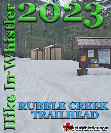
Garibaldi Park ![]() Helm Creek
Helm Creek ![]() Jane Lakes
Jane Lakes ![]() Joffre Lakes
Joffre Lakes ![]() Keyhole Hot Springs
Keyhole Hot Springs ![]() Logger’s Lake
Logger’s Lake ![]() Madeley Lake
Madeley Lake ![]() Meager Hot Springs
Meager Hot Springs ![]() Nairn Falls
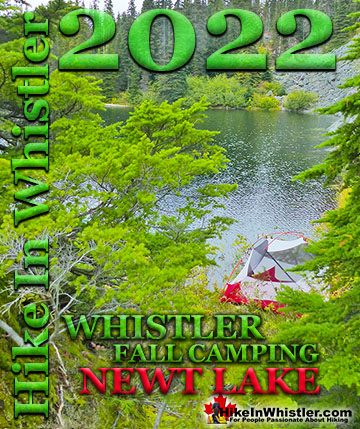
Nairn Falls ![]() Newt Lake
Newt Lake ![]() Panorama Ridge
Panorama Ridge ![]() Parkhurst Ghost Town
Parkhurst Ghost Town ![]() Rainbow Falls
Rainbow Falls ![]() Rainbow Lake
Rainbow Lake ![]() Ring Lake
Ring Lake ![]() Russet Lake
Russet Lake ![]() Sea to Sky Trail
Sea to Sky Trail ![]() Skookumchuck Hot Springs
Skookumchuck Hot Springs ![]() Sloquet Hot Springs
Sloquet Hot Springs ![]() Sproatt East
Sproatt East ![]() Sproatt West
Sproatt West ![]() Taylor Meadows
Taylor Meadows ![]() Train Wreck
Train Wreck ![]() Wedgemount Lake
Wedgemount Lake ![]() Whistler Mountain
Whistler Mountain
![]() January
January ![]() February
February ![]() March
March ![]() April
April ![]() May
May ![]() June
June ![]() July
July ![]() August
August ![]() September
September ![]() October
October ![]() November
November ![]() December
December
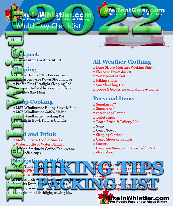
Clothing, gear and how you pack is not always straight forward and having a checklist to work from will avoid any mistakes in packing. Find a hike that matches the exertion you want to put in. A steep and difficult trail may be enticing until you find yourself struggling to keep a pace. Wedgemount Lake is a wonderful destination, but difficult trail. We’ve seen at least one person crying on their way down after turning back two thirds the way up the trail! What might be a nice and fun hike into the mountains may prove to be a miserable endurance test for those out of shape or overloaded with a heavy pack. Equally important to the steepness and difficulty of a trail is the length of the hike. Panorama Ridge in Garibaldi Provincial Park is only moderately challenging in terms of steepness and difficulty, however its length makes it quite challenging. A 5 kilometre hike(each way) is pretty easy, a 10 kilometre(each way) trail adds up to 20 kilometres roundtrip and significantly more strenuous. Panorama Ridge is a 30 kilometre(roundtrip) hike and too much distance for most hikers to tackle in one day. Use our hiking gear checklist to ensure you have everything to be prepared for a safe and enjoyable hike. Small things can ruin a hike, but can be remedied easily on the trail. A blister can make every step agony, however remembering to bring duct tape can stop a blister from getting painful. Having a toque and extra sweater in your pack can make a world of difference if the temperature dips below expected.
MULTI-DAY HIKING PACKING LIST
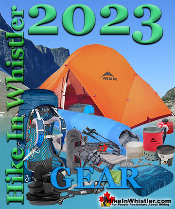
Backpack (50-75 litre)
We recommend the Osprey Atmos AG 65. The Atmos AG 65 is the best-fitting, most ventilated and comfortable pack ever made for traditional backpacking trips up to a week or more in duration. The innovative AntiGravity suspension makes it feel like you're carrying less weight and seamlessly wraps around your body, which means you'll enjoy every kilometre more than ever. From easy to use stretch mesh side pockets, Stow-on-the-Go trekking pole attachment, and FlapJacket for lidless use, the Atmos AG 65 is the best backpack available today.
We recommend the Osprey Aura AG 65. Incredible Anti-Gravity comfort, women’s-specific fit, robust feature set with additional front pockets and removable pad straps for overnight or week-long trips. Tackle heavyweight weekends or weeklong backpacking trips with gravity-defying comfort and premium ventilation with the Aura AG 65. Featuring a women's-specific fit, its innovative suspension and harness delivers a seamless fit that envelopes your back and hips in 3D-suspended mesh. From easy-to-use stretch mesh side pockets, Stow-on-the-Go trekking pole attachment and integrated raincover, the Aura AG 65 is a compromise-free women's backpacking pack.
Sleeping
- □ Tent
- □ Sleeping Bag
- □ Sleeping Bag Liner
- □ Sleeping Pad
- □ Sleeping Pillow
Camp Cooking
- □ Hiking Stove & Fuel
- □ Coffee Maker
- □ Cooking Pot
- □ Bowl/Plate & Utensils
- □ Dish Soap and Sponge
Food and Drink
- □ Meals + Extra Food
- □ Snacks
- □ Water Bottles or Water Bladder
Navigation & Safety
- □ Headlight
- □ Paper Map & Trail Guide
- □ Phone with GPS Map/Compass(or GPS)
- □ Power Bank to charge smart phone
- □ Watch
- □ First Aid Kit
All Weather Clothing
- □ Long Sleeve Moisture Wicking Shirt
- □ Hiking Shorts or Hiking Pants
- □ Wicking Base Layer
- □ Fleece or Down Jacket
- □ Waterproof Jacket
- □ Waterproof Pants
- □ Toque
- □ Gloves
- □ Sun Shielding Hat
- □ Hiking Shoes
- □ Hiking Socks
- □ Sandals
- □ Hiking Socks
Personal Items & Accessories
- □ Camera
- □ Lip Balm
- □ Sunscreen
- □ Sunglasses
- □ Toilet Paper
- □ Towel
- □ Tooth Brush
- □ Toiletry Kit
- □ Soap
- □ Sleeping Clothes
- □ Duct Tape(for blisters & repair)
- □ Multi-Tool and/or Knife
- □ Insect Repellant
- □ Campsite Fees
- □ Trip Itinerary Left With A Friend
Hiking Safety
Hiking with an avid hiker or someone who has done the trail before is a great way to stay safe. An experienced and knowledgeable hiking partner will be prepared for known and unforeseen difficulties that you may overlook if alone. Bring a map and GPS with you. All smartphones these days have GPS built into them and work without a cell signal. Compass apps and trail map apps are easy to find and often free to download and infinitely better than conventional GPS units. Anyone who has used their smart phone with a five-dollar map app next to a top of the line $650 GPS unit will be astonished by the difference. GPS units have remained stagnant while smart phones have lapped them several times in terms of usability and function. A smart phone map app will appear large, clear and astoundingly detailed. An expensive GPS unit will usually be inferior in every way with its tiny and pixelated screen. The common advantage touted by GPS enthusiasts of better power(spare batteries) and reliability(waterproof and drop proof), don’t hold up if you bring a small power bank and smartphone case. Waterproof smartphones are now being seen more often replacing the old and very effective hiker technique of saran wrapping their phone.
A paper map is great to bring along as it can’t run out of battery power and therefore foolproof in all weather conditions. Paper maps often provide tips and advice on hiking in the areas covered. A feature not usually found in map apps. Always mention to a friend where you are hiking and return time. People have disappeared while hiking popular and safe looking trails. A note to a friend before leaving or a post it in your car at the trailhead can narrow a search dramatically. A simple one sentence note can lead rescuers to you quickly where without a note they could be wasting time and effort in the wrong places. Drink lots and lots of water. This seemingly obvious tip is always the first one forgotten on the trail. Taking a drink of water when thirsty works well when sitting at a desk, but drinking frequently on strenuous hikes is essential. Dehydration leads to all sorts of nasty dangers. From irritability and fatigue to confusion and shock. You expel considerably more moisture during exertion and hot weather and must drink a lot to keep pace.
Carry a first aid kit and learn about it before you go hiking. The more you hike the more you see unusual and even bizarre accidents, and having some knowledge makes an immense amount of difference. From calmly and quickly covering a large wound can allow you to continue hiking. Being able to splint a broken bone can allow you to stagger back to safety or reduce that chance of shock while waiting for help. Be prepared with a good first aid kit that can deal with a 7 centimetre gash on your leg. Steri-strips are an easy and temporary alternative to stiches on the trail, while bandages and duct tape can make a dangerous situation manageable. Protect yourself from the elements. Suntan lotion, sunglasses and a hat can make a hot sunny day manageable and comfortable. Hikers are always mystified at the blinding brightness of hiking on snow or glaciers. Not having sunglasses can make your hike uncomfortable or even dangerous. Not using suntan lotion can make your night at the camp a painful experience trying to sleep with a sunburn. A hat is an enormous luxury to have on a hot and sunny day and often an oversight for new hikers. Hours spent without sun protection inevitably lead to great discomfort and lasting pain.
Keep an eye on the time and know when the sun sets. Getting caught out after dark is one of the biggest causes of hiking fatalities. Getting lost in the beautiful scenery can make you forget about the time. The ease of looking at your wrist compared to taking your phone out of your pocket is considerable. Without a watch, you will often lose track of time. Having a watch allows you to easily keep aware of the time and timing your hike keeps you aware of how much further you need to travel. Bring extra food and water. More food and water than you will need keeps you safe from unforeseen problems. Also, your exertion while hiking will give you a huge appetite. Having trail mix, granola bars or chocolate bars with you will keep your energy up and better able to enjoy the trail. Take a break and enjoy the view once in a while. Taking a moment, once in a while to sit on a rock or fallen tree and take in the surroundings gives you a chance to rest, eat and drink. Keeping a regular pattern of hiking breaks will keep you hydrated and help prevent accidents resulting from fatigue.
More Whistler Updates!


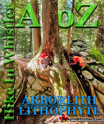
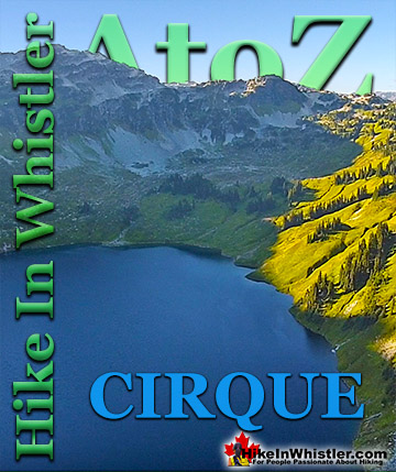
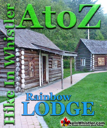
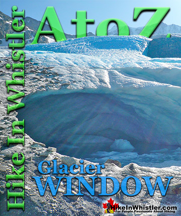
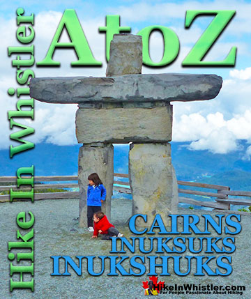
Whistler & Garibaldi Park Hiking Glossary A to Z


Whistler & Garibaldi Park Best Hiking by Month!


Explore BC Hiking Destinations!

Whistler Hiking Trails

Squamish Hiking Trails

Vancouver Hiking Trails

Clayoquot Hiking Trails
Victoria Hiking Trails

