
![]() The Green Lake Loop is the original trail that runs around the back side of Green Lake. Before the Sea to Sky Highway was cut through the valley in 1964, the road for vehicles went through a treacherous route on the opposite side of Green Lake. With the Sea to Sky Highway open for cars, the old road behind Green Lake became the trail known as the Green Lake Loop. The Green Lake Loop stretches a windy and often steep 6 kilometre arc up around Green Lake and emerges from the forest 30 metres to the left of Wedge Creek bridge.
The Green Lake Loop is the original trail that runs around the back side of Green Lake. Before the Sea to Sky Highway was cut through the valley in 1964, the road for vehicles went through a treacherous route on the opposite side of Green Lake. With the Sea to Sky Highway open for cars, the old road behind Green Lake became the trail known as the Green Lake Loop. The Green Lake Loop stretches a windy and often steep 6 kilometre arc up around Green Lake and emerges from the forest 30 metres to the left of Wedge Creek bridge.
Whistler & Garibaldi Hiking
![]() Alexander Falls
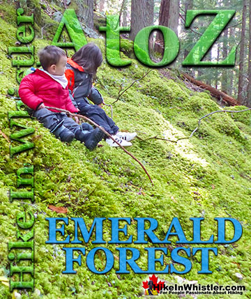
Alexander Falls ![]() Ancient Cedars
Ancient Cedars ![]() Black Tusk
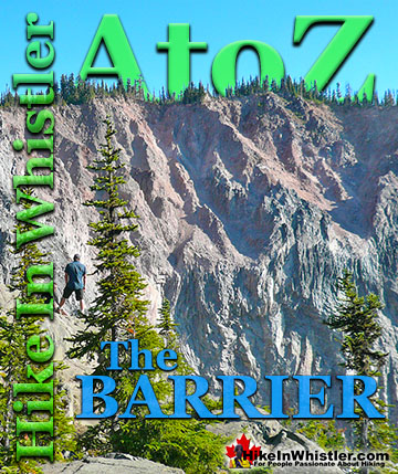
Black Tusk ![]() Blackcomb Mountain
Blackcomb Mountain ![]() Brandywine Falls
Brandywine Falls ![]() Brandywine Meadows
Brandywine Meadows ![]() Brew Lake
Brew Lake ![]() Callaghan Lake
Callaghan Lake ![]() Cheakamus Lake
Cheakamus Lake ![]() Cheakamus River
Cheakamus River ![]() Cirque Lake
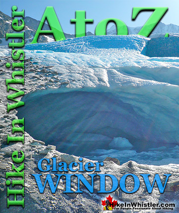
Cirque Lake ![]() Flank Trail
Flank Trail ![]() Garibaldi Lake
Garibaldi Lake ![]() Garibaldi Park
Garibaldi Park ![]() Helm Creek
Helm Creek ![]() Jane Lakes
Jane Lakes ![]() Joffre Lakes
Joffre Lakes ![]() Keyhole Hot Springs
Keyhole Hot Springs ![]() Logger’s Lake
Logger’s Lake ![]() Madeley Lake
Madeley Lake ![]() Meager Hot Springs
Meager Hot Springs ![]() Nairn Falls
Nairn Falls ![]() Newt Lake
Newt Lake ![]() Panorama Ridge
Panorama Ridge ![]() Parkhurst Ghost Town
Parkhurst Ghost Town ![]() Rainbow Falls
Rainbow Falls ![]() Rainbow Lake
Rainbow Lake ![]() Ring Lake
Ring Lake ![]() Russet Lake
Russet Lake ![]() Sea to Sky Trail
Sea to Sky Trail ![]() Skookumchuck Hot Springs
Skookumchuck Hot Springs ![]() Sloquet Hot Springs
Sloquet Hot Springs ![]() Sproatt East
Sproatt East ![]() Sproatt West
Sproatt West ![]() Taylor Meadows
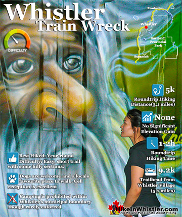
Taylor Meadows ![]() Train Wreck
Train Wreck ![]() Wedgemount Lake
Wedgemount Lake ![]() Whistler Mountain
Whistler Mountain
![]() January
January ![]() February
February ![]() March
March ![]() April
April ![]() May
May ![]() June
June ![]() July
July ![]() August
August ![]() September
September ![]() October
October ![]() November
November ![]() December
December
The loop part of Green Lake Loop comes from the trail that runs through Parkhurst Ghost Town and loops back around to reconnect to the main trail. In 2009 the Green Lake part of the Sea to Sky Trail was built and now overlaps much of the Green Lake Loop. Because the newer trail is nicer and newer, the old trail is slowly being forgotten. The small 0.9km section of the Green Lake Loop that branches off from the Sea to Sky Trail and down to Green River is rarely used. When this section was a road it was known as suicide hill due to its steepness and sharp turns. These days is takes you down through a nice, serene and dark forest full of yew trees and winding along Wedge Creek. The short trail ends at an unmarked trail junction next to the wonderfully disintegrating Wedge Creek bridge. The very old Wedge Creek bridge, now decommissioned was the only bridge across Wedge Creek until the Wedge Creek Falls bridge in current use, now crossed by the Sea to Sky Trail was built. The Wedge Creek bridge is near the now, main trailhead for Parkhurst Ghost Town. A few metres after crossing the bridge you find the unmarked parking area for Parkhurst as well as the Sea to Sky Trail.

From the trailhead parking area most hikers cross Wedge Creek bridge and continue past the unmarked and hardly noticeable Green Lake Loop on the left and continue to the Parkhurst Wye. A wye is a large triangular arrangement of train tracks that is used by trains to turn around. Walking through the wye, keeping to the left of the main, double set of tracks on your right you come to the old Green Lake Loop, or more commonly known these days as the Parkhurst Trail on your left. A small trail sign, very rare in Parkhurst, says "Green Lake Loop/Parkhurst Trail". This trail takes you gradually up into the main part of Parkhurst where most of the houses were.
Green Lake Loop - Parkhurst Loop Trail
![]() All but two have collapsed and the nice Parkhurst Loop Trail takes you through the old town with the main highlight being the Blue Face House. This largely intact house was painted with a haunting blue face a decade ago by professional muralist Kris Kupskay. A small side trail takes you down and across the train tracks to the shore of Green Lake and the hulking monster of an old Caterpillar tractor. This huge old Cat was built in 1939 and was abandoned here in 1956 when the Parkhurst Sawmill closed for good and the town quickly became a ghost town.
All but two have collapsed and the nice Parkhurst Loop Trail takes you through the old town with the main highlight being the Blue Face House. This largely intact house was painted with a haunting blue face a decade ago by professional muralist Kris Kupskay. A small side trail takes you down and across the train tracks to the shore of Green Lake and the hulking monster of an old Caterpillar tractor. This huge old Cat was built in 1939 and was abandoned here in 1956 when the Parkhurst Sawmill closed for good and the town quickly became a ghost town.

Green Lake Loop - Parkhurst Sawmill
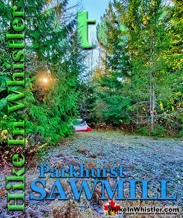
![]() The old Parkhurst Sawmill was located on the peninsula adjacent to the old Caterpillar tractor. A little bit of bushwhacking takes you into a surprisingly big clearing in tangle of forest. The clearing is caused by the collapsed sawmill's metal roof covering the forest floor and preventing big trees from taking root. You can only see some of the huge metal sheets as most of it lays under a carpet of forest that has settled in over the past 65 years. The clearing is serene and cut off from the world by a thick perimeter of jungle, making it a sunny paradise on a nice day.
The old Parkhurst Sawmill was located on the peninsula adjacent to the old Caterpillar tractor. A little bit of bushwhacking takes you into a surprisingly big clearing in tangle of forest. The clearing is caused by the collapsed sawmill's metal roof covering the forest floor and preventing big trees from taking root. You can only see some of the huge metal sheets as most of it lays under a carpet of forest that has settled in over the past 65 years. The clearing is serene and cut off from the world by a thick perimeter of jungle, making it a sunny paradise on a nice day.

Venturing into the forest around the clearing you will encounter the huge, old chimney from the sawmill as well as a pile of bricks that once housed the sawmill's boiler that powered everything. Further into the forest you will find two more logging tractors. An old Cletrac tractor that dates from the mid 1940's and an unexpectedly impressive Caterpillar buried in the forest with its huge plow being lifted off the ground by several trees. You will probably find yourself crawling around in amazement, peering under the 4000 kilogram plow, wondering how it is possible.

The Green Lake Loop Trail
![]() It is a testament to how forgotten the Green Lake Loop has become when you consider that it lacks reasonably defined trailheads on either end. The southern trailhead, near the Fitzsimmons River Lost Lake Bridge is easily missed and hardly marked, while the northern trailhead near Wedge Creek bridge is not marked at all. Come to that, the trailhead and parking area for Parkhurst Ghost Town, the Green Lake Loop and the Sea to Sky Trail just a few metres away is not marked at all. An directions to find it are based on vague references to 'the end of the logging road near the yellow gates.' Not a big deal as once you see the trail once, you know where to park and where to go, and the back side of Green Lake is largely used by locals it seems anyway. To get to the northern trailhead, which is the best way for most if on foot and have a car to get there is pretty easy. Drive north on the Sea to Sky Highway past Green Lake and turn right at the turnoff for Wedgemount Lake, cross the bridge over Green River, turn right and drive to the end near the yellow gates. Park and walk past the colourful cement barricade and into the forest toward Wedge Creek.
It is a testament to how forgotten the Green Lake Loop has become when you consider that it lacks reasonably defined trailheads on either end. The southern trailhead, near the Fitzsimmons River Lost Lake Bridge is easily missed and hardly marked, while the northern trailhead near Wedge Creek bridge is not marked at all. Come to that, the trailhead and parking area for Parkhurst Ghost Town, the Green Lake Loop and the Sea to Sky Trail just a few metres away is not marked at all. An directions to find it are based on vague references to 'the end of the logging road near the yellow gates.' Not a big deal as once you see the trail once, you know where to park and where to go, and the back side of Green Lake is largely used by locals it seems anyway. To get to the northern trailhead, which is the best way for most if on foot and have a car to get there is pretty easy. Drive north on the Sea to Sky Highway past Green Lake and turn right at the turnoff for Wedgemount Lake, cross the bridge over Green River, turn right and drive to the end near the yellow gates. Park and walk past the colourful cement barricade and into the forest toward Wedge Creek.

Green Lake Loop - Wedge Creek Bridge
Wedge Creek bridge was decommissioned years ago and has been disintegrating ever since. Evidently its proximity to a cute little picnic area and fire ring next to Wedge Creek may be the cause of so many missing planks from the bridge. It is extremely sturdy for pedestrians as it was built to accommodate seriously big industrial vehicles, however its decay into a skeleton spanning a tumultuous creek below makes you step cautiously. Immediately after the bridge you will see the cute little area on your left next to Wedge Creek with a fire ring and picnic table. The very solid picnic table is a clue to the age of this seemingly forgotten little spot and likely dates back well before the 1990's, which doesn't seem old, but of course predates most of the development in Whistler.

About 30 metres after the bridge and picnic table you will see the unmarked Green Lake Loop on your left enter a forest that is immediately and unexpectedly quite beautiful. The trees block so much of the sun that not a lot grows on the ground so you can see quite far and everywhere you look big tree trunks with shafts of sun slicing through.

The contrast of dark forest and bright areas of sunshine make it feel hidden and spooky, then abruptly bright and beautiful. Added to that you have the ever present crashing of Wedge Creek that the  trail bends away from, then snakes back to frequently, always with a new and nice view of crashing glacier water. Looking into the creek and in the forest you notice that Wedge Creek is very unusual in that the boulder in and around it are very large and remarkably rounded. Even along and under the trail the rocks are often like this. Like they have been ground in the creek for centuries, which is what comes to mind on the trail. But Wedge Creek is not that big and its often dozens of metres away and the fridge sized boulders are buried in the forest and look to have been there for centuries. Also, many areas above and away from Wedge Creek have sandy and clay-like dirt, like you see at the toe of a glacier. It turns out that this is the case. Not only is the water glacier water, but the boulders were dropped by glaciers or ground down by glaciers up the valley and send down by floods. Huge floods are not uncommon in this part of the world. In late October 1955 a three day rainstorm caused landslides that washed out several railway and road bridge between Vancouver and Parkhurst. An old Parkhurst photo from Whistler Museum's Debeck Collection from the late 1930's shows, what appears to be this valley with thousands of flattened trees. Of course Parkhurst being a logging town, maybe the trees were cut for lumber or more likely to make way for power lines. It is not until you walk a little further up near Wedge Creek Falls that you get a confirmation that a glacier once filled this valley when you spot the striations on the top of the broad hill next to the Sea to Sky Trail near Wedge Creek. The flat and broad rock face that shows the grinding grooves that only result from boulder grinding on bedrock under a substantial glacier moving down the valley.

Green Lake Loop Pacific Yew Trees
In the dark forest around the Green Lake Loop you will see quite a few Pacific yew trees. Easy to spot in late summer with their bright red berries. Yew trees are notorious for being very poisonous and the berries, or at least the seed inside the berries are toxic to humans. Taxine alkaloids in all species of yew trees worldwide cause them to be extremely poisonous. The Pacific yew is the least poisonous variation of yew tree as it contains only minimal amounts of Taxine, though still quite dangerous. Moose and deer seem to be the only animals to be unaffected by Taxine alkaloids as they happily eat the needles without ill effect. In humans Pacific yew needles may lead to death by cardiogenic shock. For most animals, including humans, ingesting any part of a Pacific yew tree containing Taxine alkaloids will result in neurological damage resulting in convulsions, fasciculation (rapid, uncontrolled muscle twitching) and paralysis.

Pacific yew trees are very distinct from other trees in the forest due to their brightly coloured bark. Usually a variation of deep red, but other times you will see brown, purple, or even bright orange, vaguely comparable to arbutus trees! The range of colour is also due to the layer visible. The outer layer will be a duller purple or brown colour, while the inner layer of bark will be a much more vibrant, shiny and fresh looking deep red or purple. One characteristic of Pacific yew trees that often makes them strikingly beautiful is their tendency to grow in lunging, angular shapes. They prefer shady forests, but grow absurdly powerful and long branches to reach sunny cracks in the forest canopy. The Pacific yew pictured below is in a dark forest along the River of Golden Dreams and has several massive branches searching for light.

Stealth Camping Along Wedge Creek
Along the serene stretch of the Green Lake Loop along Wedge Creek you encounter a couple of very inviting areas ideal for a camp. These areas, similar to the one near the Wedge Creek bridge are decades old and mostly forgotten. As with everything within Whistler's municipal boundary camping is not permitted, but stealth camping easily goes unnoticed. The goal of stealth camping is to not be seen and to never leave a trace you were there.

Just a couple metres from your tent you get this view of Wedge Creek crashing by. Notice all the huge, rounded boulders in the creek as well as piled up in the distance. This little camping area shows signs of being a fair bit more elaborate and spacious. Along the creek running north the clearing continues for about 15 metres and is too perfectly flat to be natural. Though the forest has moved in to some degree with little trees and bushes, it hints at a lot of usage decades ago.

Green Lake Loop to Wedge Creek Falls
![]() The Green Lake Loop sharply ascends up a steep switchback and connects to the Sea to Sky Trail, which is effectively a gravel road here. The usually open yellow gate at the trailhead parking area for Parkhurst, Green Lake Loop and the Sea to Sky Trail is this road. Where the Green Lake Loop merges with the Sea to Sky Trail, you turn right to continue on toward Parkhurst. If you turn left and walk down the gravel road(Sea to Sky Trail) for 1 minute you come to the Wedge Creek Falls bridge. Wedge Creek Falls is beautiful with its ever-present tangle of logs crisscrossing it.
The Green Lake Loop sharply ascends up a steep switchback and connects to the Sea to Sky Trail, which is effectively a gravel road here. The usually open yellow gate at the trailhead parking area for Parkhurst, Green Lake Loop and the Sea to Sky Trail is this road. Where the Green Lake Loop merges with the Sea to Sky Trail, you turn right to continue on toward Parkhurst. If you turn left and walk down the gravel road(Sea to Sky Trail) for 1 minute you come to the Wedge Creek Falls bridge. Wedge Creek Falls is beautiful with its ever-present tangle of logs crisscrossing it.

Wedge Creek Falls is not only very beautiful in a wild, idyllic and picture-perfect way, but also because hiking along the right side of it takes you to one serenely beautiful rocky outcrop after another. On a sunny day these areas are a tranquil, forest paradise as the ice cold glacier water crashes all around you. The trail on the right side of Wedge Creek Falls is not so much a trail as a route as the terrain is rocky, steep and constantly changing. Overall it is not to tough and is pretty fun as you climb over boulders, fallen trees and emerge at dozens of nice viewpoints as well as areas down by the creek itself.


Green Lake Loop to Parkhurst Ghost Town
![]() Backtracking from Wedge Creek Falls up the Sea to Sky Trail back to the point where you merged from the Green Lake Loop, you continue to ascend up the old gravel road and soon come to the side trail that leads down to Parkhurst Ghost Town and the Parkhurst Loop Trail. Here you find yourself in the middle of the old ghost town where most of the houses were located. Now they are almost all flattened by the crushing weight of springtime snow. Back in the days when Parkhurst was a logging town it was still vacated in the winters when the mill shut for the season. Caretakers had to remain over the winter to ensure pipes didn't freeze and burst as well as to clear the snow off the roofs of the houses before it crushed them. The two remaining houses are the Ghost Shack and the Blue Face House. The Ghost Shack is just a one room shack with no floor and falling apart. The Blue Face House is much more intact with its solid roof covered in sheet metal. A small chimney pokes out of the roof, but the stove is long gone as well as the doors, windows and whatever else that could be moved or destroyed.
Backtracking from Wedge Creek Falls up the Sea to Sky Trail back to the point where you merged from the Green Lake Loop, you continue to ascend up the old gravel road and soon come to the side trail that leads down to Parkhurst Ghost Town and the Parkhurst Loop Trail. Here you find yourself in the middle of the old ghost town where most of the houses were located. Now they are almost all flattened by the crushing weight of springtime snow. Back in the days when Parkhurst was a logging town it was still vacated in the winters when the mill shut for the season. Caretakers had to remain over the winter to ensure pipes didn't freeze and burst as well as to clear the snow off the roofs of the houses before it crushed them. The two remaining houses are the Ghost Shack and the Blue Face House. The Ghost Shack is just a one room shack with no floor and falling apart. The Blue Face House is much more intact with its solid roof covered in sheet metal. A small chimney pokes out of the roof, but the stove is long gone as well as the doors, windows and whatever else that could be moved or destroyed.

The mural painted on the front of the house dates back to 2011 when local muralist Kups painted it. Back then the house was a blank canvas, now the inside is mostly covered in colourful murals and graffiti.


Green Lake Loop After Parkhurst
Returning to the Green Lake Loop from the Parkhurst Loop, you ascend up to some beautiful viewpoints over Green Lake. Several rocky hilltops give you a panoramic view of this beautiful lake.

Looking to the right you can see the peninsula where the Parkhurst Sawmill was located and directly beyond that, where the lake ends and Green River starts you can barely make out the location of the famous Toad Hall. In the early 1970's several ski bums took over the abandoned logging camp there for a few seasons and shortly before they were evicted a group photo was taken with the residents wearing nothing but ski boots. This iconic photo was made into a poster and can be purchased at the Whistler Museum. Toad Hall and the other houses are long gone and the area is now an empty, grassy field surrounded by trees overlooking the lake. Whistler purchased the land there along with Parkhurst in 2017 and eventually it all will likely morph into a park somewhat similar to Rainbow Park with its historical information boards and preserved structures.

There are countless, hidden areas overlooking the lake along the endlessly undulating trail. Mostly overlapping the newer Sea to Sky Trail, the Green Lake Loop is wide and very bike friendly.


Descending down toward Lost Lake you come to the short side trail to the Green Lake viewpoint which looks over Green Lake and Nicklaus North Golf Course.


The Green Lake Loop finally ends at the Lost Lake trail near the Fitzsimmons Creek Lost Lake Bridge. Fitzsimmons Creek is the reason Green Lake has its wonderful green colour as the water comes from the numerous glaciers on and near Overlord Mountain.

Overlord is the massive mountain that you see directly between Blackcomb Mountain and Whistler Mountain from Whistler Village. Most noticeably is The Fissile on the right flank of Overlord Mountain. The Fissile is the roughly pyramid shaped peak that Whistler Village was actually designed to get a perfect view of. Village Gate Boulevard was laid out in the original plans of Whistler Village to line up with a view of The Fissile. The picture below is from Whistler Golf Course and shows Overlord Mountain and The Fissile as well as the Peak 2 Peak Gondola

Below is an aerial view of Overlord Mountain and The Fissile. Overlord Glacier is one of many glaciers that feed Fitzsimmons Creek that flows into Green Lake and gives it its wonderful and surreal colour. The 14.5 kilometre Singing Pass trail that starts from Whistler Village takes you to the foot of The Fissile at Russet Lake in Garibaldi Provincial Park.

After crossing the Fitzsimmons Creek Lost Lake Bridge you pass through Nicklaus North Golf Course and come out at Green Lake and Whistler's Valley Trail continues in a few directions.

More Whistler & Garibaldi Park Hiking A to Z!


The Best Whistler & Garibaldi Park Hiking Trails!
Whistler & Garibaldi Park Best Hiking by Month!


Explore BC Hiking Destinations!

Whistler Hiking Trails

Squamish Hiking Trails

Vancouver Hiking Trails

Clayoquot Hiking Trails
Victoria Hiking Trails

